May 15-May 19
 Resources
☞ Paria Canyon – Vermilion Clifs Wilferness
☞ Paria Contact Station
☞ Buckskin Gulch and the Paria River Narrows
☞ Buckskin Gulch and Paria Canyon – the ultimate backpacking guide
☞ Buckskin Gulch
☞ The ultimate Paria Canyon backpacking guide
☞ Paria River (and Buckskin Gulch)
☞ Seeking Treasure Adventures
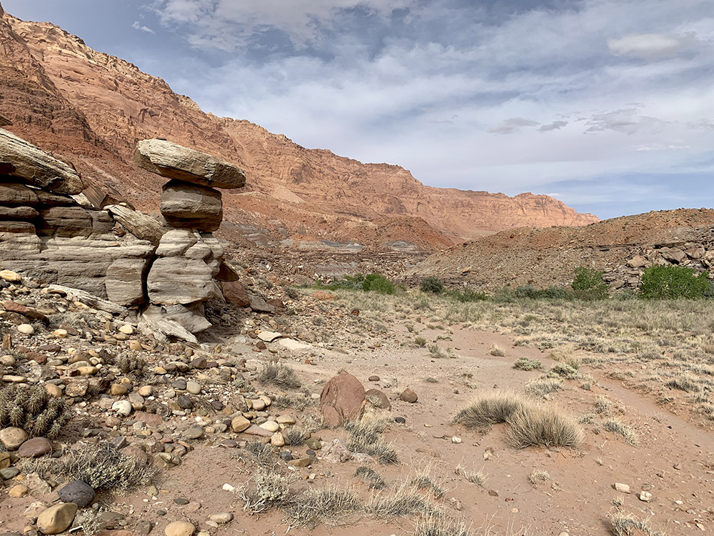
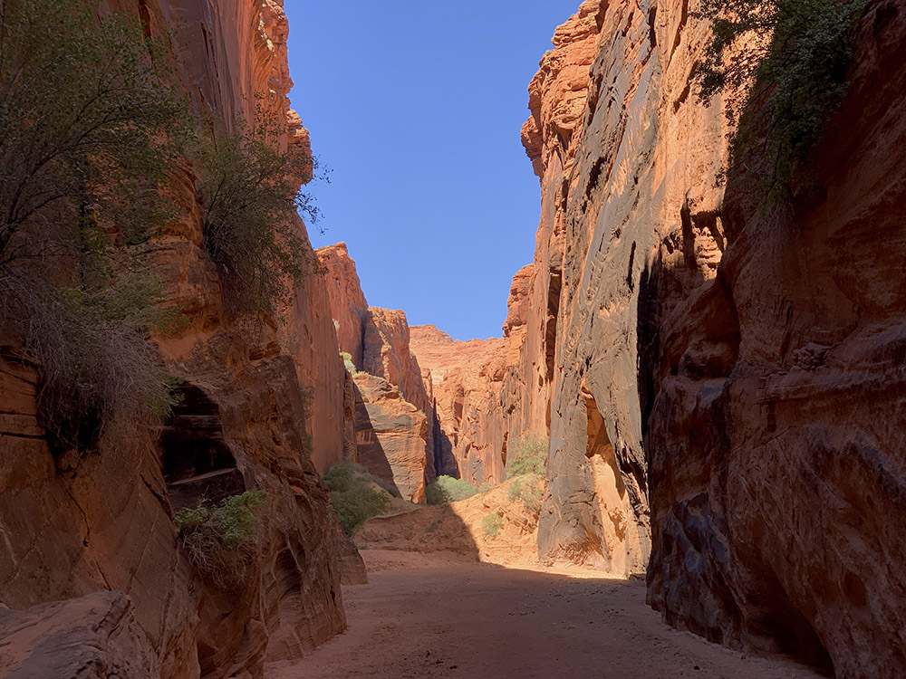
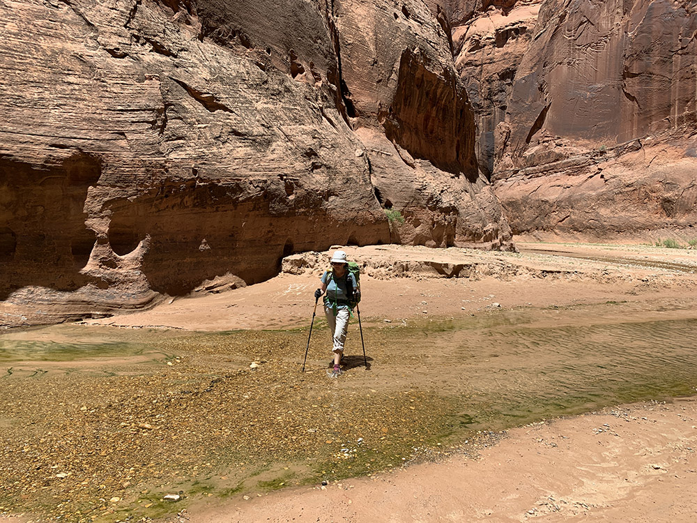
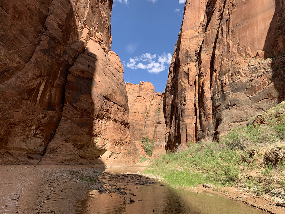
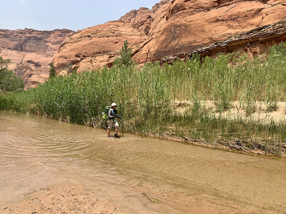
We started the day by meeting our ☞ shuttle driver at 6:20 am at Chevron Station in Marble Canyon (15 min drive from our lodge). We transferred our backpacks and followed him to Lees Ferry long-term parking lot where we left our car until our return. The shuttle took us 82 miles around Vermillion Cliffs mesa to Wire Pass trailhead. Quite scenic drive with the last part on a dirt road. Final prep and around 9 am we were on the trail. The Wire Pass trail follows a side wash which enters Buckskin Gulch several miles downstream of its beginning – not very deep at this point, but quite narrow – a true slot canyon. At its deepest (further downstream), Paria River cuts 750 m into the mesa. We followed mapped trail (shown on the map). Nowhere else to go in the gulch, but we took some alternative shortcut trails or simply cut across easy terrain in the wider part of Paria River valley. Altogether we walked 49 miles and crossed the river hundreds times. Blue line on the map follows mapped trail, we ocassionaly followed local alternative trails.
Sourcing water was our main concern, but we received good advice and up to date info at the lodge: conditions were dry, no water at all in Buckskin Gulch, but decent amount of clear water in Paria River fed only by springs (it is often muddy and very difficult to filter, especially after rain, but it was clear now after a long dry period). River was easy to cross (only a few times above knee-deep and only a few times “wall-to-wall”) and with some good pools for “swimming”. We started with 9 liters of water – it was good decision as it lasted until we reached the first strong wall spring in the morning of the second day. There was some slow stream water at Buckskin and Paria confluence (where we camped the first night), but also signs of human activity plus horse manure and a strong smell of horse urine in a few spots – it felt good to be carrying water than be desperate. With all the John Muir Trail experience everything else was easy. Portable (carry-out) toilets we got with our permits worked fine.
Walking down Buckskin Gulch and Paria River
Hiking day 1.
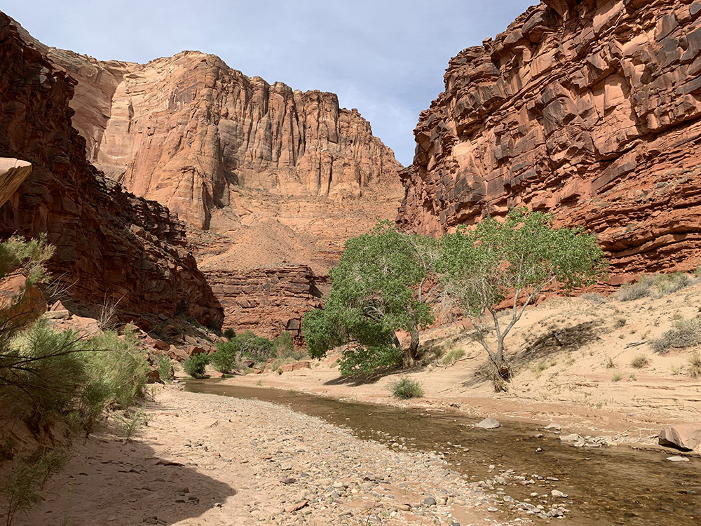
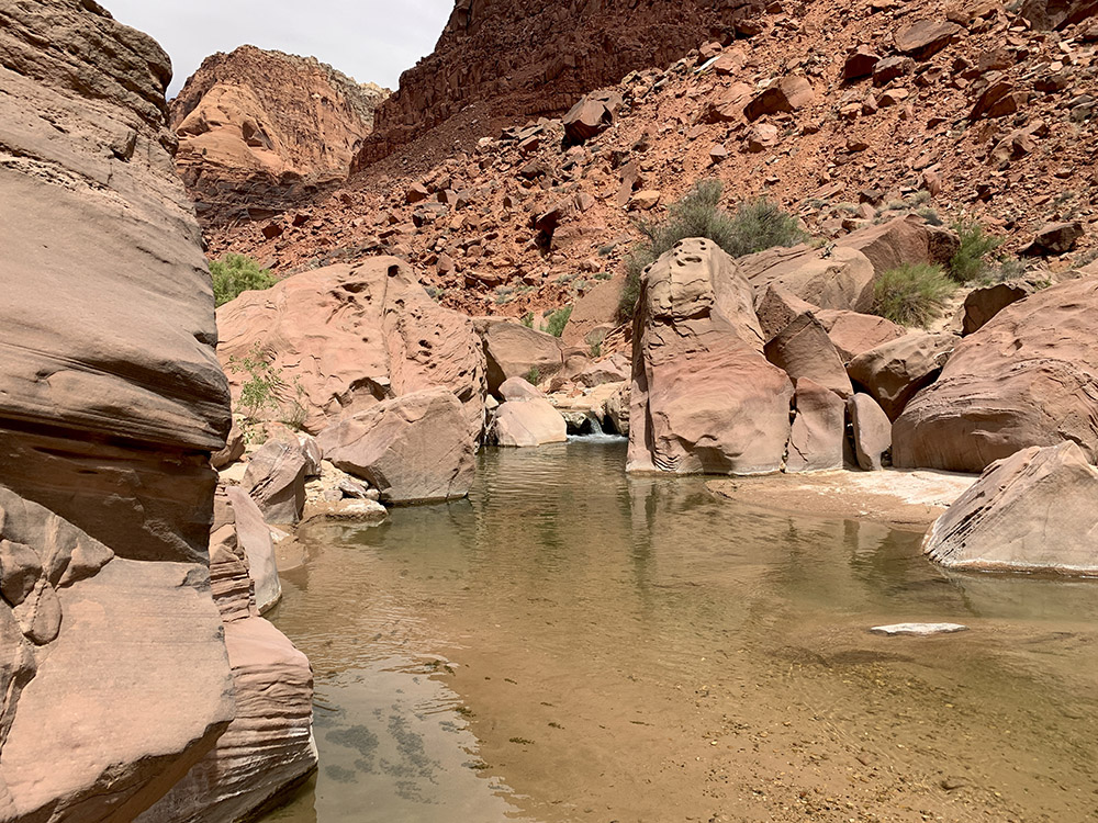
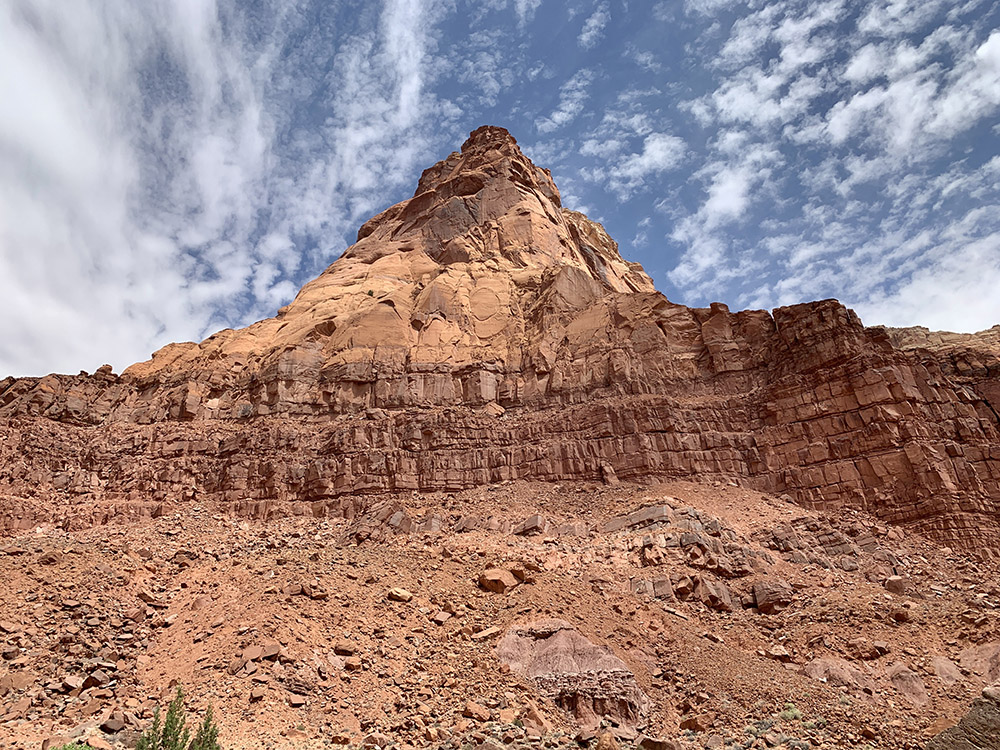
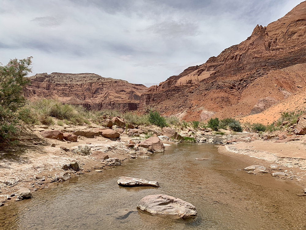
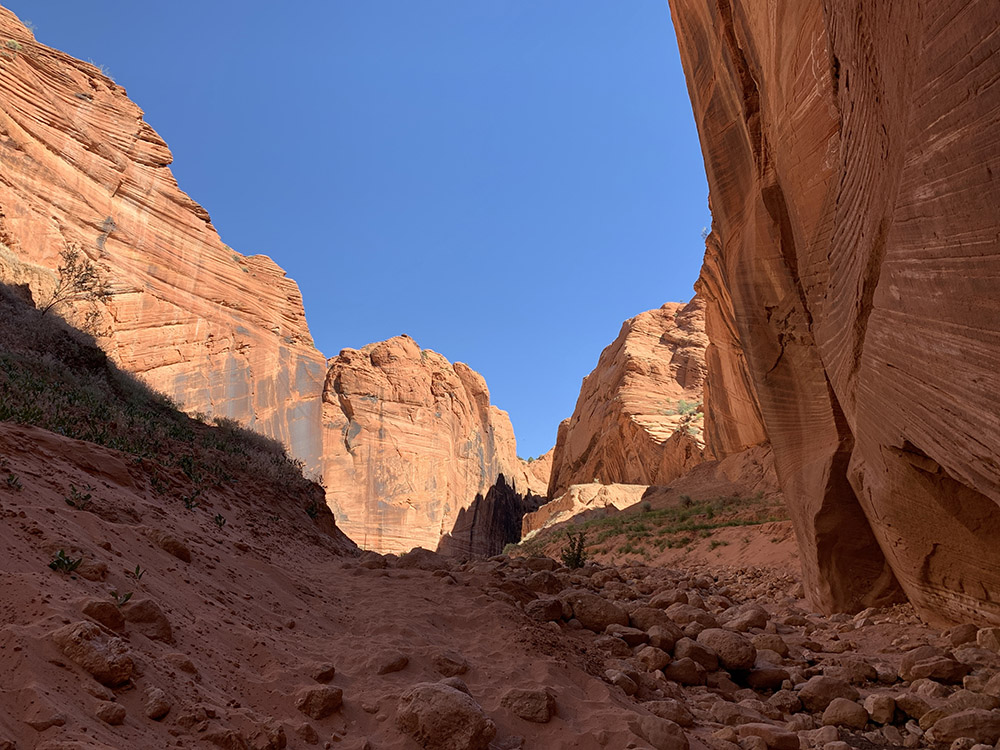
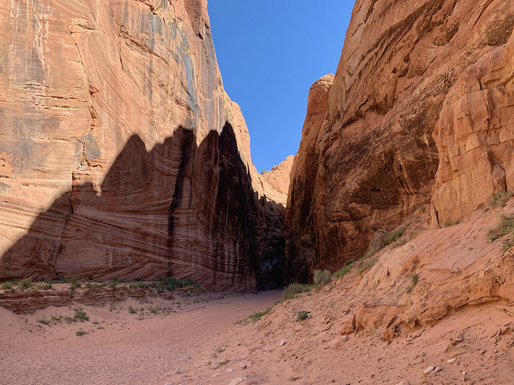
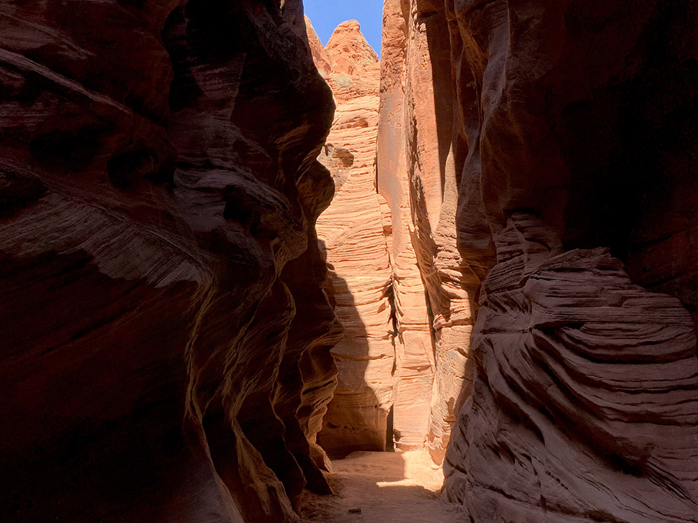
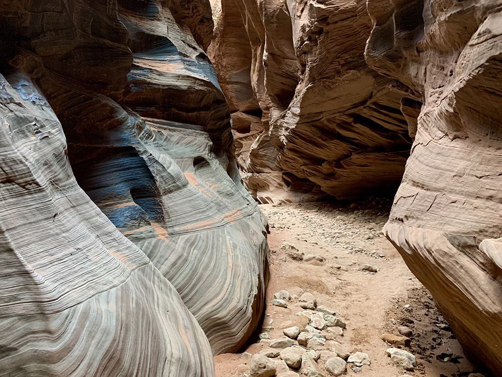
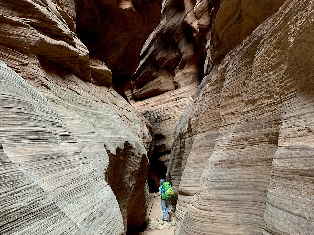
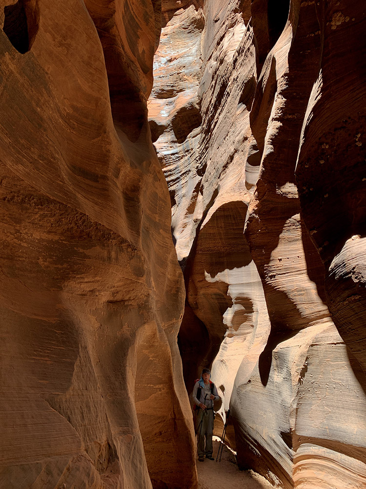
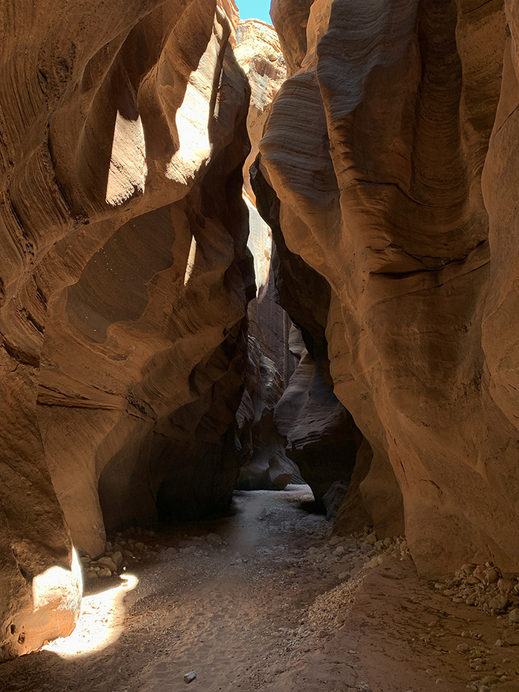
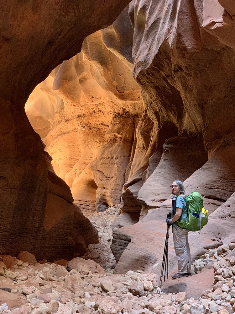
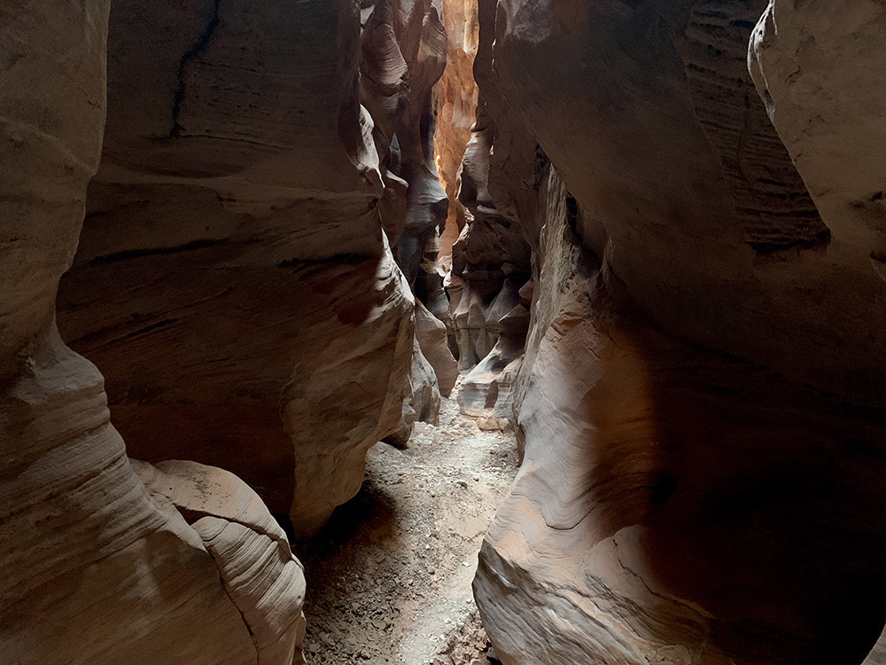
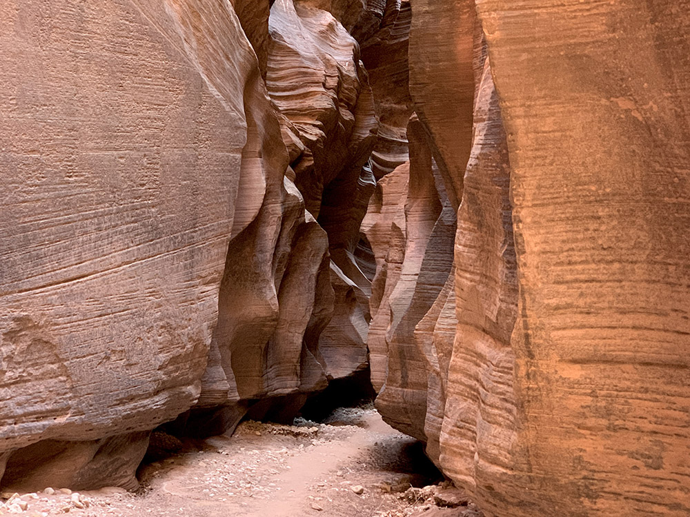
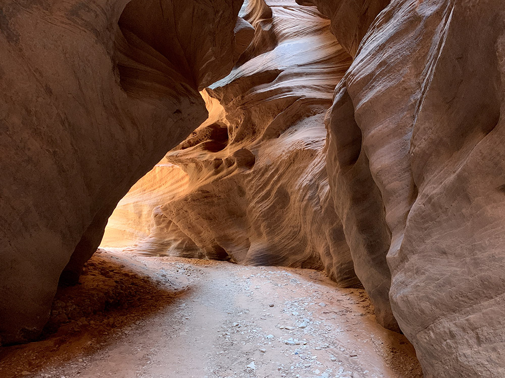
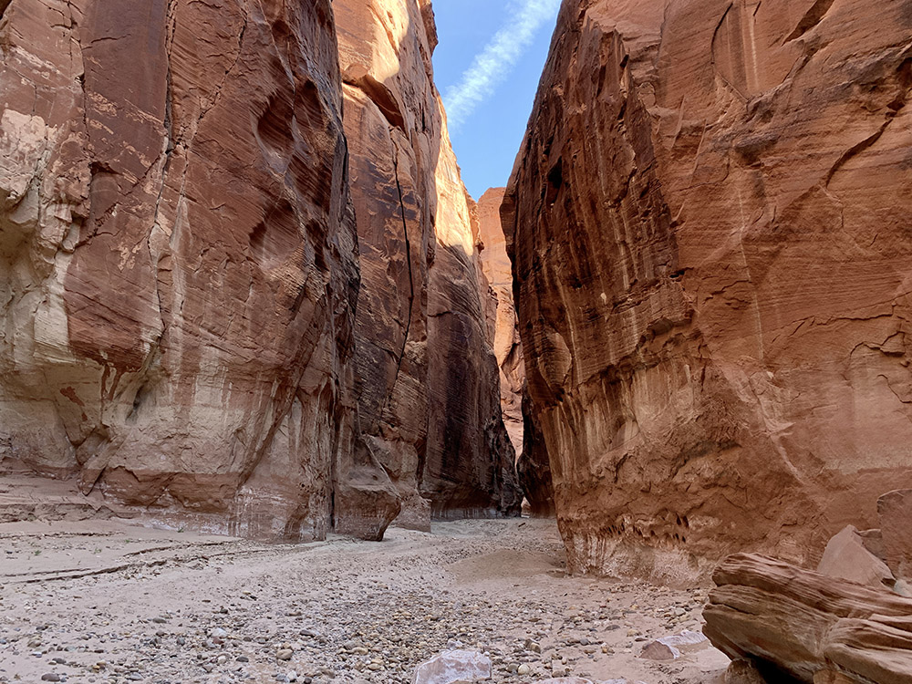
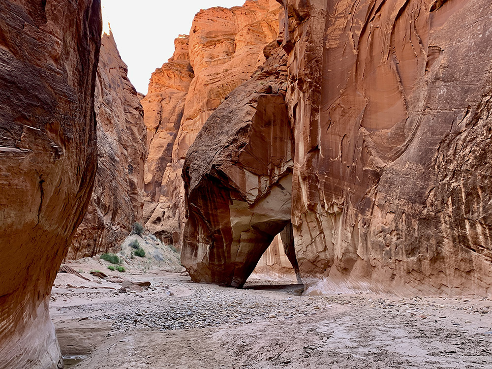
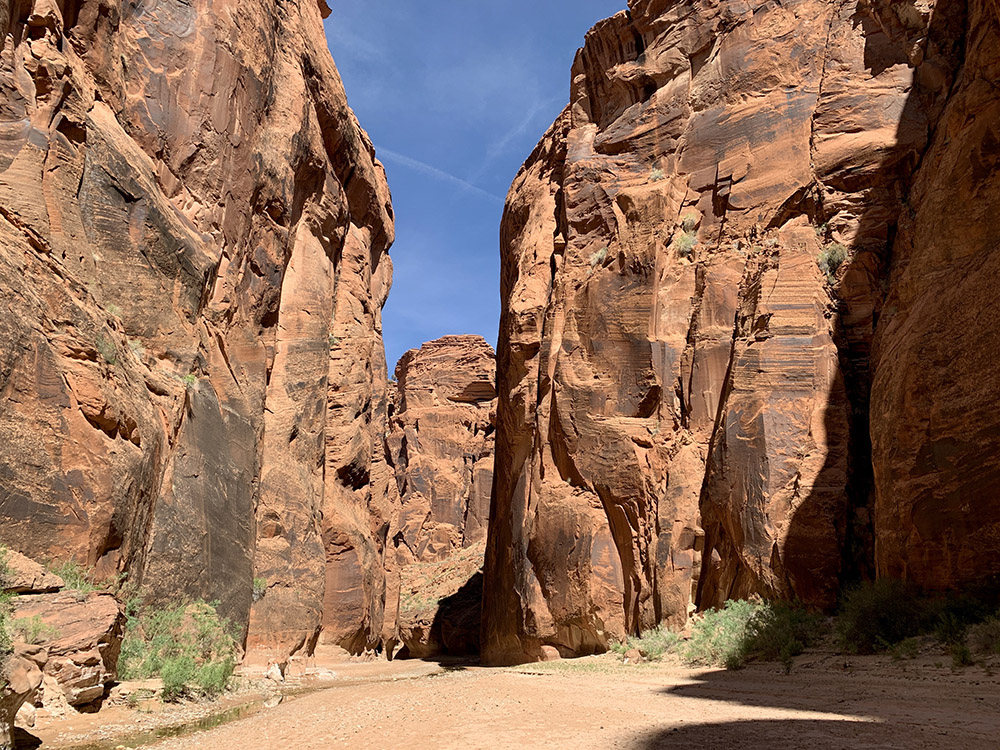
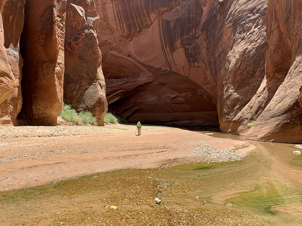
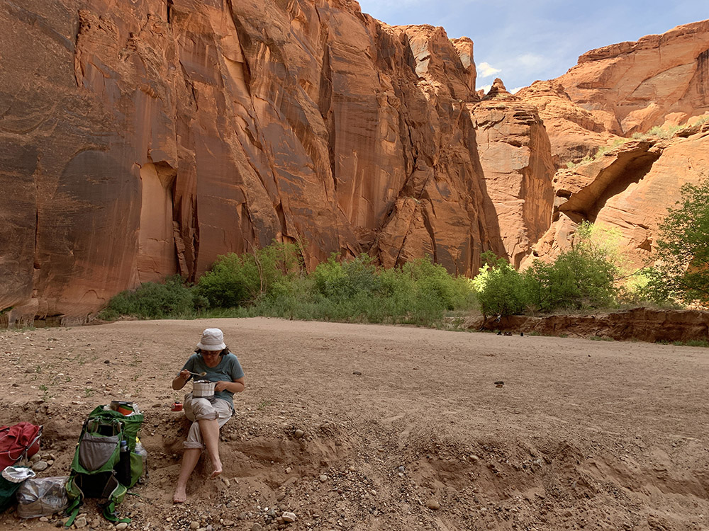
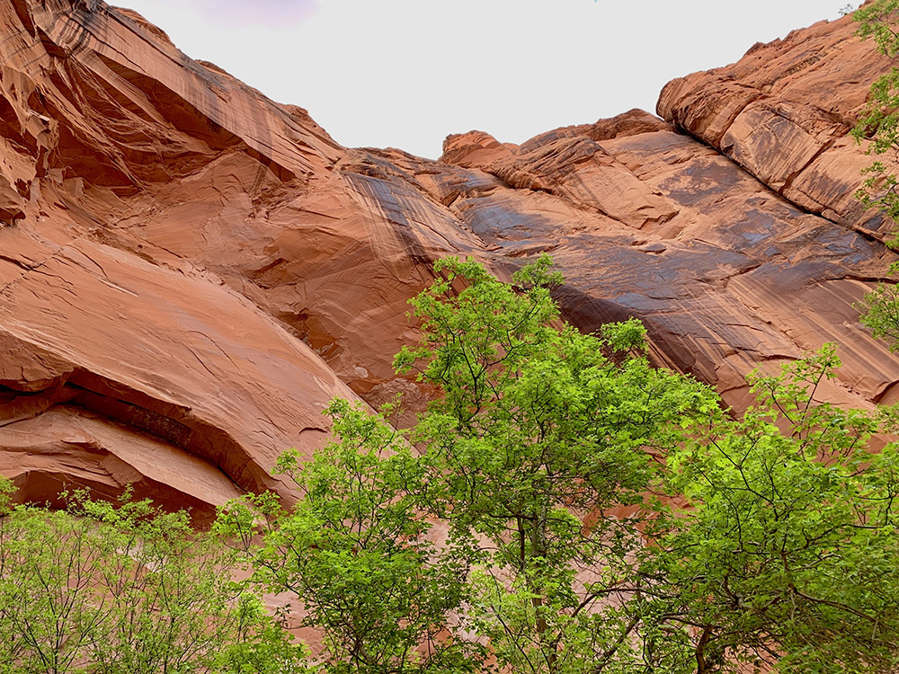
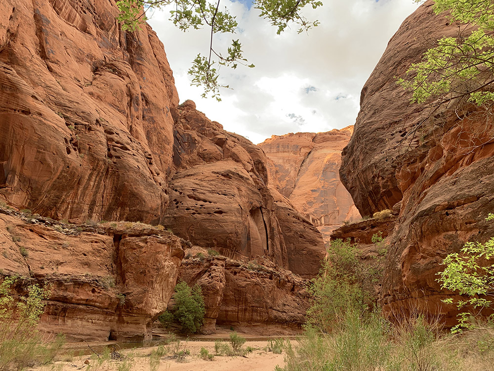
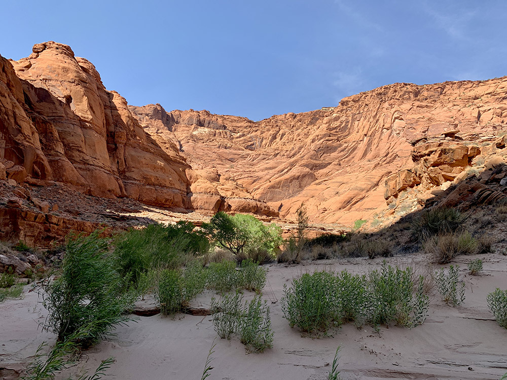
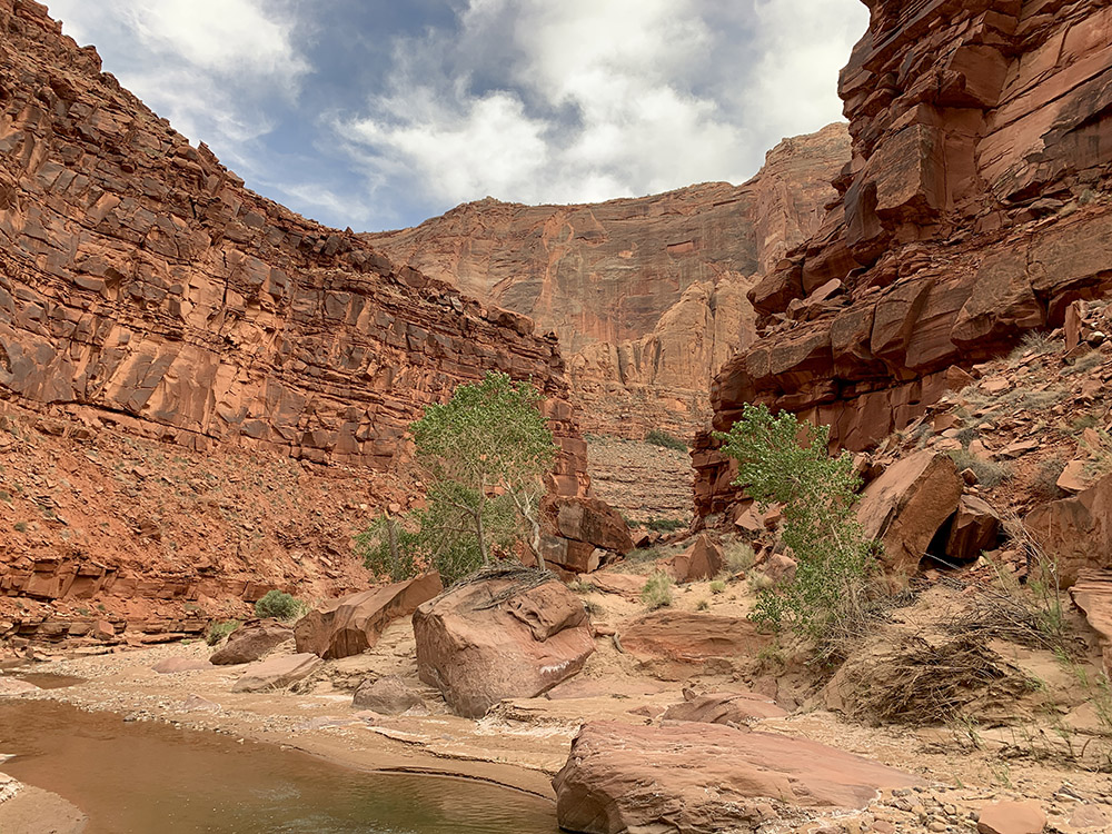
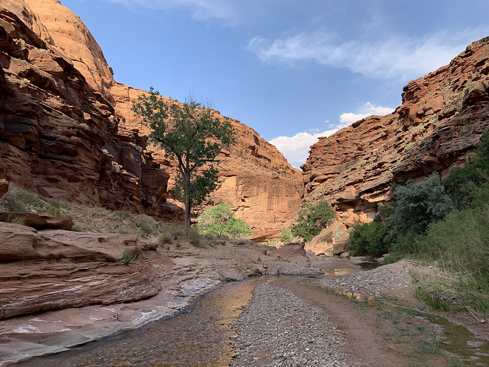
The first day was a long and incredibly beautiful walk down Buckskin Gulch, easy trail with just three small rock falls to pass. First with a ladder, second mini scrambler and last one under the rocks rather than over the top using a fixed rope (the underneath passage is sometimes blocked with flood debris). Joanna worried about this last 8 m drop we had to go through late in the day, but it turned out to be manageable with an old rope in place (we did not have to use our paracord brought in case we needed to lower our backpacks etc). It was a hot day above us, but rocks provided good “air-conditioning”. It was our first slot canyon and also the longest one in Southwest (and maybe in the world!) – we stopped constantly to admire it and take pictures. The scenery is quite stunning with colors changing from sunny and saturated to shadowy and grayish. Automatic image processing by phone camera exaggerates somewhat the extremes, but in reality the swings were also quite dramatic. We often felt like we were walking in a tunnel, as the walls seemed to close together above. They’re three dominant visual patterns: narrow passages with undulating rock walls sculpted by running water, 90° turns along major vertical cracks in huge sandstone blocks and some wider openings with sandy bottoms. We had lunch in one of the openings, the only places with enough space to sit. There were some day hikers at the beginning of the gulch, but almost nobody later on (only 20 overnight permits are issued). We have seen many photos of what it all looks like after rain (mud and muddy pools everywhere), but for us it was easy going – Joanna obviously did her homework picking the dates. Some parts of the trail are slower because of rocks, boulders and sand, but it is all flat. The first day was the longest of the entire hike (14 miles) with heaviest load (food for 5 days and water), but with all the excitement about beauty of the canyon we were not tired. We reached the first established campsite with many nice spots still quite early, but at least a dozen people already camped there. This area is the most popular. We decided to continue a bit longer to camp below the confluence (Buckskin and Paria). Nobody there, just a couple of hikers we met on the way collecting water from small river pool.
Hiking day 2.
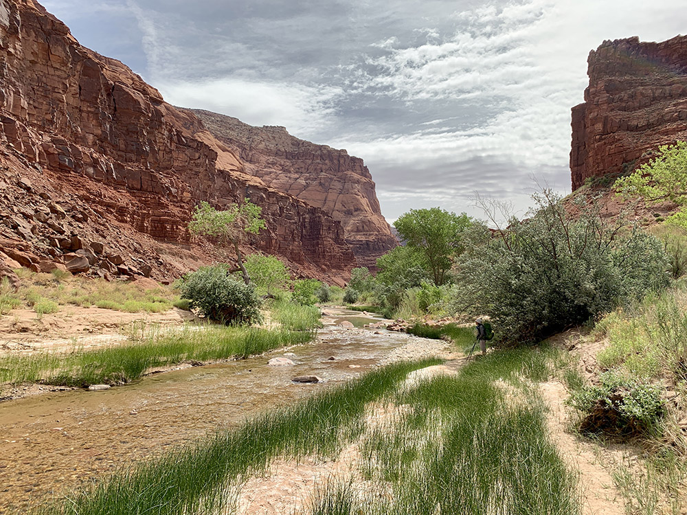
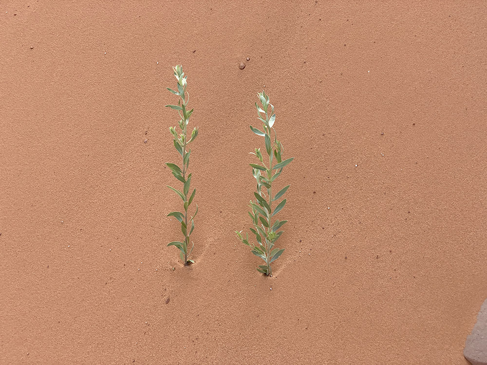
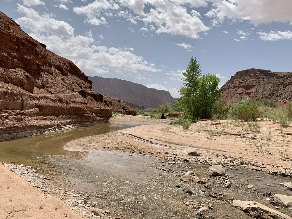
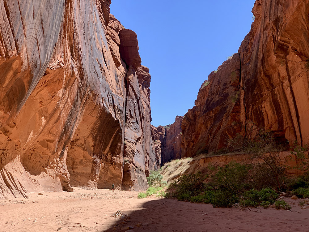
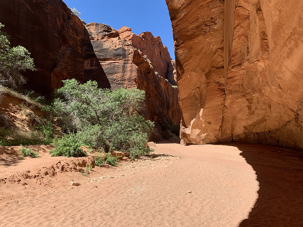
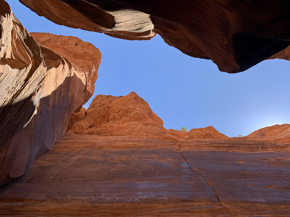
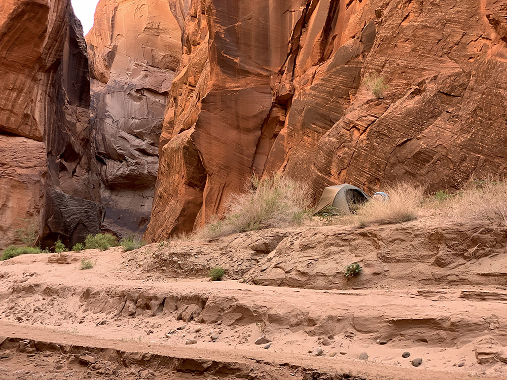
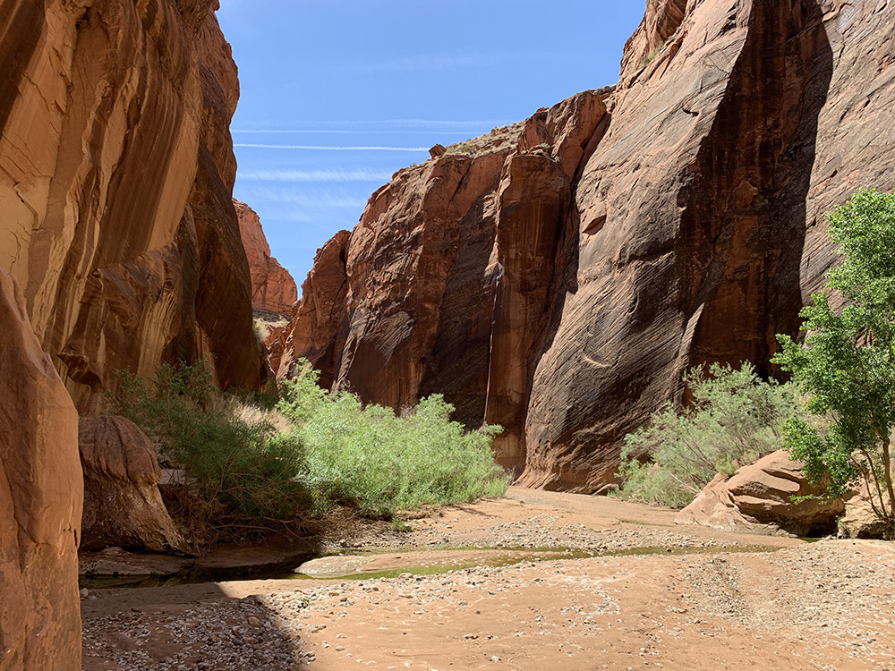
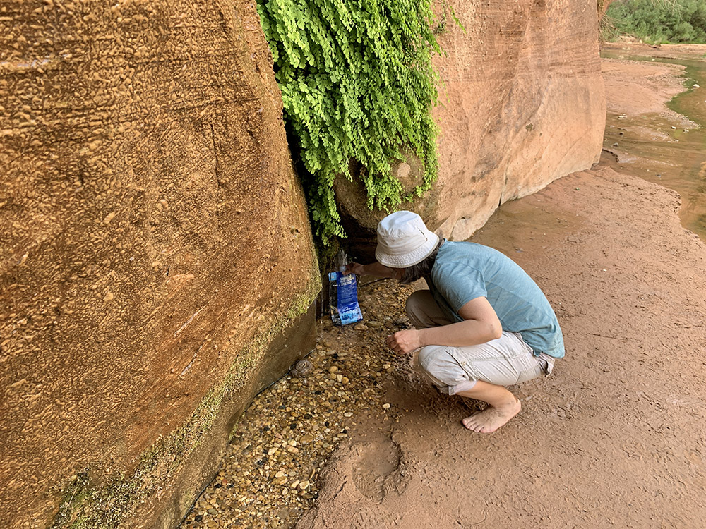
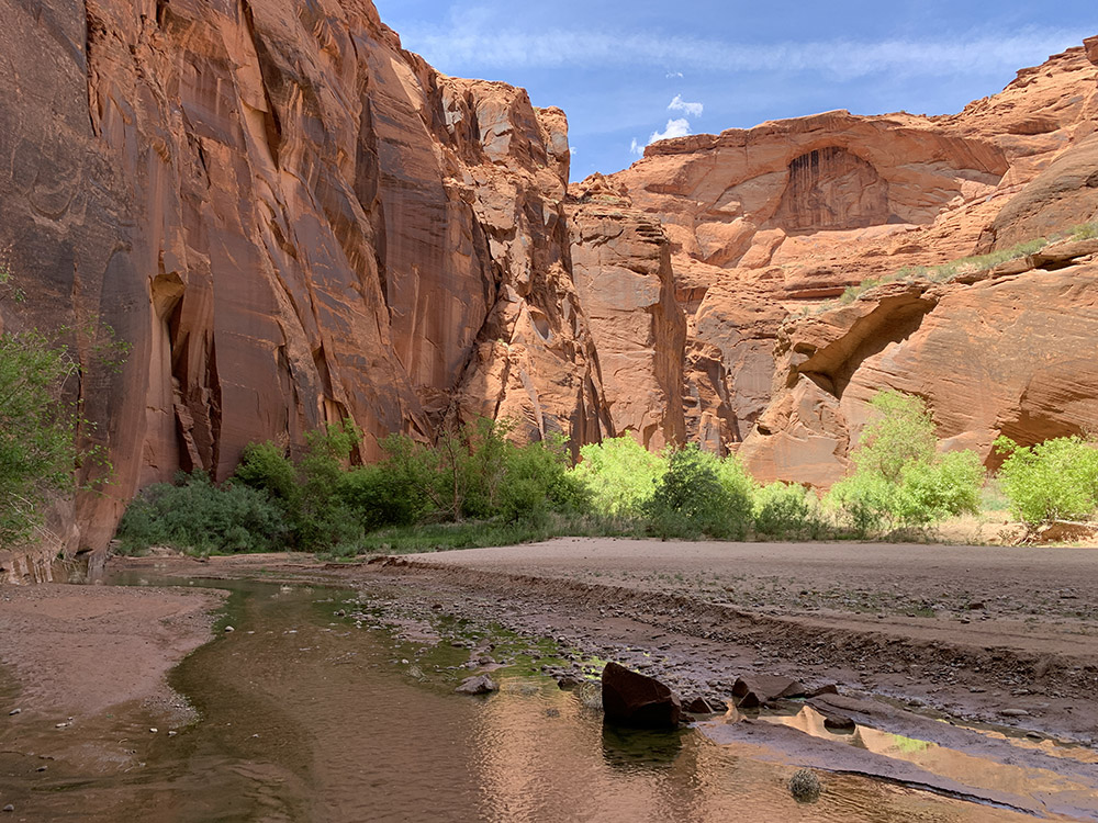
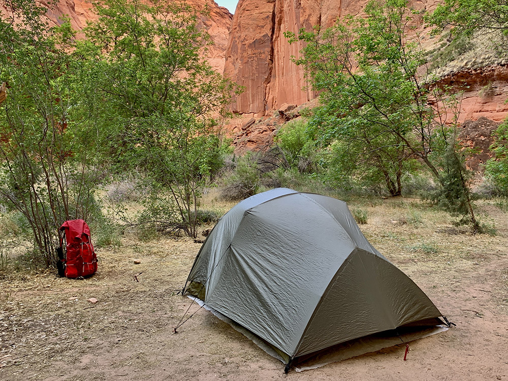
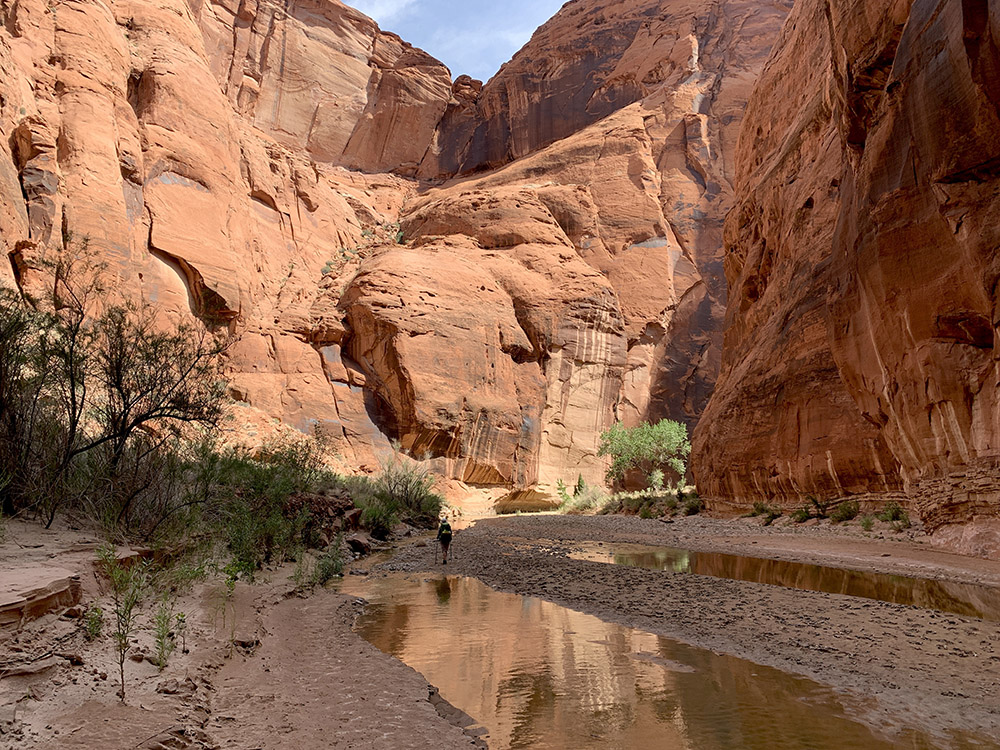
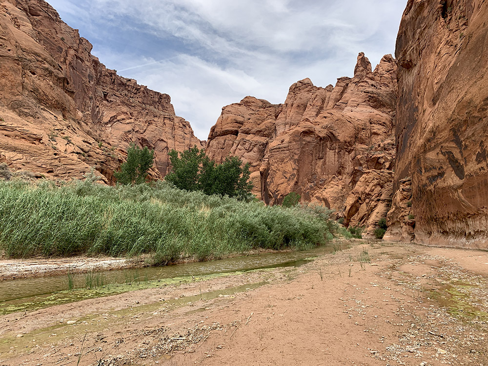
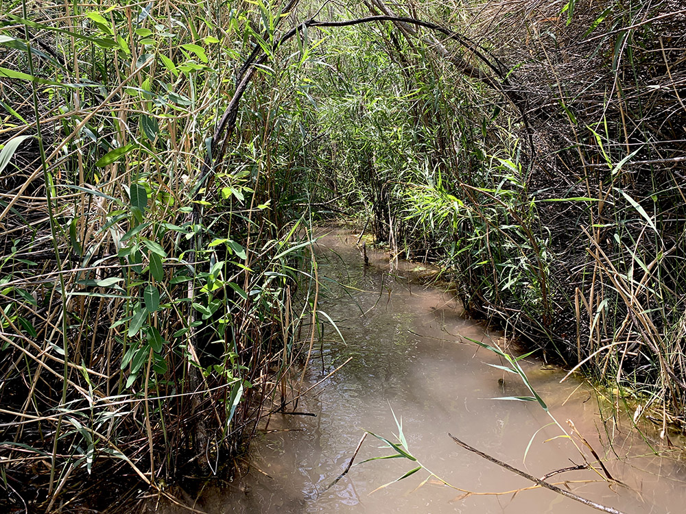
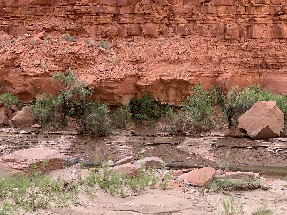
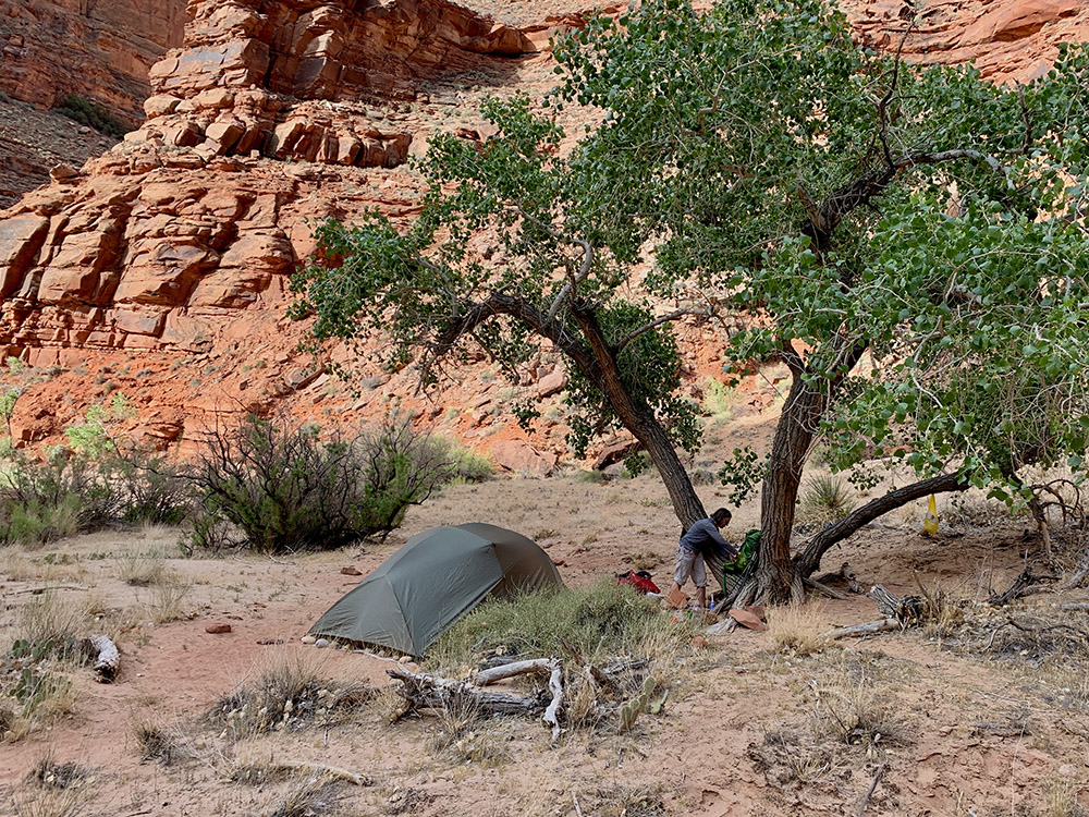
Next morning after breakfast we walked up the Paria Canyon a bit (just a mile or so) to the Arch (large piece of rock which broke off higher above and is leaning against the wall, not real arch). The trail leading up Paria Canyon (to Whitehouse trailhead) is the the most popular option in the area and we considered it as a day hike, afterwards happy we chose multi-day backpacking. We collected our stuff on the way back and continued down the river. The canyon becomes wider from here on (not a slot canyon anymore), but the walls are even more monumental. With many side wall springs there is more and more water running, quite warm and clear. There is also more green vegetation, nice contrast against yellow/red rocks. The day was hot and sunny, but canyon walls provided good shading. The plan was to walk to the first major spring and stop for lunch there. No problem filling up all our bottles quickly. At this point water in the river looked quite usable, we preferred to take it from springs (filtered it anyway). To save fuel, Joanna developed recipes which do not require real cooking, just soaking in hot filtered water (work with cold water as well, if necessary). After lunch, we walked more and started frequently crossing what now looked like a real stream/river. Jumping on stones first and then just wading through. After 8 miles or so we found a nice camp site with nobody around. With several good spots to chose from, we could not resist a solid discussion which one is the best. It was the most relaxing day (“rest” after a long hike the day before) and best campsite on our trek. We like our tent (Seedhouse 3) and were quite happy to have it successfully repaired by Big Agnes (worn zipper and poles bent by strong wind at Whitney Portal).
Hiking day 3,
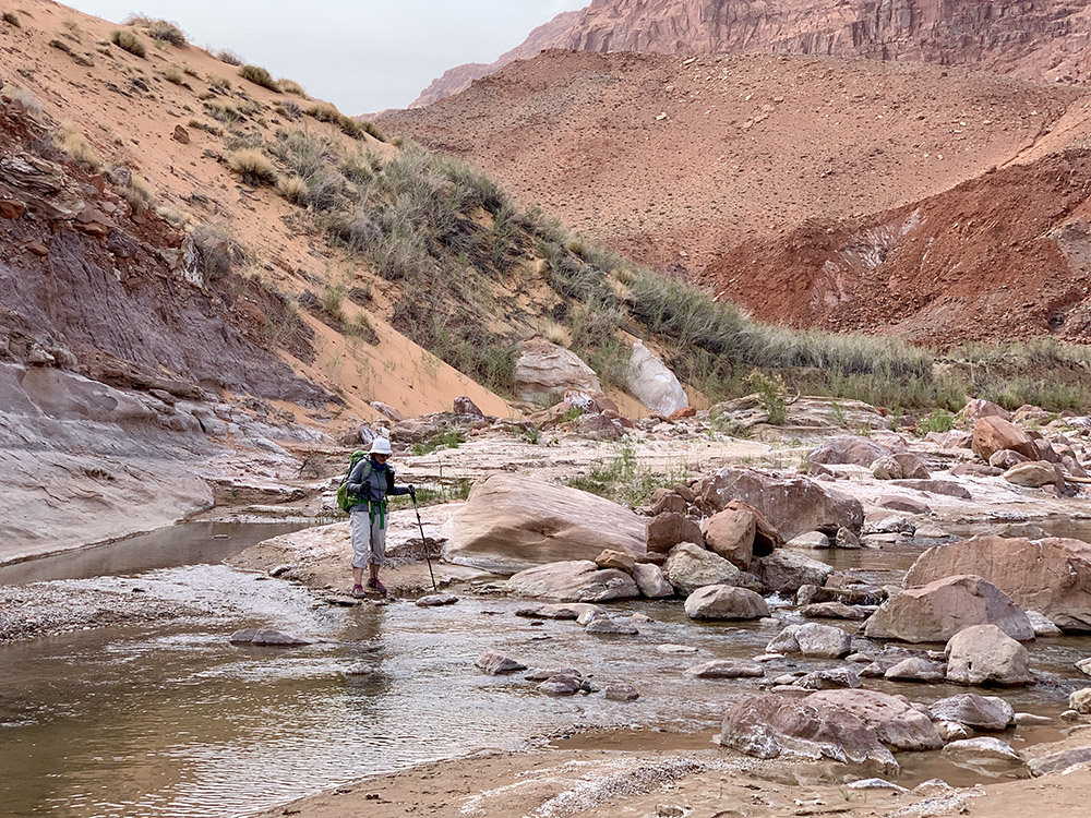
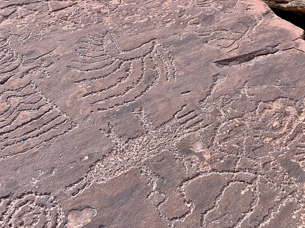
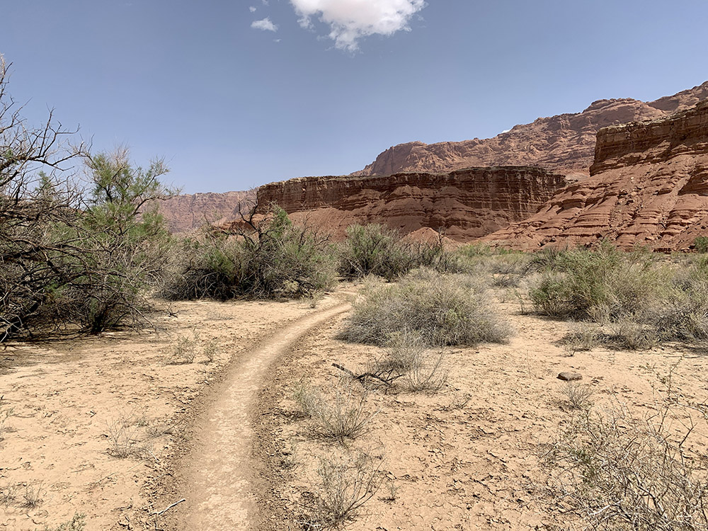
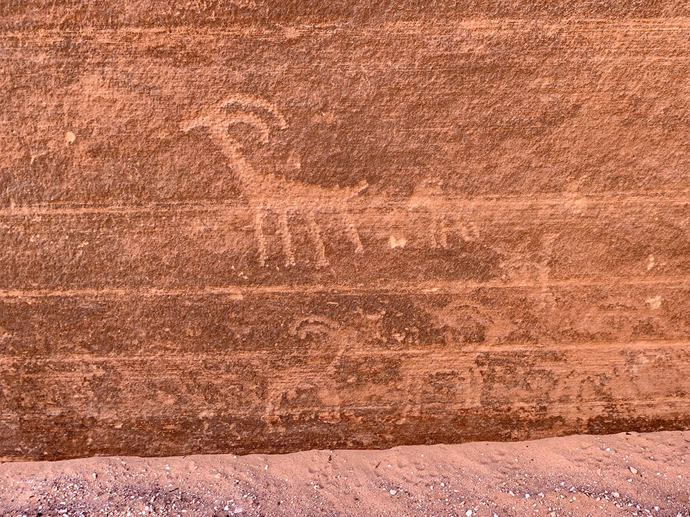
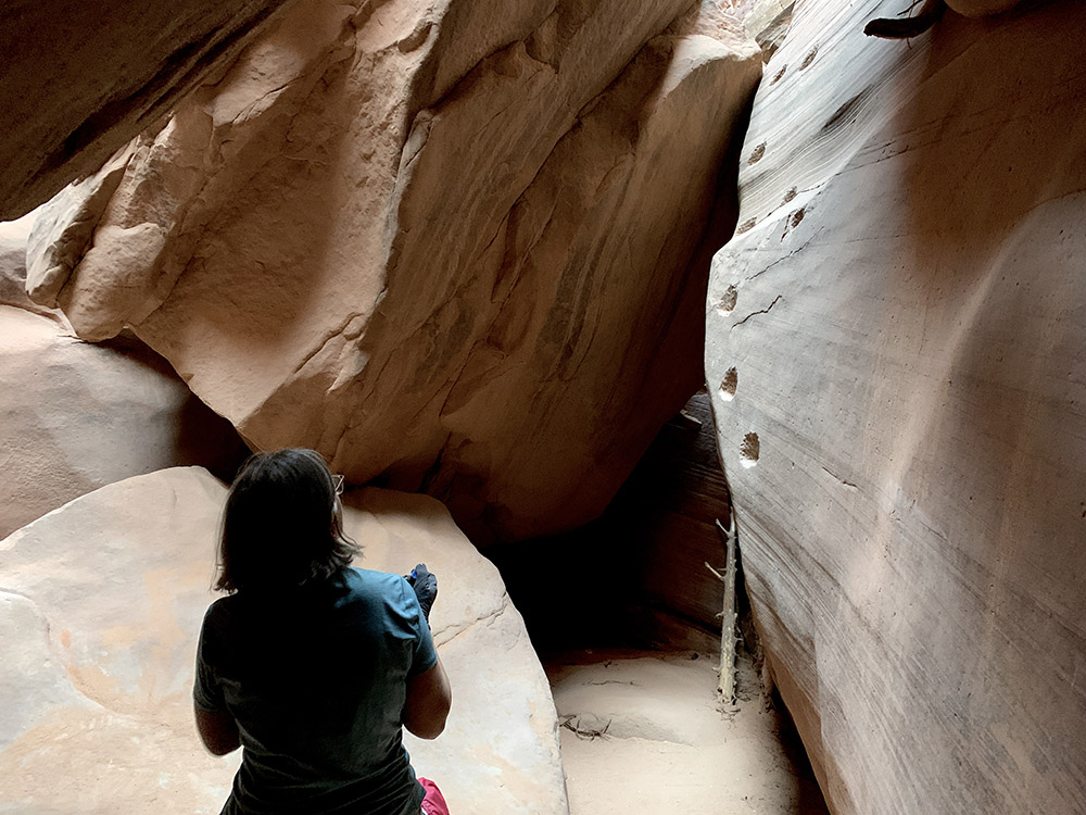
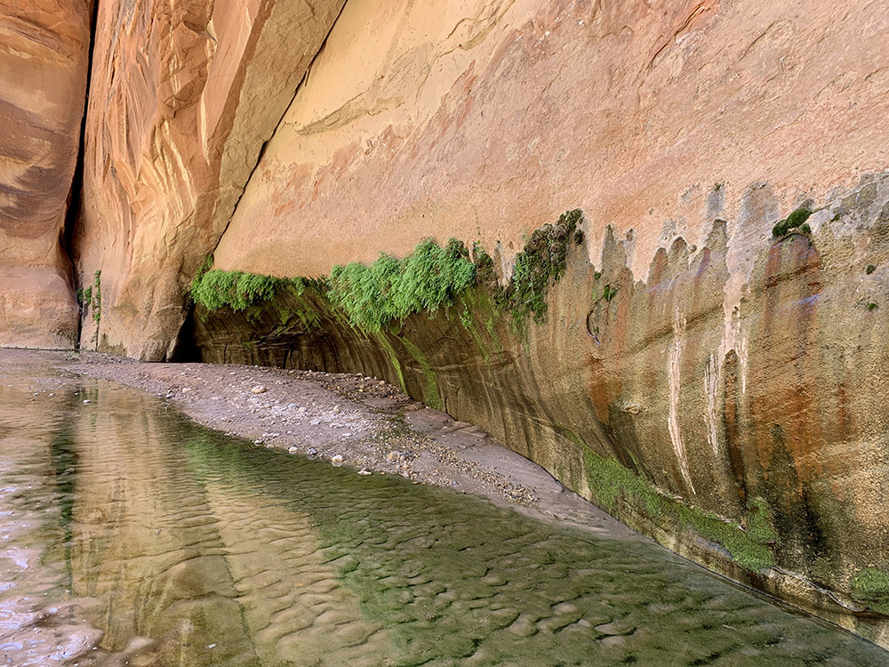
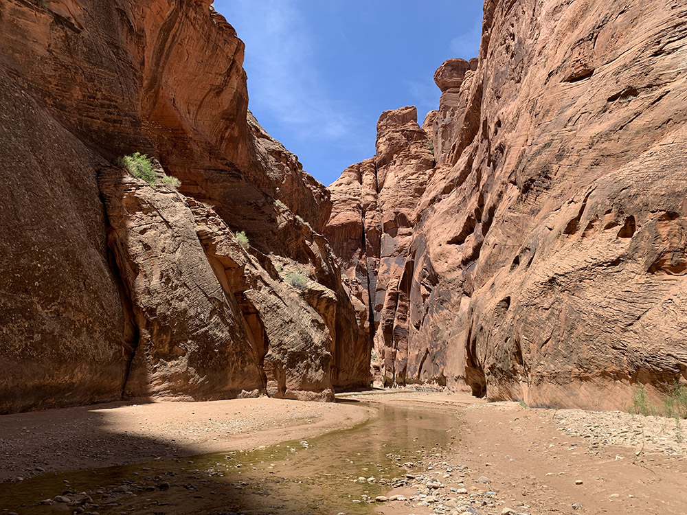
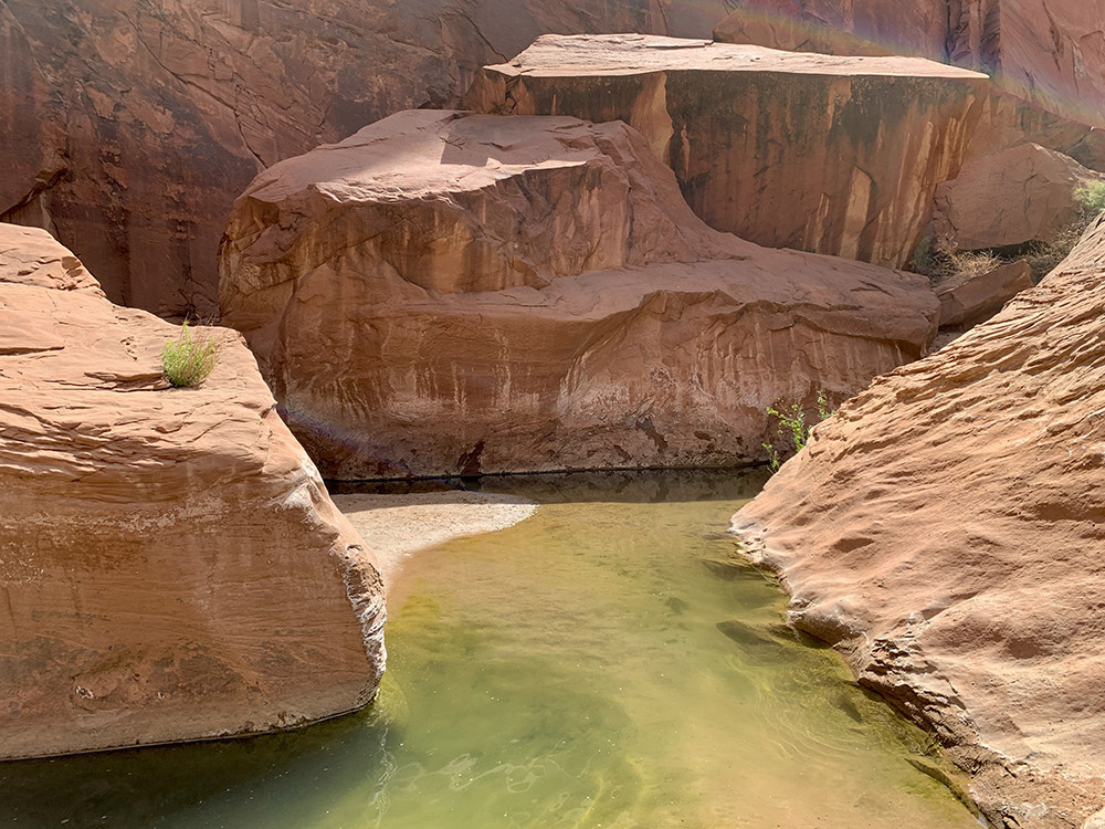
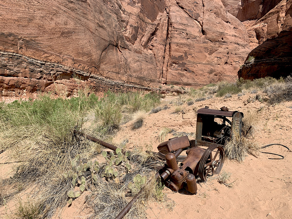
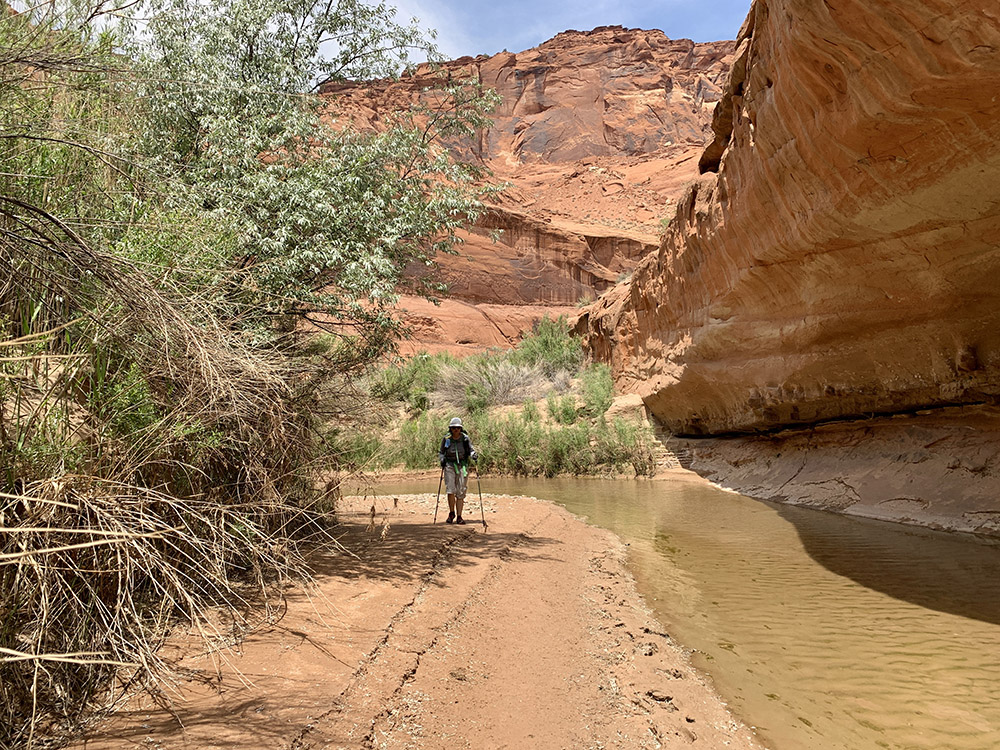
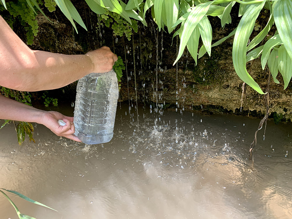
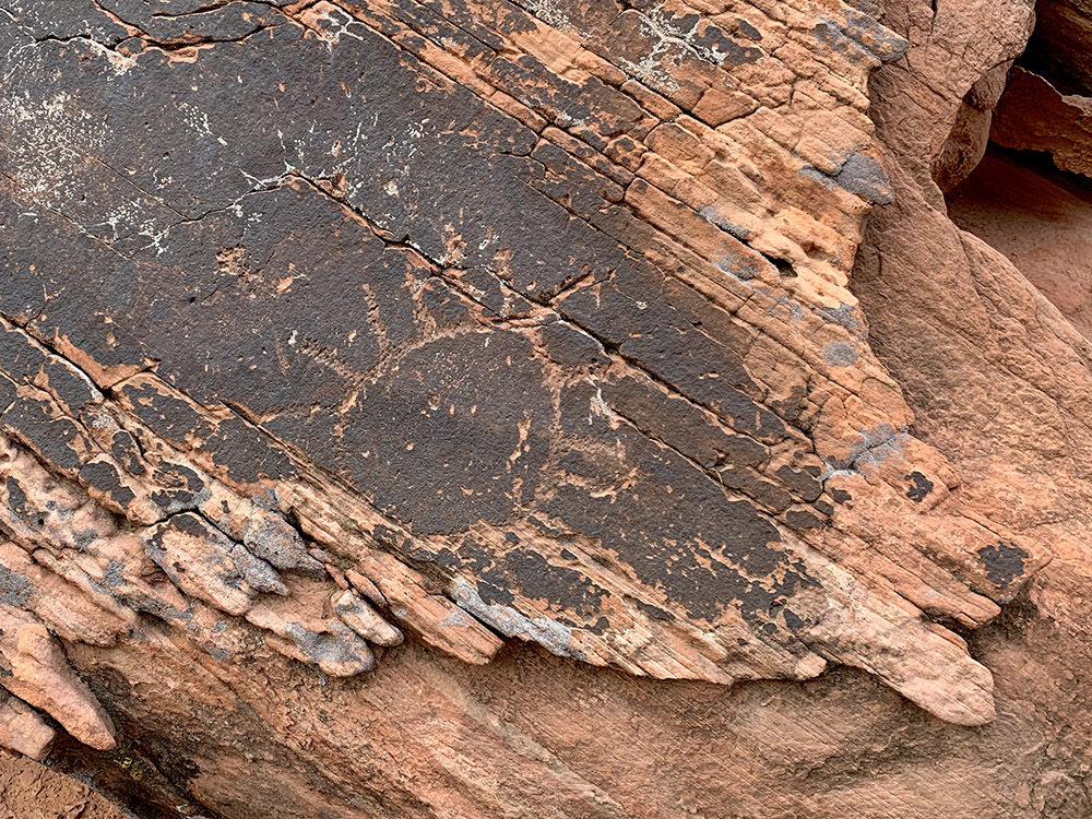
The following day we walked another 10 miles. The canyon widened, but the walls remained very steep and high most of the time. The river is shallow and flowing slowly here and still gaining volume from side springs. It is often flanked by plants, even bigger trees. Quite green. We stopped at the biggest spring along the trail for lunch break. The spring is hidden in dense bush with water dripping at good pace into muddy pool, perhaps 3 feet deep in the middle. We filled all our bottles (empty by now) standing in the pool. We continued walking on sand bars along the river or wading through shallow water avoiding muddy spots. Piotr sank about a foot stepping in one of those muddy spots, but recovered quickly. It took just 2-3 seconds. Solid bottom (probed with waking pole) was another foot deeper. There were multiple pools for good soaking. We arrived at our daily destination early enough to pitch the tent and soak for a while in whirlpools just below Shower Springs (refilled all bottles one more time). The river was running much faster here over stones and between small rocks. We could still not believe how warm the water was (comparing to mountain creeks). We saw only one hiker the whole day, but there were signs of old human activity: abandoned water pumps and pipes used to push water up to the top of the mesa (with lousy result) and what looked like a petroglyph (there suppose to be more of them at the site, but we could not find anything else).
Hiking day 4 and 5.
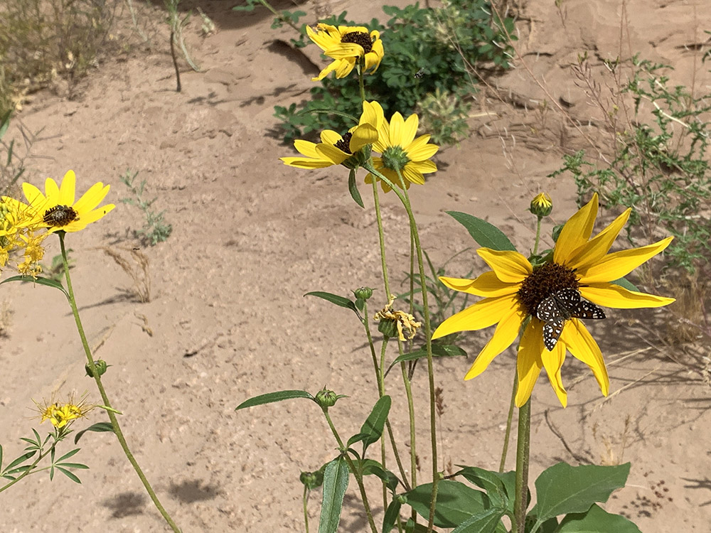
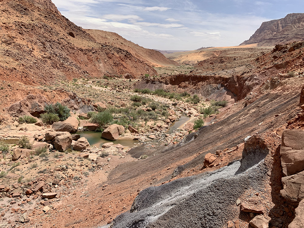
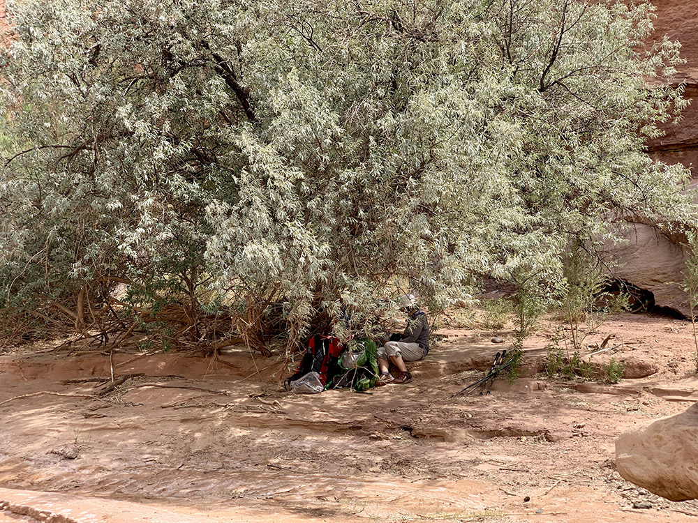
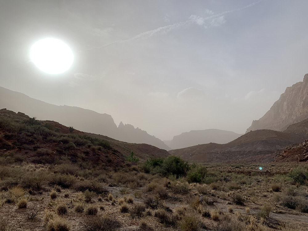
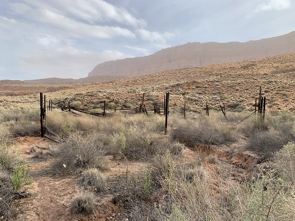
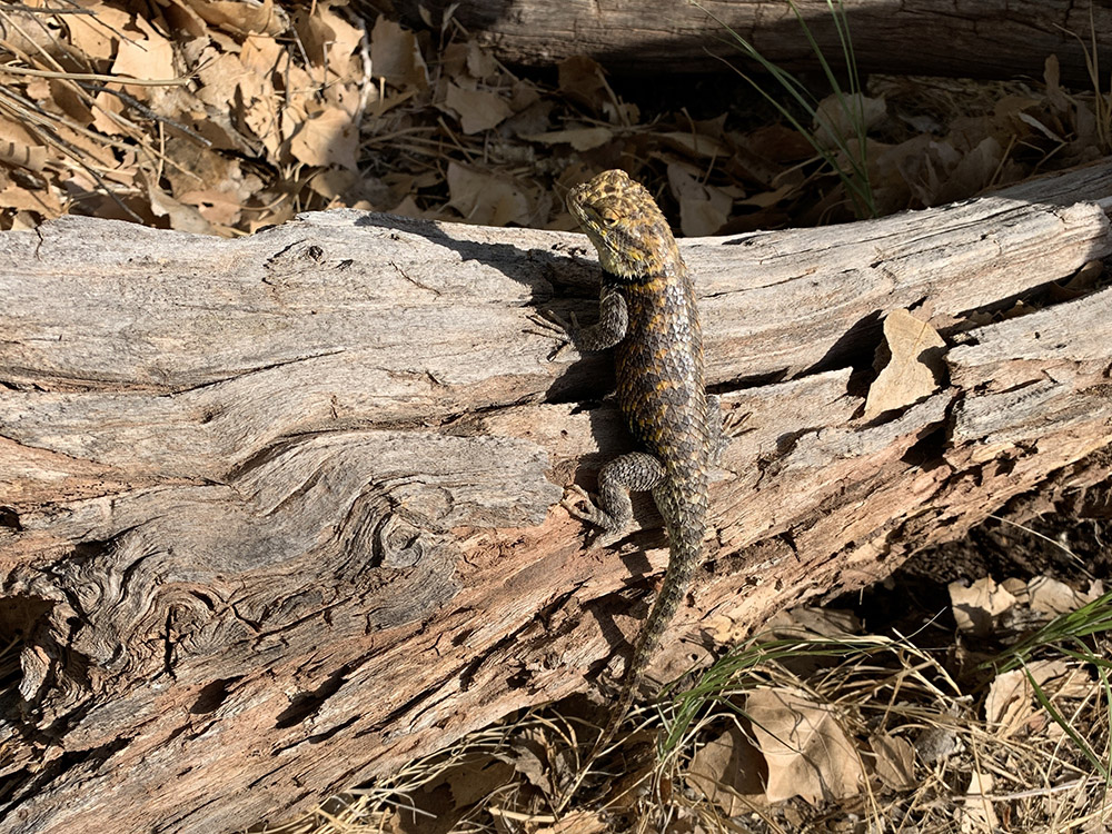
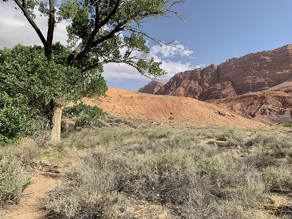
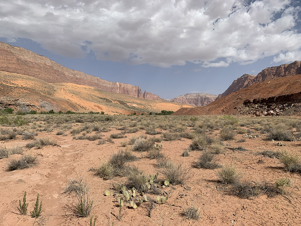
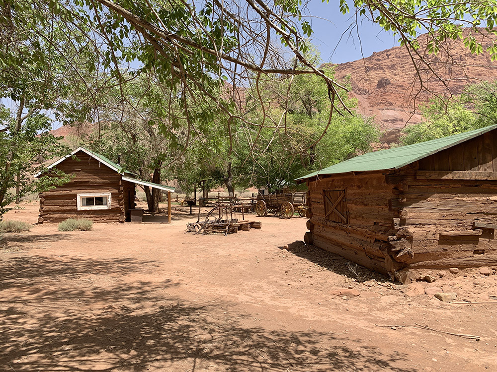
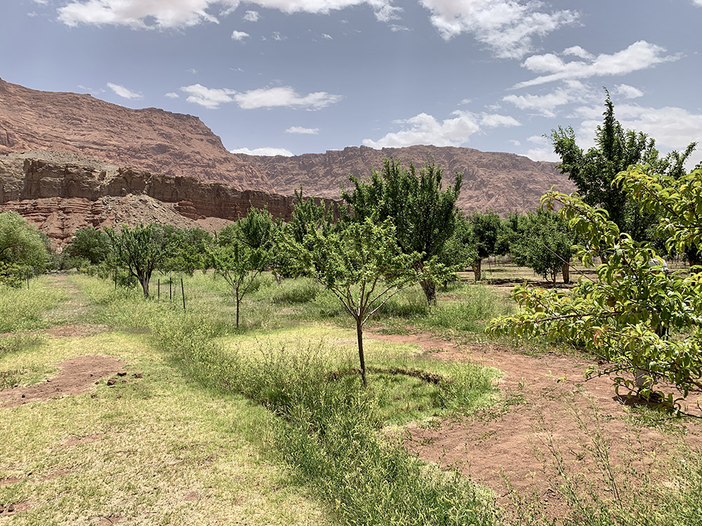
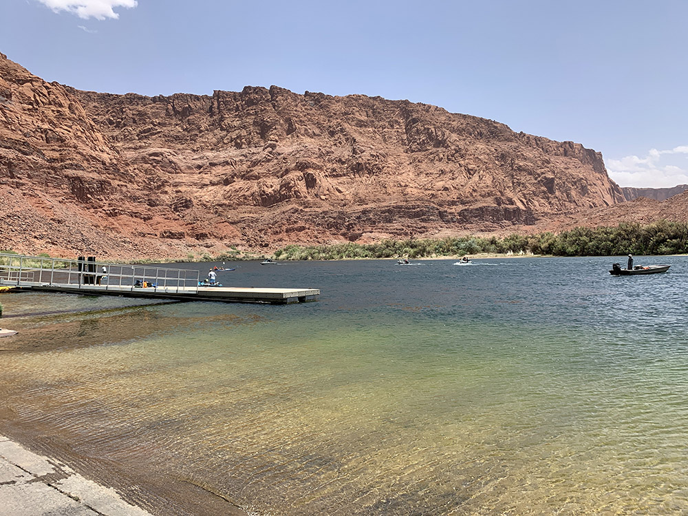
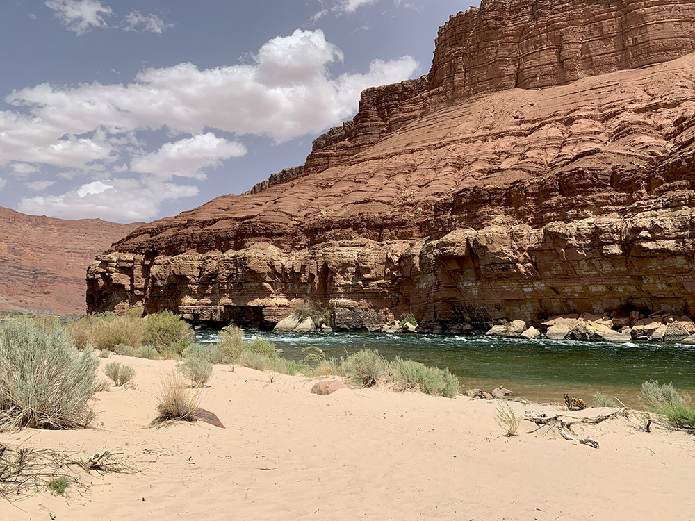
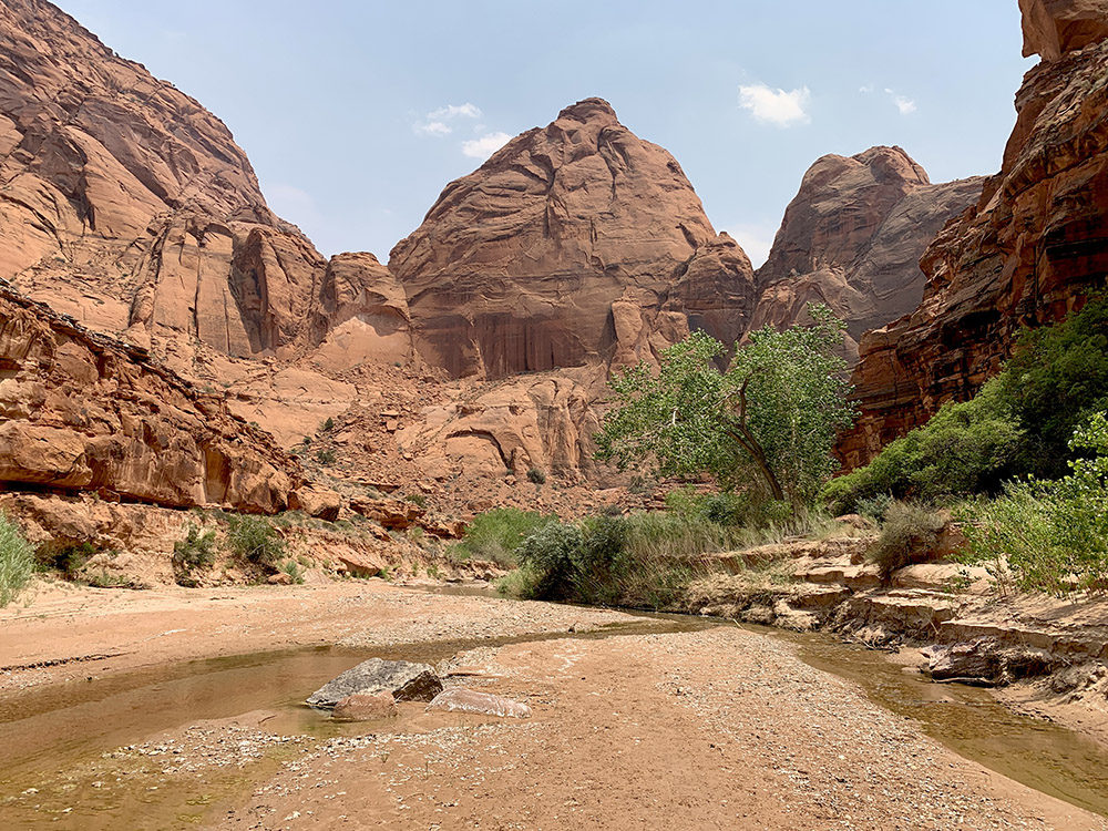
It was just day and a half of hiking (9 plus 6 miles). We were not in a hurry and stopped for the night at Wilson Ranch rather than making it a long day all the way to Lees Ferry (we expected the campground there to be crowded). Paria Canyon here looks more like a valley, wider and with rock walls on both sides less vertical/more eroded (still quite impressive). The valley also becomes drier and drier, and the river does not seem to gain much more volume. From a walk along the river the previous day it changed to a walk across a desert with river nearby. It was hot with no shade from canyon walls. We started walking across larger meanders, sometimes sandy and rather flat, sometimes rocky and quite steep. When it was time to cross the river we searched for a good spot to get on top of the other bank and look for a trail (there are always trails there). Then when the terrain got too difficult we crossed the river and repeated the same on the other side. At times we walked closer to or in the river. A few times we were actually quite high above the river: once when it cuts into a deeper canyon (it is the deepest point somewhere there, relative to the surrounding mesa), once walking on piles volcanic ash/cinders (when the canyon cuts deep enough to reach remnants of old volcanic activity) and then along big sand dunes with interesting orange/pink sand color. Different landscape variation comparing to the first 3 days. Joanna found a lonely tree just on the river to give us some shade for lunch break, but Piotr did not like bird droppings (all birds congregated on this lonely tree). After lunch, Joanna found a small pool big and deep enough for a swim – just a few strokes. Piotr settled for another whirlpool. We met nobody all day, but again found petroglyphs and camped near abandoned ranch. Wind gusts were getting stronger kicking up fine dust. They were strong enough to produce a mini sand storm in the afternoon. The wind died down at night, but picked up again next day. Wind-blown dust in the air made the landscape feel even more like desert. The old springs at the site were not accessible and this time we took water from the river. At the campsite near remains of a horse corral, we were watched all the time by lizards and rodents. There was an old skin shed by a decent size snake, but no snakes detected. Next morning was walking across much more open terrain, less interesting. Strong wind and dust was wearing us down a bit at the end. It was even difficult to stop for a snack rest, we ate some in the wind, but did not realize we were so close to Lonely Dell Ranch, a much better spot for lunch break. We made it to the farm earlier then anticipated. We looked around and continued to Lees Ferry to retrieve our car. We looked at Colorado River there and from a beach short distance further downstream. We drove to Page and stayed there at very good airbnb: large space with small kitchenette, well equipped and organized. Just what we needed to regroup, shower and rest. Plus laundry and dinner at Mexican restaurant nearby.