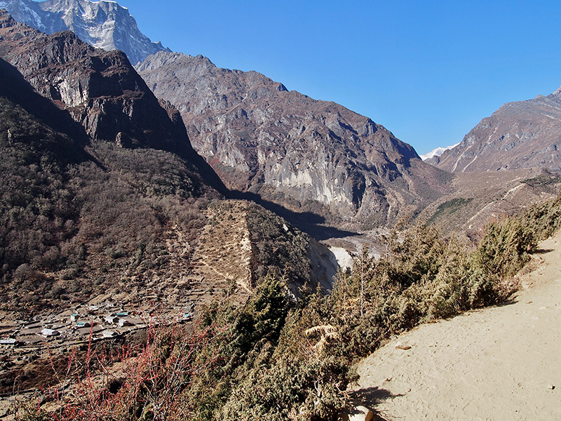
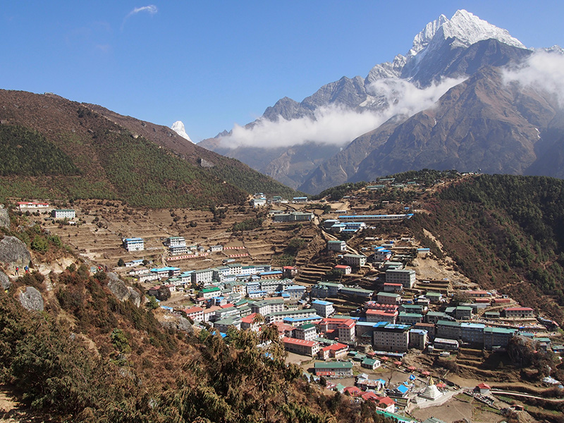
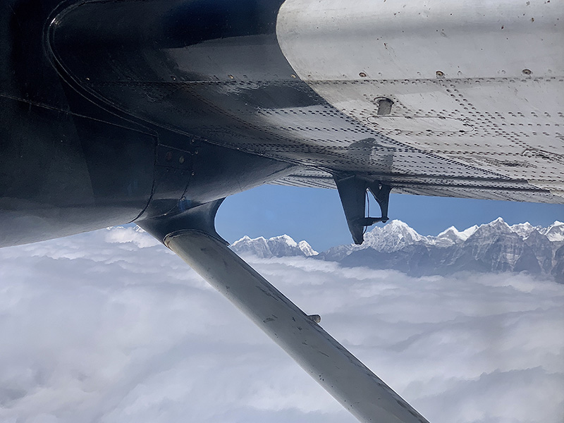
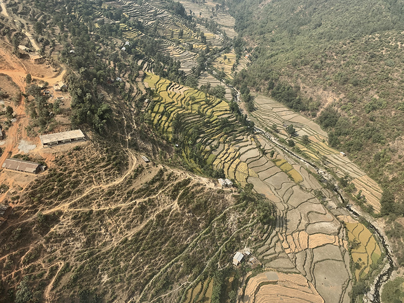
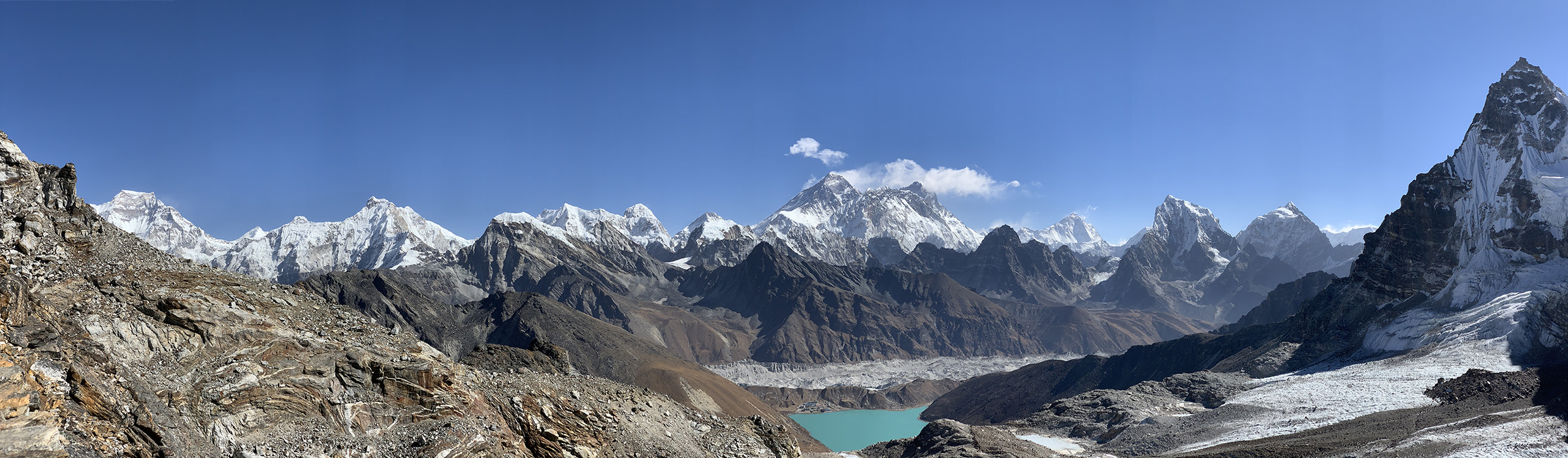
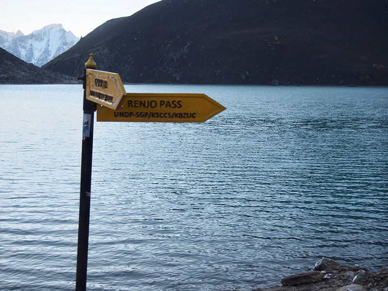
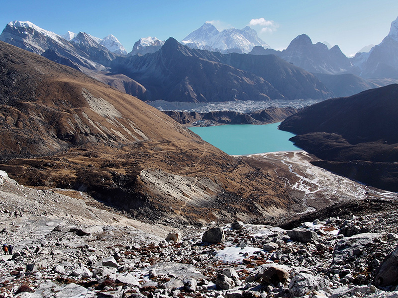
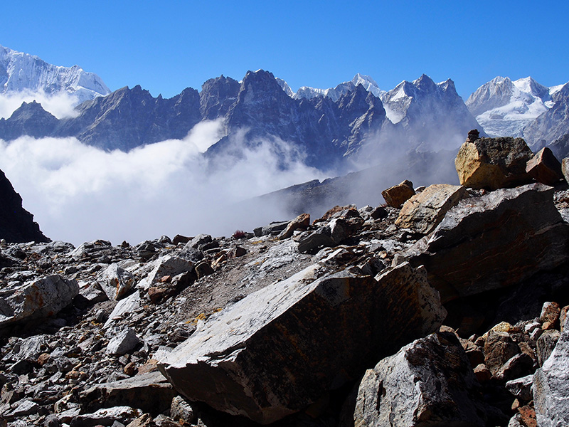
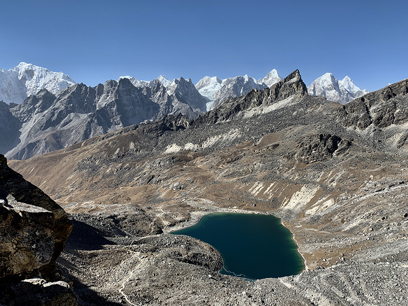
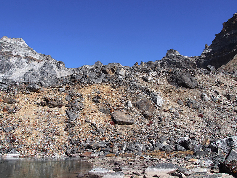
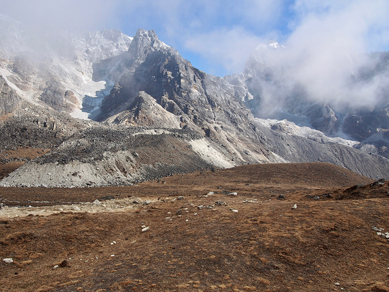
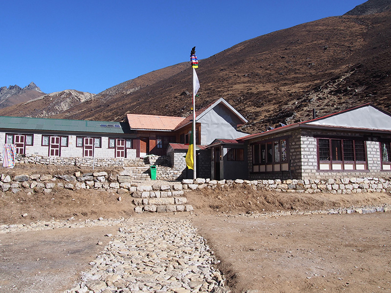
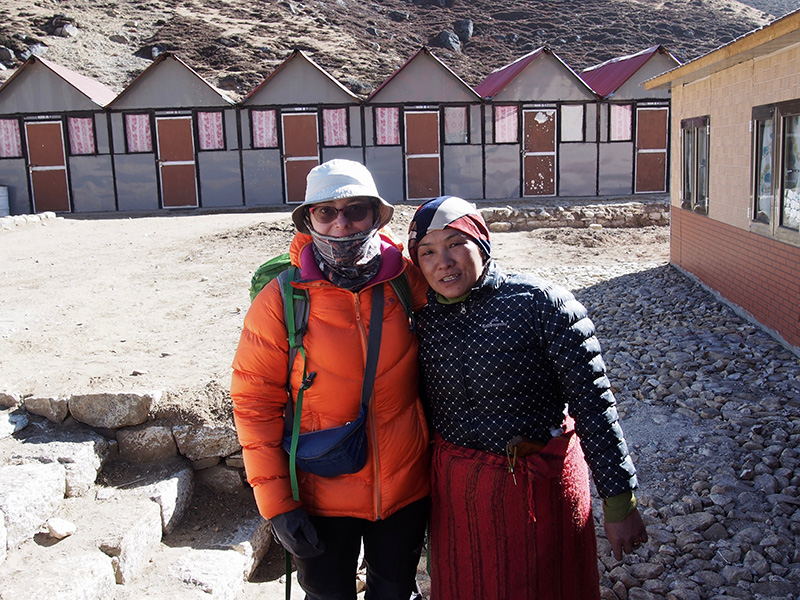
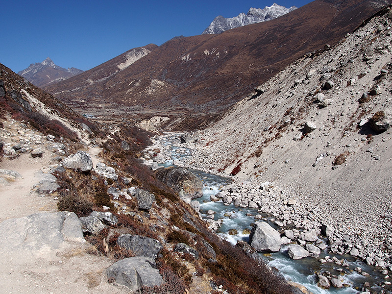
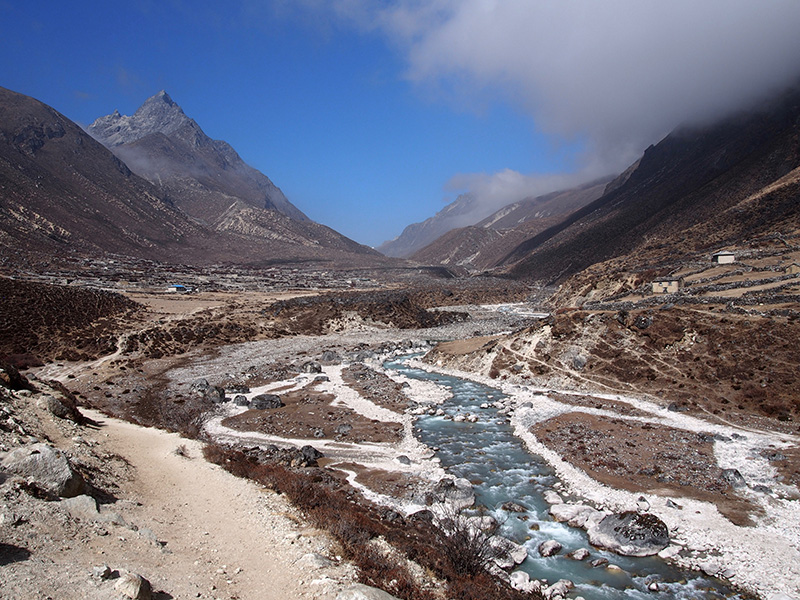
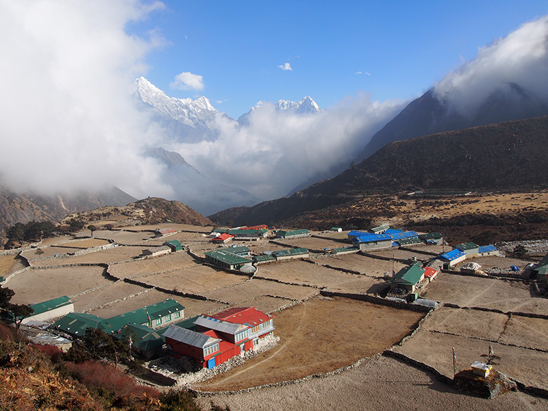
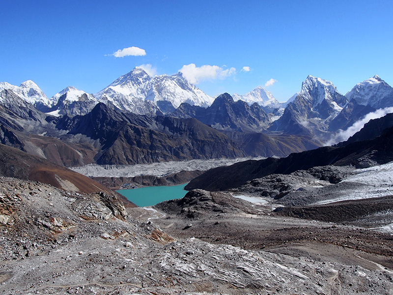
We are back in Chicago from 31-day trip to Nepal with short stops in Qatar. We had very good time hiking, slower than anticipated, but made it to all the places as planned (with only minor adjustments): Gokyo and the Lakes along Ngozumpa Glacier, Gokyo Ri, Renjo Pass. Five of the 15 World’s highest mountains were within our sight: Cho Oyu (8188) and Gyachung Kang (7952), Everest (8848) and Lhotse (8516), and Makalu (8485). Our trail was 152 km long with, 13 km total ascent, hiking between 1490 and 5375 masl. As we hiked slowly, high altitude was not a big problem.
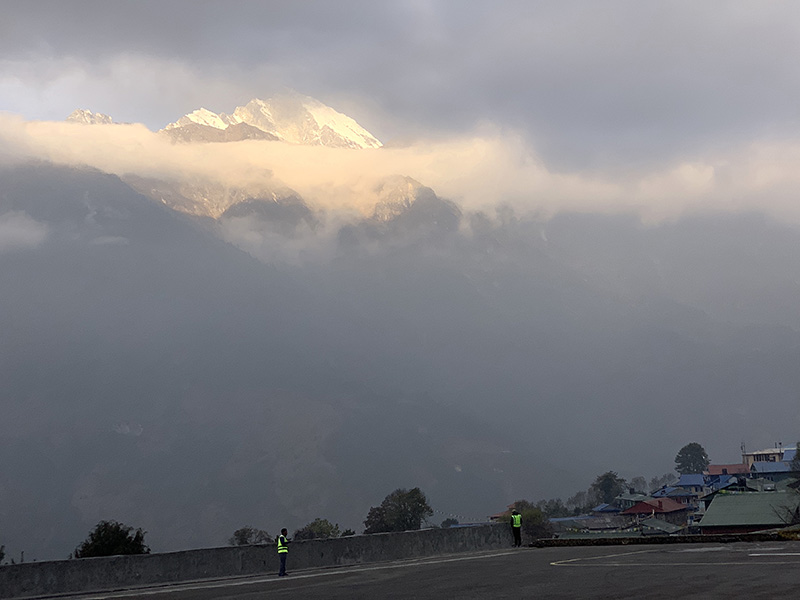
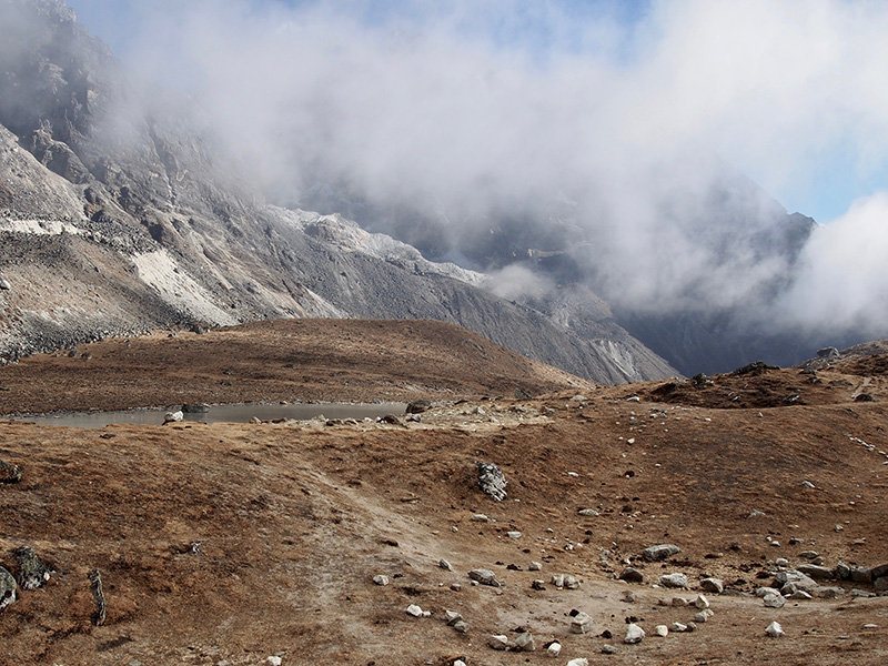
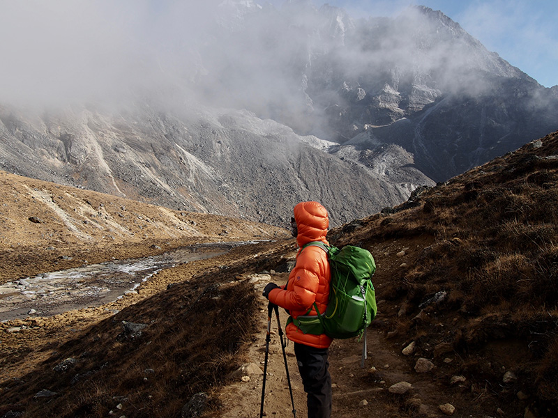
We had good weather most of the time, perfect on Renjo La for snapshots with Everest and Lhotse. It was supposed to be mostly sunny and clear in November, but each day clouds rolled in around noon or earlier (one full day was all clear, but one completely cloudy) and afternoons were really cold. But no rain or snow which was great. Overall the weather was actually not as cold as we expected despite cloud cover in the afternoons. Very warm when the Sun was out. We hiked in sub-freezing temps (-6℃) only in the morning on the Renjo La day and temps down to -1℃ to -2℃ on a couple more days with cloud cover. We had only one night with sub-zero temps in our room (down to -1℃). Joanna’sleeping bag was not very warm, but it worked well with thick lodge blankets – all lodges were well prepared for cold weather in this respect.
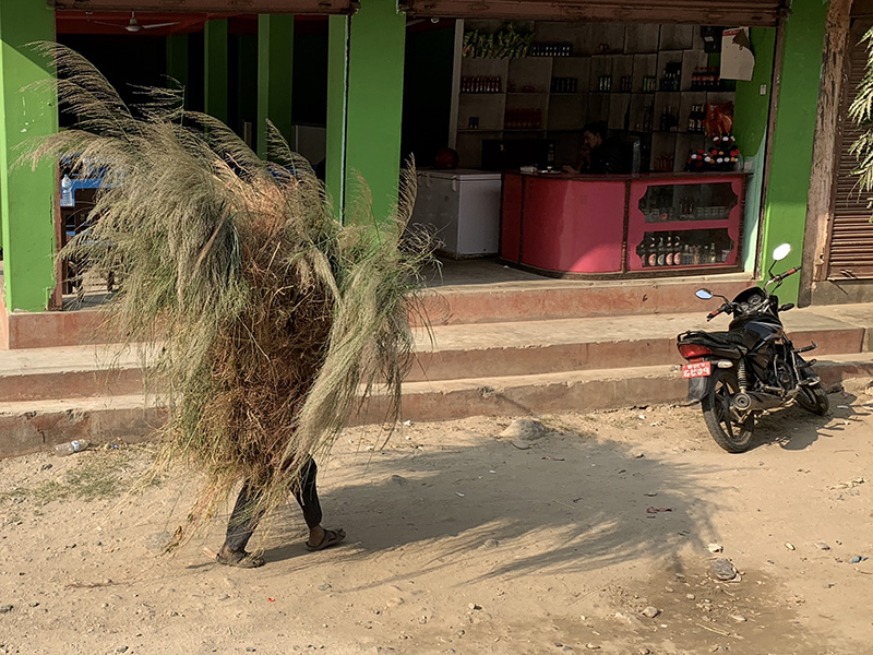
We both struggled a bit with Khumbu cough and colds. We treated all cold drinking water with UV/Steripen, but mostly drank tea and other hot beverages provided by the lodges, didn’t eat any meat and avoided uncooked vegies. Had some very minor stomach issues a few times, but not really affecting hiking all that much. We were quite tired when we came back to Kathmandu. Heavy air pollution in Kathmandu valley wore us down quite a bit at the end.
 Nepal 2018 itinerary
| Oct | 28 | Sun | ORD ➜(Quatar Airways) ➜ | |
| 29 | Mon | Doha | ➜DOH➜ Doha evening walk [@ Hoiliday Inn] | |
| 30 | Tue | Kathmandu | DOH ➜(Quatar Airways) ➜KAT➜ Kathmanduprep for trekking [@ Dil’s Homestay] | |
| 31 | Wed | Kathmandu | Prep for trekking | |
| Nov | 1 | Thu | Phaplu | Kathmandu ➜ (jeep) ➜ Phaplu [@ Lodge] |
| 2 | Fri | Taksindu | Start of trekking [@ Taksindu Resort Lodge] | |
| 3 | Sat | Jubing | Trekking [@ Gorkhali Lodge] | |
| 4 | Sun | Khare | Trekking [@ Lodge] | |
| 5 | Mon | Surke | Trekking [@ Thamserku Lodge] | |
| 6 | Tue | Monjo | Trekking [@ Mount Kailash Lodge] | |
| 7 | Wed | Namche | Trekking [@ Khumbu Lodge] | |
| 8 | Thu | Khumjung | Trekking [@ Hidden Village Lodge] | |
| 9 | Fri | Khumjung | Khunde (Piotr), rest day (Joanna) [@ Hidden Village Lodge] | |
| 10 | Sat | Dhole | Trekking [@ Alpine Cottage Lodge] | |
| 11 | Sun | Machermo | Trekking [@ Sherpa Land Lodge] | |
| 12 | Mon | Gokyo | Trekking [@ Cho Oyu View Lodge] | |
| 13 | Tue | Gokyo | Gokyo Lake V [@Thanka Inn] | |
| 14 | Wed | Gokyo | Gokyo Ri (Joanna), rest day (Piotr) [@Thanka Inn] | |
| 15 | Thu | Lunden | Trekking Renjo La [@ Renjo Pass Support Lodge ] | |
| 16 | Fri | Thame | Trekking [@ Valley View Lodge] | |
| 17 | Sat | Monjo | Trekking [@ Mount Kailash Lodge] | |
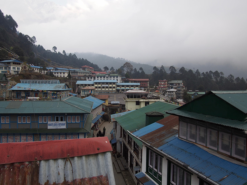
| 18 | Sun | Lukla | End of trekking [@ Lodge] | |
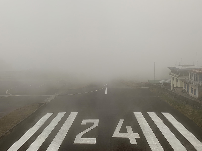
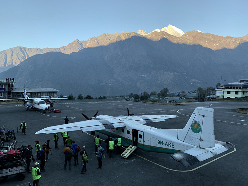
| 19 | Mon | Lukla | Stuck at LUK [@ Lodge] | |
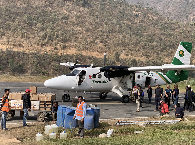
| 20 | Tue | Kathmandu | LUK ➜ (small plane) ➜RHP ➜(bus) ➜ Kathmandu [@ Dil’s Homestay] | |
| 21 | Wed | Kathmandu | Thamel ➜ Durbar Square [@ Hotel Giarmondo] | |
| 22 | Thu | Kathmandu | Thamel ➜ (taxi) ➜ Bouddha ➜ Pashupatinath ➜ (taxi) ➜ Thamel | |
| 23 | Fri | Kathmandu | Thamel ➜ (taxi) ➜ Ratna Park ➜ (bus) ➜ Bhaktapur ➜ (taxi) ➜ Thamel | |
| 24 | Sat | Kathmandu | Thamel ➜(taxi) ➜ Swayambhunath ➜ Asan Tole ➜ Thamel | |
| 25 | Sun | Kathmandu | Kathmandu ➜ (bus) ➜ Patan ➜ (taxi) ➜ Thamel | |
| 26 | Mon | Doha | KAT ➜ (Quatar Airways) ➜ DOH ➜ Doha[@ Al Liwan Suites]➜ DOH ➜ | |
| 27 | Tue | Chicago | ➜ ORD |
 Phaplu-Gokyo-Lukla
Click on wikiloc logo for more info
Phaplu-Gokyo-Lukla trail profile
Click on image to see full-size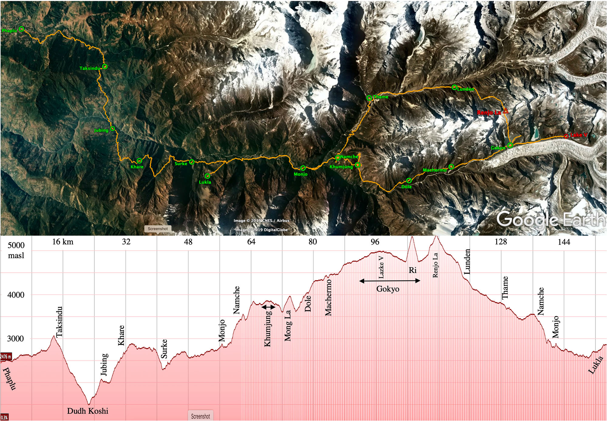
 Key waypoint distances and elevations on our Gokyo trek
| km | masl | latitude | longitude | ||||
| November | 1 | Thursday | Kathmandu | 1292 | 27°43’05″N | 85°18’28″E | |
| Phaplu | 0.0 | 2479 | 27°30’55.79″N | 86°35’4.27″E | |||
| 2 | Friday | Ringmo | 11.8 | 2736 | 27°35’15.18″N | 86°36’14.86″E | |
| Taksindu La | 13.5 | 3066 | 27°35’31.96″N | 86°37’2.70″E | |||
| Taksindu | 14.3 | 2931 | 27°35’35.30″N | 86°37’18.33″E | |||
| 3 | Saturday | Nunthala | 18.2 | 2198 | 27°35’20.47″N | 86°38’49.18″E | |
| Dhudh Koshi (river) | 22.3 | 1490 | 27°35’38.12″N | 86°40’42.52″E | |||
| Jubing | 23.3 | 1651 | 27°35’53.00″N | 86°41’11.00″E | |||
| 4 | Sunday | Kharikhola Monastery | 25.5 | 2050 | 27°36’13.68″N | 86°42’1.25″E | |
| Bupsa | 29.0 | 2348 | 27°36’51.05″N | 86°42’53.99″E | |||
| Khare | 30.8 | 2590 | 27°37’29.98″N | 86°43’4.48″E | |||
| 5 | Monday | Paiya | 35.3 | 2760 | 27°38’29.44″N | 86°43’50.94″E | |
| Surke | 41.0 | 2300 | 27°40’20.55″N | 86°43’7.54″E | |||
| 6 | Tuesday | Ghat | 48.4 | 2580 | 27°43’27.33″N | 86°42’53.48″E | |
| Phakding | 50.4 | 2620 | 27°44’24.90″N | 86°42’45.44″E | |||
| Monjo | 55.6 | 2870 | 27°46’25.34″N | 86°43’20.74″E | |||
| 7 | Wednesday | Namche | 60.2 | 3423 | 27°48’15.85″N | 86°42’37.34″E | |
| Park Headquarters | 60.8 | 3560 | 27°48’11.13″N | 86°42’54.29″E | |||
| Namche | 61.5 | 3423 | 27°48’15.85″N | 86°42’37.34″E | |||
| 8 | Thursday | Khumjung | 64.4 | 3763 | 27°49’18.20″N | 86°43’0.44″E | |
| Khumjung Gompa | 65.0 | 3797 | 27°49’30.04″N | 86°42’58.95″E | |||
| Khumjung | 65.5 | 3763 | 27°49’18.20″N | 86°43’0.44″E | |||
| 9 | Friday | Hilary Hospital | 66.9 | 3864 | 27°49’25.12″N | 86°42’17.02″E | |
| Khunde Stupa | 67.4 | 3822 | 27°49’16.35″N | 86°42’25.25″E | |||
| Khumjung | 68.8 | 3763 | 27°49’18.20″N | 86°43’0.44″E | |||
| Khumjung Viewpoint | 69.0 | 3826 | 27°49’16.61″N | 86°43’5.00″E | |||
| Khumjung | 69.1 | 3763 | 27°49’18.20″N | 86°43’0.44″E | |||
| 10 | Saturday | Mong La | 72.6 | 3970 | 27°50’21.91″N | 86°44’9.38″E | |
| Phortse Thanga | 74.4 | 3660 | 27°51’1.39″N | 86°44’35.86″E | |||
| Dole | 77.0 | 4032 | 27°52’1.52″N | 86°43’52.37″E | |||
| 11 | Sunday | Machermo | 82.3 | 4390 | 27°54’12.34″N | 86°42’58.08″E | |
| 12 | Monday | Gokyo | 89.2 | 4754 | 27°57’13.70″N | 86°41’36.35″E | |
| 13 | Tuesday | Scoundrel’s Point | 95.0 | 4990 | 28° 0’5.99″N | 86°41’10.33″E | |
| Gokyo Lake V | 95.4 | 4965 | 28° 0’6.86″N | 86°41’0.03″E | |||
| Gokyo | 101.1 | 4754 | 27°57’12.25″N | 86°41’37.54″E | |||
| 14 | Wednesday | Gokyo RI | 103.0 | 5350 | 27°57’40.99″N | 86°40’59.03″E | |
| Gokyo | 104.8 | 4754 | 27°57’12.25″N | 86°41’37.54″E | |||
| 15 | Thursday | Renjo La | 109.2 | 5375 | 27°56’50.71″N | 86°39’30.21″E | |
| Lunden | 116.0 | 4350 | 27°54’19.01″N | 86°38’12.92″E | |||
| 16 | Friday | Thame | 125.5 | 3800 | 27°49’52.02″N | 86°38’56.82″E | |
| 17 | Saturday | Namche | 134.2 | 3423 | 27°48’15.85″N | 86°42’37.34″E | |
| Monjo | 138.9 | 2870 | 27°46’25.34″N | 86°43’20.74″E | |||
| 18 | Sunday | Lukla | 151.9 | 2847 | 27°41’14.29″N | 86°43’55.10″E | |
| 19 | Monday | Lukla | |||||
| 20 | Tuesday | Kathmandu |
Piotr’s packing list: total 15.7 kg
| TOTAL | 15.7 | kg | |
| clothing | 7.3 | ||
| equipment etc | 4.6 | ||
| shared equipment/supplies | 3.3 | ||
| water | 0.5 | ||
| ON ME | 3.9 | kg | |
| boots | 1347 | g | Vasque Breeze 2.0 Mid GTX |
| wool socks | 73 | Smart Wool | |
| underwear | 62 | Exofficio | |
| pants | 320 | Columbia Silver Ridge Convertible | |
| belt/suspenders | 110 | – | |
| tshirt | 165 | – | |
| buff | 38 | Buff | |
| hiking cap | 58 | Outdoor Research | |
| hiking gloves | 73 | Ergodyne ProFlex 812 | |
| trekking poles | 476 | Komperdell | |
| pocket knife | 90 | Gerber Torch | |
| sunglasses | 34 | – | |
| camera/battery | 488 | Olympus E-PM2 14-42 mm | |
| scope | 190 | Alpen 8×25 monocular | |
| phone | 215 | iPhone XS | |
| watch | 38 | Timex Expedition | |
| passport/money | 115 | – | |
| ON MY BACK | 11.8 | kg | |
| backpack/liner/cover | 1208 | g | Granite Gear Crown 60 (long 65 L) |
| sleeping bag/sack | 1397 | Sierra Design Ridge Runner (Down 600 15 F/-9 C) | |
| liner | 253 | Sea to Summit Thermolite | |
| downjacket/bag | 907 | Mountain Hardware hooded 650 down | |
| jacket | 504 | Columbia | |
| rainpants | 175 | Mountain Warehouse Pakka | |
| daypack/organizer | 69 | Sea to Summit Ultra-Sil | |
| pants | 340 | Columbia Silver Ridge Convertible | |
| fleece | 286 | North Face | |
| 3 x wool socks | 321 | Smart Wool, Darn Togh | |
| 3 x underwear | 216 | Exofficio, Calvin Klein | |
| 2 x tshirt | 315 | – | |
| 3 x top | 594 | Terramar | |
| 2 x bottom | 356 | Terramar | |
| 2 x gloves | 180 | Fleece, insulated | |
| 2 x wool beanie | 150 | – | |
| light shoes | 554 | Nike Quest running | |
| slippers | 76 | Holliday Inn Doha | |
| light/batteries | 281 | Nitecore HC65/NL1829LTP 2900mAh | |
| chargers/batteries | 399 | – | |
| repair kit | 50 | Homemade | |
| temp beacon | 14 | Blue Maestro Tempo Disc | |
| spare glasses | 31 | – | |
| 4 x mesh shopping bags | 46 | Shopping Mall Nairobi | |
| 2 x emergency blanket | 96 | – | |
| guide/map | 198 | – | |
| money | 100 | – | |
| towel | 71 | – | |
| steriPEN Ultra | 134 | Katadyn | |
| thermos | 376 | GSI MicroLite 1000 | |
| water bottle | 88 | Nalge 1000 | |
| cup & spoon | 62 | – | |
| soap & meds | 1245 | – | |
| lyophylised fruit/chocolate | 215 | – | |
| water | 0.5 | kg | – |
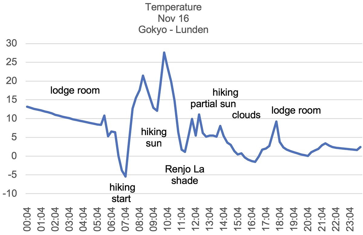
Diagram of hiking temperature ℃ on Renjo La day
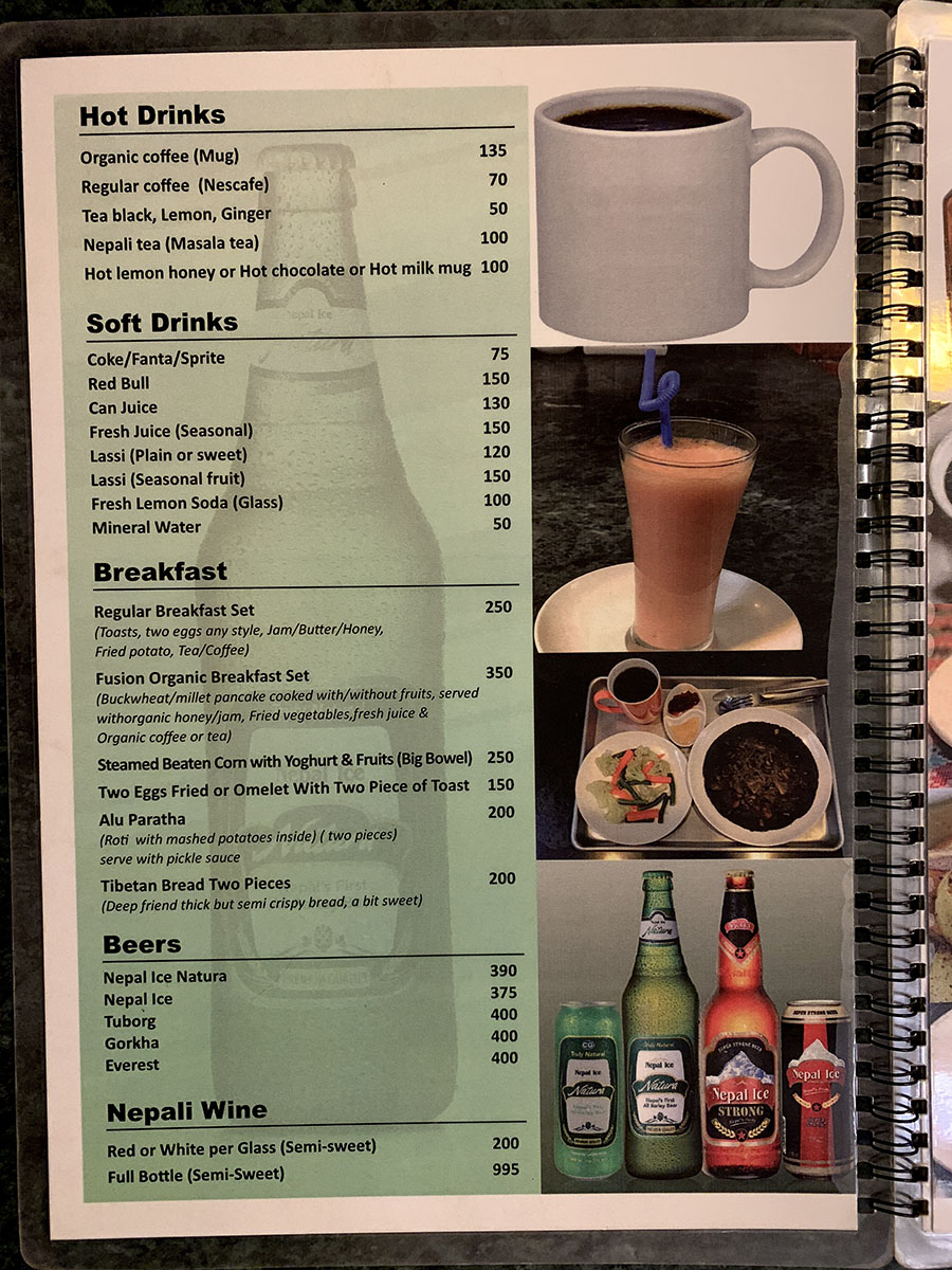
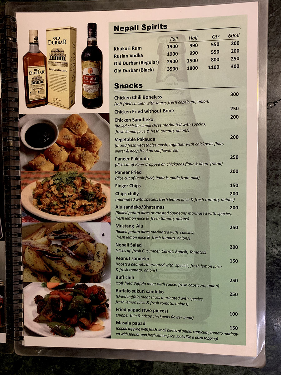
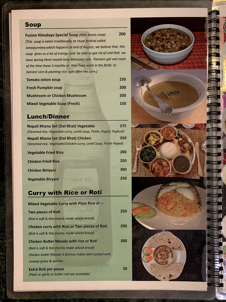
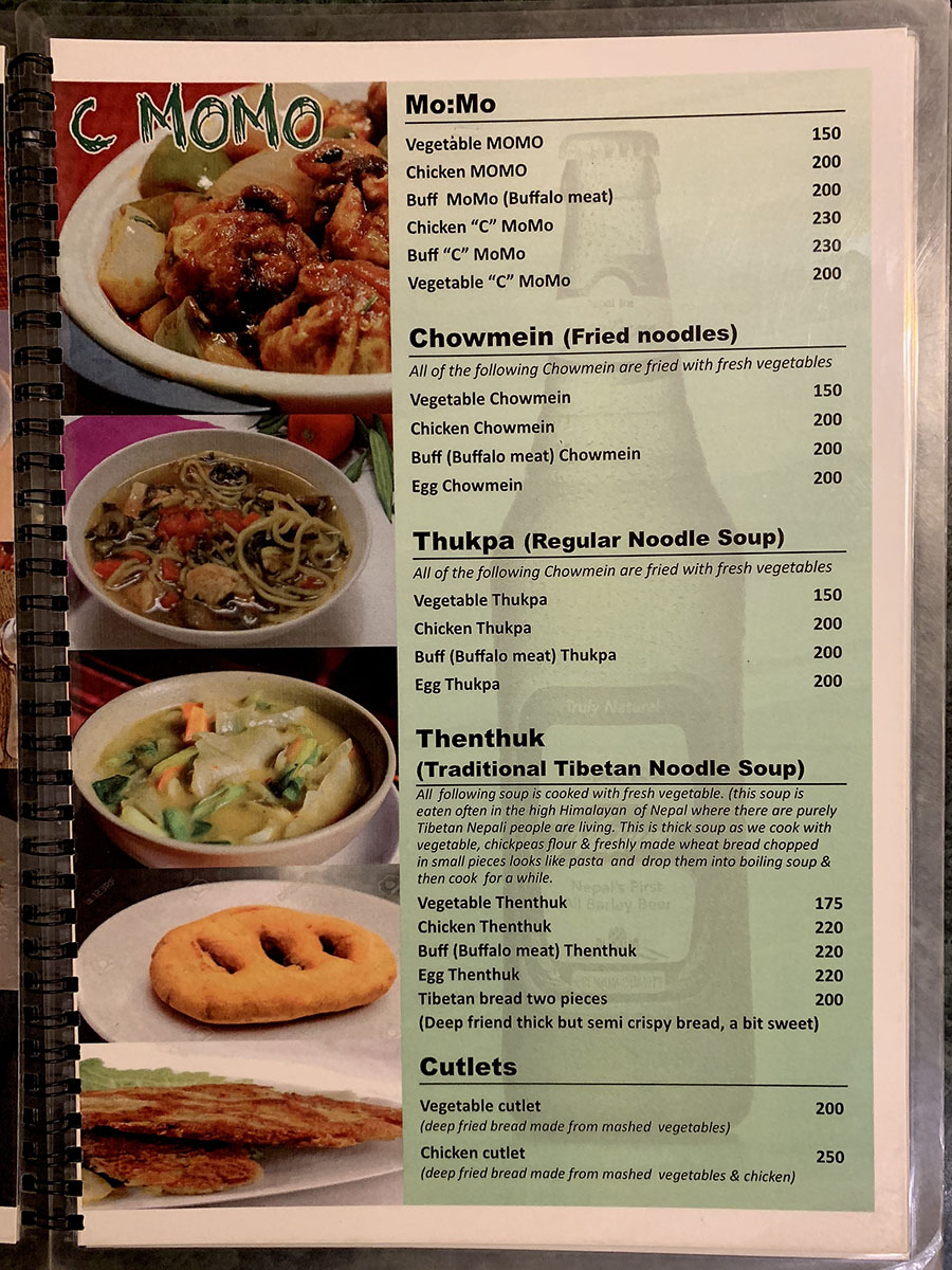
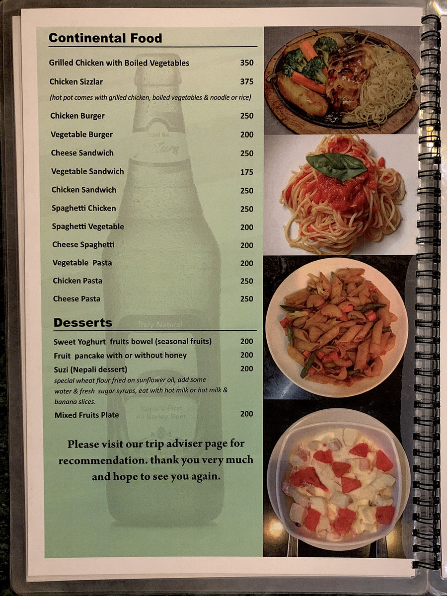
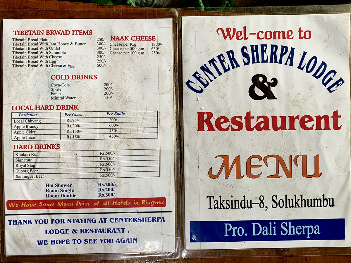
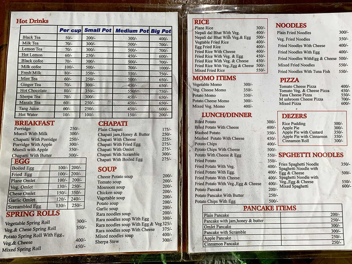
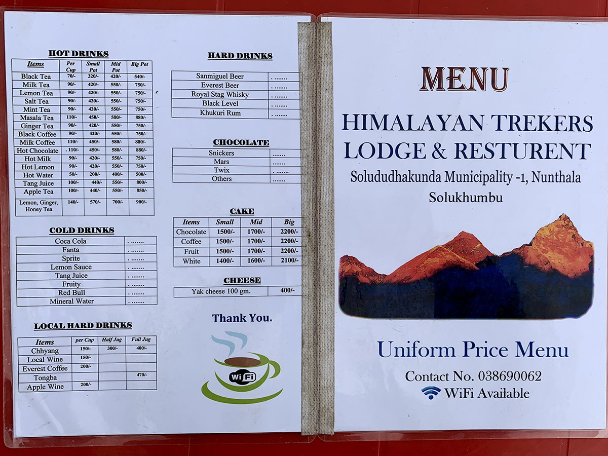
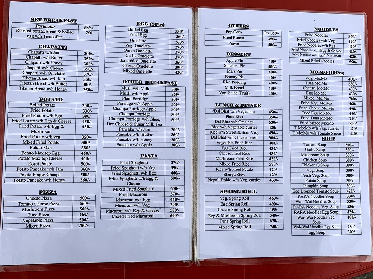
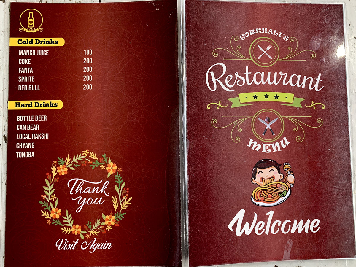
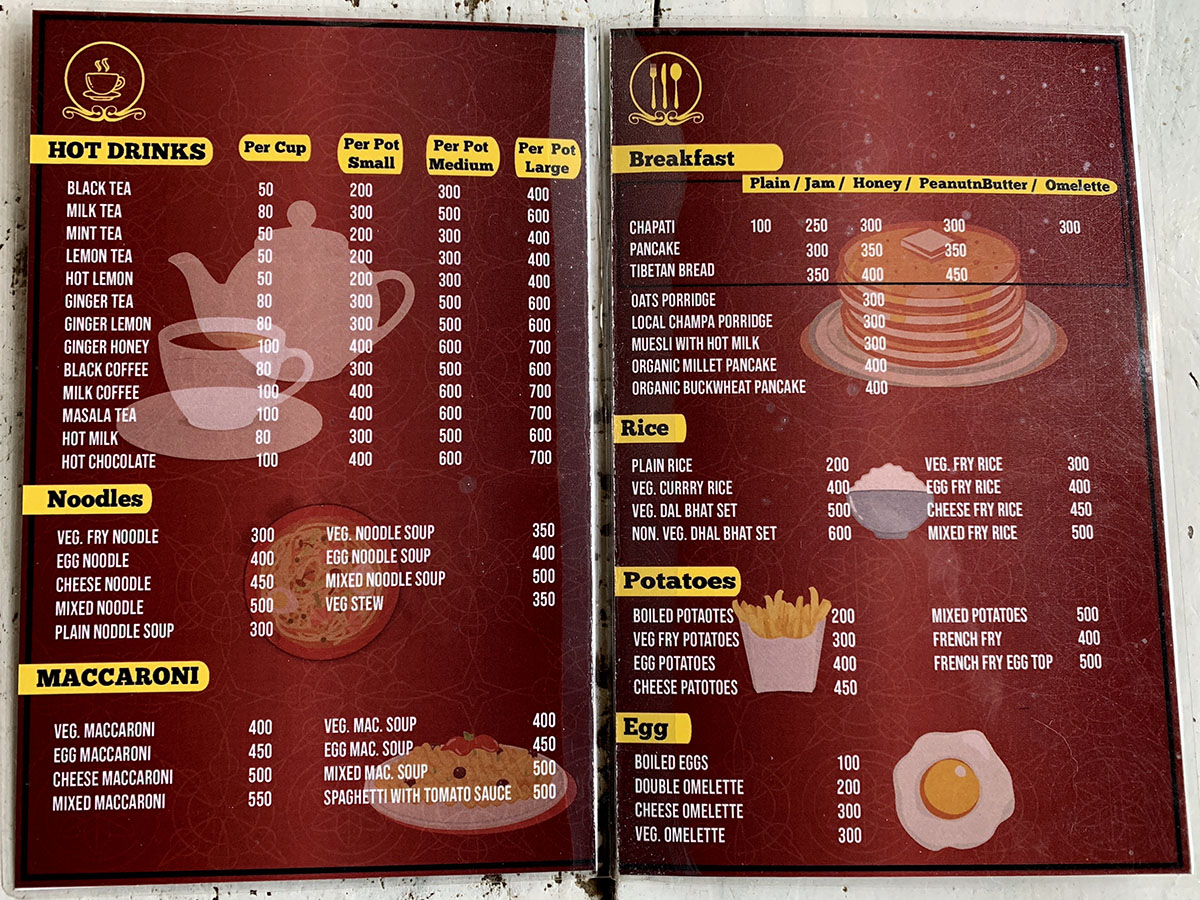
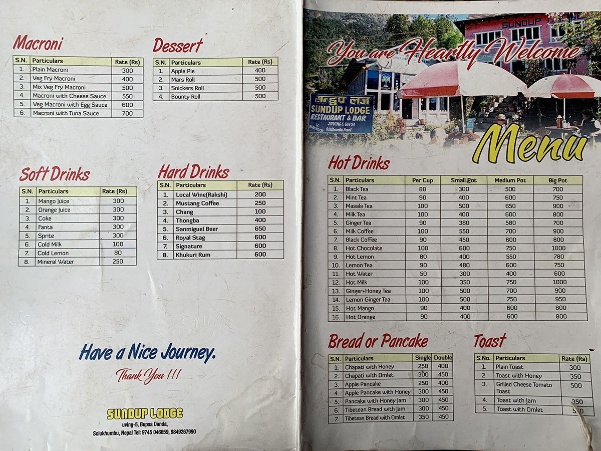
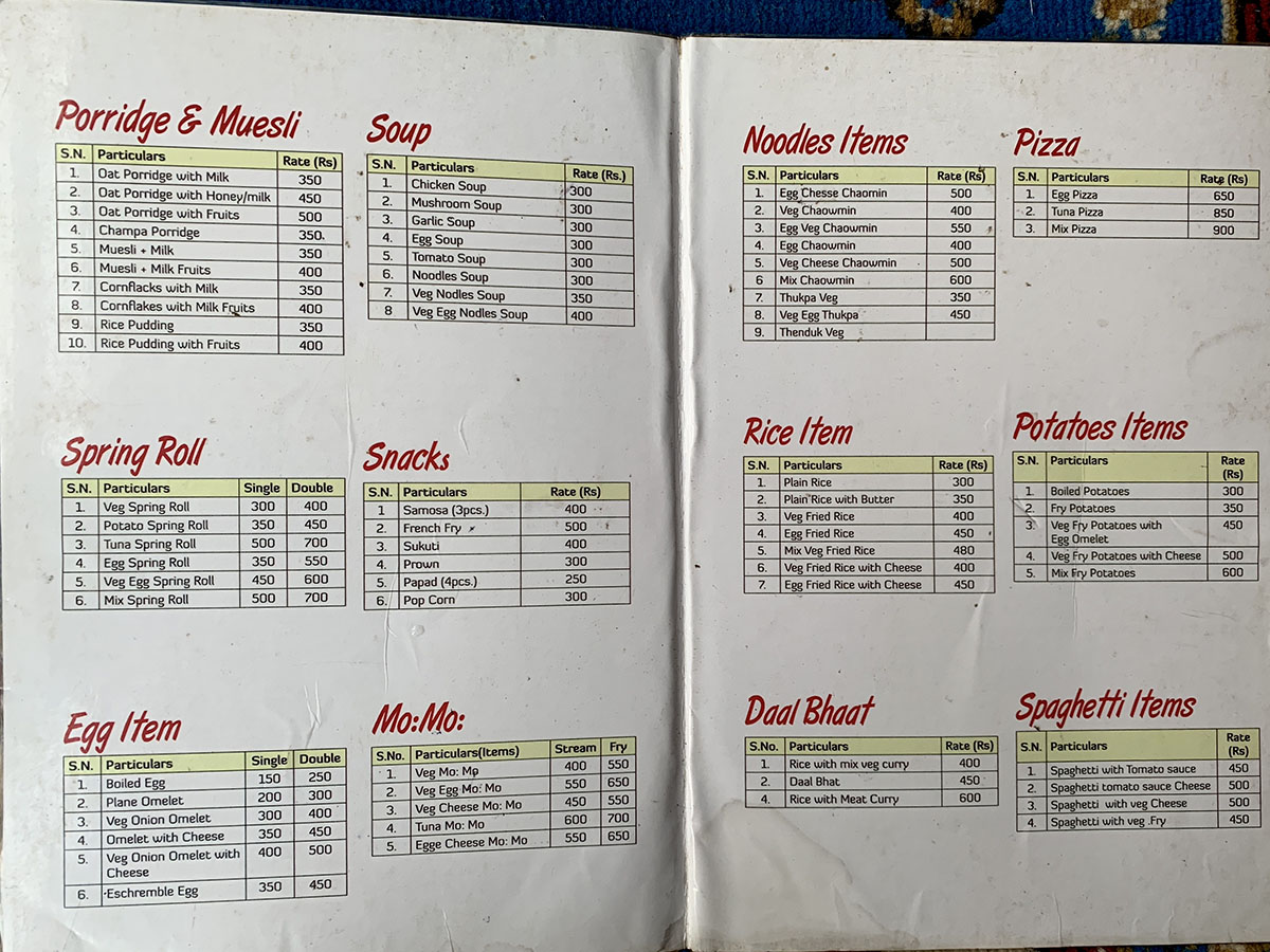
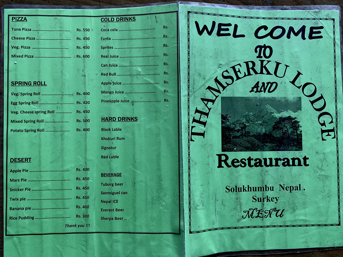
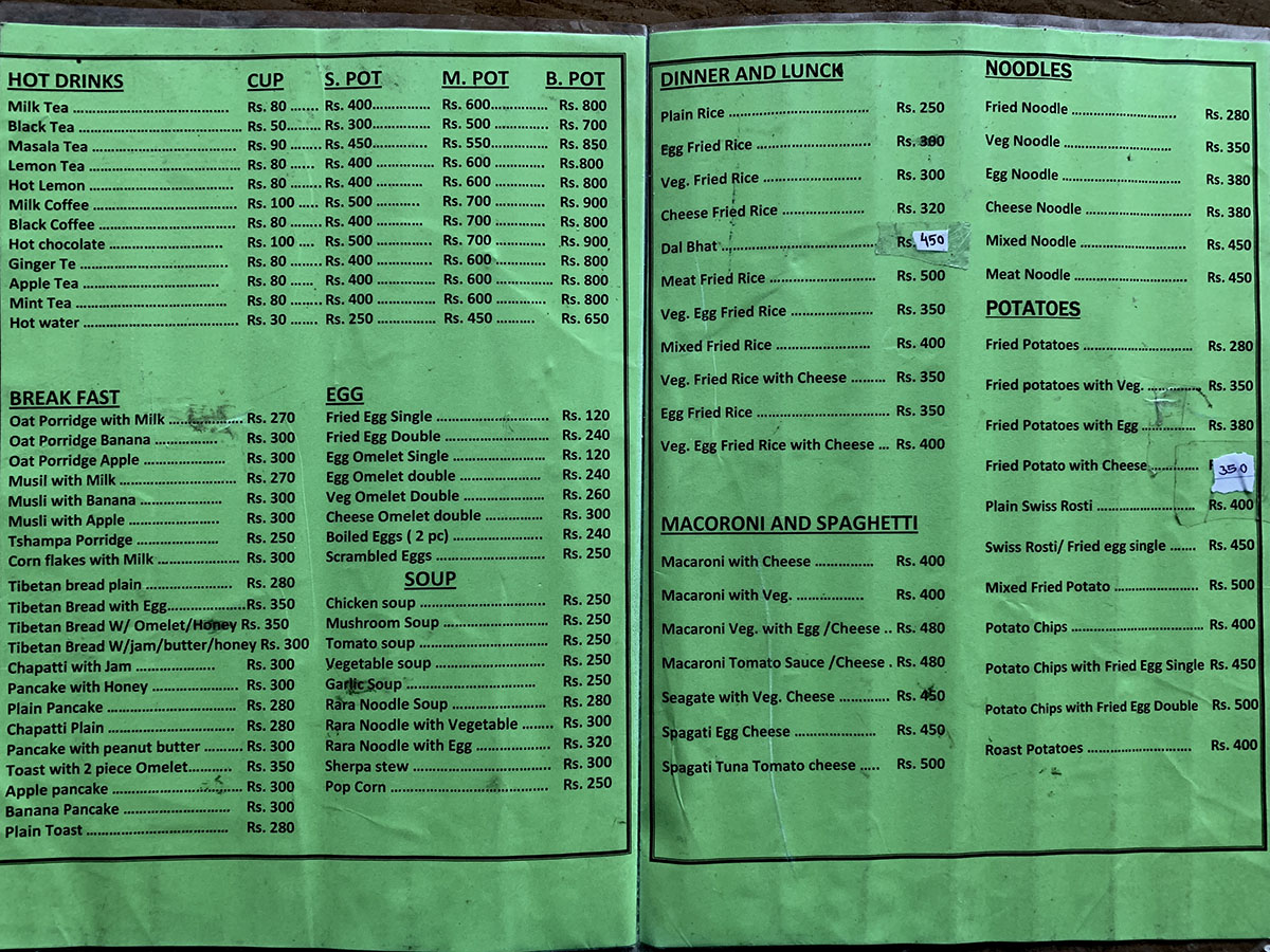
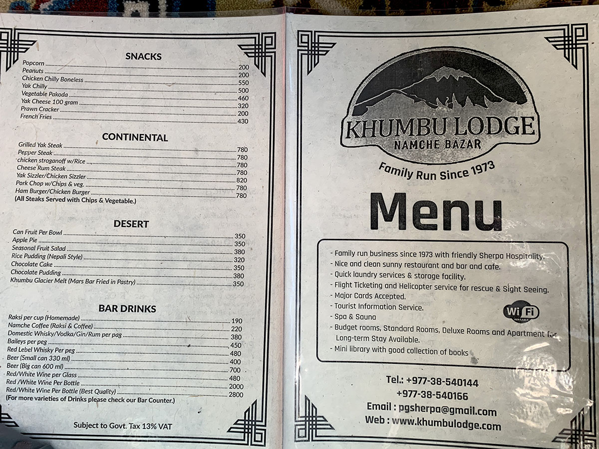
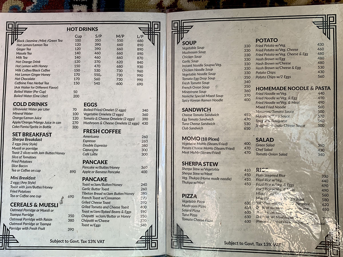
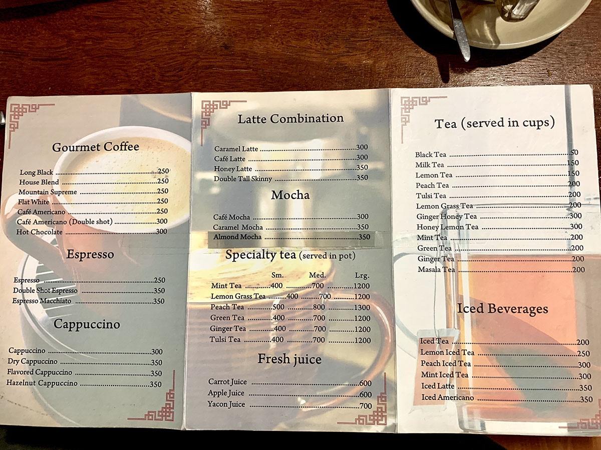
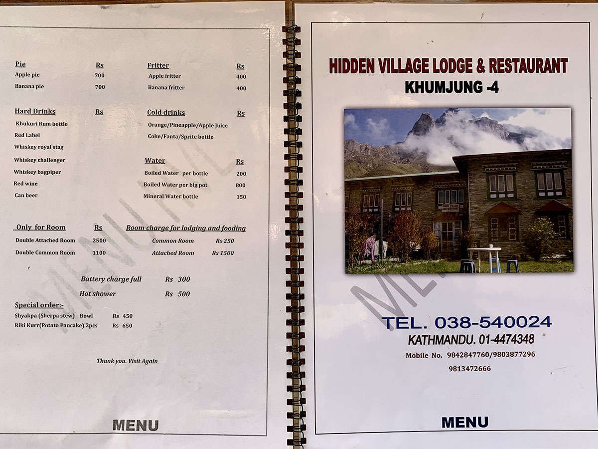
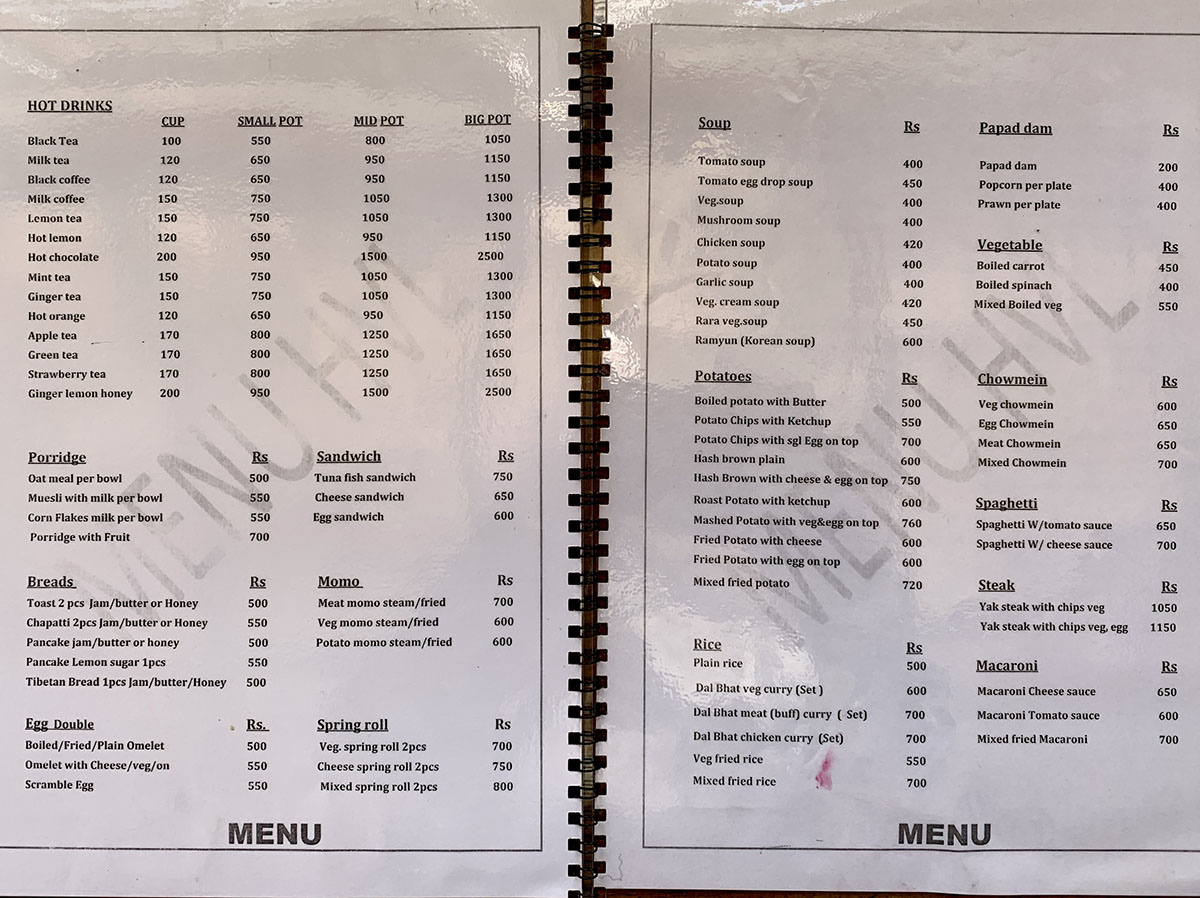
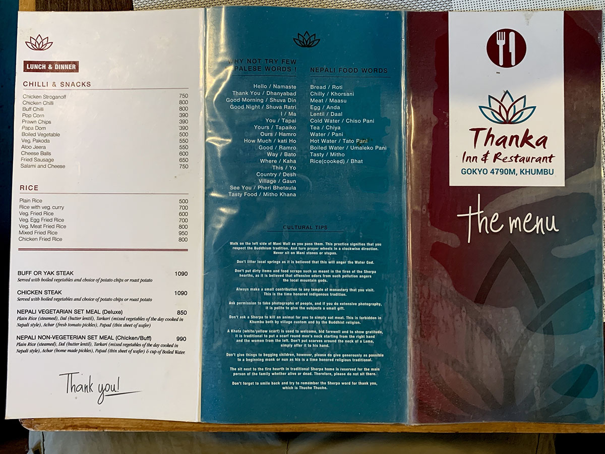
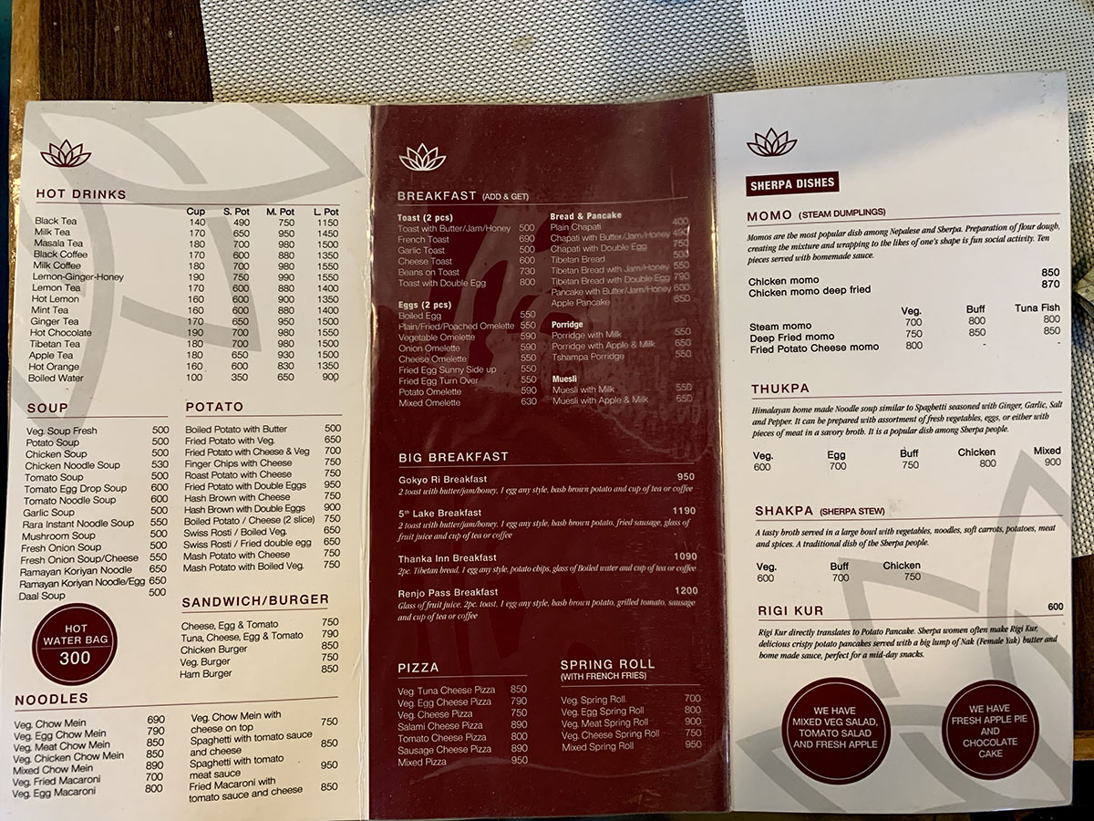
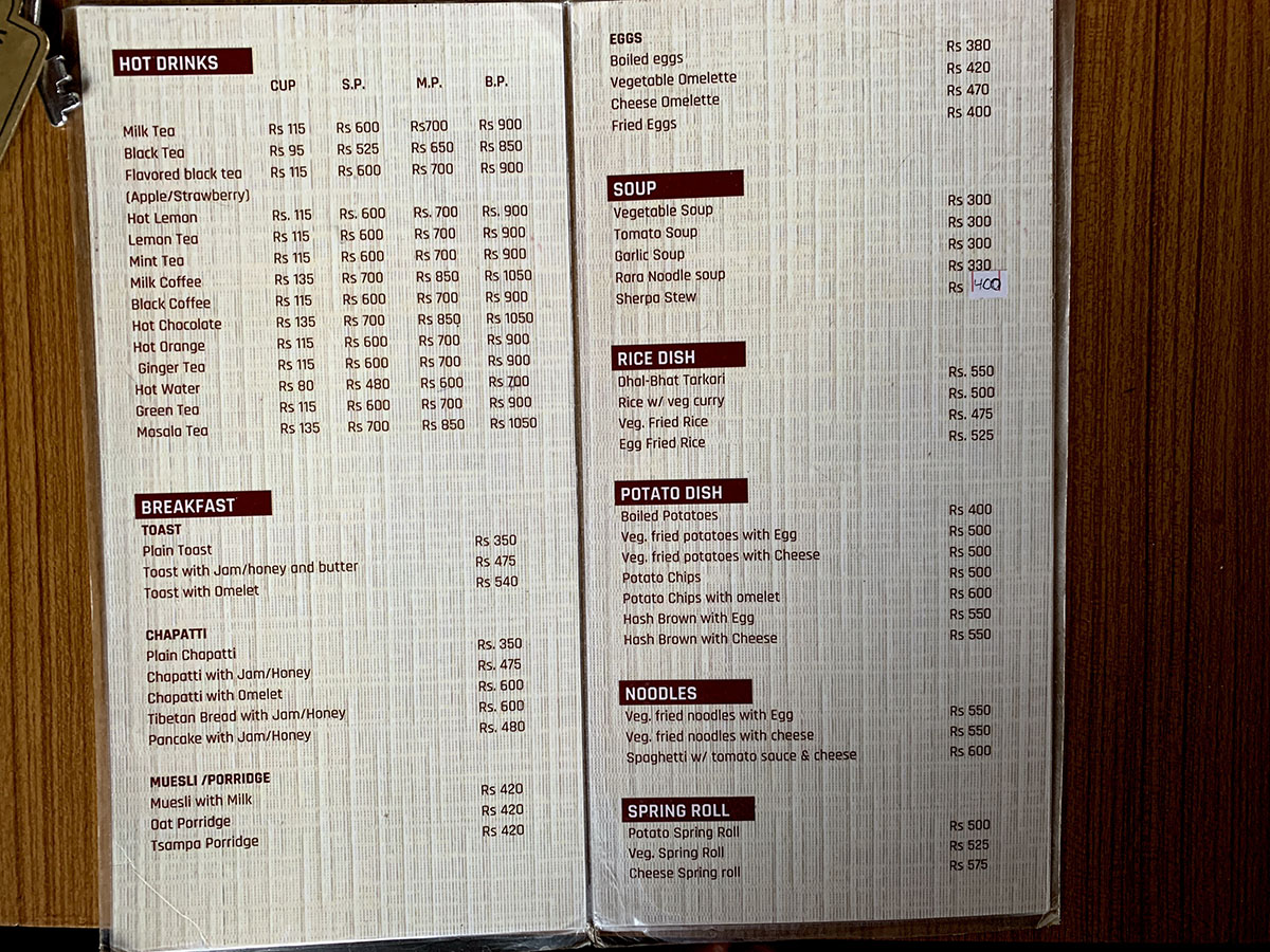
Food menus
Click on image to see full-size

 Nepal video clips
Highlights