One week in Tulum

November 2-9

It was a quick decision to go to Mexico on direct United flight from Chicago to Tulum. Easy to organize at last minute, expecting reasonable weather, lesser crowds and lower prices during low/shoulder season. First day was just travel, settling down and grocery shopping. We selected modern studio apartment at Casa del Arbol (recommended). Located in Tulum Centro away from Zona Hotelera along the beach we didn’t visit, but close to everything else (ADO bus station, celectivo stops, shops, restaurants and Chedraui Supermarket). It was excellent, well organized and very clean. Joanna did not like noise of passing cars and motorcycles at night, not a problem for Piotr. We examined Día de Muertos decorations and we ate Pan de Muerto in the evening watching motorcycle parade along our street trying to wake-up somebody (?).

Next day we took colectivo to Tulum ruins and spent half a day there. Colectivos here are convenient and inexpensive mode of transportation, easier to use than in South America. The scene approaching and at park entrance was quite chaotic. We just moved with the flow, waited in two lines to buy tickets and pay “tax” (not too bad), went through “environmental” check-point (had to throw away every piece of plastic they found in our backpacks and yes, they asked us to remove energy bar wrappers too). We asked about, but rejected guided tour offers (very dynamic pricing). Once inside, it was just walking around in well organized and maintained park with many visitors on sunny Sunday. Open sea proximity and views made it even more pleasant experience.

Structures here are quite different from all other Mayan ruins we have visited, both in shape – rectangular buildings not pyramids, and location on ocean cliff – not in flat jungle. Afterwards we went for a swim and walk on the beaches, hard to resist after hot day at the ruins. The coral reef is very close (short boat ride from the beach) and we decided to try to come back for snorkeling.

We liked tropical plants surrounding ruins and enjoyed watching iguanas, Yucatan jays and Great-tailed grackles. A predatory bird was circling in the sky above. We ended the day with seafood dinner at Sabor de Mar and Mexican craft beer in our comfy apartment.

Day 3. We are in Yukatan, we must snorkel/swim in cenotes. Short colectivo ride and shuttle into jungle and we were at Cenotes Yax-Muul. We first explored three cave cenotes with entertaining guide, Joanna rappelled down into one of them and then we went back to swim some more on our own. Water was very clear and at most time there were no or not too many people nearby (except for rappelling) making it an interesting experience.

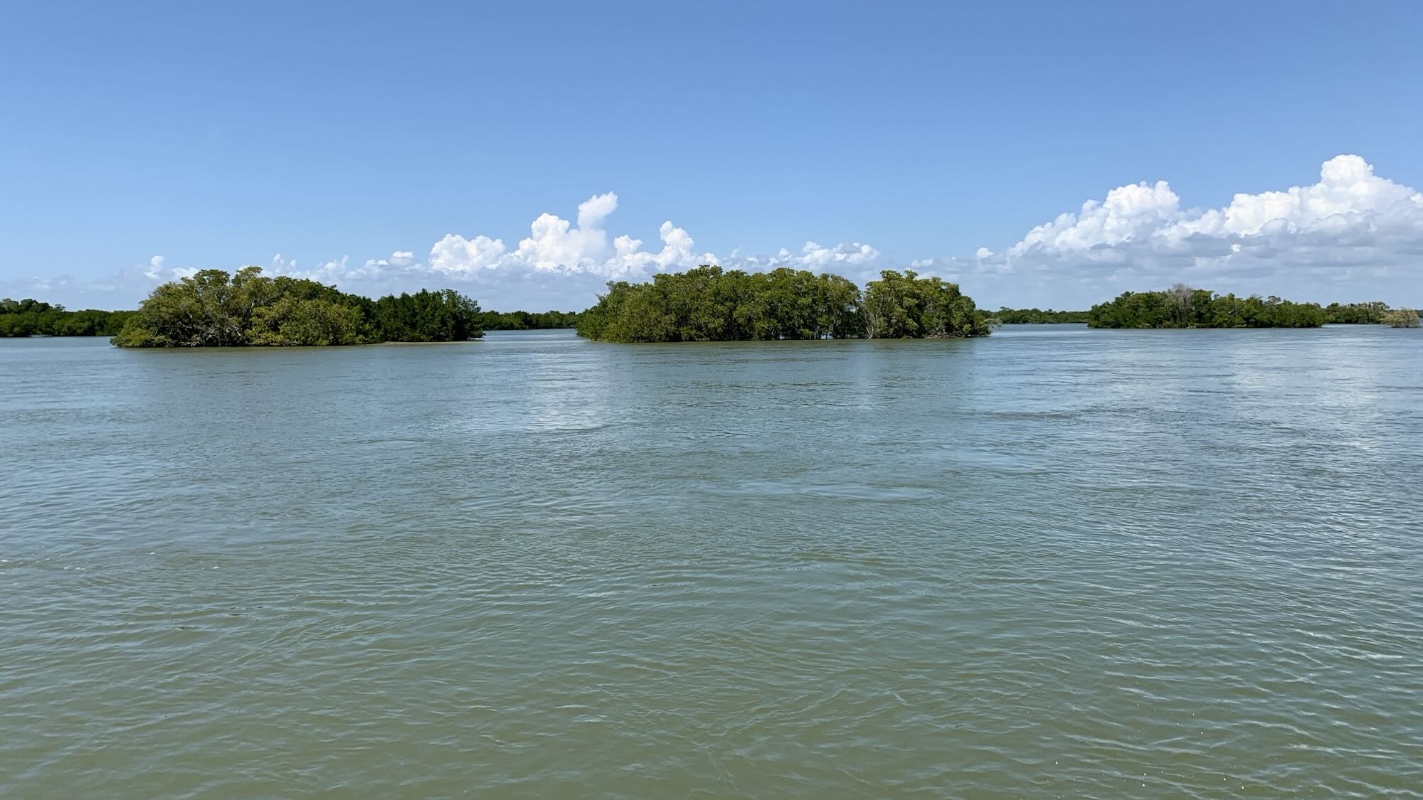
Day 4. Sian Kaʼan Biosphere Reserve: boat tour of brackish water lagoons and mangroves watching wildlife. Plus soaking in Caribbean Sea at Punta Allen beach followed by lunch in local restaurant. The sea was too rough for snorkeling at coral reef. We were lucky to see several (West Indian) manatees hanging around underwater cenote. They appeared for a few seconds at a time to breath, we gave-up on taking pictures and just observed them. We spent some time with two pods of (Bottlenose) dolphins, watched turtles and crocodiles. We circled around Isla Pajaros to watch birds. In addition to what we captured on film (below), we saw vultures, cormorants, ibis and other birds, and another, this time very large crocodile parked at red mangrove edge.

We went with ☞ Mexico Kan Tours (recommended), after extensive on-line and in person investigation. Good decision: everything was well organized and relaxed, guides were good and engaged, groups were small, we were quite lucky with wildlife, but wished conditions were good for snorkeling. The entire tour was from 7 am pick-up to 4.30 pm drop-off with 6-hour and 80-km boat part.

Day 5. Kind of slow day. Joanna was looking for open cenotes to swim in, found deep Cenote Cristal with fish and turtles. Many open cenotes were closed because of recent rains. Piotr was resting.

Day 6. More Mayan ruins, this time in Coba. We took Oriente bus from ADO terminal. Upon arrival at the archeological park, we were approached by many people offering services (guides, bike rentals, bike “taxis”) frequently, but not overwhelming like in many other tourist destinations. Coba was reminiscent of other Mayan sites we visited in Guatemala and Belize. Easy walking on old Mayan roads (stone causeways) shaded by trees between excavated/restored structures with many more unexcavated piles of stones hiding in the jungle. Coba was a large center with history going back two thousand years, great influence at its peak and competing with Chichen Itza. It was abandoned by mid 16th century. There are many reasonably preserved structures/pyramids to explore (climbing them is no longer permitted), but stelas are quite aged. Access to Nohoch Mul pyramid (tallest in Coba) was restricted by construction of new viewing platforms.

We took colectivo on the way back. We found the stop, but asked around about departure times with mixed results. One person knew the correct answer and we soon were back in Tulum. We each had 4 tacos for dinner at Taqueria Maya on Sagitario Oriente: tasty, with different ingredients and flavors.

Day 7. Snorkeling at coral reef and swimming at Tulum beaches. We traveled by colectivo to Tulum ruins again (and later back), but this time we went straight to Playa Paraiso and all other beaches. Line to check point was very long, but at least we were ready without a trace of plastic in our backpacks. Joanna took 2-hour boat trip arranged on Pescadores beach to snorkel at two locations on coral reef: many fish species including large stingrays and many turtles. Plus an opportunity to see Tulum ruins from the sea. Piotr spent time relaxing, swimming and watching beach life. Documented 8 different bird species visiting that day. To visit the beaches, one has to either pay entrance fee (“tax”) like us or visit one of the beach clubs lining the shore (the boat trip was from one of them).

On the way home, we stopped at Tamales Don Taco on Centauro Norte (recommended) to pick-up dinner: 8 tamales in several different varieties (mostly chicken). We ate them in the evening with more bear preparing for the return trip next morning. The tamales were very large, fresh, tasty and with different flavors. Wrapped in real banana leaves. Throughout our visit we tried a dozen bears and left tequila/mescal tasting for next time.

We felt safe moving around Tulum and having good base (our apartment) to rest at the end of the day made the trip relaxed and comfortable. Our interactions with local people were friendly and helpful as we were trying to find our way around. Some chaos and sale attempts/tricks at touristy sites were not too surprising and did not affect us much. We liked traveling on colectivos, no-nonsense and inexpensive approach to quickly move people around. Buses were on time and efficient even though buying tickets at the terminal was unbelievably slow (better to buy on-line). Long-term weather forecasts were not reliable. We expected more rain, but we had great sunny or partially sunny days.

Last day was just travel: colectivo to ADO bus terminal, bus to all new and modern Tulum (Felipe Carrillo Puerto) airport for flight back to Chicago. Everything on time and without problems.

Days 18 – 22: Icefields Parkway – Banff and Jasper National Parks

July 1-5

Day 18. We continue moving north on Icefields Pky – it is very scenic making (easy) driving a pleasant experience on its own. But we are making stops on the way. First to visit Mistaya Canyon which is very nice. We got a good views of Mistaya River and falls from different angles. Next was Saskatchewan River Crossing, a small travel stop serving tourists, to get coffee and gas (most expensive of the entire trip). The Parkway now runs along North Saskatchewan River. Views of the river and surrounding mountains are impressive. Big Bend Viewpoint is located on 180º highway switchback.

We are getting closer to famous glaciers flowing down from Columbia Icefield. To see Saskatchewan Glacier we hiked on Parker Ridge Trail in Banff NP through alpine landscape with rewarding views from the ridge (6.5 km return, 440 m total gain) — very beautiful. Later, we stopped briefly at Columbia Icefield Visitor Center in Jasper NP (packed, long wait to get coffee) and parked for two nights at Wilcox Campground (packed full).

Day 19. All about Athabasca Glacier in Jasper NP. We first walked up Wilcox Pass Trail for views from across the valley (7 km return, 330 m total gain). Only the edge of Columbia Icefield can be seen. Weather on the pass was fog and drizzle, but improved soon. Special heavy busses transport visitors to the glacier’s edge (dirt road on top of lateral moraine), but we parked our car near Sunwapta (glacier) Lake and walked across gravels of old terminal and bottom moraines, crossing streams and pools. This area was all under ice 70 years ago. 180 years ago the glacier extended all the way to the Visitor Center which sits on top of the old terminal moraine. Polished bottom rock and old lateral moraine indicate what once was. With micro-spikes and walking poles we were ready to explore, slowly gaining confidence as it was our first time on glacier. Exciting and easier that we expected. Dinner at Altitude Restaurant (next to the Visitor Center), Wilcox Campground.

Day 20. We are heading to Jasper. First stop at Sunwapta Falls — the river flows from Sunwapta Lake at the base of Athabasca Glacier. Second stop at Athabasca Falls. Icfields Pky runs now along Athabasca River all the way to Jasper. Third stop to watch brown bear grazing along the parkway. Stopped briefly at Jasper Visitor Center to talk to rangers about hiking. Settled at Becker’s Chalets cabin (recommended) for two nights (we were lucky to get the cancellation as everything was booked). It was comfortable and relaxing stay, badly needed (restocking, laundry) after camping for 11 straight nights. We were in Jasper before this summer fire, fortunately the Chalets survived.

Day 21. Maligne Lake. We were learning about underground caves and channels draining water from Maligne Lake to Medicine Lake to springs in Maligne Canyon. It was slow going as the road serves only tourists. We watched two eaglets on high nest at Medicine Lake, not quite ready to fly. Then came a grizzly bear on the shore looking for something. Then another grizzly with two cubs and black bear walking on the road. Another brown bear feeding along the road. Most bears we have seen in a single day. Some spectators getting off cars and way to close, bumped into our car when grizzly scared them with false charge.

We walked a 8km loop that day, first along Maligne Lake and then to Moose Lake. We stopped in Jasper on the way back to Becker’s Chalets and saw big elk bull grazing along the road. It was beautiful day, great views and so many animals.

Day 22. Maligne Canyon Trails are very popular with visitors. Most of the time it looks like a slot canyon, but in fact these are remnants of old underground, glacial run-off water plumbing with tops now collapsed so they are open. Such underground channels connect Maligne and Medicine Lakes to this day, and then run through cave system to re-surface 16 km downstream through springs in Maligne Canyon. We spent several hours walking up and down the canyon/river. We arrived at Mount Robson Park in early afternoon and secured camp site for two nights at very large Robson Meadows Campground (recommended) before it started to fill-up. We had time for a short walk from the campground along Fraser River to Overlander Falls.

Days 14-17: Yoho National Park – Icefields Pkwy – Banff National Park

June 27-30

We ended spending only one day in Yoho National Park. Somewhat disappointing as we were hoping for a few days of backpacking. We were really discouraged by the rangers claiming bad weather and trail conditions, some trails were closed due to snow still on the ground at higher elevations. The weather that day was really not too good, foggy and rainy. So we drove to Takakkaw Falls and Emerald Lake just to walk around. Both places are worth visiting and mountains in low clouds looked at times interesting too. We settled at Waterfowl Lakes CG in Banff NP (recommended) for 4 night as our base for day-hikes. The campground has flush toilets and hot water washroom, very nice and convenient cooking shelters.

The following day we stopped briefly at Peyto Lake Viewpoint just off Icefields Pkwy and then continued to Bow Lake for 10 km (230m elevation gain) hike to Bow Glacier Falls. The trail goes around Bow Lake and then up along Bow River to the base of the falls at 2100 masl. Plenty of space and rocks to explore to look at the falls from different angles. Joanna honed her rock hiking skills. Patches of snow on rocks, but nothing on the trail. Great mountain scenery. Pleasant day, with good weather (rain passed at night) and few people further away from the trailhead.

Mistaya River connects Upper nad Lower Waterfowl Lakes with the campground located on the river bank in between them. Chephren & Cirque Lake trailhead is just across the bridge over the river. No need to drive anywhere. We spent all day walking (total 13 km, 330 m elevation gain). Good and easy trails, relaxing walking mostly through forest and some wetlands, with panoramic mountain views at both lakes. We heard from another hiker first report of bear (grizzly?) sighting on a trail (to Chephren Lake), couple of hours before we came (we only saw bear scat).

Finally, on the last day we walked only 3 km along the river to both Waterfowl Lakes. Rested at camp.

Days 11-13: Banff National Park

June 24-26

Approaching Banff we were prepared for crowds as the National Park is very popular. Not a big surprise, scenery all around is fantastic. It was crowded, but not overwhelmingly in most places. Fewer people further away from main atractions along roads. Normally we find campsites at the end of the day, but here we secured sites a day or two in advance or in the mornings when campers leave, and sometimes switched to different sites that we liked more.

On day 11, with car packed, we drove a short distance from Two Jack CG along Two Jack Lake to Lake Minnewanka. As we were walking along the lake (crowded), we decided to hike along Cascade River into Stewart Canyon (fewer people up there) – just easy 6.5 km. We did not spend much time in Banff itself, other than talking to rangers at the Visitor Center about day-hikes and possible backcountry backpacking. Higher elevation trails that we were interested in were still closed because of snow. Of course we stopped at the famous Banff Springs Hotel at the end of the day. For the night, we moved to Tunnel Mtn Village I CG located outside Banff with Tunnel Mountain Rd and Banff Ave wrapping around it – you get great views already from the roads (photos below).

Johnston Canyon is worth visiting, but it was packed with visitors (not even weekend). Walking in line and waiting 20 mins to get to viewing platform at Upper Falls. Beyond this point, along Johnston Creek and around Ink Pots, the crowd thinned quickly making for a nice walk. Springs bubling quietly in the pots are fun to watch. Rocky mountains all around. Good, easy walking (12 km, almost 500 m up and down).

Our Lake Louise campground was called “hard-sided” (cars and campers, but no tents) in case bears come knocking on your door. Trail along Bow River neaby was closed to protect their habitat. Bear warnings are everywhere and park rules for camping are quite strict (same for all parks from now on) – pretty much nothing can be left outside when nobody is around to watch/protect. For us it meant extra packing.

Time for Lake Louise, another popular destination. We took community bus from the village, inexpensive and convenient (good advice from Visitor Center). Parks Canada shuttles were all booked (to Moraine Lake also ). Lake shore near the parking lots and Fairmont Hotel, another famous building, was quite crowded. But we quickly started walking on trails to Mirror and Agnes Lakes and Little Beehive. Still many hikers, but not too bad. Each lake is different and views from the trail higher up are realy nice. With little time to spare (to catch last bus back to the village), we made it a 12-km loop, 550 m up and down. Now we felt like we were hiking in the mountains.

For the second night we moved to soft-sided part of Lake Louise campground complex protected by electric fence. Plus showers. Campgrounds in Banff NP are very good.

error: Content is protected