July 17-August 23
We are back in Chicago. We were lucky this year to obtain permit from Tuolumne Meadow to Whitney Portal (combination of lottery and permit exchange). We had to cancel the trip in 2020. We chose Lyell Canyon entry trailhead to avoid crowds in Yosemite Valley and also because we already hiked most of the first segment of the trail ☞ Tenaya Lake to Tuolumne Meadow, part of our ☞ 2012 trip to the West, and visited the Valley a few years earlier.
We drove 4200 miles (round trip) from Chicago to Lee Vining and back with several stops on the way. It took us 38 days. It was our second road trip in our Subaru minimalistic camper. We left our car parked at Mono Basin Visitor Center in Lee Vining and took YARTS bus to Tuolumne Meadow, and at the end ESTA bus back from Lone Pine.
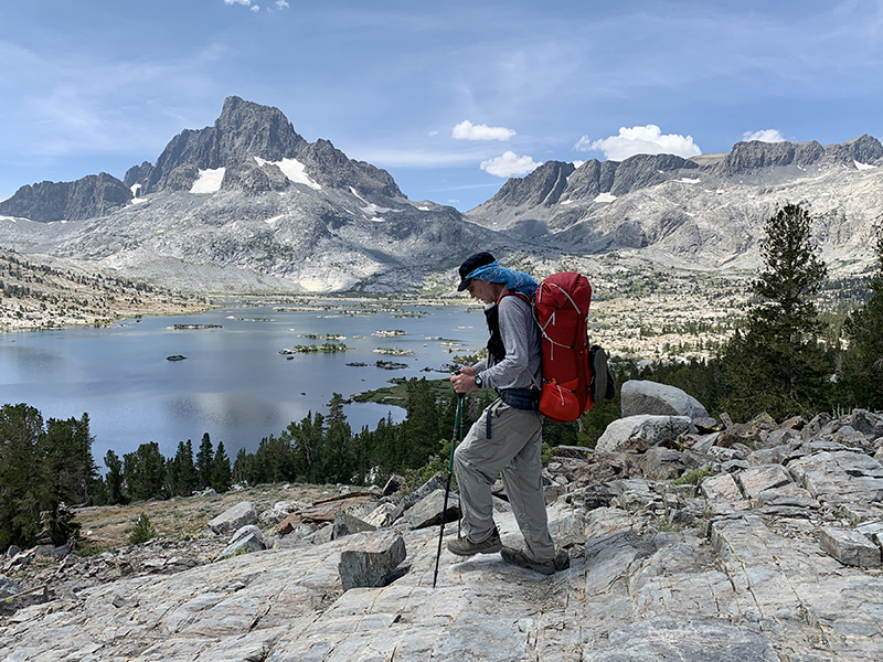
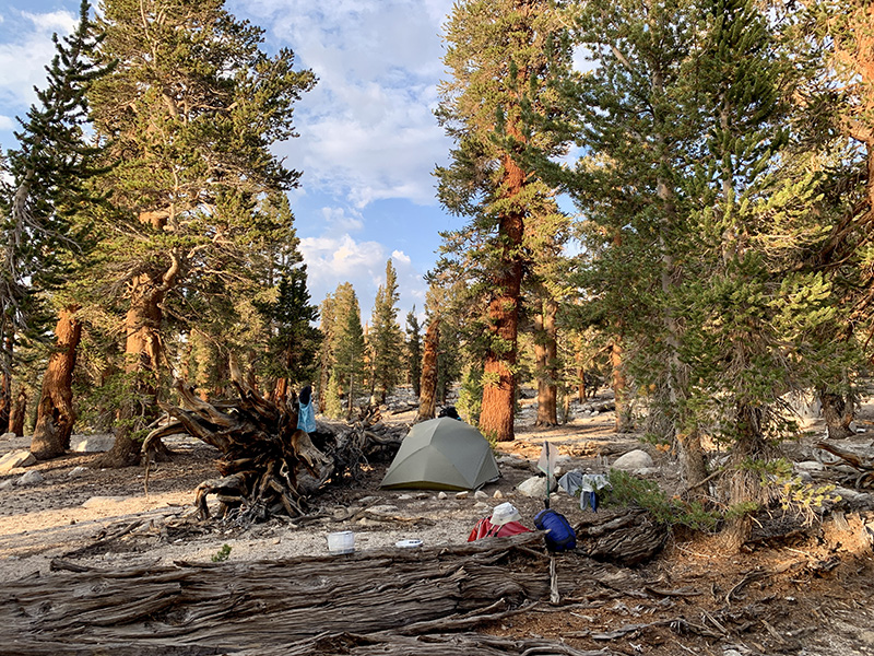
We walked SOBO 220 miles (350 km), most of JMT, except three additional short sections when we hiked down to resupply sites and used different cut-offs to get back on track. 14 km total ascent. We actually hiked a bit faster than planned: 8.1 miles per day, 29 days (including two rest days). We used one saved day to get extra rest in Independence and one on the way back to Chicago to make extra stops. We did not really follow the most common JMT daily routine – we were getting to a slow start in the morning and cooking dinner later in the afternoon or evening. We also spent extra time to find more remote camping spots, to comply with the rules (to keep a bit of distance from trails and water), and stay out of the way of other hikers who operated on different schedule. We had no problem finding established sites in most places. We had pretty good plan for each day with alternatives in cases we moved faster or slower. No serious issues with altitude (nor other medical issues) as we walked slowly and hit the highest points later in the hike.
Navigation was not a problem as we stayed on JMT. Used trail plotted in ViewRanger with waypoints from Wenk’s guidebook (John Muir Trail: The essential guide to hiking America’s most famous trail)and Guthook Guide app (John Muir Trail) to quickly identify our position, mostly when we were looking for next water source or campsite. We lost trail only once when walking in the rain through forest burned down last year – soil erosion was so bad it was impossible in places to tell the difference between trail and water run-offs. We had no cellular connection in the mountains even at resupply sites, except on the way down from Kearsarge Pass to Independence and at the edge of Mt Whitney summit. We were able to send messages from VVR and MTR using local computers connected via satellites.
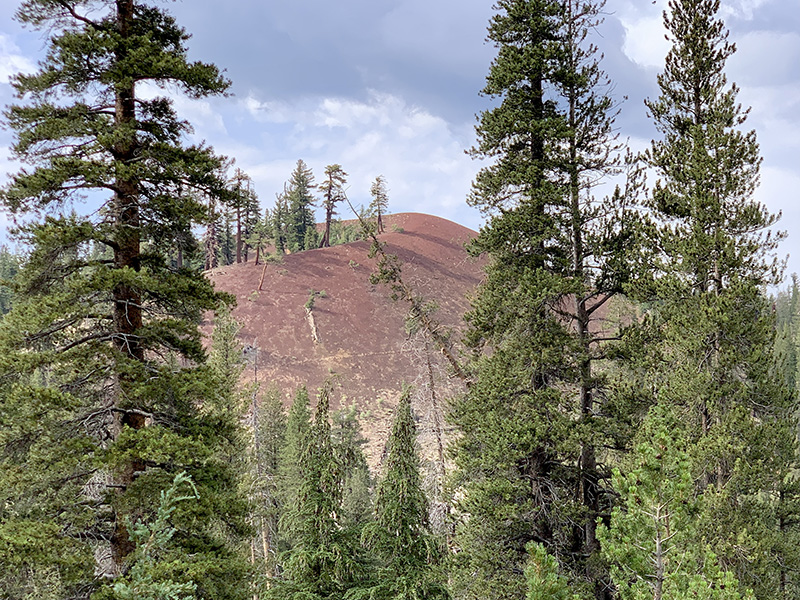
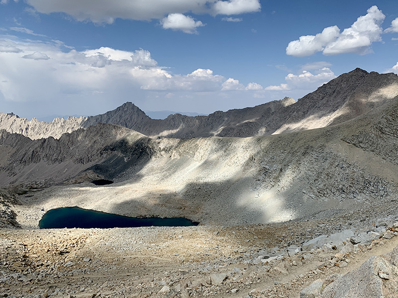
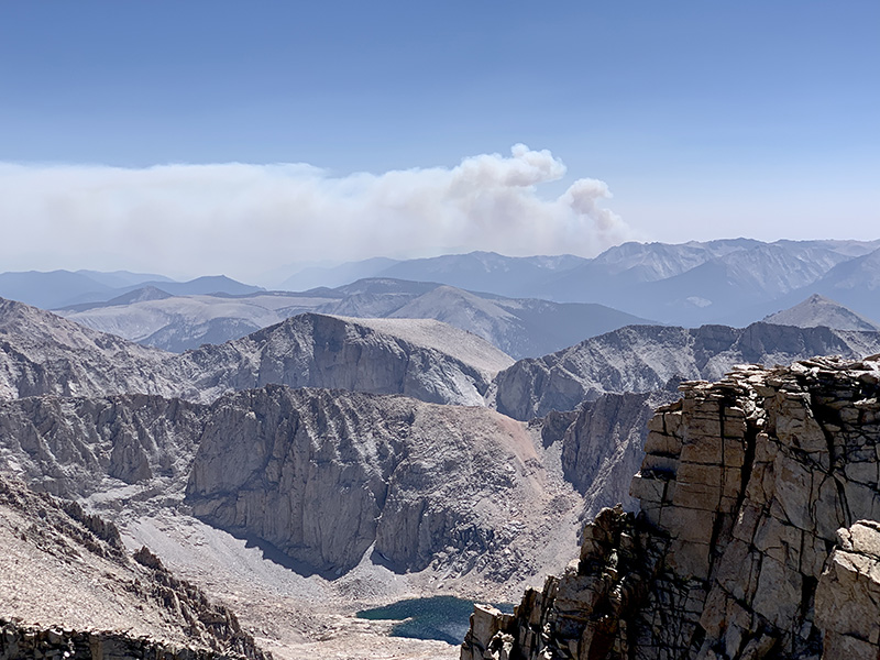
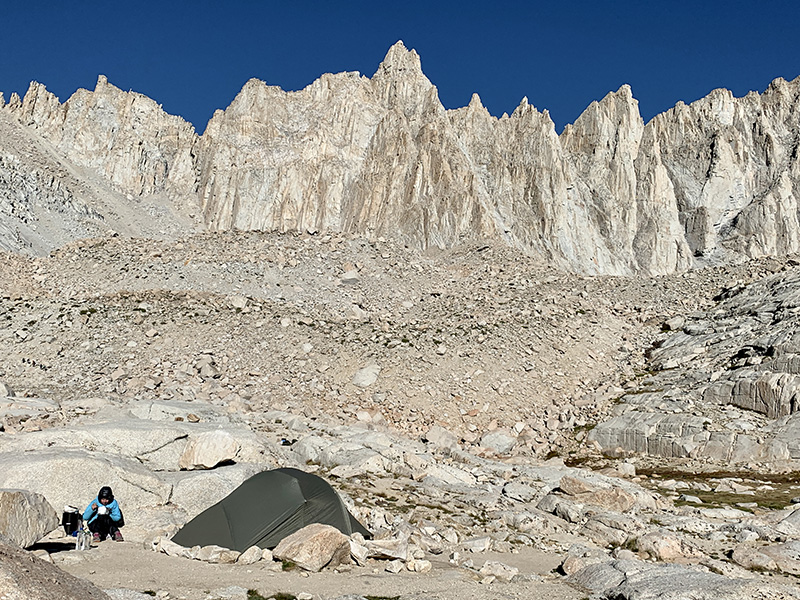
We were lucky with the weather, mostly sunny and warm even at high altitude. Mid-day high temps were mostly in the twenties (°C), in the teens on Mt Whitney, felt warmer with full sun exposure. Sleeping temps were also very comfortable dropping to 8-12°C in the morning (only once to 6.5°C). Some rain on the trail and some after hours when we were able to wait it out in our tent or at night. Nothing too bad. A couple of days with strong wind. The sky was often hazy because of smoke fromdistant wild fires. One afternoon wind blew more smoke into the valley where we camped, we could smell it but it was not intense enough to affect us much. And from the slopes of Mt Whitney we watched a big plum of smoke appear suddenly on the horizon. We walked half a day through burned forest near Vermilion Valley Resort (VVR).
We were carrying on average 930 g of dry food per day for two, plus small reserve for extra day or so. And we had extra meals at resupply/rest points. All recipes were designed and meals prepared by Joanna to maximize calories/g and minimize cooking time: just bringing water to a boil (or even just using cold soaking to which we did not have to resort to). Calories were limiting – Piotr lost almost half a pound per day. Water was plentiful on most days, so there was no need to carry a lot. We did frequently refill our bottles when resting (UV sterilized). We used our full water carrying capacity only once for dry camping at Young Ridge. We started with lighter loads (fewer days to carry food for). Still there was a lot of going up and down, and up again. Our backpacks got quite heavy after resupply for the 10-day third section: Piotr’s backpack topped at 38 lb and Joanna’s at 23 lb.
Joanna spent nearly two years on research, extra long as we lost 2020 hiking season. She drafted daily hiking plan, investigated resupply options, tested new food recipes. Piotr prepared digital maps and navigation tools. We modified/updated our hiking kit. Anything to cut weight.
 JMT 2021 itinerary
 Resources and hiking kit
Guides, maps and navigation
Piotr’s packing list
Piotr’s backpack
Water, food, kitchen
More hiking kit
 JMT video clips
Other video clips
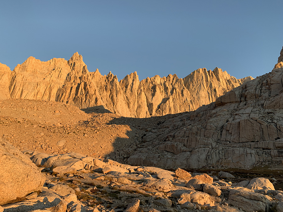
With good weather and us feeling well, we were confident Mt Whitney was within reach – flat summit hiding behind rock outcrops near the end of the video. We looked down at the valley where we camped the night before and surrounding mountains, and the mountain range on the horizon we crossed to get here (and many more before it). Not bad.
Highlights…
Extremely impressive! 14 km ascent is a lot! Looking forward to more details..
How many hikers were on the trail? Also, how many batteries and SD cards for cameras you had to carry? How are your shoes after this?
For photography, we relied entirely on iPhone XS to keep weight down, decent photo quality plus apps (maps, GPS, docs), an obvious trade-off (no second camera, no optical zoom for wildlife). With cellular connection and all unused apps turned off, we used about 50% of the phone battery per day. 20 Ah powerbank was enough for 10-day section with everything fully charged at rest stop, with extra power available for flash lights, steripen, and some reserve. Newer phone would be even better. We took 5000 photos and shot 80 short video clips.
My (Piotr) Merells survived OK with obvious, but just surface damage/wear. Walked some 350 miles in them already. They are soft and comfortable, on the lighter side. Soles are reasonably flexible with some feel-through on stones, which I like. No ankle support, but it is fine for me. The waterproof membrane would not make a big difference for hiking in the rain on JMT (we had pretty much dry weather). It worked well on wet and muddy trails on Isle Royale.
We saw ~30 people/day, I think. More in popular areas like Rae loop, Kearsage trail (exiting to Onion Valley), going down from Mt Whitney, less on the rest of the trail. We were out of sync, starting and ending later than most people.
Shoes survived (with some wear and tear of course)!
Great achievement. Congrats.