We made last minute decision to take different route on the way back home: crossing Utah and Colorado to Denver on I-70. We made short stops at Great Basin NP, Colorado National Monument and Silverthorne at Dillon Reservoir. We divided the extra day saved on JMT between these places to have at least some time to look around. We stopped in North Platte for the last night just to break the miles.
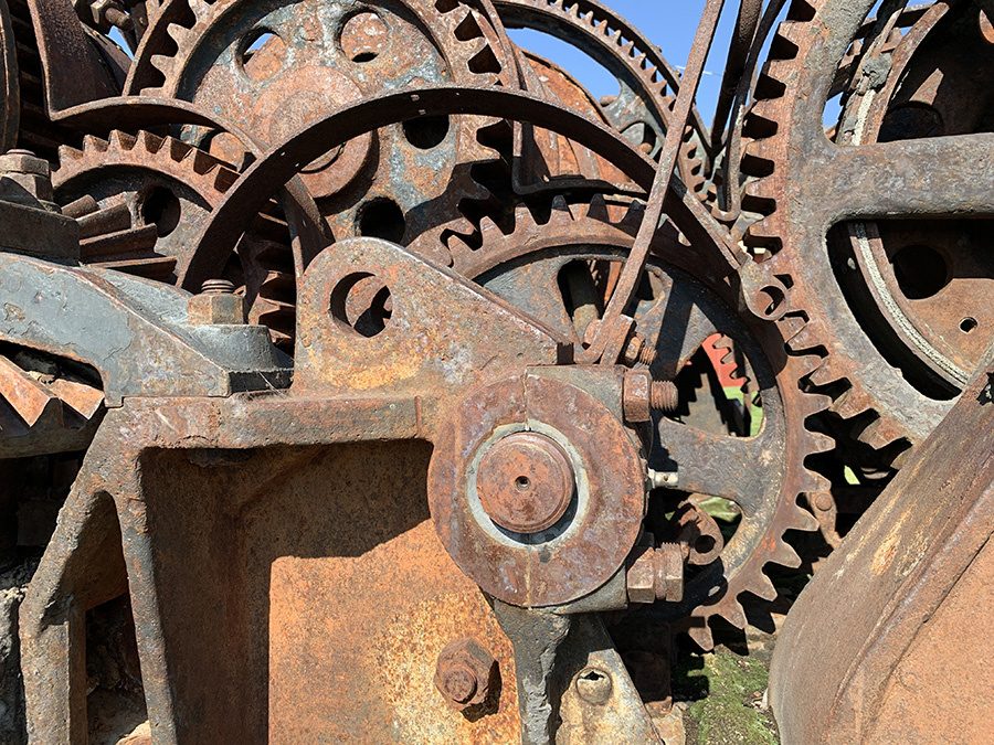
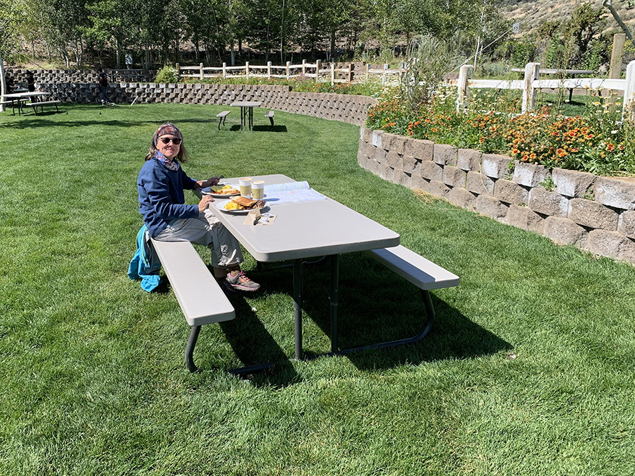
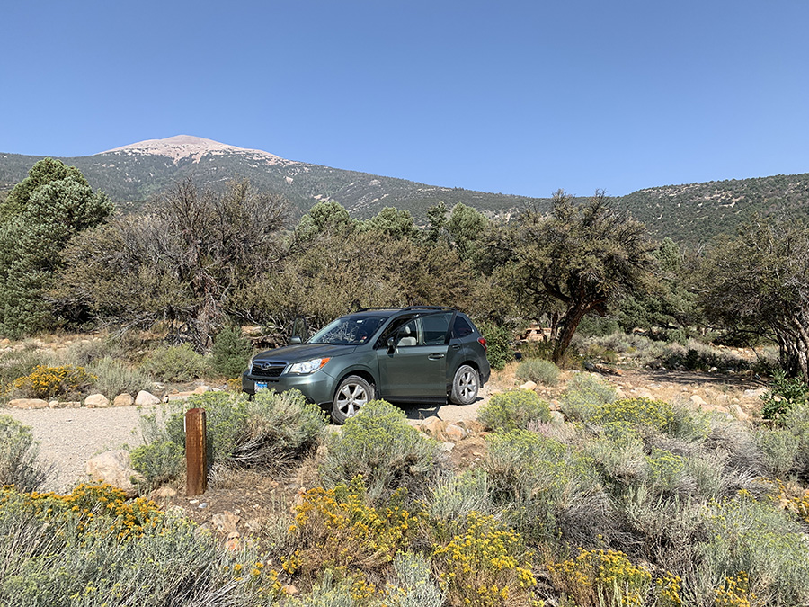
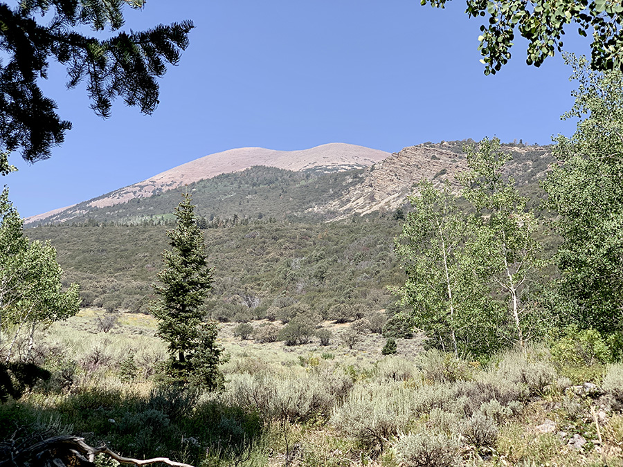
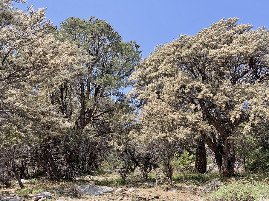
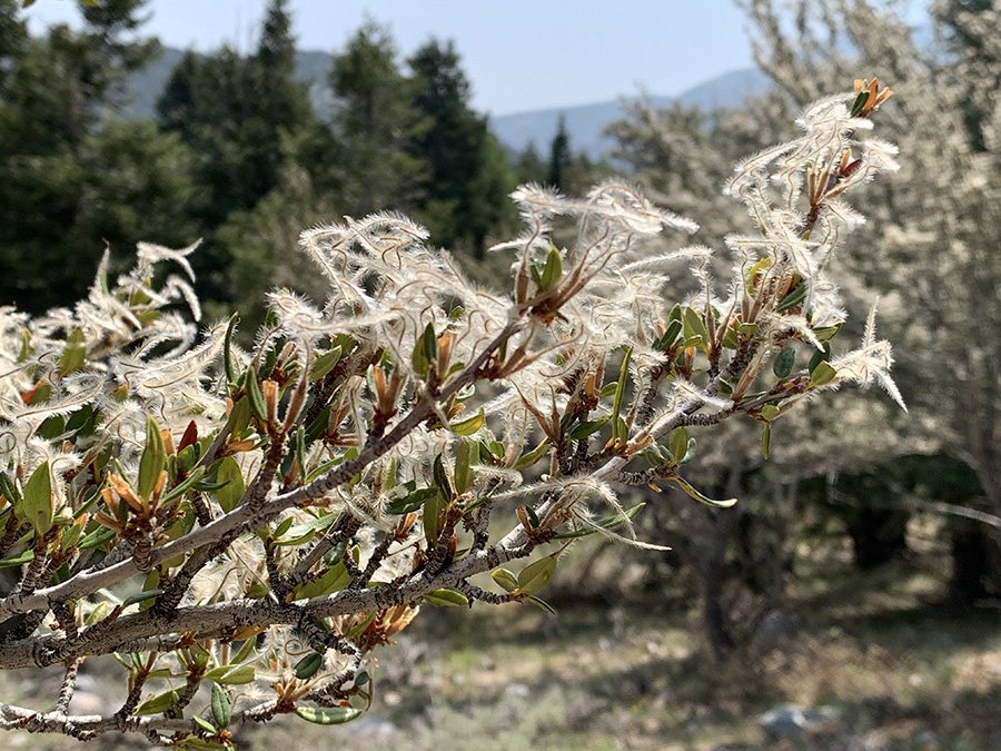
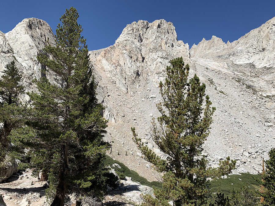
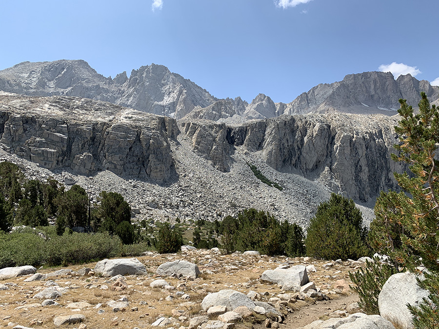
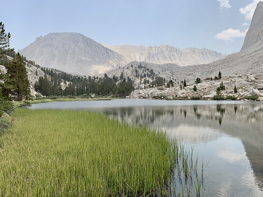
But first we had to get back to our car in Lee Vining: 3-hour 122-mile ESTA bus ride from Lone Pine and 1-mile street walk to Visitor Center, final backpacking effort of the trip. Our car was fine waiting for us. We stopped briefly at Mono Basin Historical Society exhibition to examine old, rusting machines and then had dinner for breakfast at Whoa Nellie Deli (Piotr had big steak and two x-large lattes with extra shots) and very soon started crossing Nevada on now familiar Rt 6. We diverged in Elly to visit Great Basin NP. Found nice spot at Baker Creek Campground (recommended). Tickets for full Lehman Caves tour were sold-out and road to Wheeler Peak Summit Trailhead was closed, we walked nature trail near visitor center and hiked 4-mile Baker Creek loop instead. Interesting flora ecosystem – Pines, Aspen, Curlleaf Mountain Mahogany and shrubs. Wheeler Peak always in the background. Stopped for lunch at Baker Creek picnic area and started driving towards Utah.
Expo at Mono Basin Historical Society
Breakfast at Whoa Nellie Deli
Looking for last gas station…
…before driving on empty stretch of Rt 6…
…
Camping at Baker Creek
Wheeler Peak from Baker Creek trail
Mountain Mahogany…
…
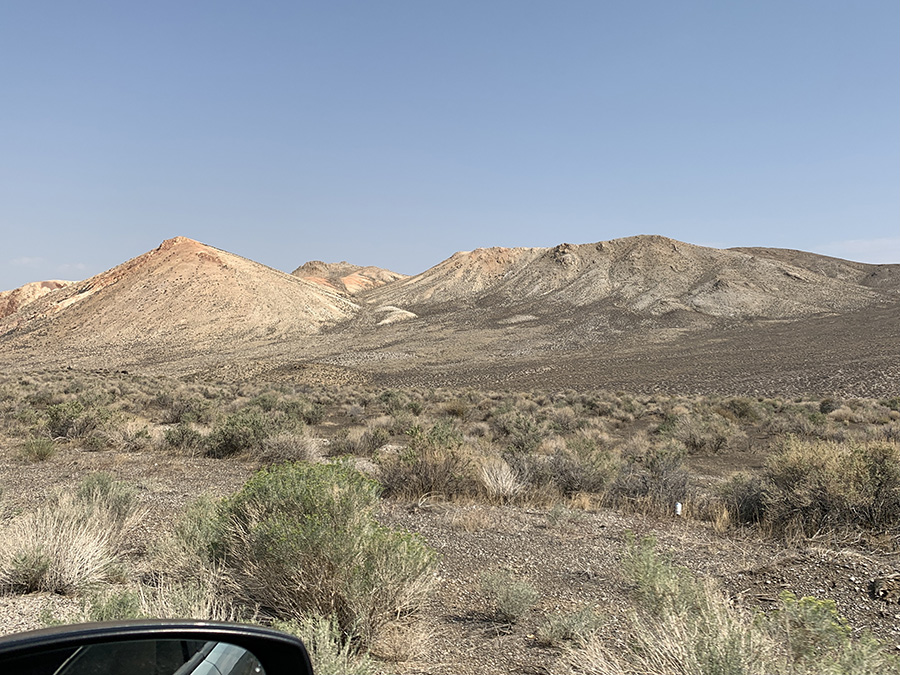
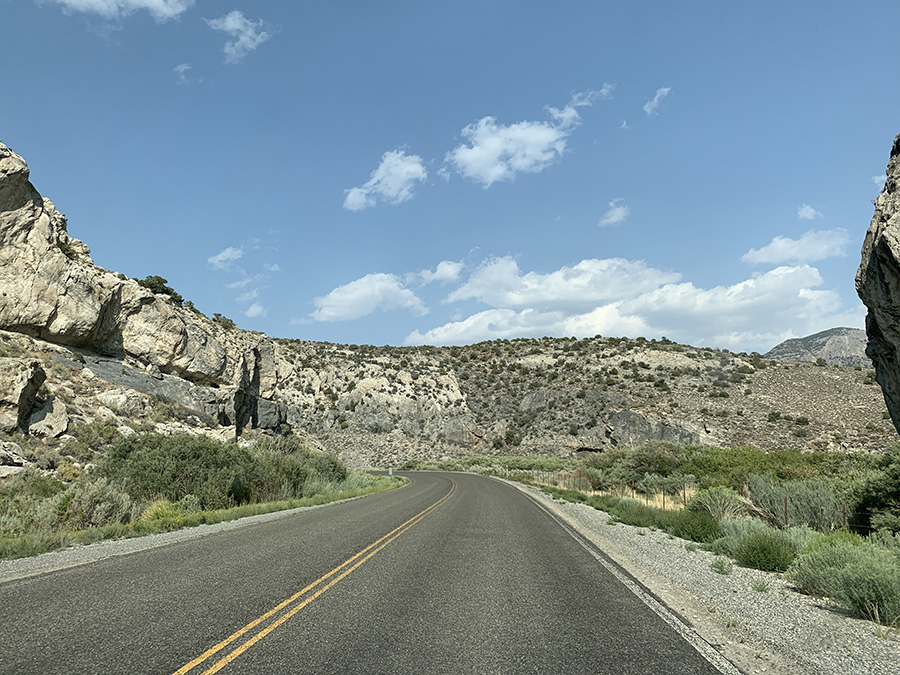
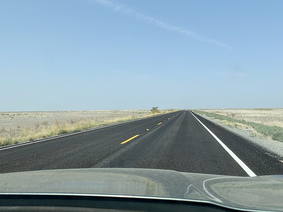
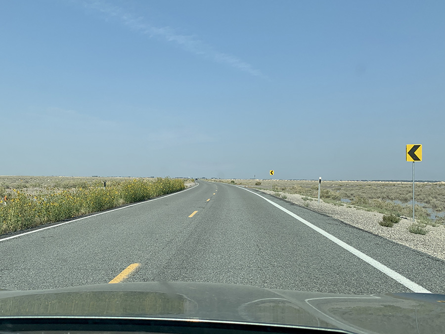
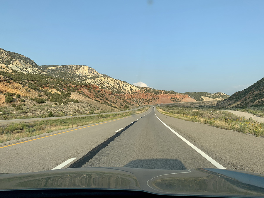
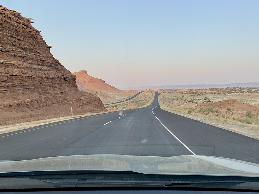
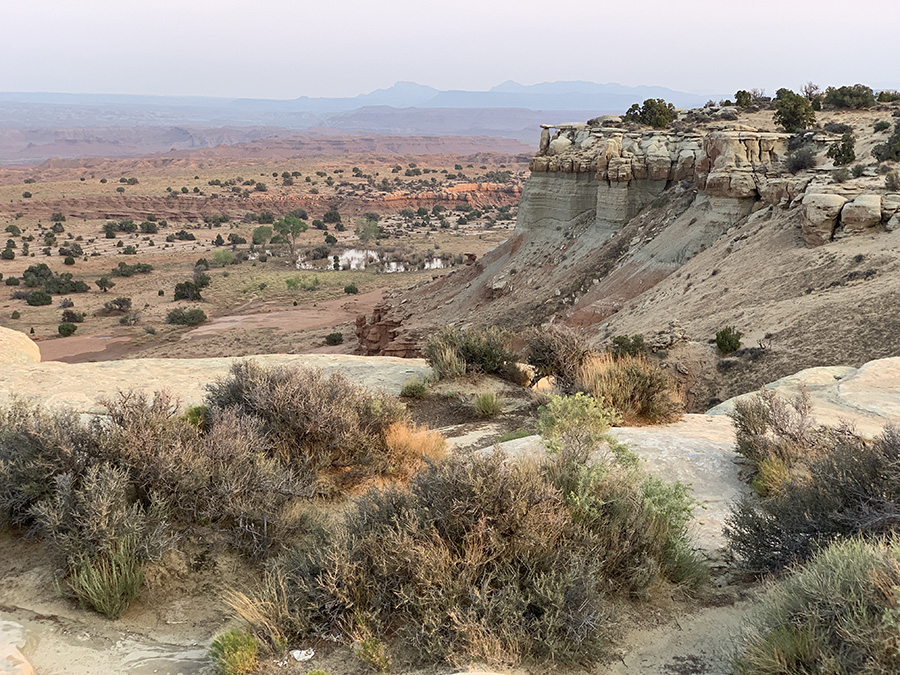
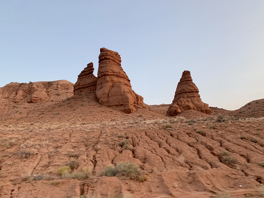
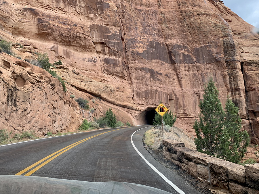
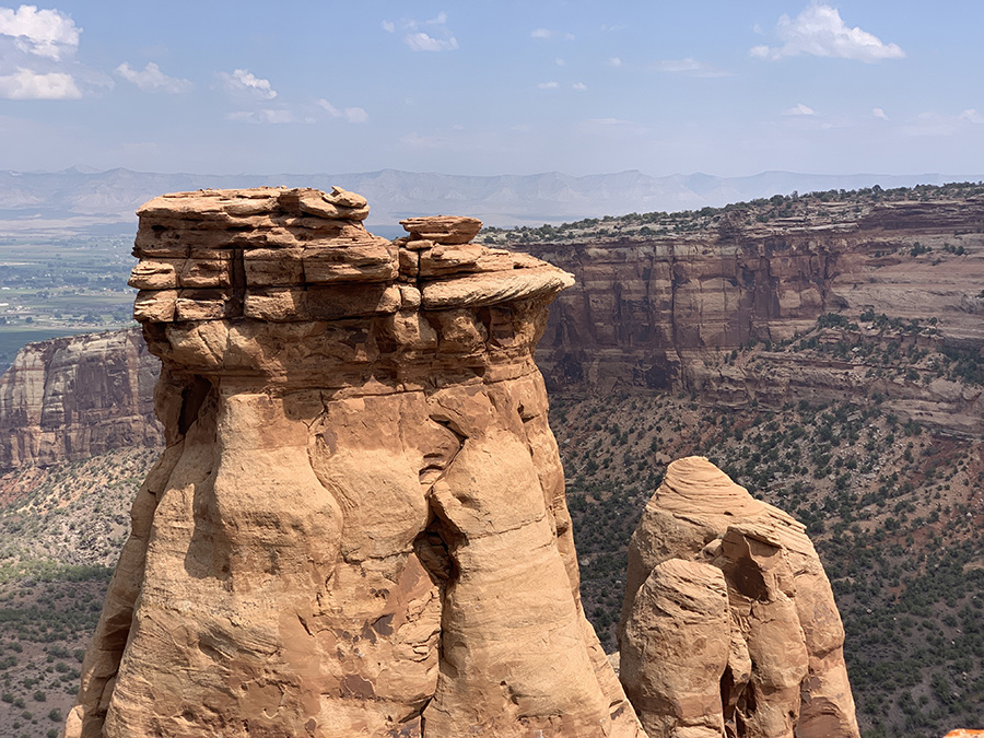
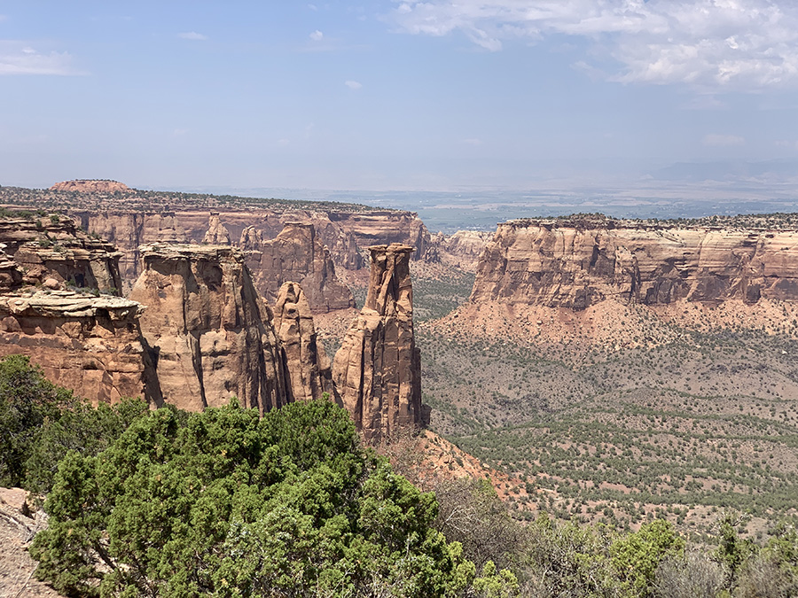
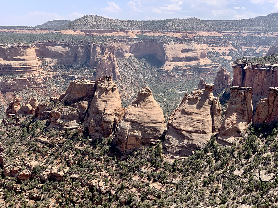
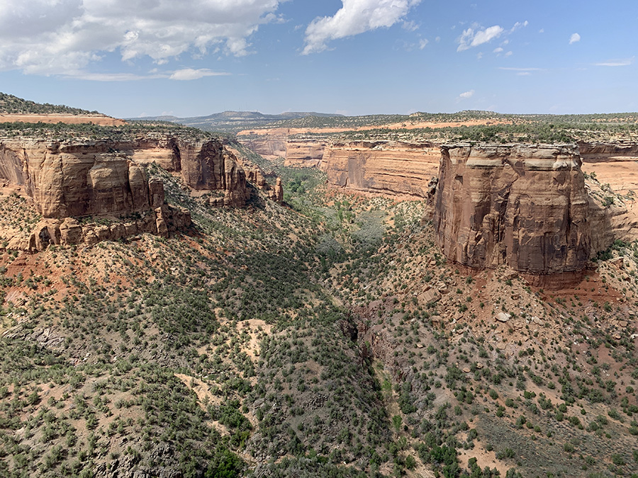
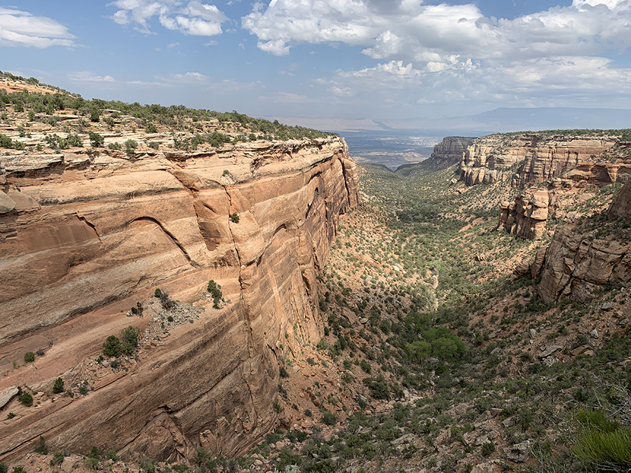
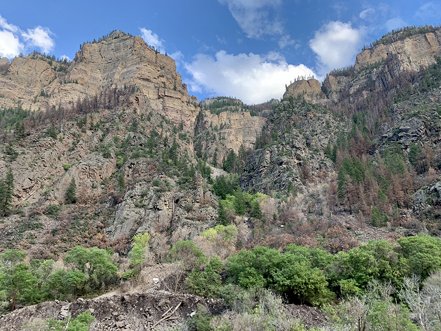
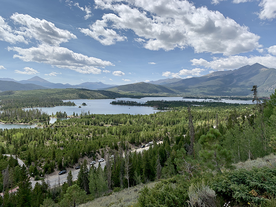
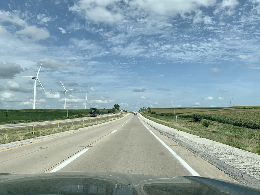
Driving across west-central Utah: straight empty highways for miles (flat Sevier Desert), then colorful hills, and later cliffs and canyons with interesting rock formations. We only had time to stop at couple of viewpoints on I-70, but agreed we should come back to explore this part of the country. It was getting dark, so we decided to stay at motel in Green River. We later regretted the decision – campground at Colorado National Monument was great, as we discovered next day, and far better option even if we arrived very late. Dark clouds greeted us when we arrived at Colorado National Monument, but not much rain fell and the rest of the day was mostly sunny. We spent several hours on 23-mile Rim Rock Drive on top of the mesa. Stopped many times to view canyons and walk short trails to interesting rock formations. We spent afternoon and evening driving into the Rockies, across Vail Pass to Silverthorne. The area was packed with tourists, mostly bikers, but despite arriving late at Heaton Bay Campground we got nice campsite. Next morning we did two short walks: along the banks of Dillon Reservoir and to the Old Dillon Reservoir. The rest was just driving: CO, NE, IO and IL – familiar route we were on multiple times before.
Independence Monument View
Ute Canyon View
West-central UT (Sevier Desert), highway straight to horizon…
…sharp left turn…
…colorful hills
Driving down to prehistoric sea bottom
Castle Valley Overlook
…
Tunnel to Colorado National Monument
The way we came up to the top of mesa
…
Monument Canyon View
Coke Ovens Overview
Ute Canyon View
Red Canyon Overlook
On I-70 along Colorado River (on the right)…
…into the Rockies
Dillon Reservoir, looking west towards Silverthorne
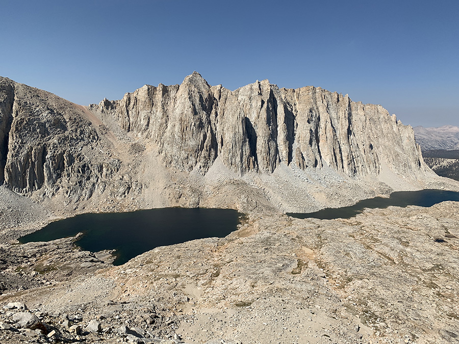
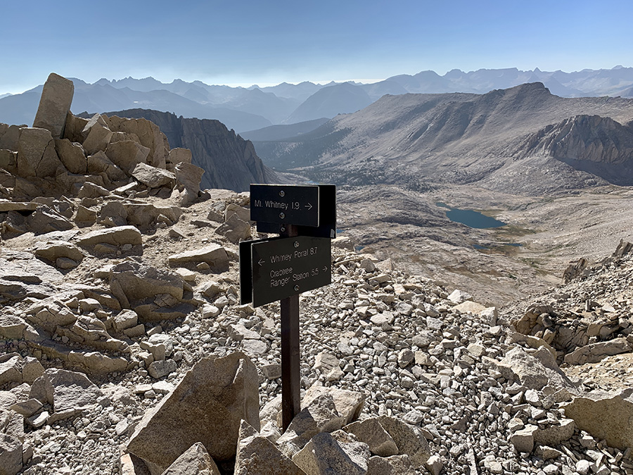
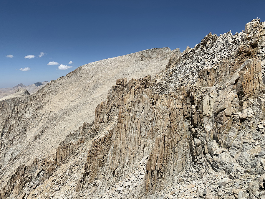
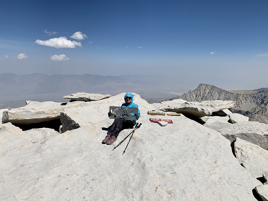
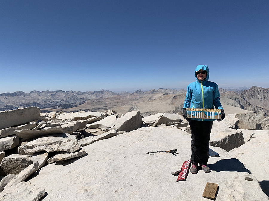
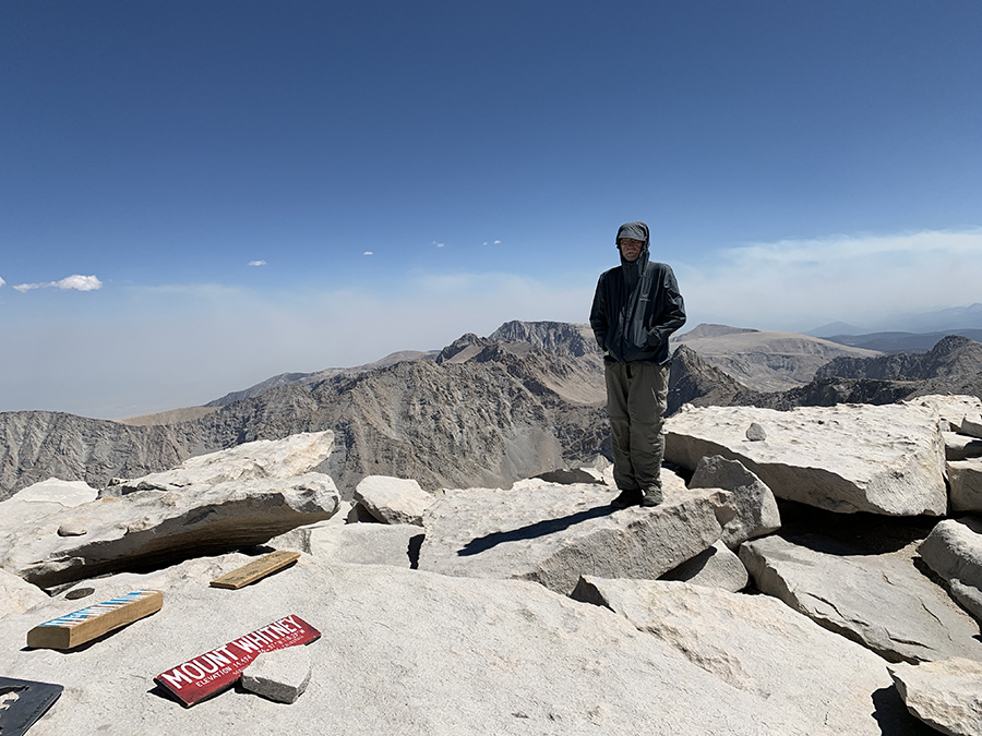
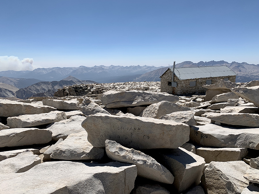
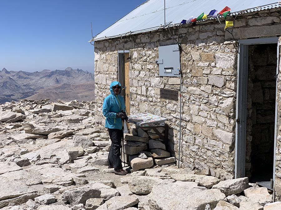
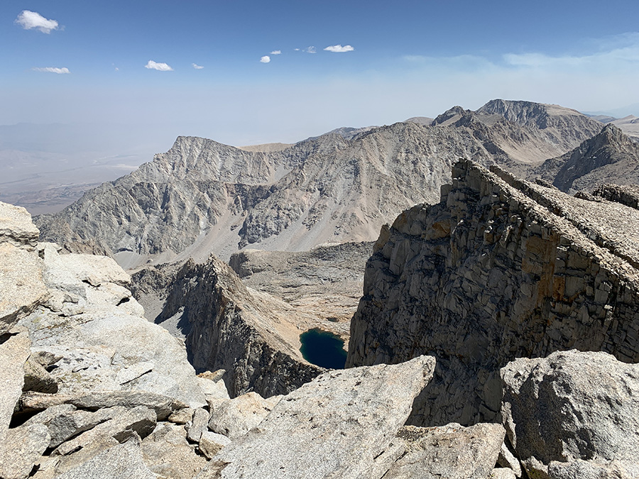
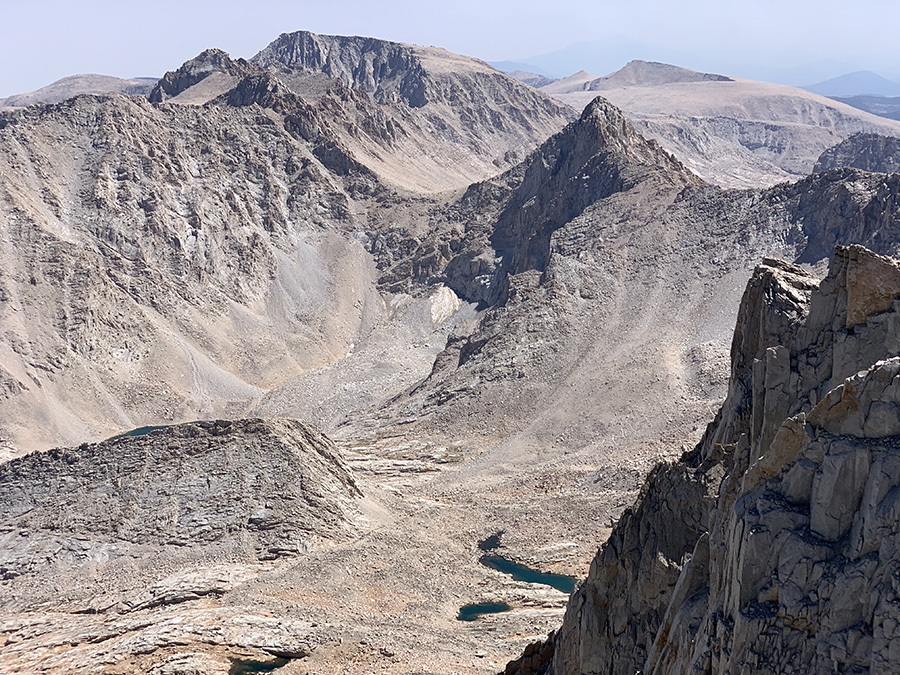
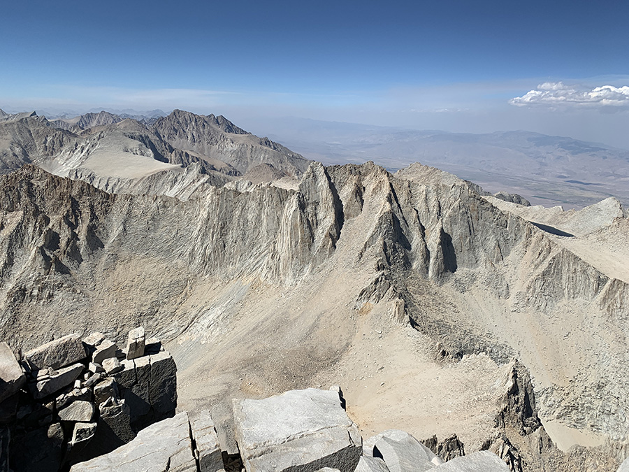
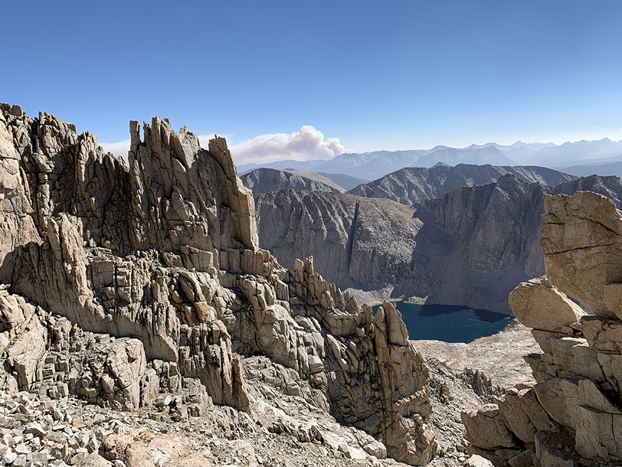
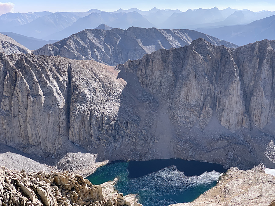
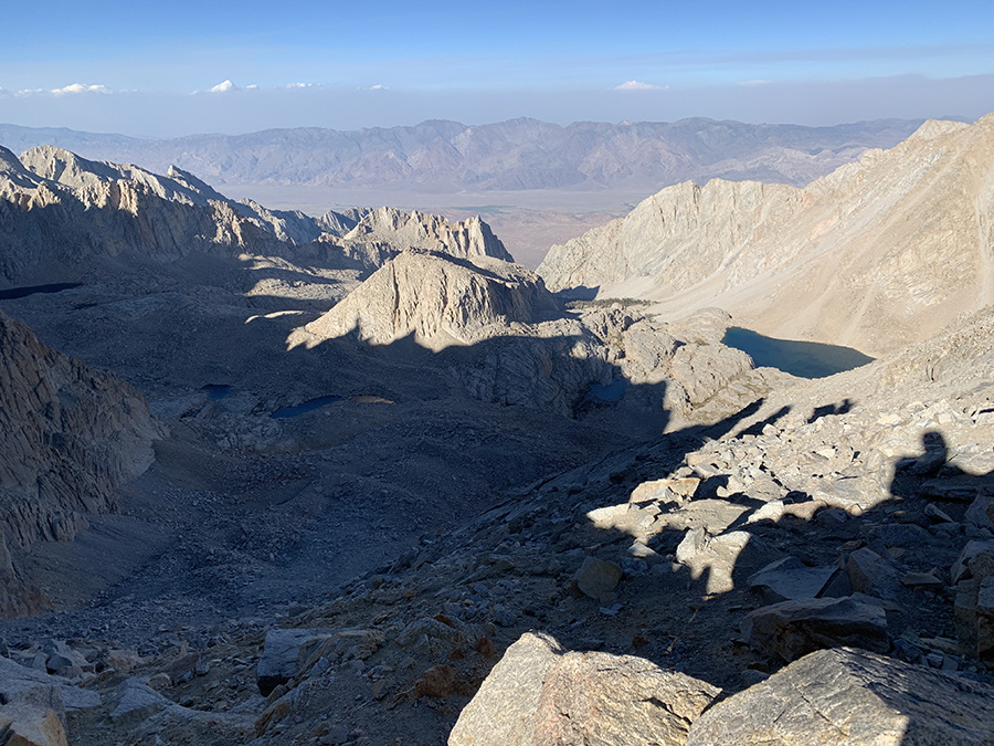
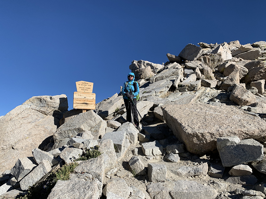
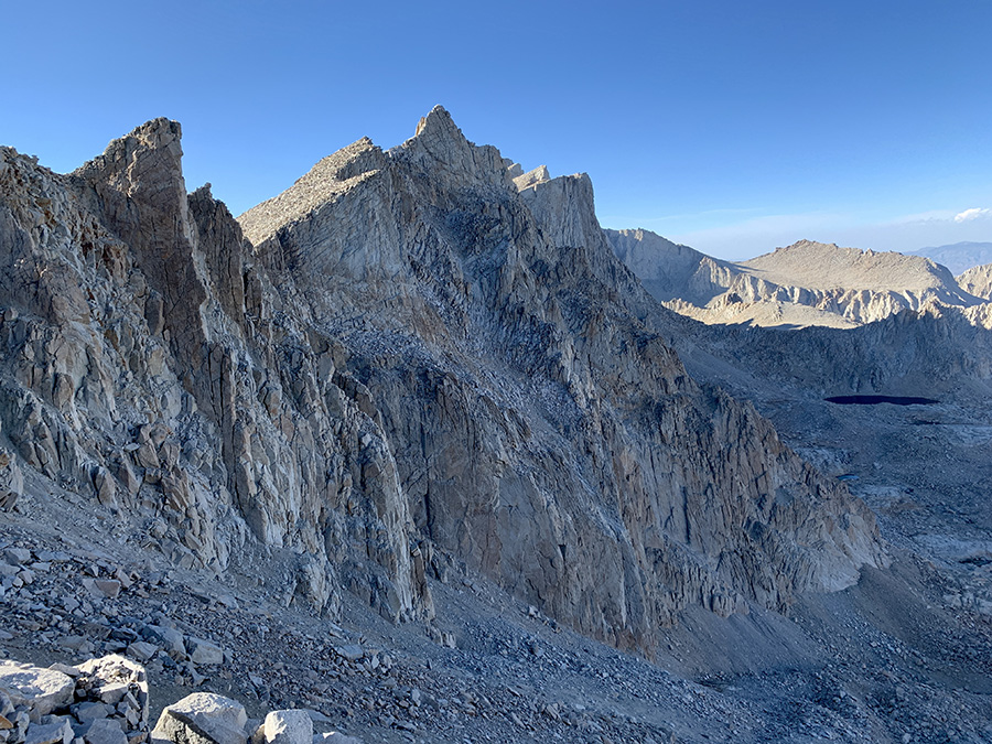
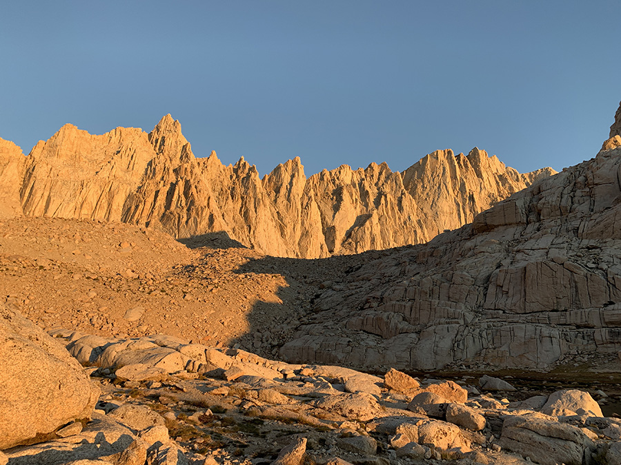
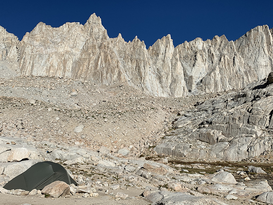
Mt Whitney (4421 m) day started shortly after midnight – we heard voices of quite a few hikers moving up the trail to catch sunrise on the summit. After breakfast we were on the move too, at 9 am. Some people already came down from the summit. The trail is not particularly difficult or steep, just steady going up 900 m. In addition, last 3 km and 350 m ascent was without backpacks (left them at trail junction). To Piotr final approach looked somewhat reminiscent of Ben Nevis (hiking from north face), grander scale of course – both summits are flat piles of stones with precipice on one side. We were hiking in full sun and in comfortable temperatures, but wind gusts were getting very strong. We watched big plum of smoke developing from very recent fire. Distant sky looked hazy (smoke), as most of the days – more so during second half of our hike (even more smoke in Onion and Owens and Valleys). All what looked before like big mountains were now below us. We spent an hour on the summit which was deserted (all but a few people hiked down already) and very windy. Finally, we had cell connection to check messages and e-mails, and call friend – we always tried to keep our friends and family informed about our whereabouts.
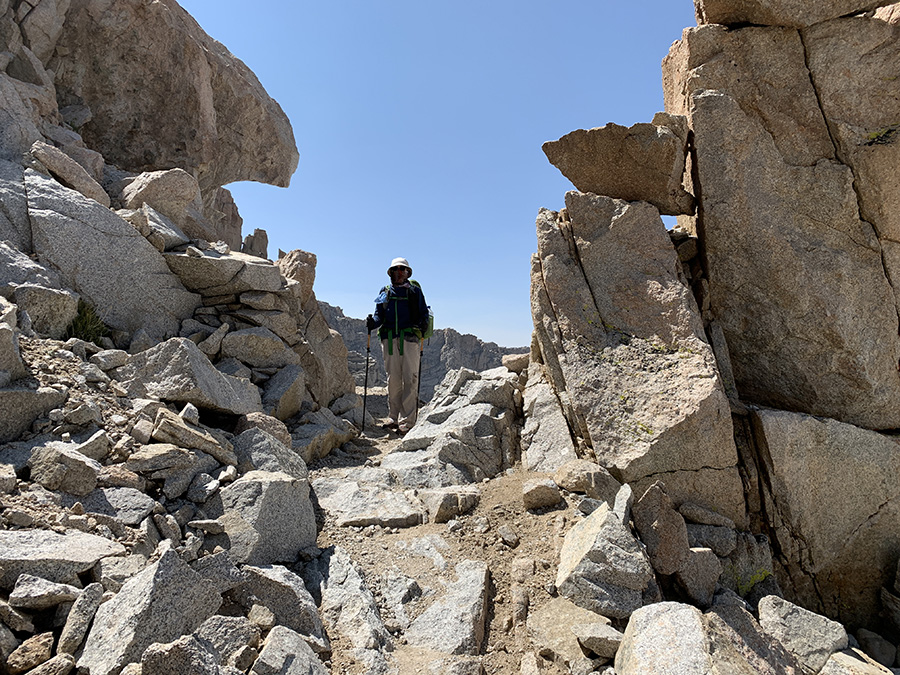
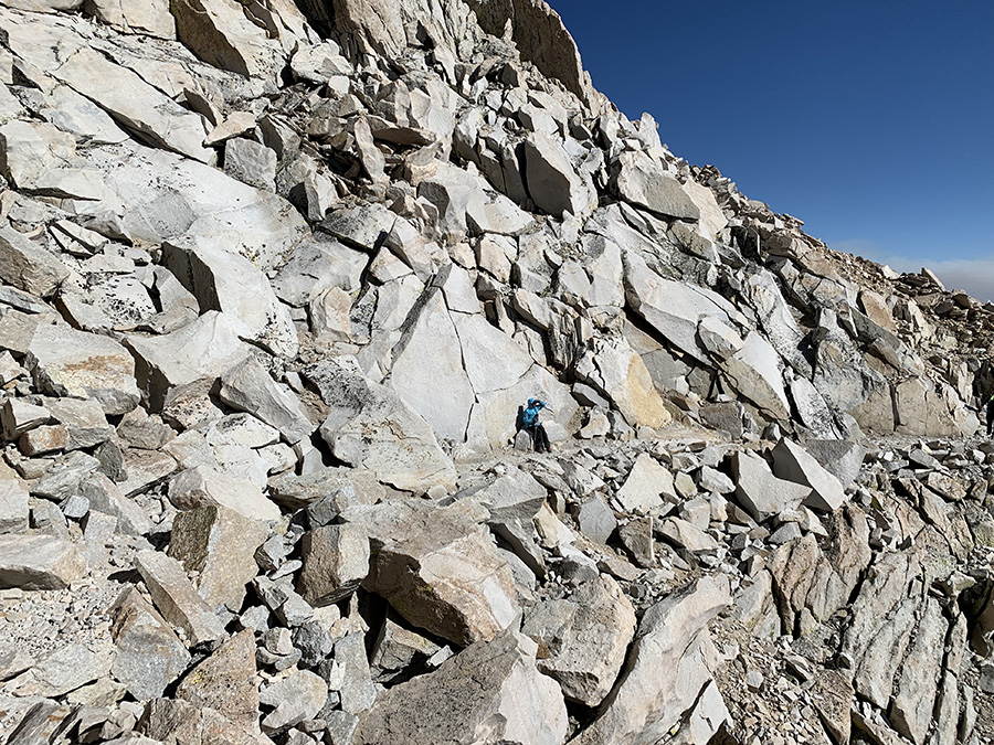
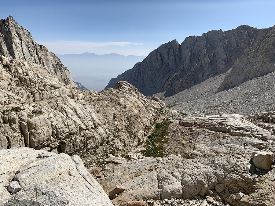
We walked down back to the trail junction to collect our backpacks, crossed over Trail Crest (4166 m) couple hundred meters away and started descending to Trail Camp Tarn on 99 switchbacks. When we arrived late in the afternoon many camp sites were already occupied and we spent quite a bit of time looking for something suitable for our tent and at least partially shielded from wind coming down from the crest. Joanna preferred less windy spots under rock walls, but Piotr did not like a threat of puddle or stream under the tent in case of rain nor driving stakes into granite. One strong wind gust caught us just as we were unfolding our tent, we managed to hold on to the sail, but next gust bent one of aluminum posts (remained usable). Once everything got nailed down we were OK. It was clear our larger tent was not suitable to camp on the summit – yes, crazy idea to dry-camp there crossed our minds.
Summit view south to west
Summit view west to north
On Mt Whitney slope, Mt. Hitchcock below…
…cutting through rock outcrops…
…left backpacks at trail junction (tucked against rock wall)…
…walking towards flat summit…
…made it, Owens Valley in the bacground..
…
…
…
…signing register
…mountains on other three sides…
…
…
…hiking down already, smoke plume on the horizon…
…Hitchcock lakes
…quick rest on the trail…
…Guitar Lake last time..
…Lone Pine Creek valley, the way down…
…crossing Trail Crest…
…and we are on the other side of the teeth
Joanna got early morning view…
…Piotr overslept, but mountains were still there
We were rewarded in the morning with nice views towards Mt Whitney, although its summit was not visible from this spot. Joanna cooked last backpacker’s breakfast and coffee, and we were on the way to the trailhead. Then nice scenery with lakes and Lone Pine Creek, greener and greener.
Mt Whitney teeth (summit out of sight)
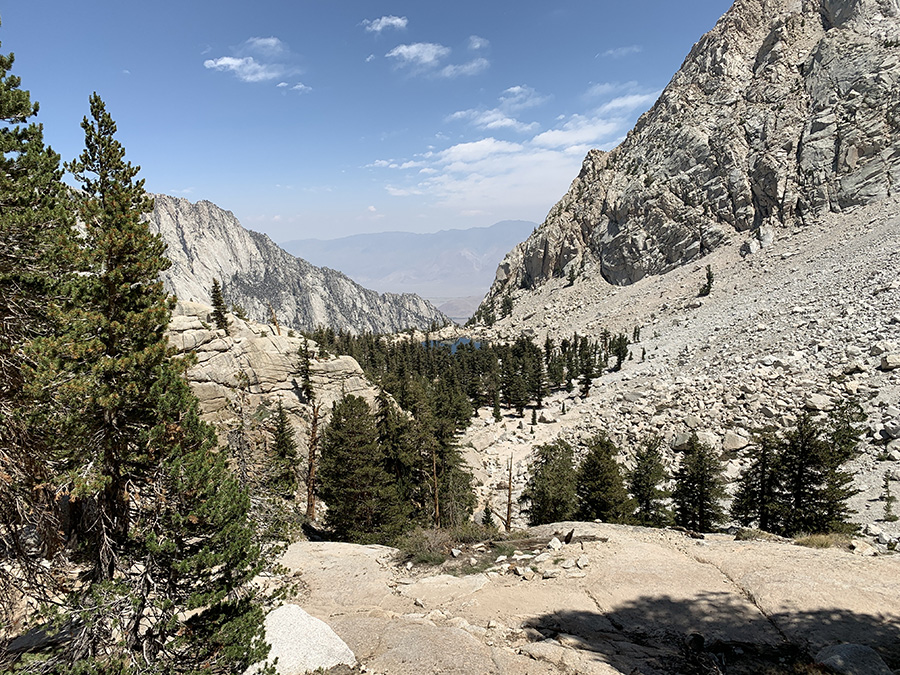
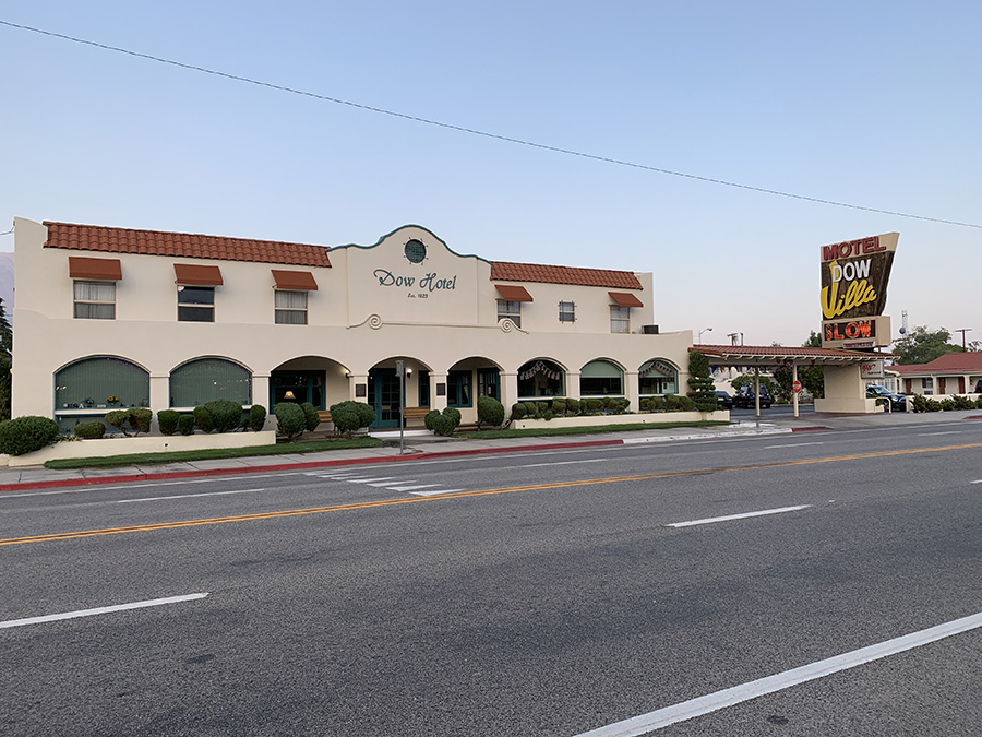
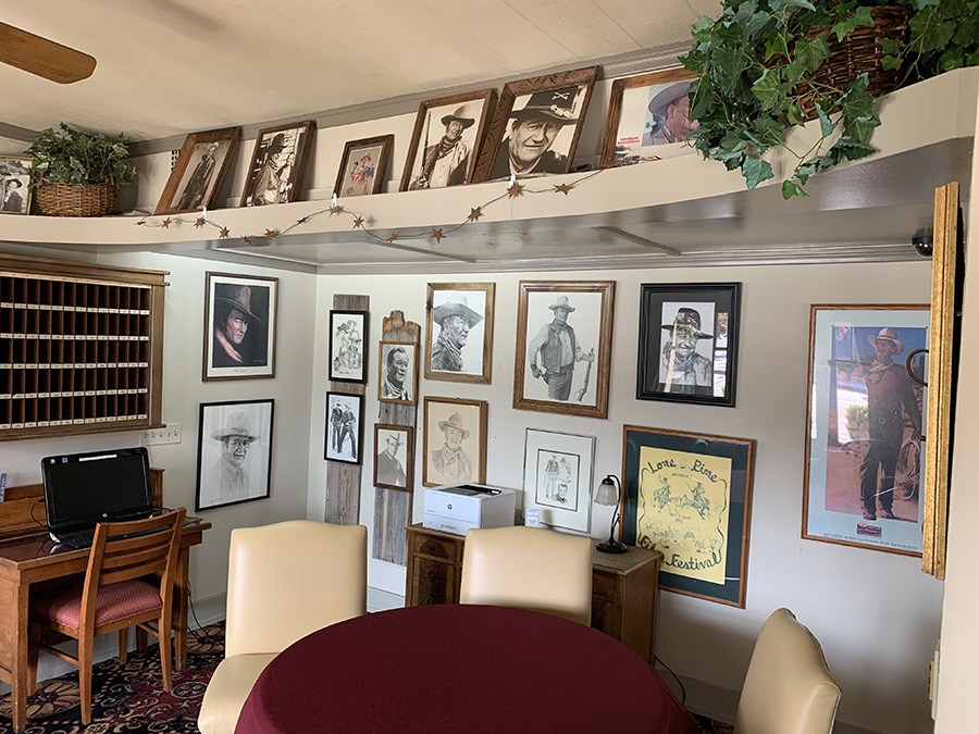
At a rest stop Joanna lost her favorite beanie hat which she had on all treks, on four continents. Many more people on this side of the mountain, often on day-hikes. We were greeted and cheered on arrival – finishing JMT is considered quite an accomplishment.We ate big lunch at the store at Whitney Portal and started asking around to hitch a ride to Lone Pine. Not difficult, but took longer than in Onion Valley. We, and another hiker, got a ride all the way to Dow Villa Hotel where we stayed for the night. In the past, many actors stayed at the hotel when filming at nearby Alabama Hills. We ate, did laundry and shopped to get ready for return to Chicago.
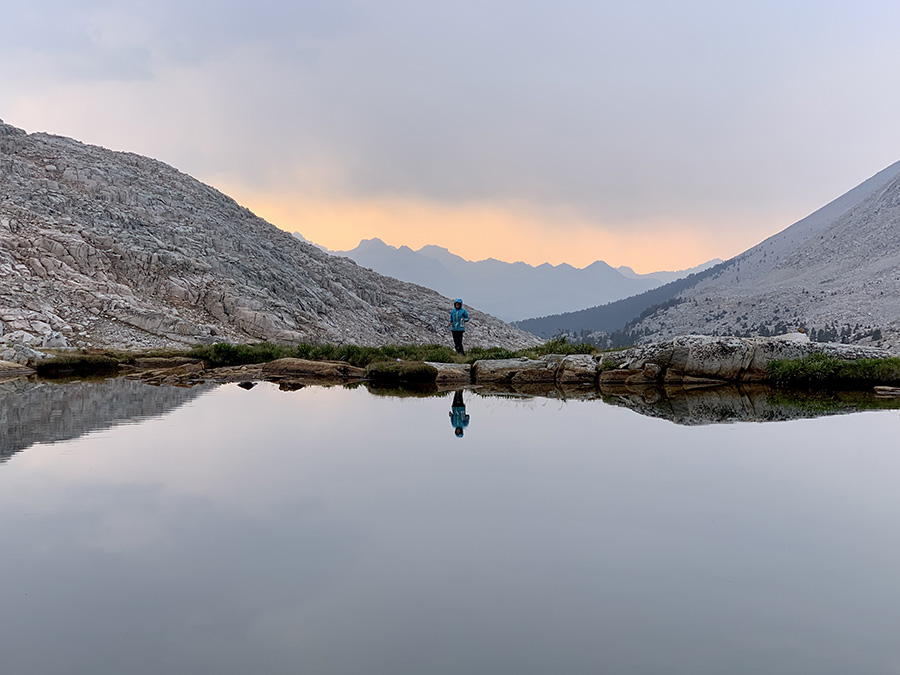
We started the final 6-day 48-mile section well rested and relaxed. The plan was to do it in 7 days. With stable weather pattern and a spare day to wait out bad weather, lighter backpacks and good physical conditions we were ready for Mt Whitney. We were already acclimatized, so going quickly up above 3000 m from 1200 m (Independence) was not a problem. Mt Whitney was of course in our plans, but we never made it into ambition satisfying goal. Just as we never intended to go faster or cover longer daily distances – we could in case of emergency, but it was not necessary. Joanna was hoping we could start moving earlier in the morning, but it did not work on the trail.
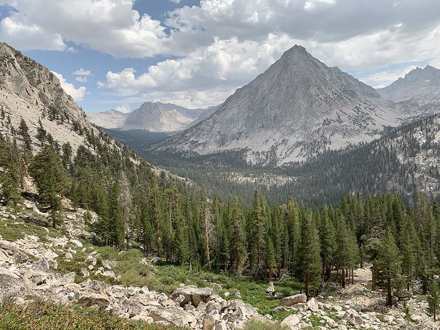
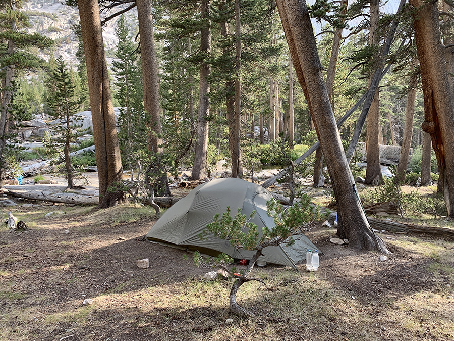
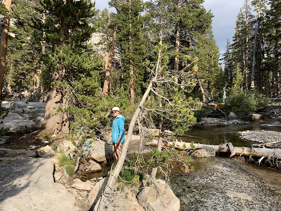
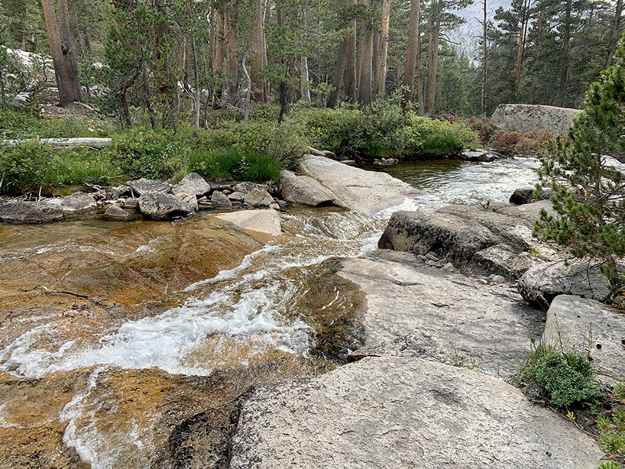
We worried about return to high mountains from low elevation of Independence with heavier = resupplied backpacks. Owner of Independence Inn drove us (and another hiker) to the trailhead. We had plenty of time to get ready the day before, so we took off earlier. First half of the day we were hiking through familiar landscape. It was actually fun to see everything from opposite direction. On the way down we selected possible campsites and convenient points to refill water bottles. None of this was necessary: we forgot to get water, jumped over Kearsarge Pass and passed “just in case” campsites, and kept going with ease and further than planned. Our bodies were already well trained, our backpacks and food rations optimized, and we were after full day of rest. We started saving time again – it was important to have some time reserve to wait out bad weather for Mt Whitney day. We passed Bullfrog Trail junction where we camped 3 nights earlier. Then down to Bubbs Creek and up the creek to Upper Vidette Meadow (which looked more like forrest). 9.9-mile day with 1000 m total ascent. We quickly found nice campsite at the creek and had sunny time to relax.
Return to Kearsarge Pass…
…Bullfrog Lake…
…Bubbs Creek ahead
Camping…
…
…at Bubbs Creek (Upper Vidette Meadow)
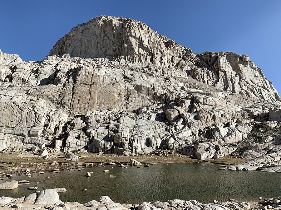
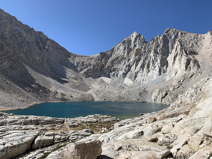
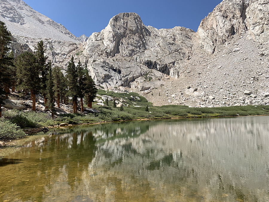
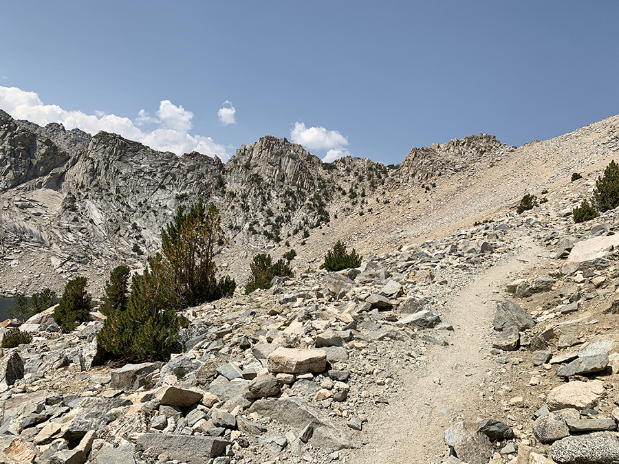
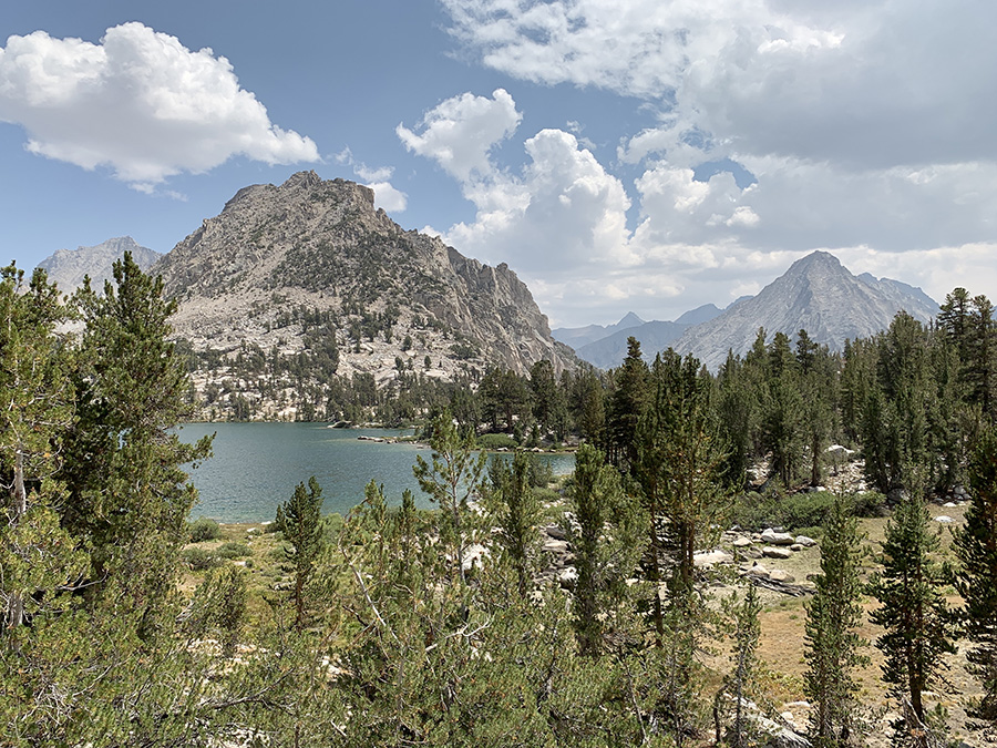
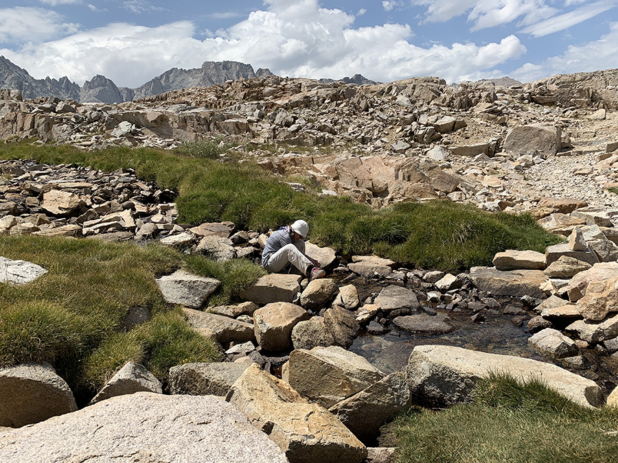
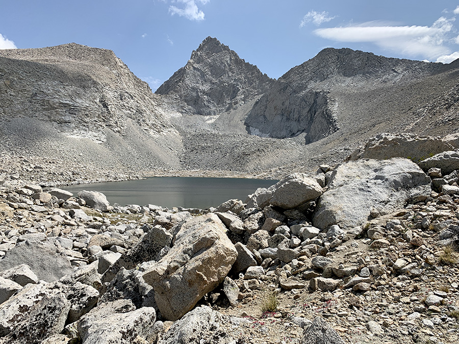
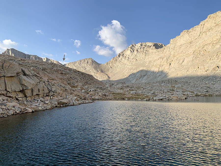
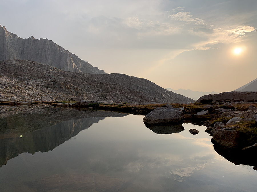
In the following 3 days we hiked to the base of Mt Whitney, just above Guitar Lake. We continued along Bubbs Creek and then up to Forester Pass, the highest pass on the trail (4009 m) gaining 1000 m. Some switchback sectors were steep, but somehow did not feel extremely difficult. We made it to Lake 12250 and reached the pass later than any other hikers that day. Weather was nice on the north side, but at the pass we saw dark clouds spreading to the south so we quickly descended to Tyndall Creek. Scenery around Forester Pass looked quite “high altitude” = bare rocks all around. Camping at the lake before pass (considered in case we got tired early) would be difficult, just piles of rocks everywhere, and once we started going downhill we continued to second of two lakes on Tyndall Creek below Diamond Mesa. We found good spot, but exposed and wind started to pick-up. It was the highest campsite of the trip – 3730 m. The Sun was still high so we climbed down the rocks to waterfront, washed and refilled water bottles. Joanna was cooking and Piotr was attaching our tent to Mother Earth, well after dark. Wind gusts were strong and we had some rain at night; it all cleared overnight. Still it was one of our favorite campsites, near lakes and with nobody else for miles in any direction.
Hiked out of Bubbs Creek valley.
Taking water frequently not to carry weight
Just passed Lake 12250…
…view from Forester Pass, Lake 12250
Looking for way out, and down to lakes where we camped
We camped above this lake, Forester Pass on horizon (arrow)
Checking cords, stakes and anchors one more time
Sun-heater coming to our tent in minutes
Lake changed color in the morning
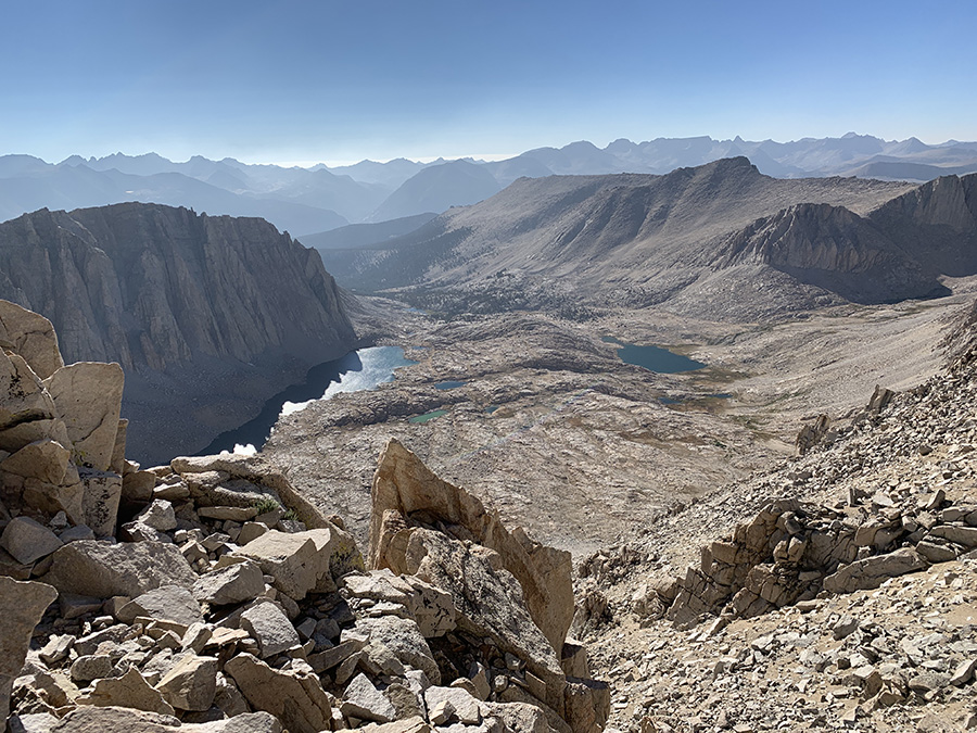
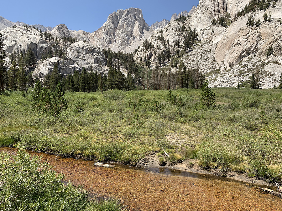
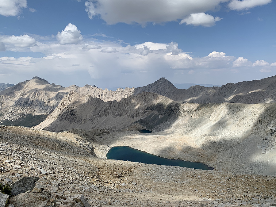
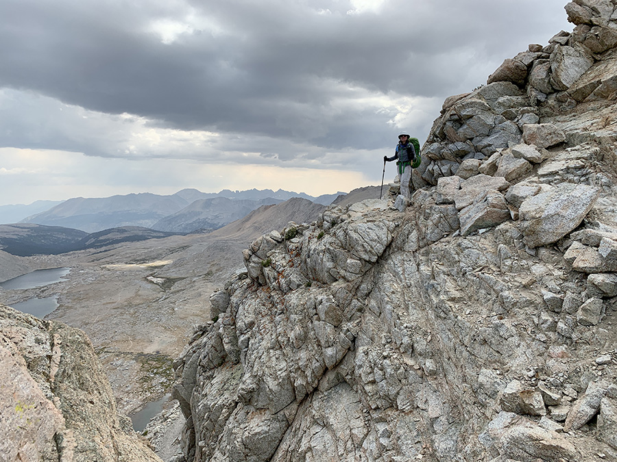
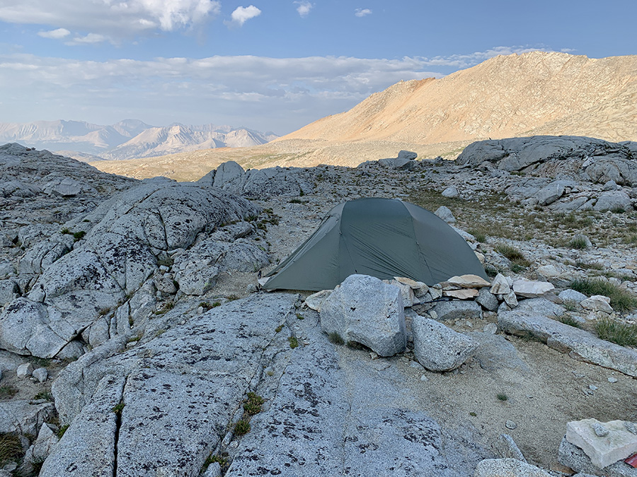
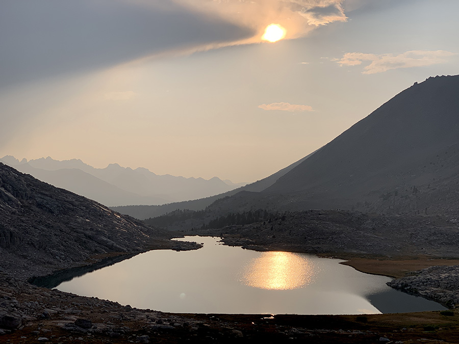
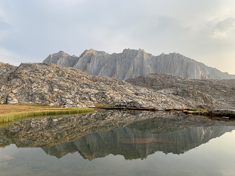
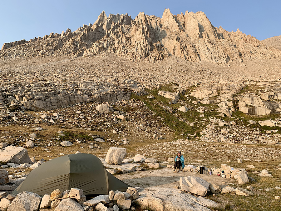
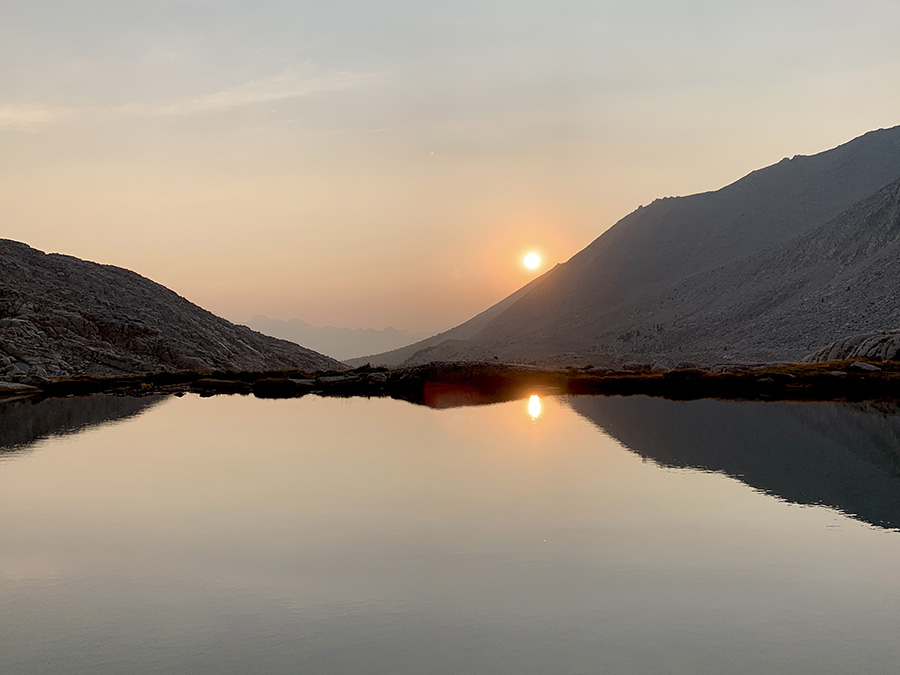
Next day was down Tyndall Creek, up to Bighorn Plateau and Lake (dry) where we had first view of Mt Whitney (not too scary from this angle), down to Wallace Creek, up to Young Ridge. We saw helicopter search and rescue near Shepherd Pass Trail junction, did not learn any details, but decided to refresh our knowledge of hand emergency signals when we get home – we did not send any to avoid confusion, just walked down steadily to show we were not seeking help. We arrived at Wallace Creek quite early and decided to continue to dry-camp at Young Ridge. We brought extra 2 L juice bottle from Independence (for dry-camping) – we filled everything up at the creek. It was very good decision, we were ahead of schedule one full day again and camping at Young Ridge saddle was most relaxing of all: sunny, warm, beach-like sandy, interestingly lit forest, evening and morning. No neighbors of course. And we made next day just 6 miles long: down to Whitney Creek, up to Timberline Lake, Guitar Lake and a small tarn above it. Storm was brewing when we arrived at Guitar Lake but Joanna decided to push on. Weather patterns during our hike were always confusing and we just kept going most of the time, but this time it looked really bad. High mountains held the storm just long enough for us to pitch our tent, the only time we did not really care where the spot was (we discovered much better spots later). It rained, lightings and thunders, and then it stopped just before dinner and sunset. Very lucky ! It was a beautiful place, with tarns and view of Guitar lake and high mountains. We were all certain of good weather for coming days and Mt Whitney summit.
View from Forester Pass
Waiting out storm at tarn above Guitar Lake
Search & rescue helicopter just took off (Tyndall Creek valley)
First good look at Mt Whitney from Bighorn Plateau