Chile day 7: El Tatio Geysers & Pukara de Quitor

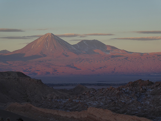
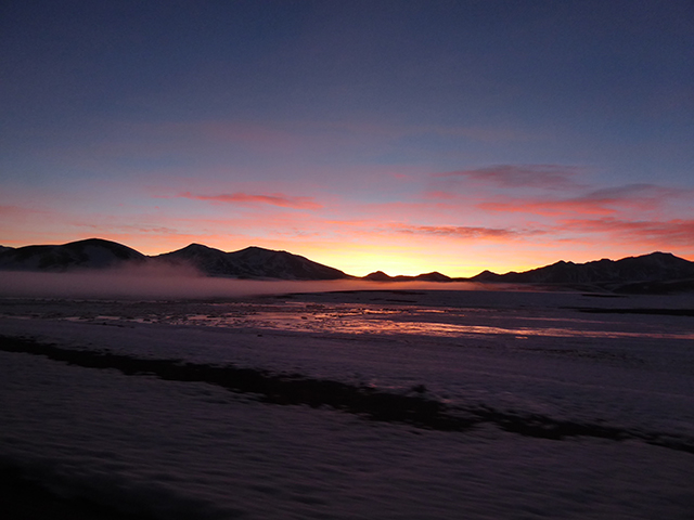
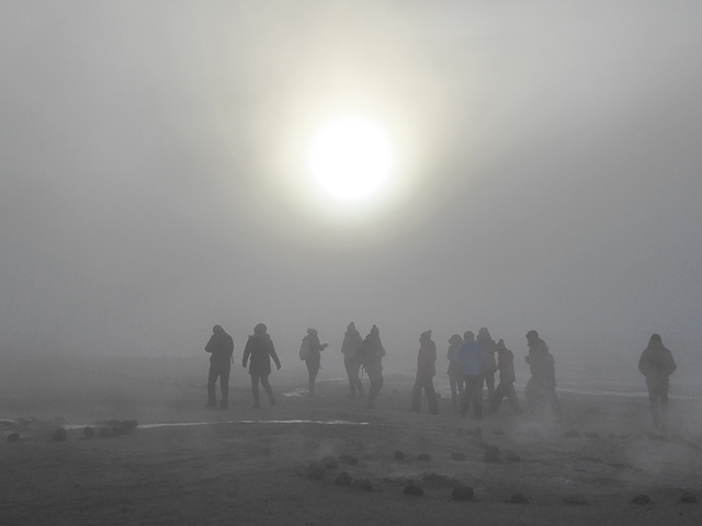
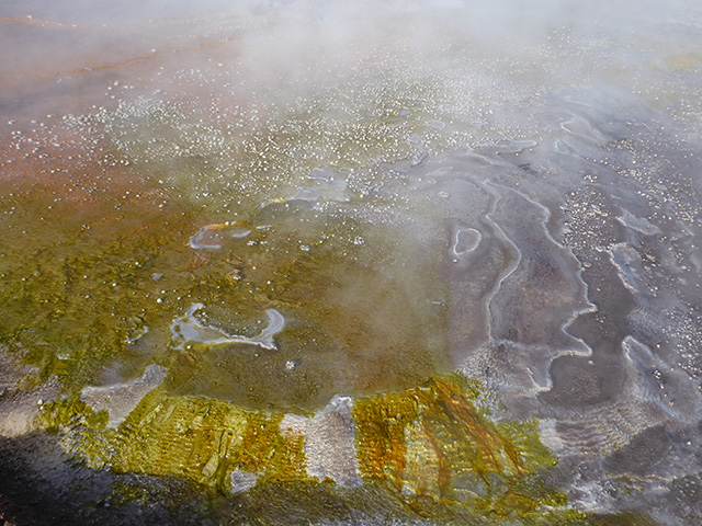
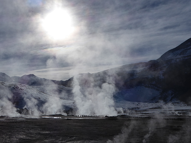
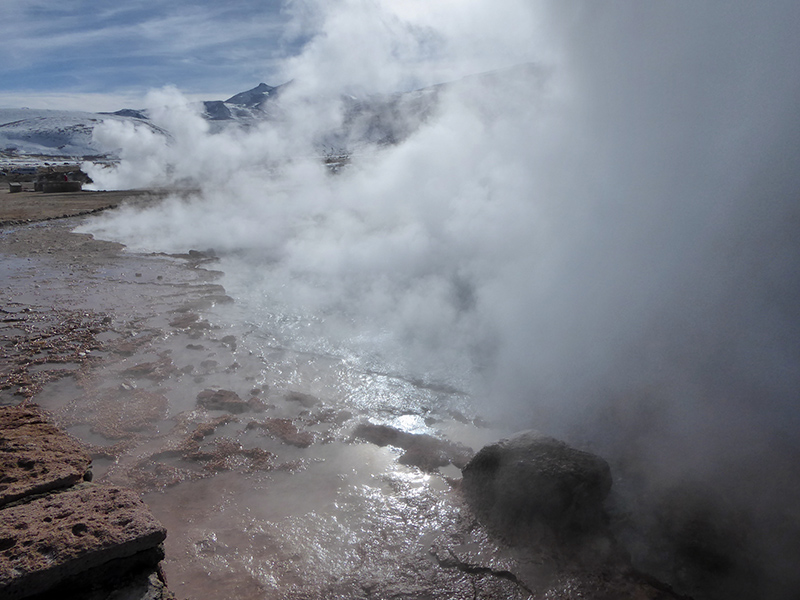
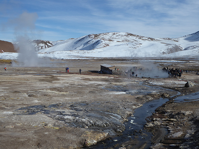
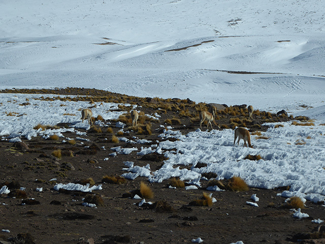
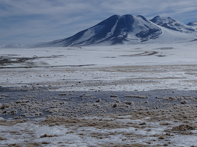
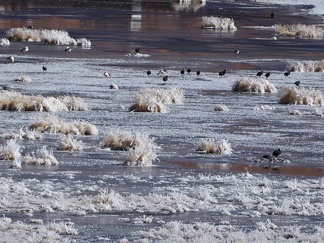
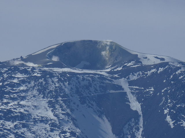
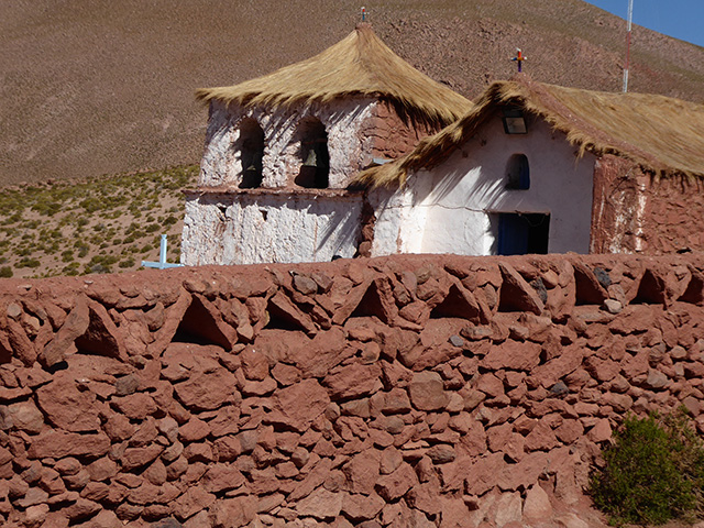
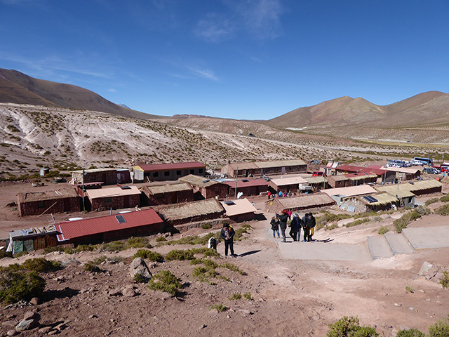
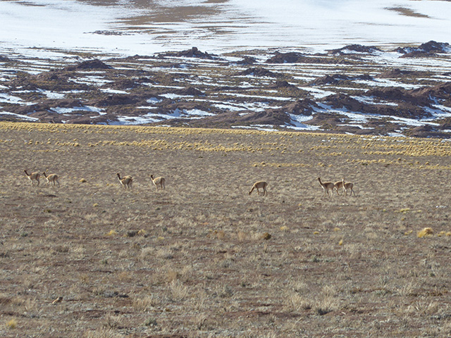
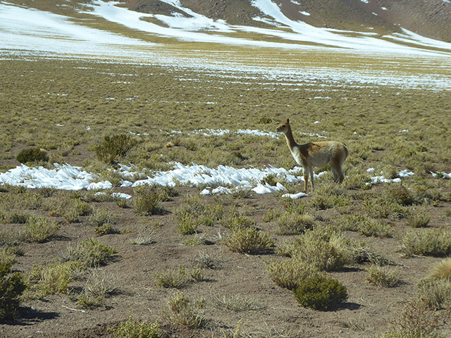
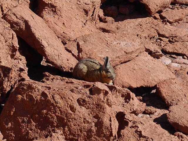
A trip to geysers requires an early start, in the dark at 5 am (winter time). We went with Flamingo, relatively small group and a good guide, but the tour was too rushed for us (same for all companies). We arrive at the last moment to catch sunrise over the mountains at the geysers, but we saw the sunrise, with mist/steam in the distance, driving the last couple of kilometers. The geysers are active only early in the morning, before the sun warms the air. It is quite cold at 4,300 masl, but we were well prepared. The temperature that morning was only -3℃. We walked on well marked paths among small geysers, had breakfast with a view right between them, and had an option to use very nice thermal pool, but with only half an hour and many layers of clothing we opted for more geyser exploration. The geyser field is nice as it is quite large (you can visit only 2 of 3 parts), with lot of steam in the morning, but eruptions are rather low.  On the way back we saw vicuñas, viscachas warming in the sun, waterfowl at Putana river wetlands and an active Volcano Putana. We stopped in a small village Machuca which thrived during times of llama caravans, but now is revived as  tourist stop served on rotating basis by one family of the community. There is church that locals don’t allow tourist to go into. The village was abandoned and only recently rebuilt, houses have new roofs (metal with solar panels) decorated with grass to imitate the old look. Since we went towards the church we didn’t have enough time to try llama skewers (anticuchos).

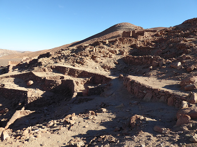
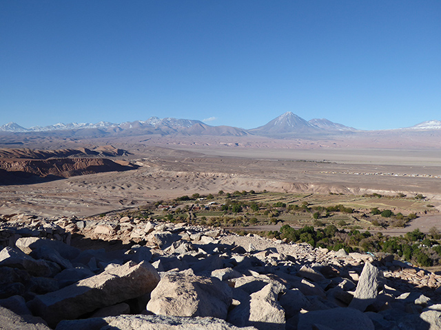
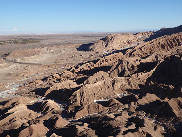
In the afternoon we walked along the river from San Pedro to nearby ruins of fortress Pucara de Quitor – at last on our own, accompanied only by very friendly dog. The ruins of Atacameño culture fortres are on steep hill overlooking  river valley, well protected on all sides. There is a series of miradors on nearby hill with very nice views towards San Pedro, Rio San Pedro, the desert and Valle de la Muerte. Very nice afternoon. At night we tried to join astronomic (stargazing) tour, but we didn’t like it and opted out (I went to a wrong agency, next door to a recommended good one which I intended to go with).

Walk to Pukara de Quitor

Map combines 2 partially overlapping trails: to Pukara de Quitor and to Quebrada del Diablo.
Click on wikiloc logo to see more details


Chile day 6: Laguna Miscanti & Piedras Rojas & Laguna Chaxa

We wanted to visit Lagunas Altiplanicas (Altiplano lakes) and Piedras Rojas (red stones). The road to Lagunas Altiplanicas opened only 2 days earlier (it was blocked by drifting snow) and it wasn’t sure if it would remain open. Different companies offered different stories why the tour there or to Piedras Rojas was not possible. We went with Maxim (although we bought the tour from somewhere else) and got quite lucky. Collecting passengers took long time, but it was a small group and apparently we were the last van admitted to Lagunas Altiplanicas (snow melts later in the day creating too much mud) and larger buses were not allowed at all. There was really a lot of snow, certainly I didn’t expect that in the driest desert on Earth, but this is Altiplano, over 4,100 masl. Miscanti lake was frozen and the all white landscape was beautiful but quite different from the usual brown/red/yellow desert colors. There was no wind so it felt quite warm. The road to the smaller Miñiques lake was not cleared. We saw many vicuñas on the way.

The road to Piedras Rojas had a sign “closed except for official vehicles”, but all tours went in without problems. Flat red stones (piedras rojas) led to another frozen lake surrounded by volcanos, very beautiful. Here it was windy. We had time to walk around and onto the frozen lake. Piotr spotted a cute furry viscacha very close on the rocks. We stopped for lunch in Socaire, in a different restaurant than all other groups, simple and tasty.

The last stop was Laguna Chaxa in Salar de Atacama, at lower altitude and not frozen, in the middle of the Atacama salt flat. It is visited by 3 species of flamingos, we saw many chilean flamingos and I think I spotted a smaller and paler James’s flamingo. There were also andean avocets and ducks. It was a very nice full-day tour. The guide was good, but I wished she offered more explanation.

Chile day 5: Valle Arcoiris & Yerbas Buenas Petroglyphs & San Pedro

Next morning we went to Valle Arco Iris (Rainbow Valley) with Flamingo. Very nice tour, small group, less people in the valley, more relaxed and we had a great guide Sophie (we had 2 very good tours with Flamingo and one very bad, see later posts). We stopped at a viewpoint for brief explanation of the geology of Salar de Atacama and Cordillera Domeyko, metal-rich mountain range named after Polish geologist and engineer Ignacy Domeyko. In Valle Arco Iris we walked around rock formations colored by various metals and minerals (iron, copper, manganese, gypsum, salt). After late breakfast (great French baguettes) we continued to Yerbas Buenas, at the crossroads of ancient Atacameño trade routes, where shamans recorded important events by petroglyphs. Llama domestication is encoded in the drawings. It is all desert now, with just small rivers/streams, but the landscape was created by large rivers flowing through the area some time ago (Rio Grande). In the afternoon we wanted to visit archeology museum, but it was closed for relocation to a larger space, so we just wandered around San Pedro.

Chile day 4: Valle de la Muerte & Valle de la Luna

We took pre-booked taxi (expensive) to the airport for an early LATAM flight to Calama. In Calama we took Transvip transfer to San Pedro, fast and efficient. We didn’t realize there is also bus from the airport to San Pedro 4 times a day. In San Pedro we stayed in nice AirBnB in a quiet neighborhood within walking distance from very busy tourist center. Public transport to attractions is non existent, you have to rent a car (better to do in Calama) or use tours, which we, as most others, did. There are over 80 tourist agencies in small San Pedro competing for your business, our host recommended few of them, but quality depends also a lot on a particular guide. It is all quite chaotic. It is wise to start with lower elevation tours and save the highest for the end of the trip. On our first day we went on sunset tour of Valle de la Muerte (or Marte – Death or Mars valley) and Valle de la Luna (Moon valley) with Latchir, one of few agencies that included Valle de la Muerte. The tour and the guide were good, but the group was quite big. We stopped at Piedra del Coyote for panoramic view of the valley and Salar de Atacama. White deposits are salt as Valle de la Luna is in Salt Mountains (Cordillera de la Sal). Next, we stopped in Valle de la Muerte where people go sandbording and mountain biking. In Valle de la Luna we watched salt formations up close in slot canyons and hiked up a ridge to the top of Duna Major, the highest dune with panoramic views of the valley (Amphitheater) and Licancabur volcano. Walking on the dune is no longer allowed. We stayed there until sunset. It was nice introduction to Atacama desert.

Valle de la Luna leaflet from TO

Click on image to see full-size


error: