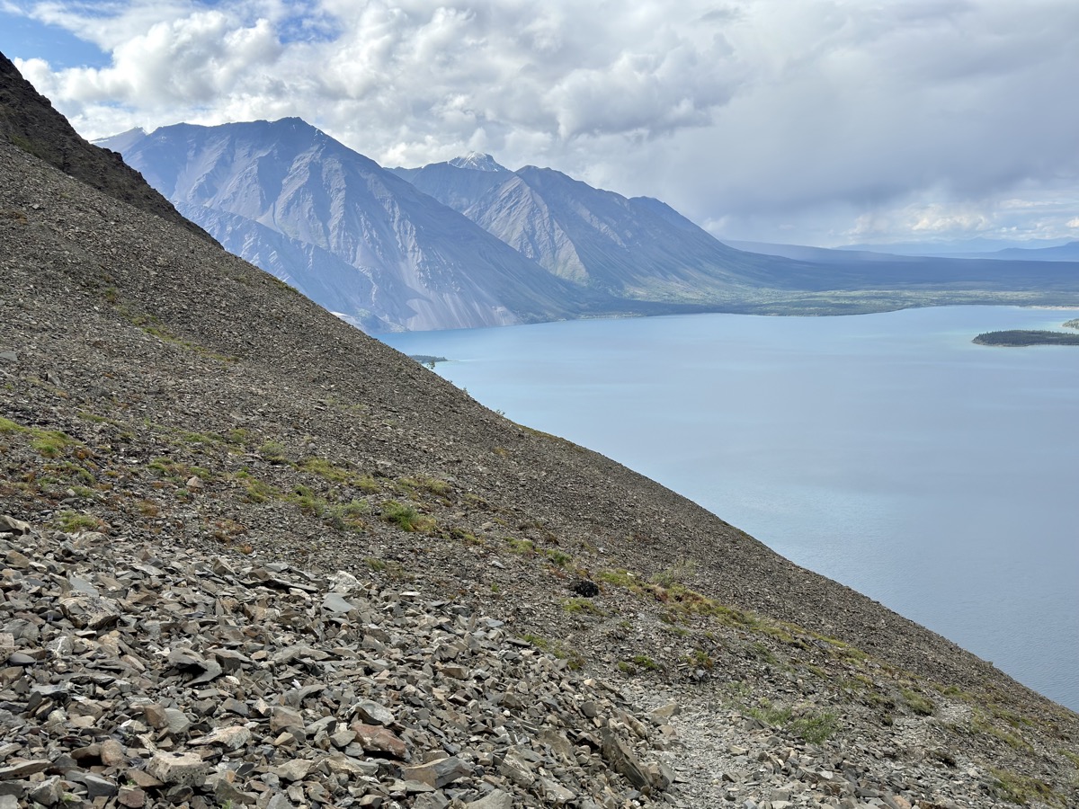
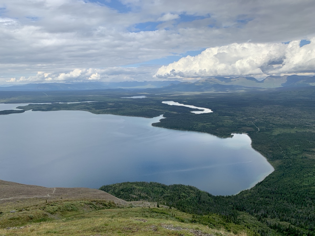
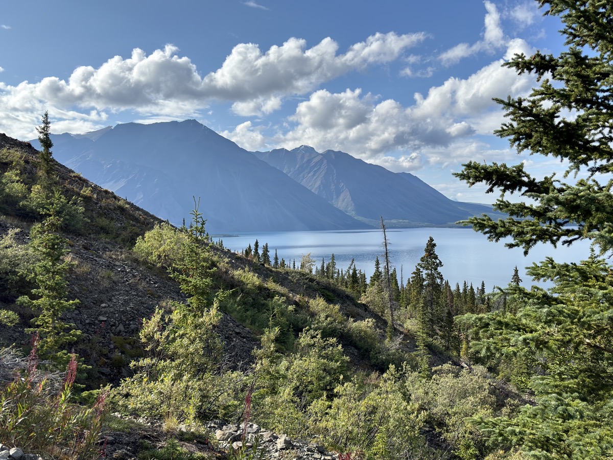
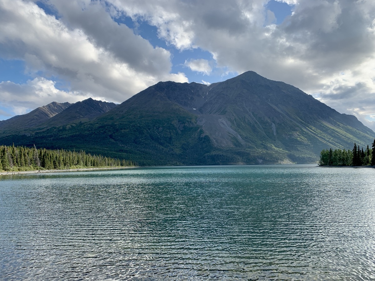
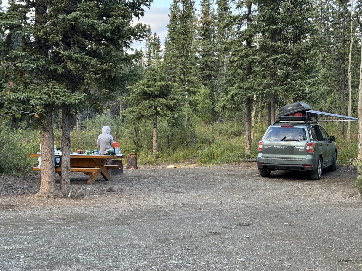
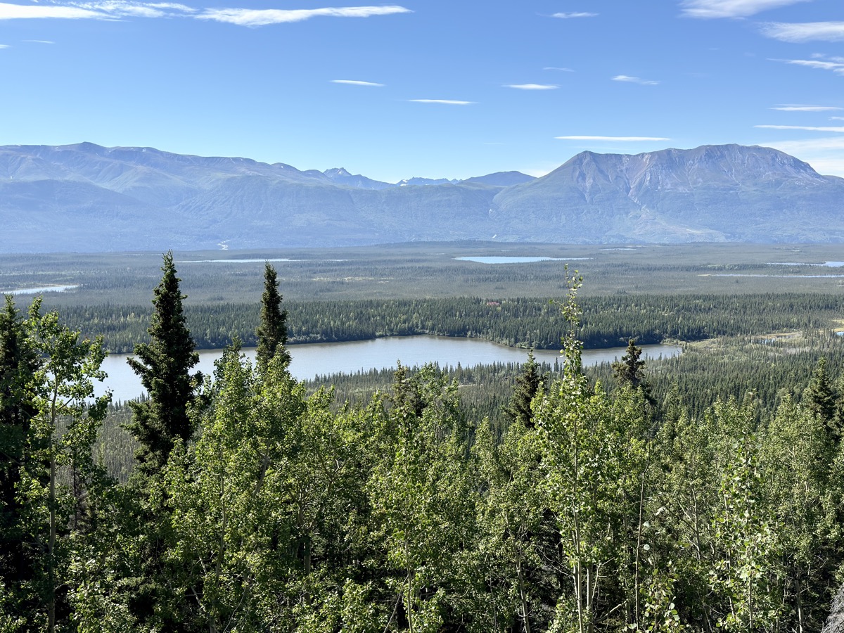
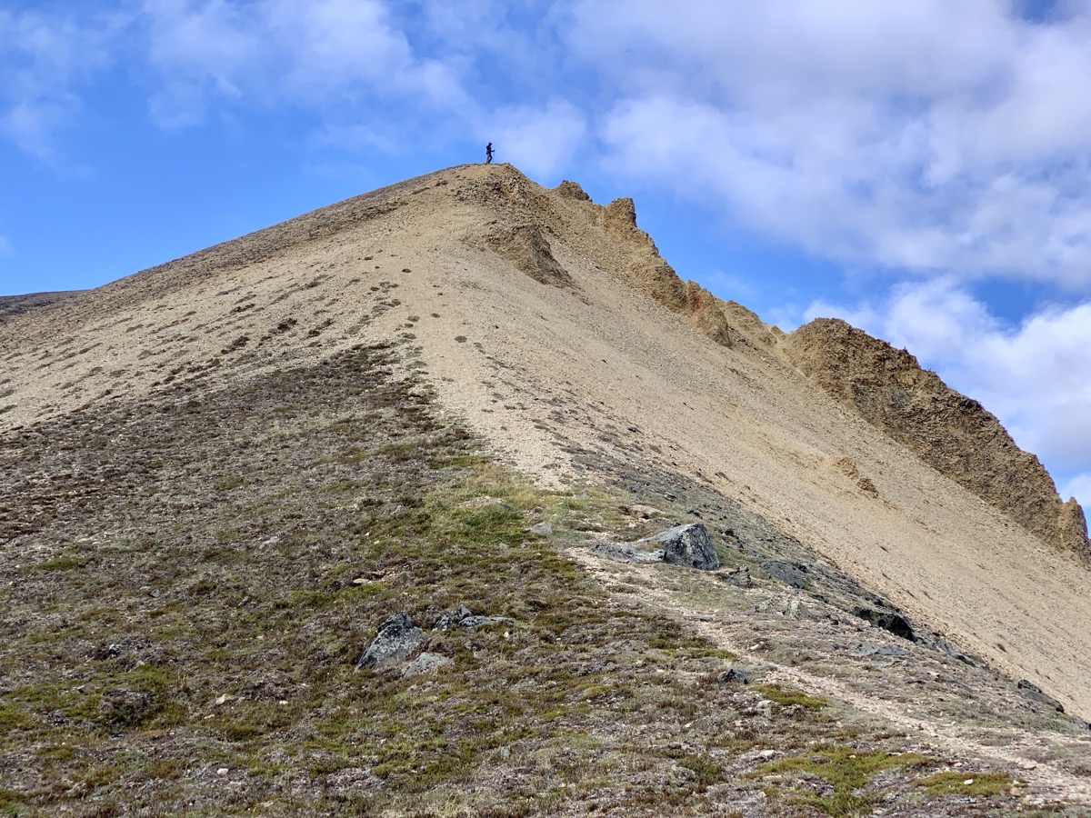
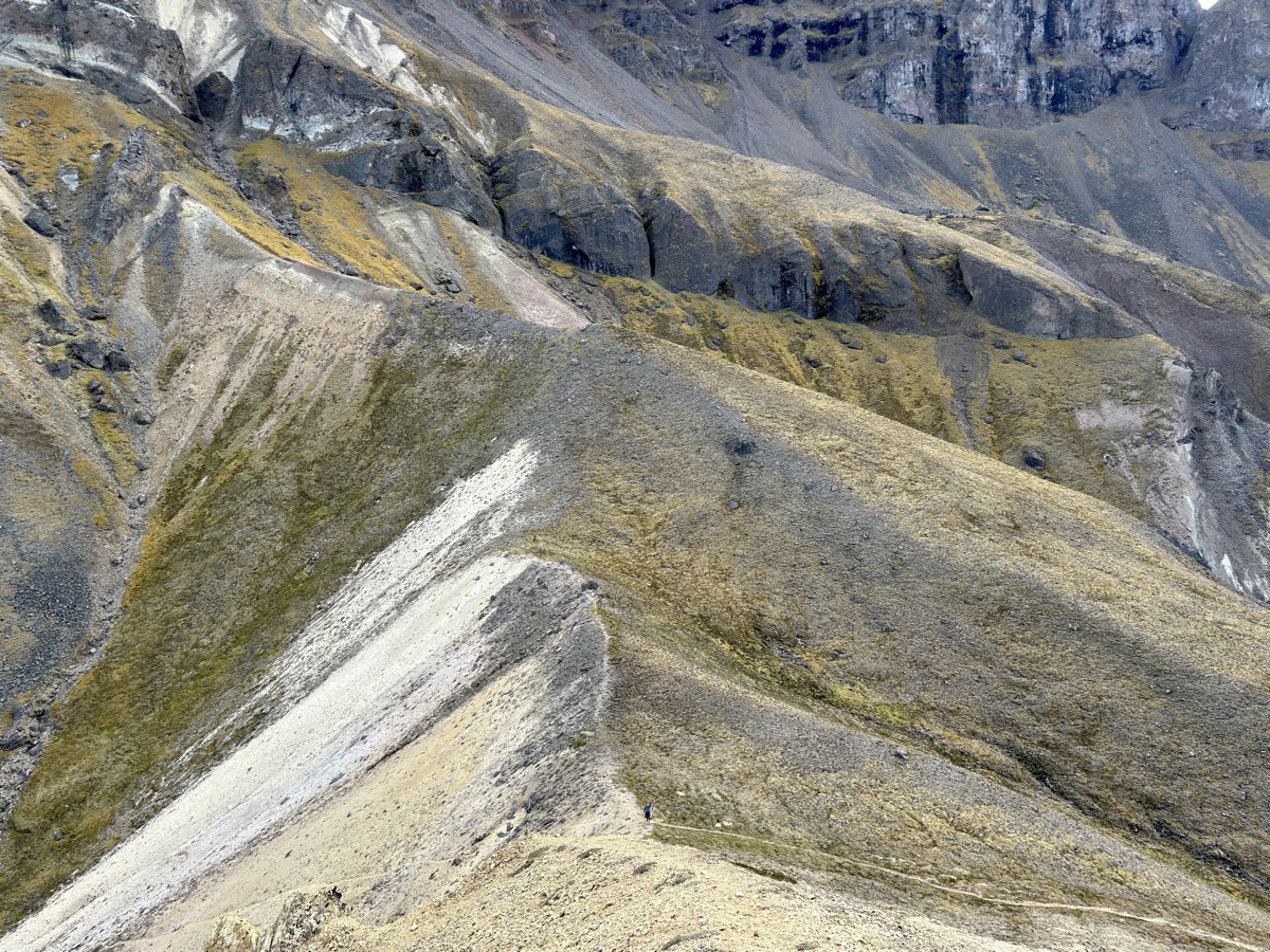
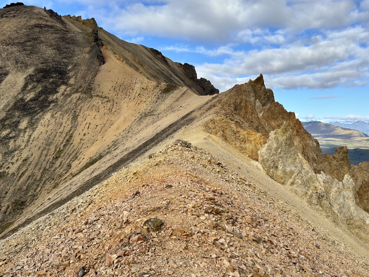
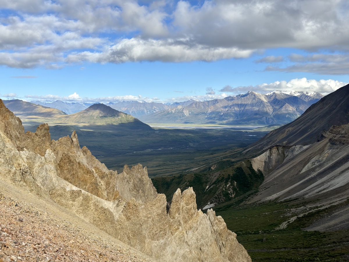
After short visit at Haines Junction (Kluane NP) Visitor Information Centre, with supplies loaded, we drove short distance and settled quickly at Kathleen Lake Campground (for two nights). With weather improved, mix of sun and clouds, we were ready for a hike. We decided summiting King’s Throne Peak was probably too much for that day, but hiked up to King’s Throne “seat”- bottom of the bowl below it. Trail starts easy at Kathleen Lake (near campground). It then turns into good workout on steep rocky slope, almost scramble with fading trail in places. Joanna again could not resist and hiked higher to see what’s on the other side of the mountain. Piotr just guessed – more mountains. Upon return, we relaxed on lake’s shore. Enjoyed long day with sunny weather to cook dinner. Piotr refreshed his skills chopping wood logs. It was good, well organized NP campground.
King’s Throne
Quite steep almost scramble in places
Flattens at destination (view from Joanna’s higher vantage point)
On the way down
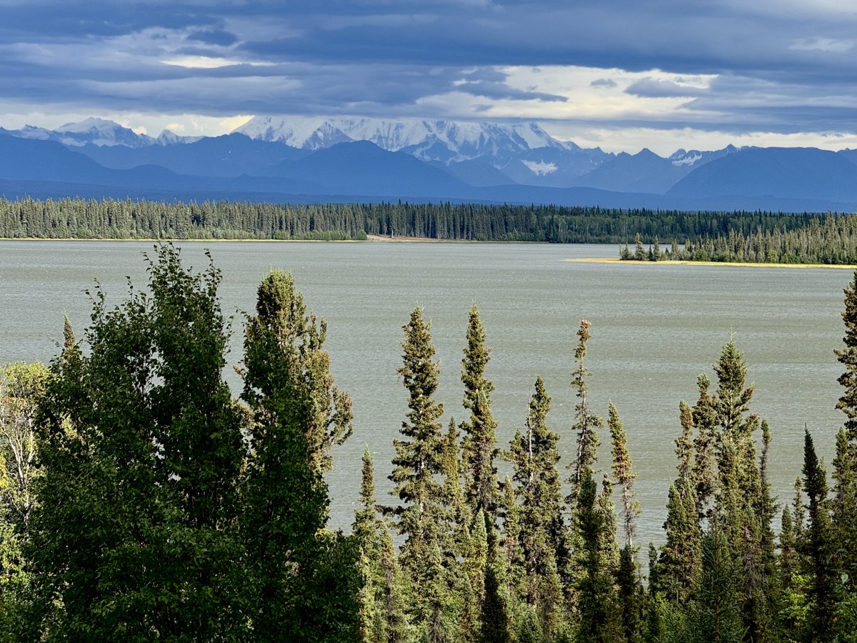
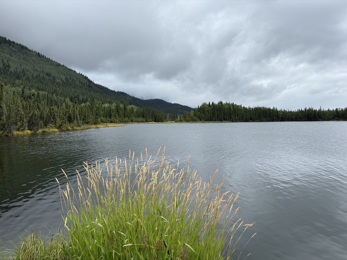
Kathleen Lake
Kathleen Lake CG
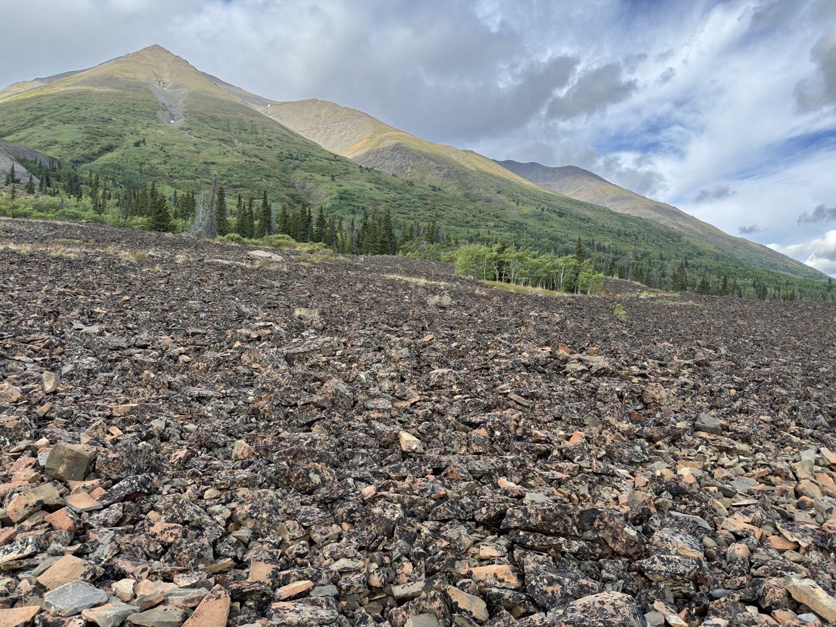
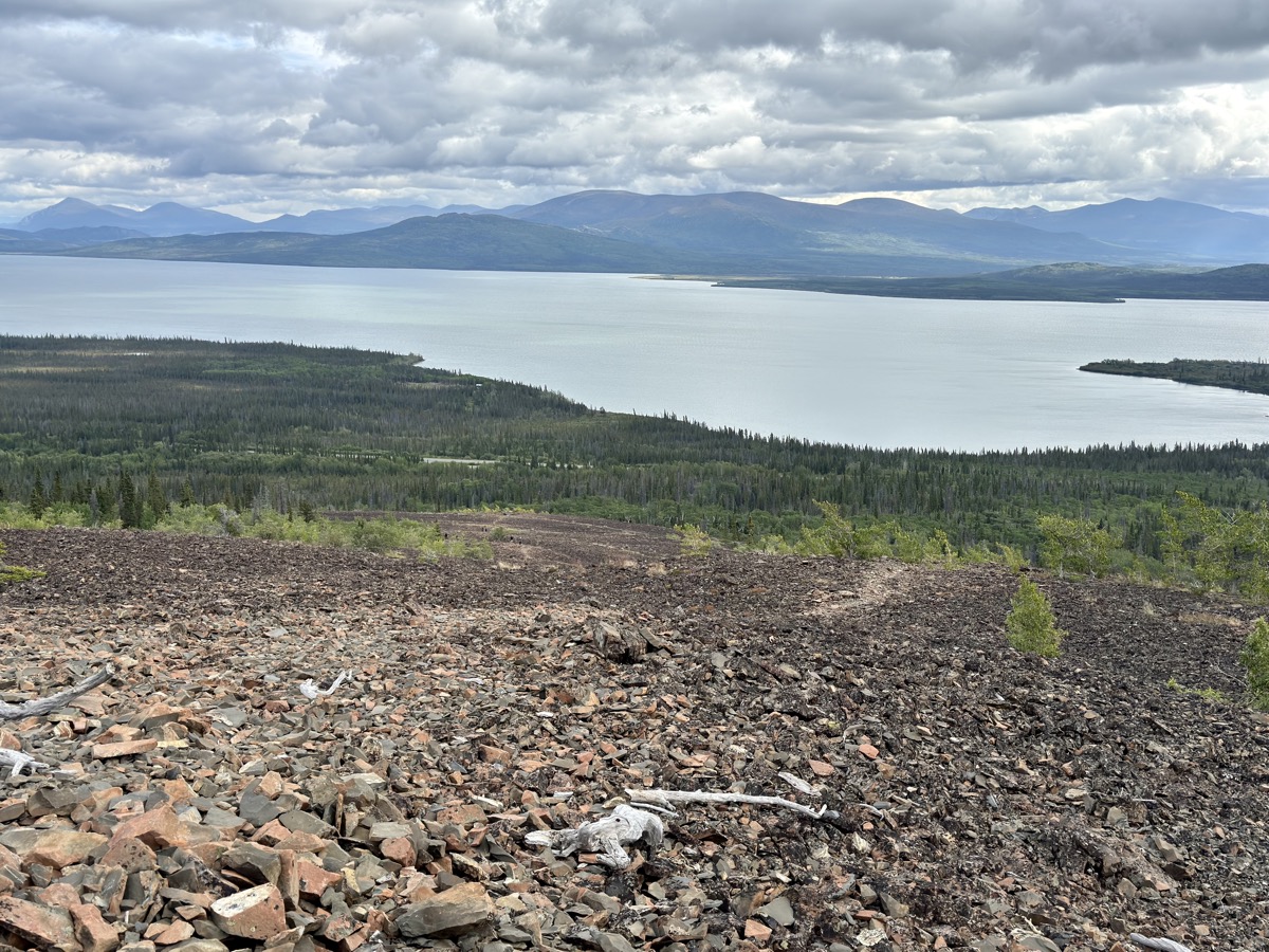
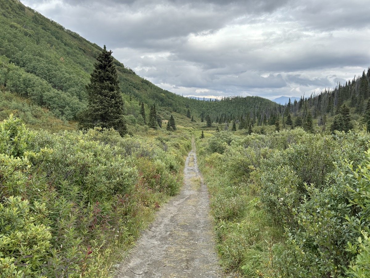
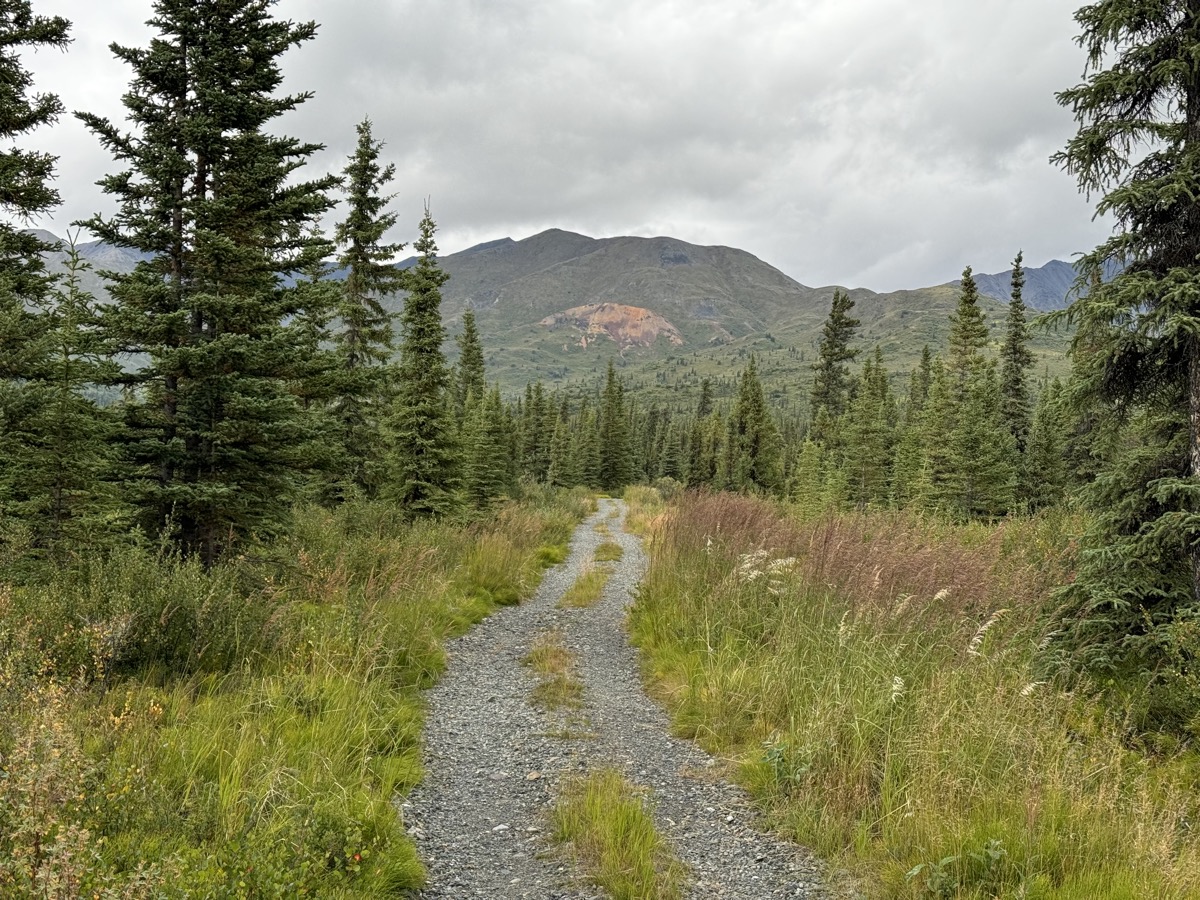
Next day weather was mixed and hard to predict. We used the day for two short hikes. On Rock Glacier – a pile of frozen rocks, rather than a big chunk of ice like the other glaciers we visited. Interesting feature to explore, even in light rain. Then very easy, almost flat trail (old forest road) to St Elias Lake, enjoyable in better weather.
Rock Glacier…
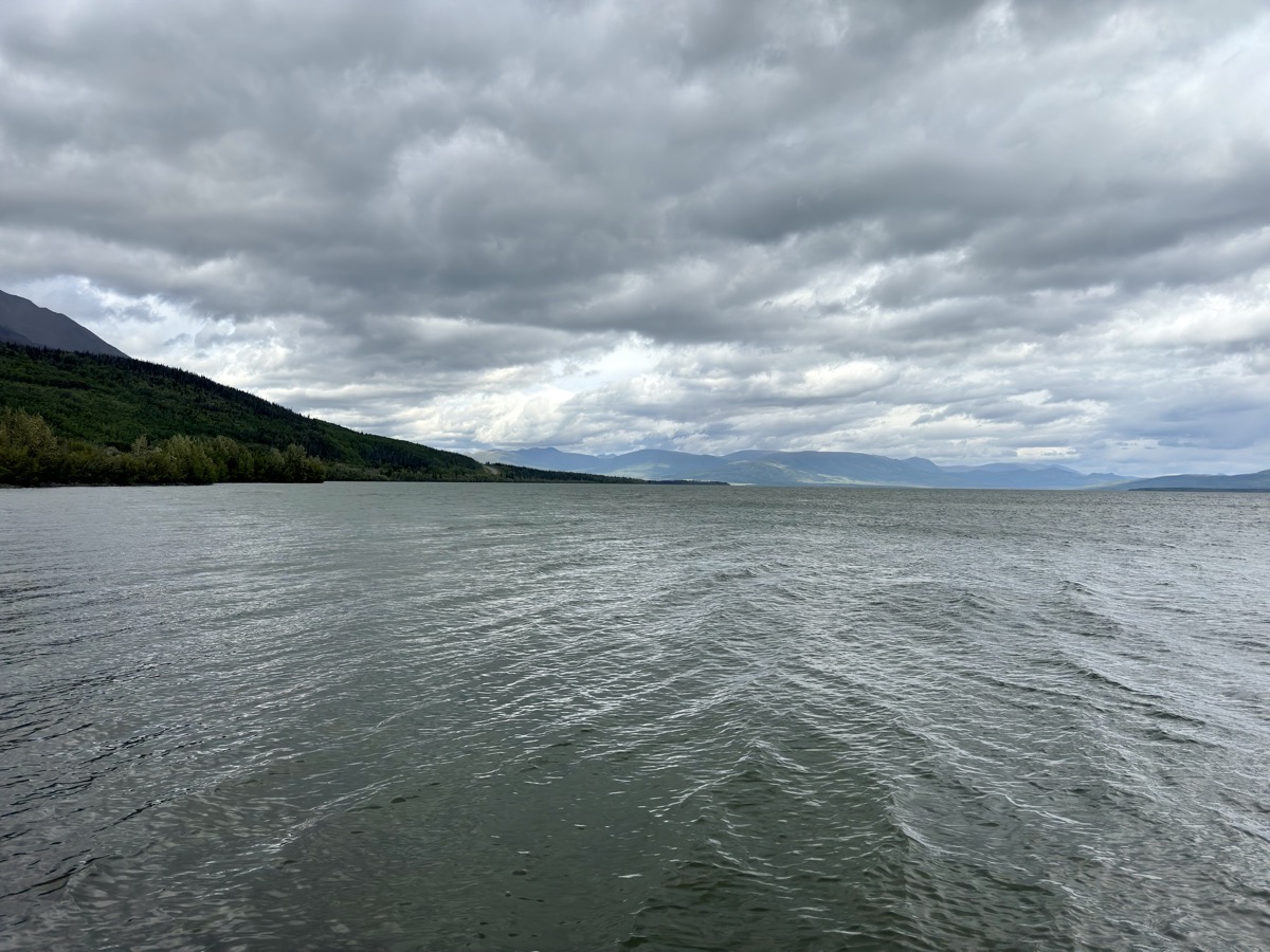
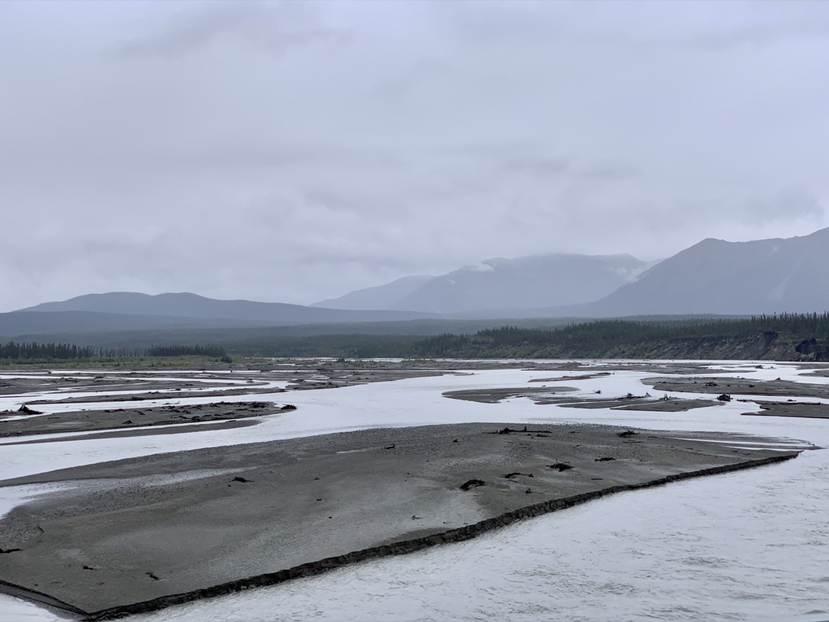
…flowing into Dezadeash Lake
Dezadeash Lake
Trail to St Elias Lake
…
St Elias Lake
We left the final decision whether to go to Haines for the following morning.
Day 73.
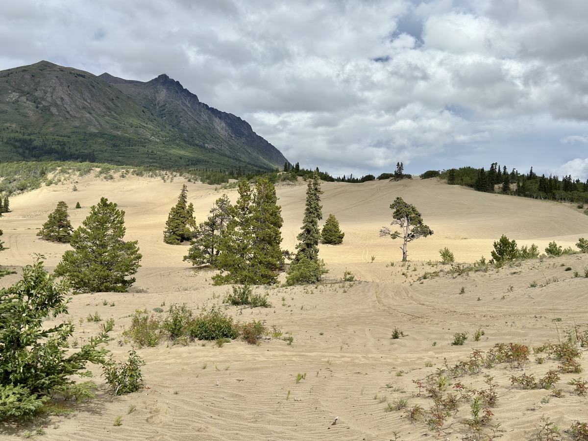
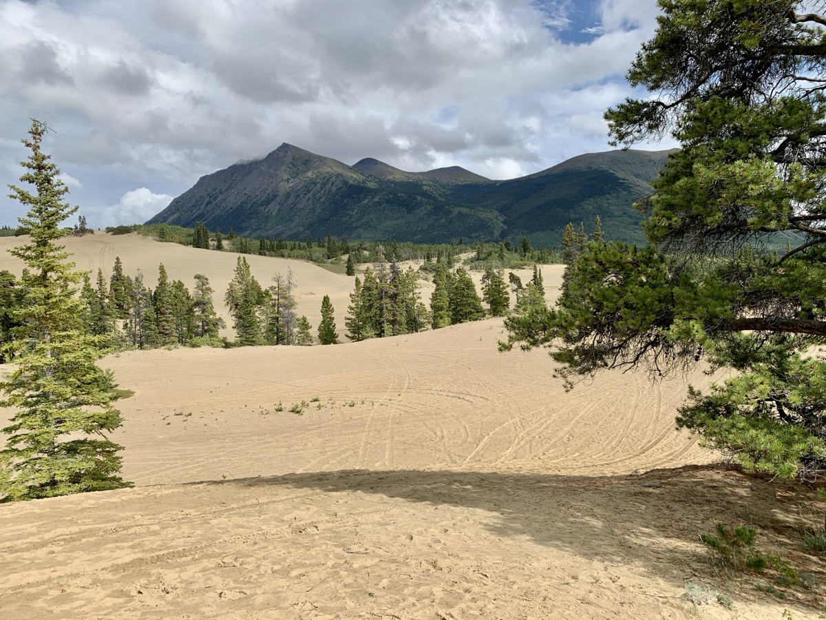
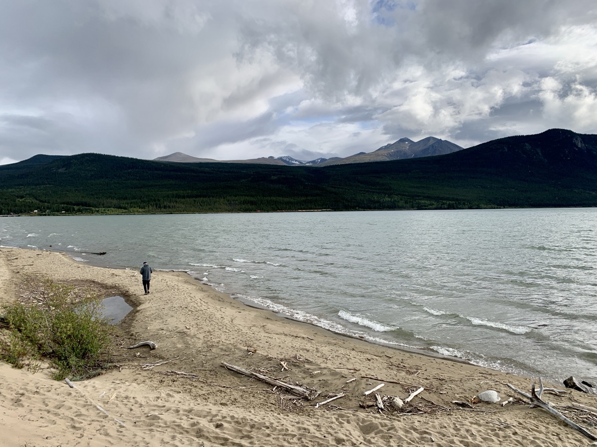
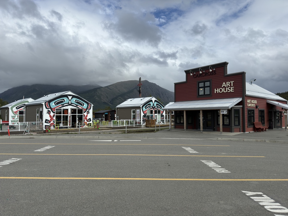
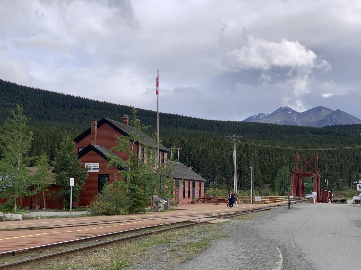
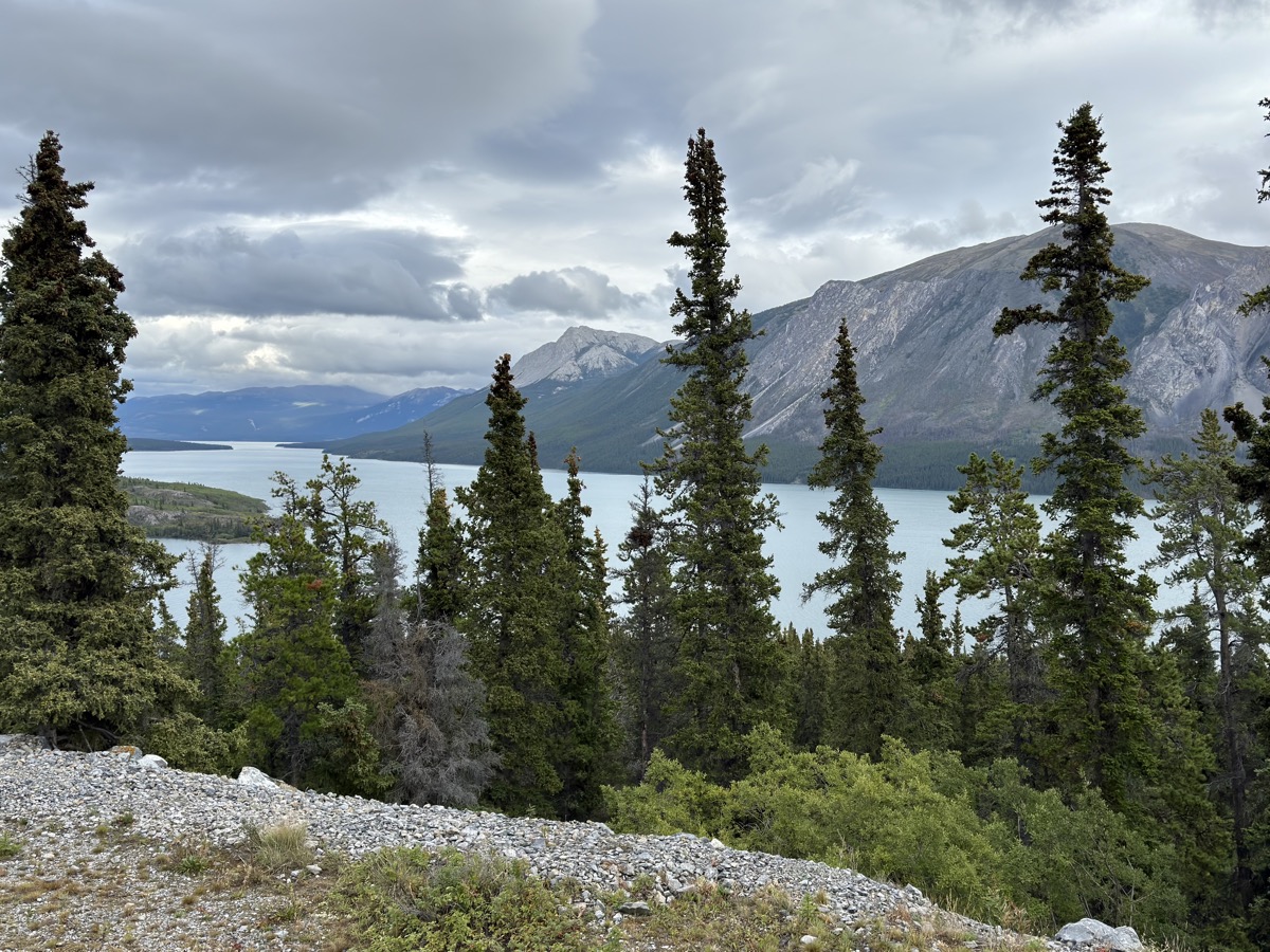
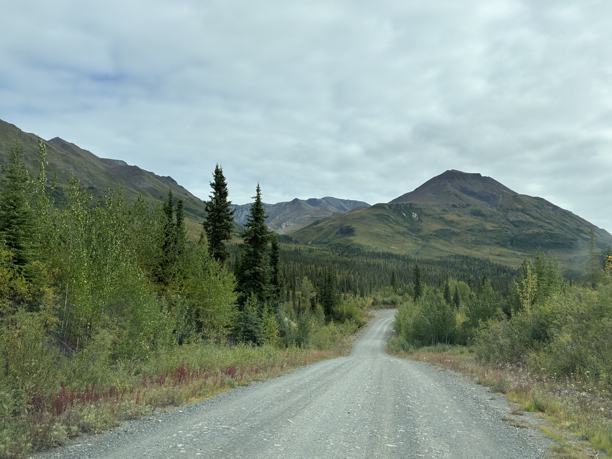
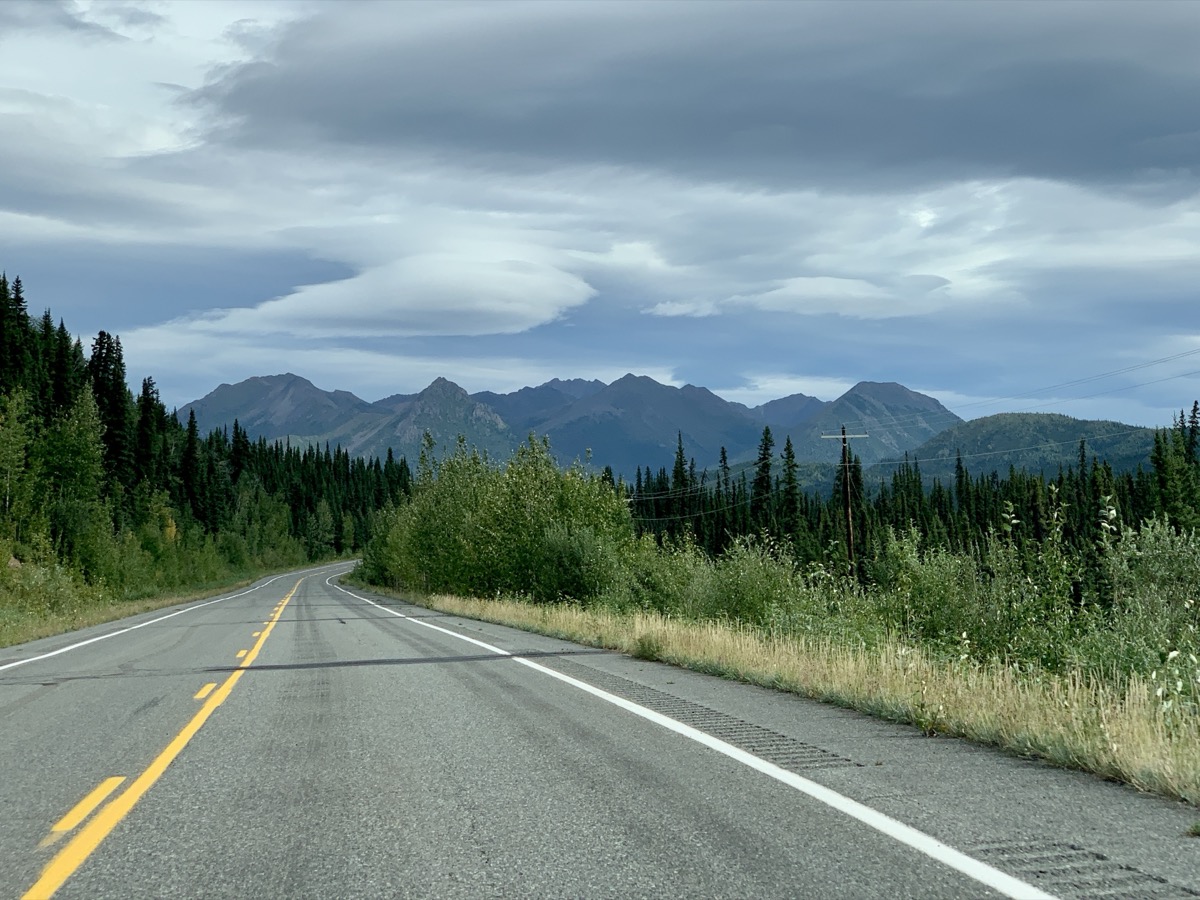
With rain in the forecast on the coast and car ferry sold-out, we decided to skip Haines, turn inland and drive around to Skagway. It was all day of slow driving watching mountains and valleys, rivers and lakes passing by – car tourism. We passed Whitehorse again (without stopping this time), but spent some time in Carcross. Important station on White Pass & Yukon Railway during gold rush. We liked the small town, now just tourist destination, visitor center, good coffee and pastries. We walked a bit on Carcross Desert (large dune, not true desert) – what a change after walking on glaciers. Plus short evening walk on Lake Bennett.
Carcross Desert
…
Lake Bennett
Carcross visitor center
White Pass & Yukon Railway
SS Tutshi Memorial
We settled for the night further along Klondike Hwy at almost empty Conrad Campground on shore of Windy Arm of Tagish Lake. It is located on the grounds of long closed and dismantled copper mining operation.
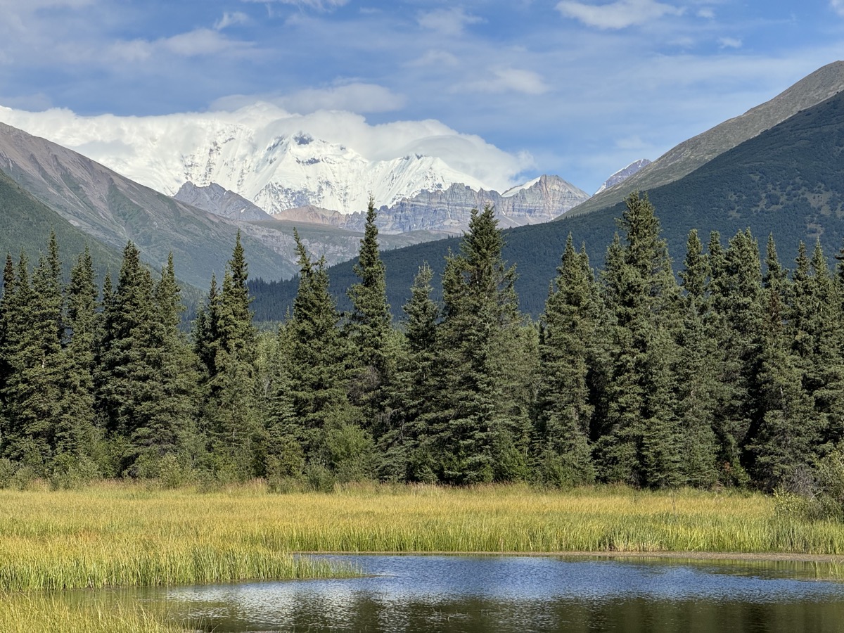
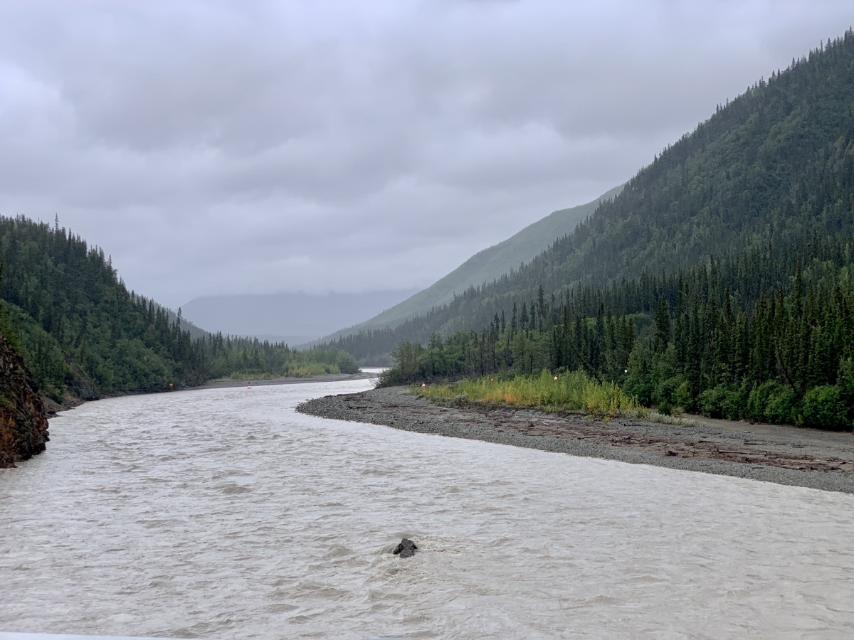
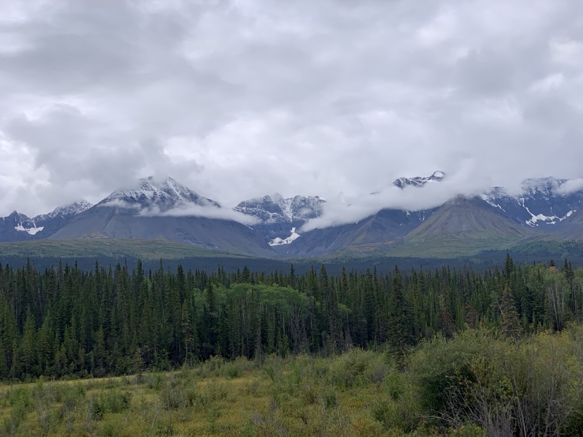
After short, morning hike to Crystalline Hills we were heading back to Chitina to the end of McCarthy Rd and then to Glennallen – we came that way. Just driving around Wrangell Mountains without much stopping. Weather was mixed, but we could see the high peaks: Blackburn (we saw its other side from airplane), Wrangell and Sanford, although their tops were in clouds. In Glennallen we ignored low fuel warning and continued to Gakona only to discover that gas stations there were closed. So we had to go back. Joanna was making phone calls from the road to find a place to stay in Gakona. Nothing worked, but one place (Snowshoe Haven Cabins in Gakona) called back with an offer: no cabins available, but we could rent an old house under renovation for the night. Very nice hosts. Bedrooms upstairs and kitchen/living room were already done, bathroom was still old. We had entire house for ourselves, good opportunity to regroup. Another case on this trip when interesting opportunity came along on the go.
Crystalline Hills
View from Crystalline Hills Trail
McCarthy Rd
Mt Blackburn from McCarthy Rd
End of McCarthy Rd in Chitina
Mt Blackburn, Willow Lake from Richardson Hwy
Day 67.
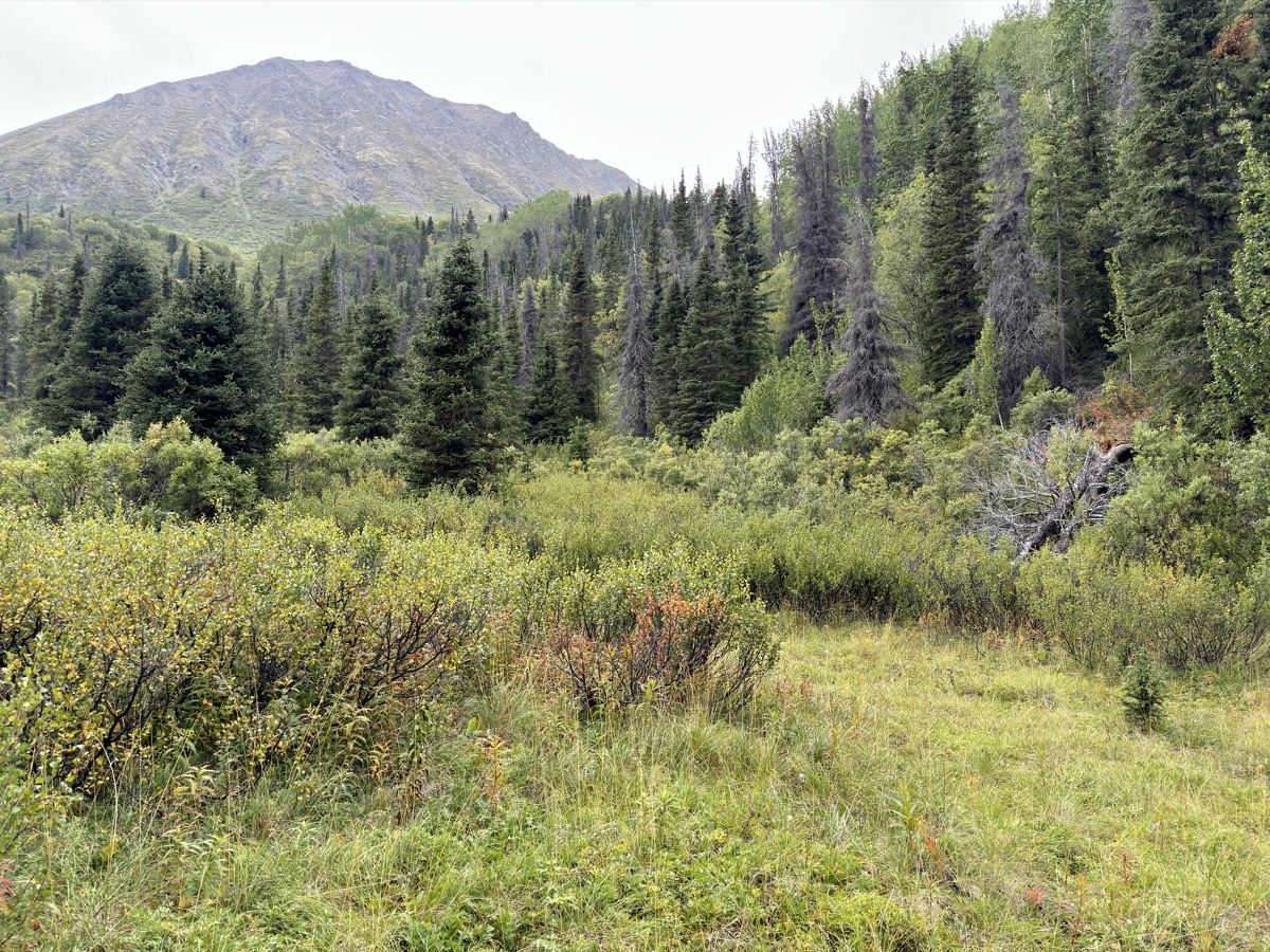
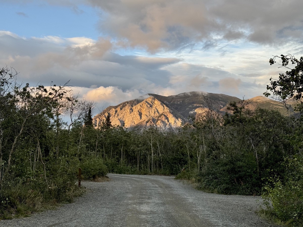
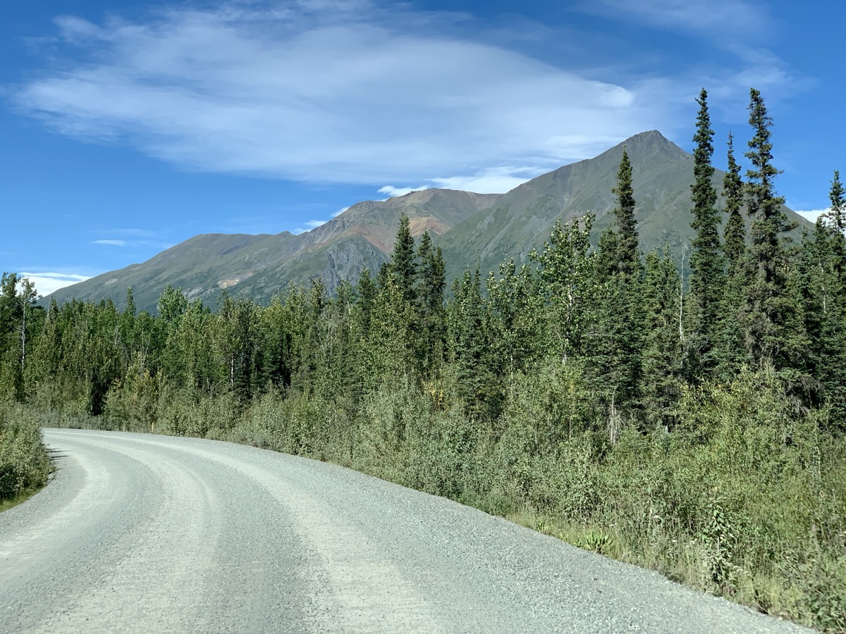
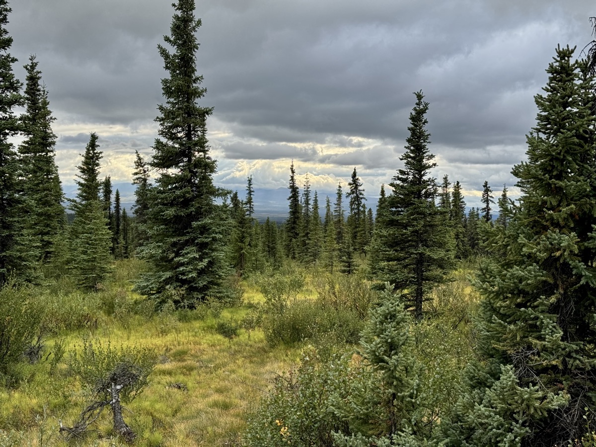
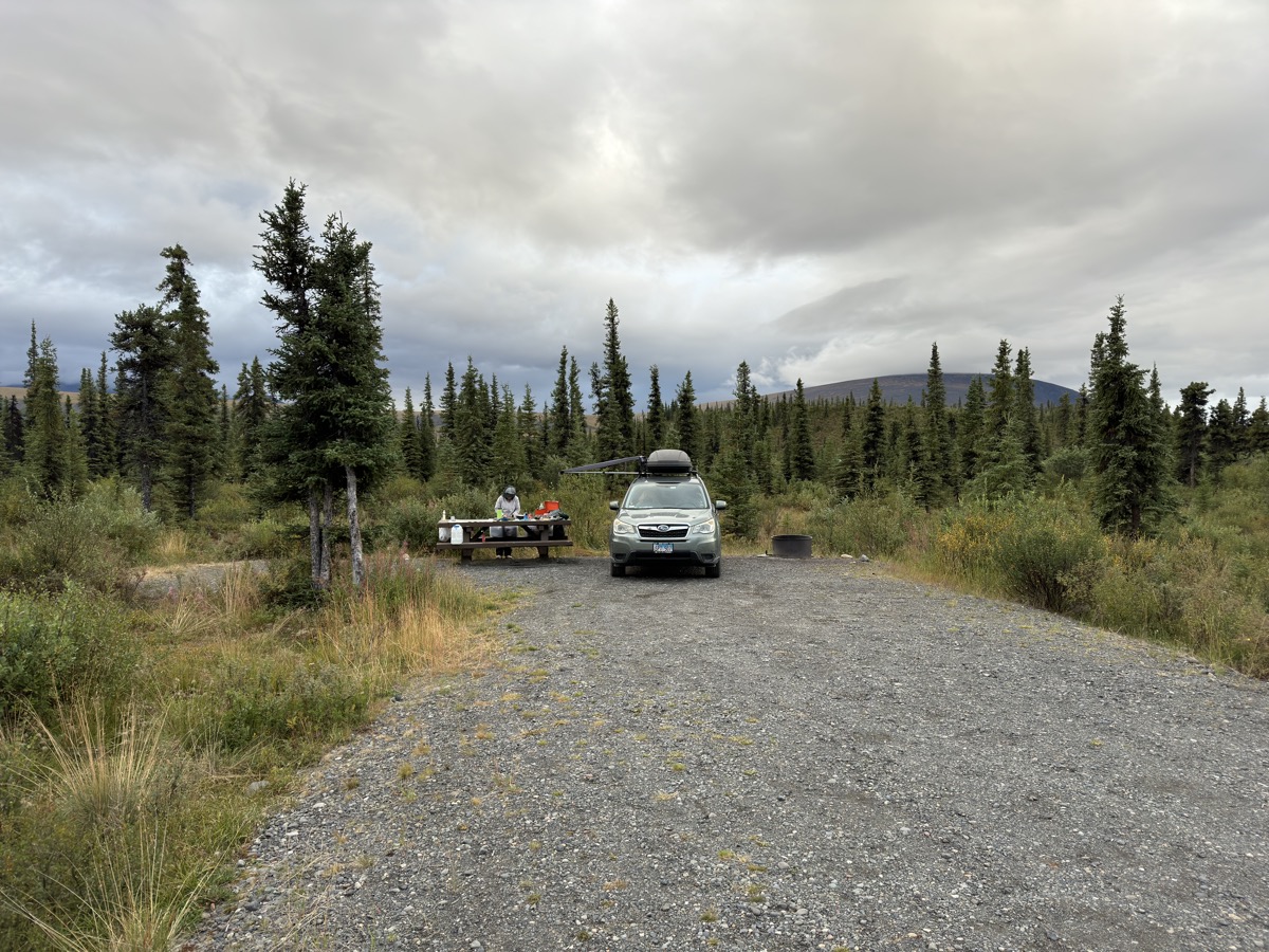
Another day of driving – interesting, scenic Tok Cut-Off Highway to Nabesna Road to enter Wrangell Mountains, this time from north – spontaneous decision, as we liked this NP a lot. We talked to rangers at Slana Station, filled-up water containers, we had enough food. Nabesna Rd is first paved and then good gravel. Not much traffic and many camping options. We chose to stay at excellent Kendesnii Campground (NP). Like camping on the edge of taiga. Small lakes and mountain views everywhere. We had only a couple of neighbors – one was also Subaru camper. Enough time left for afternoon hike to Caribou Creek. To cook dinner we had to dress like winter time – temps dropped a few degrees below freezing at night and local mountaintops were dusted with snow in the morning. Not even the end of August and winter made its first move.
Caribou Creek Trail
Taiga all around
Kendesnii Campground
Days 68.
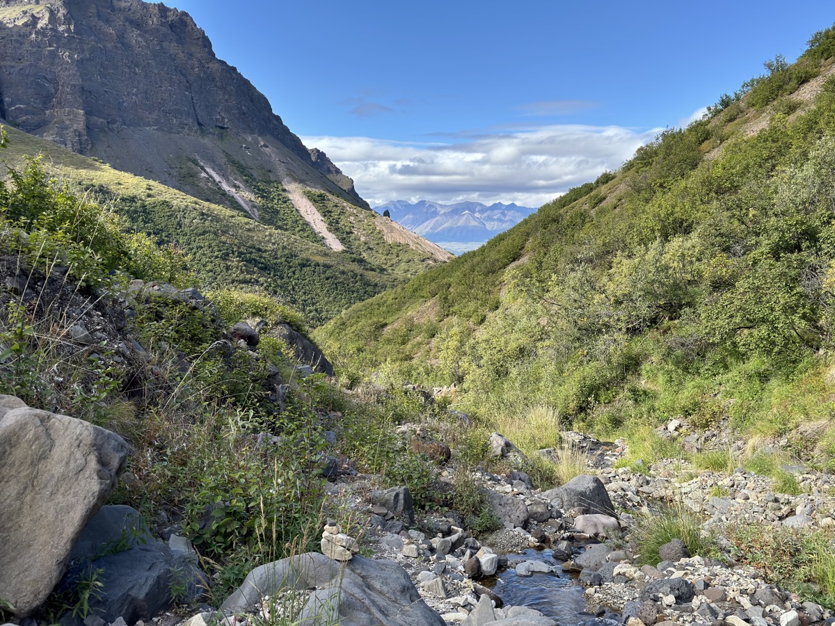
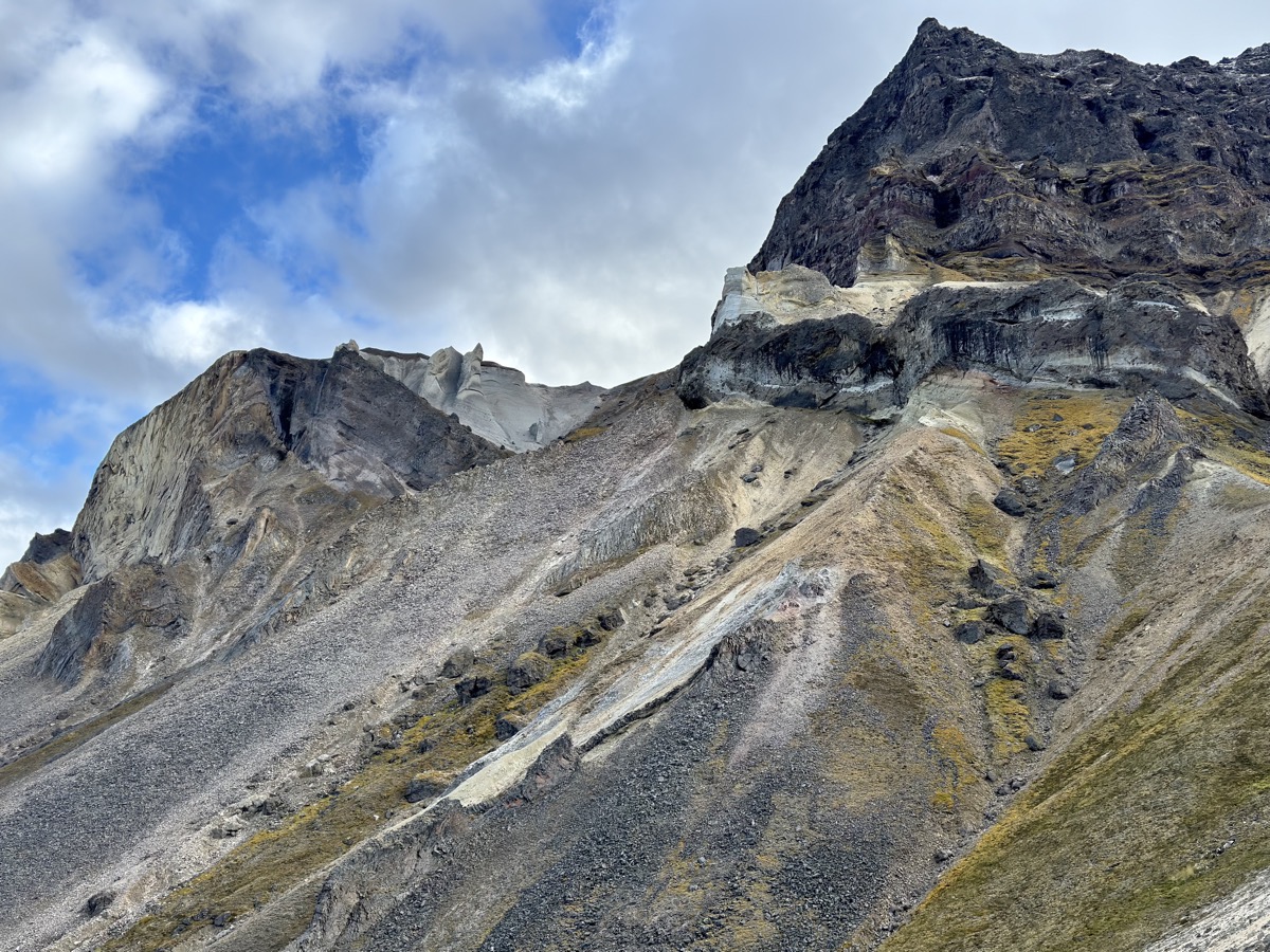
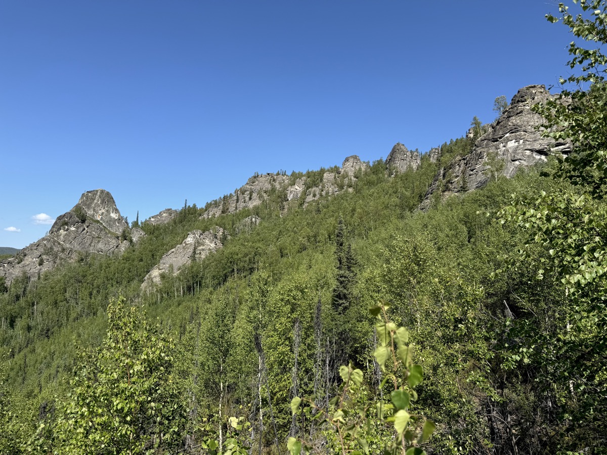
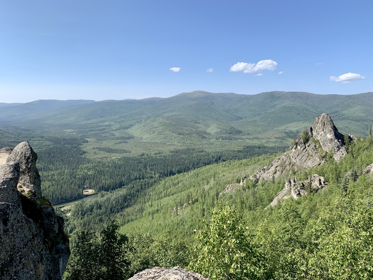
We drove, after same hesitation, further up Nabesna Rd to Skookum Volcano trailhead and spent several hours going up and down the mountain. Steep trail to Skookum Volcano Pass with great colorful rock formations and view of Alaska Range. Good, mostly sunny weather, nice experience. We then drove to the end of drivable road (Subaru) to the site where Nabesca Mine used to be for evening view of Alaska Range. Our Forester got tested on not so good stretches of road and crossing streams. Back to Kendesnii Campground for another wintery night. Joanna tried to rent one of the backcountry cabins, but everything was booked (?). We were glad we came this way: nice scenery, interesting volcano hike with Dall sheep sightings and we liked relaxing camping in taiga despite freezing weather.
Good part of Nabesna Rd
Thors Pond
Trail…
…to Skookum Volcano Pass
Skookum Volcano
To go higher (Joanna)…
…or rest at the pass (Piotr)?
…
Alaska Range on the other side
Alaska Range at sunset from Nabesna Mine site
Not bad here, but it was bumpy ride before and road became impassable for us shortly beyond the sign
Crossing shallow streams is easy, but people sometimes get stuck in small, loose gravel lining the bottom
Day 69-70.
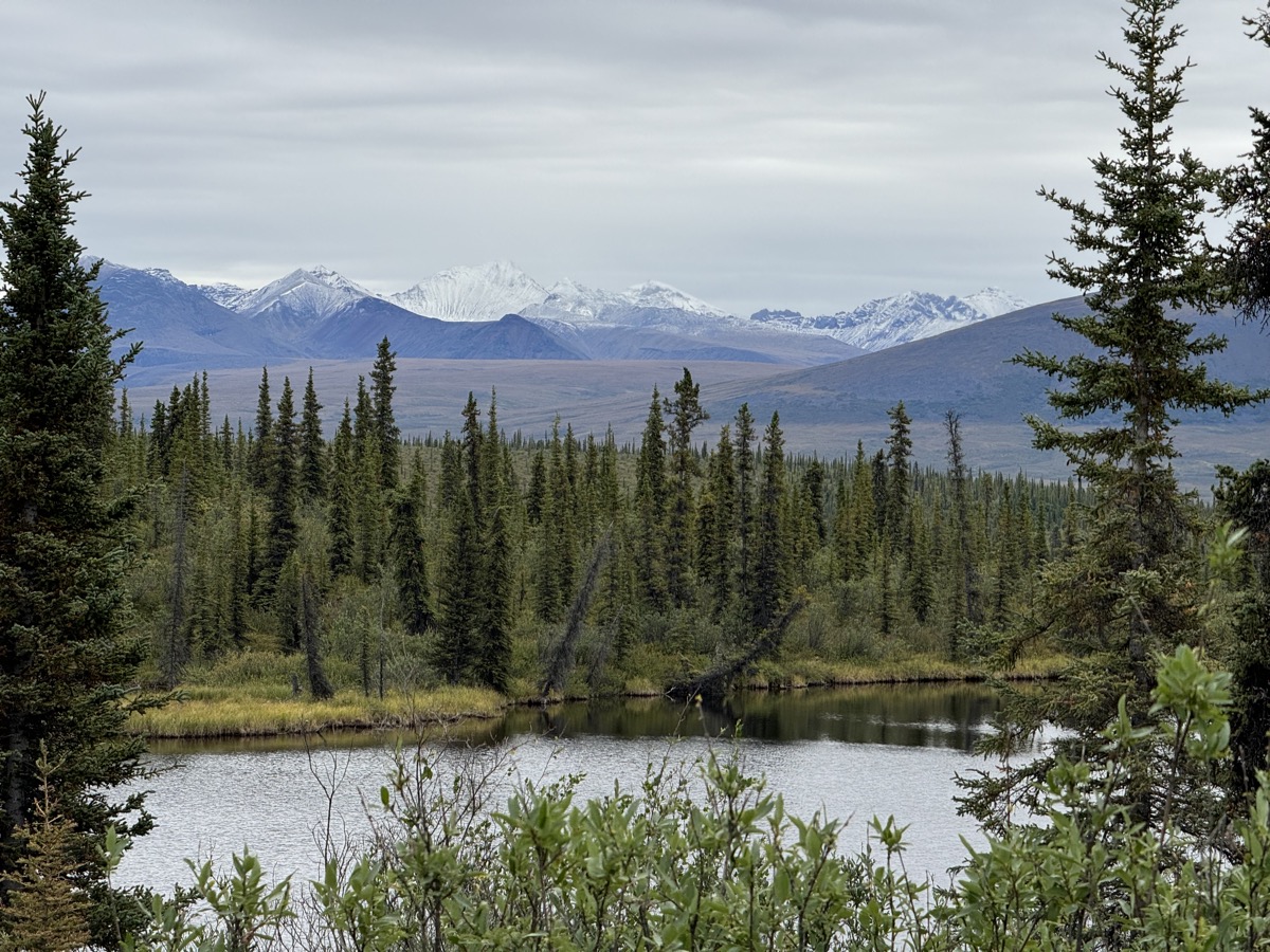
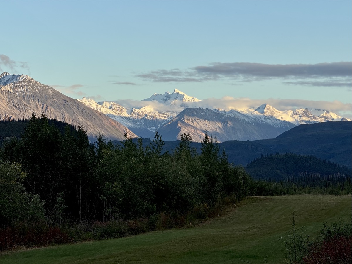
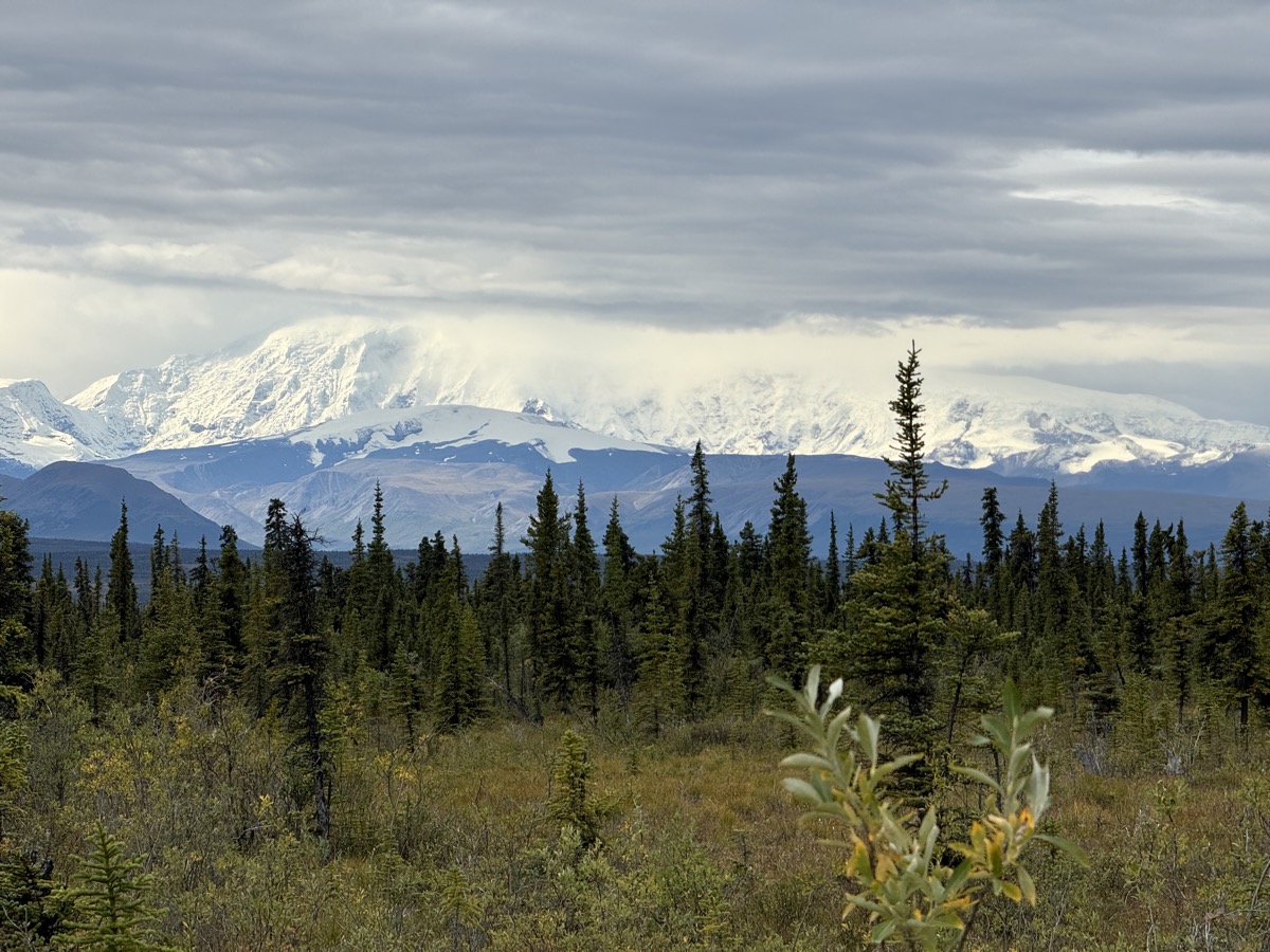
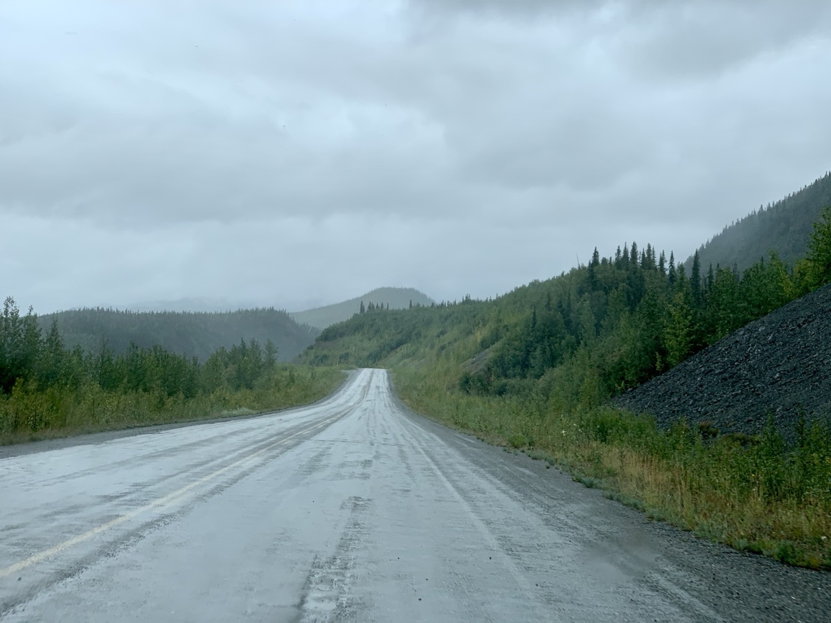
Now it was time to go to Kluane NP. Two days of easy, but somewhat monotonous driving despite interesting scenery starting with short opening in clouds to view (base of massive) Mt Wrangell. First back on Nabesna Rd to Tok Cut-Off Hwy and then Alaska Hwy to nice Deadman Lake CG. We stopped in Tok for lunch at Fast Eddy’s Restaurant and to pick-up groceries (plus Denali Beer Variety Pack and Jagermeister) at Three Bears. Some small businesses already started shutting down for winter. We stopped in Tok earlier on the way to Alaska. We were lucky to get camping spot and had only little time to walk to Deadman Lake and on short nature trail. The following day, we crossed the border and continued on Alaska Hwy to Haines Junction where we rented (Airbnb) room in newly renovated small house with two bedrooms, modern shared living room and kitchen. Rainy and cold weather was a factor in deciding to stay there. Despite end of season hotels were full as everybody (campers) tried to stay indoors. Piotr showed his skills quickly starting fire in wood stove to warm the house (our host came later to start gas furnace). We spent the evening cooking, drinking beer and talking to French couple from Martinique, travelers (bikers) staying in the other bedroom.
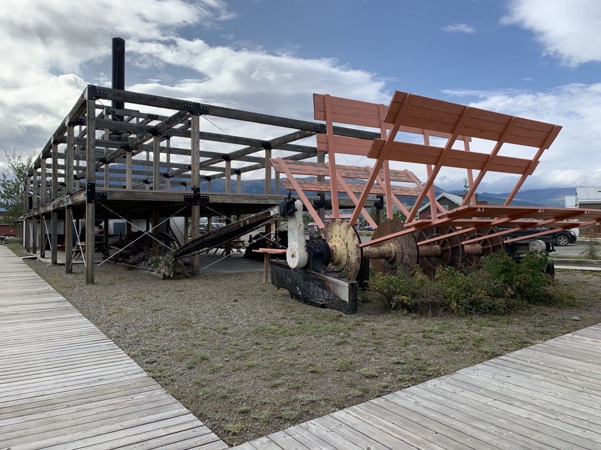
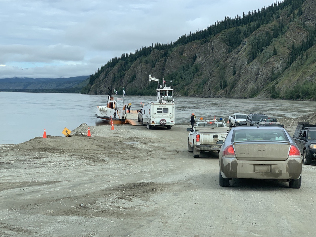
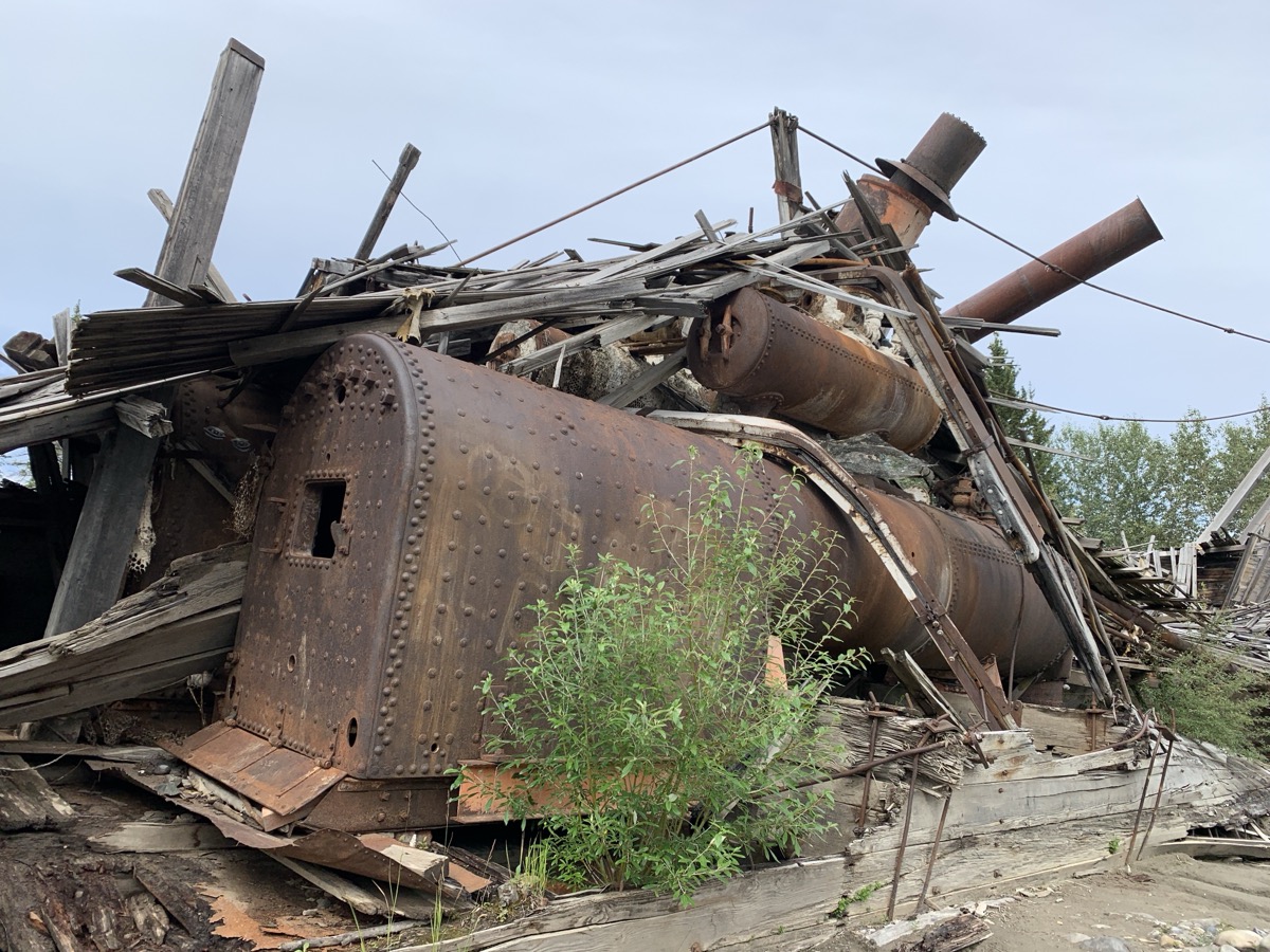
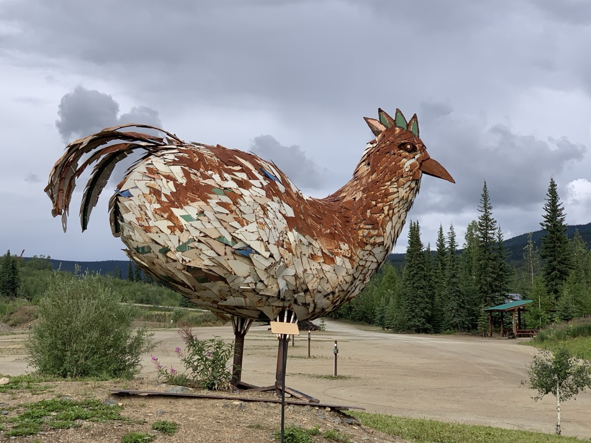
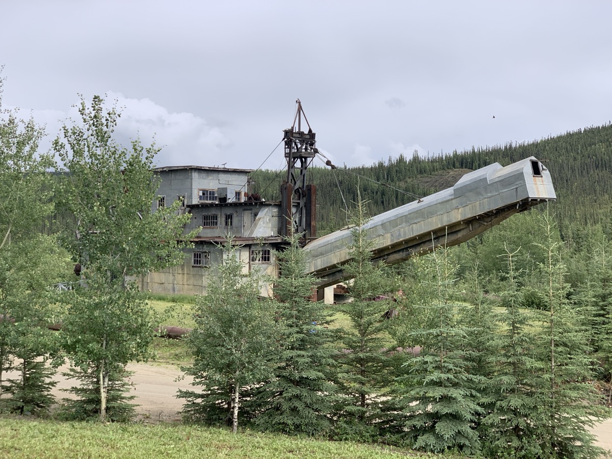
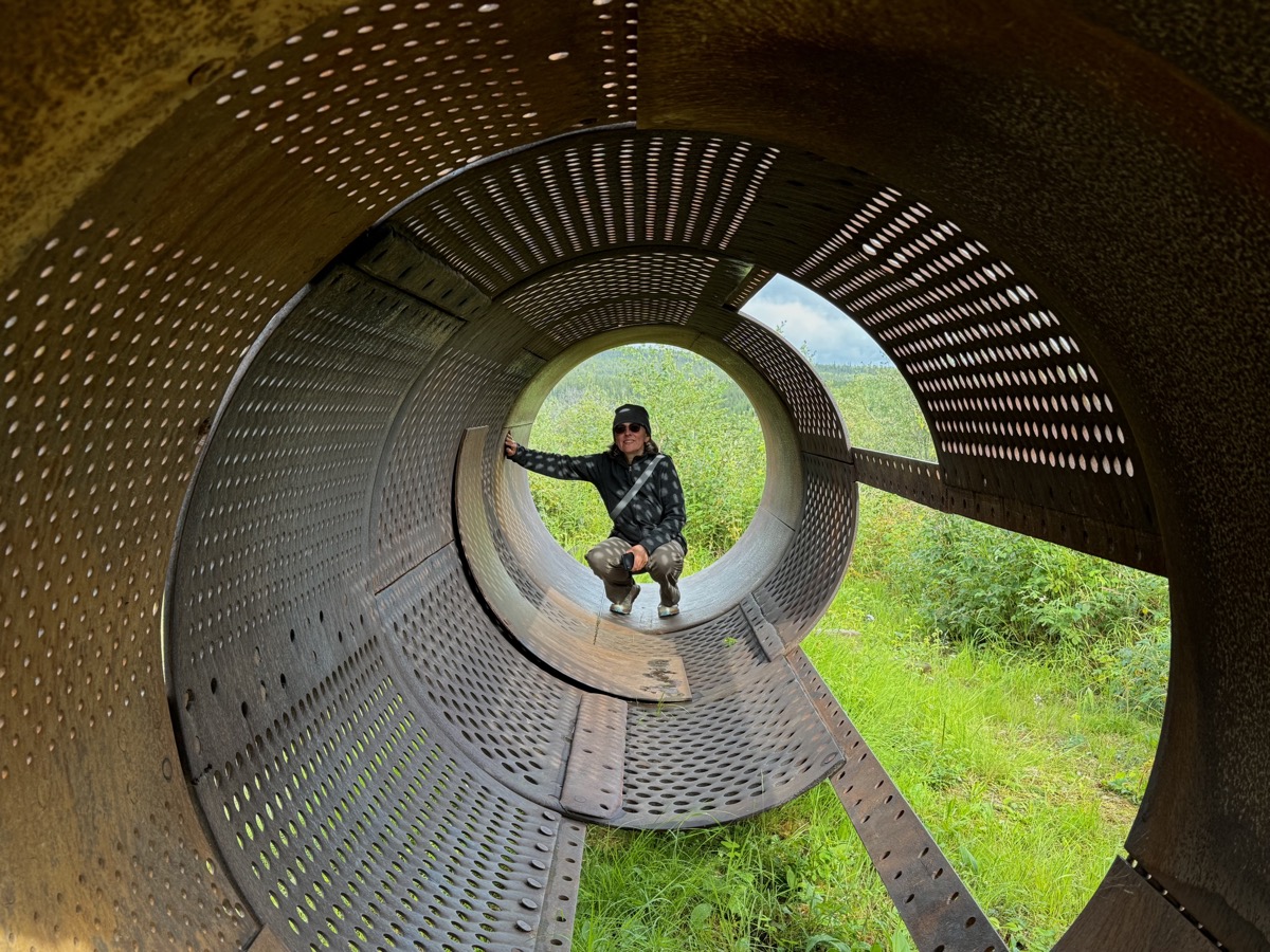
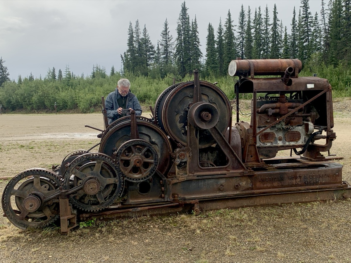
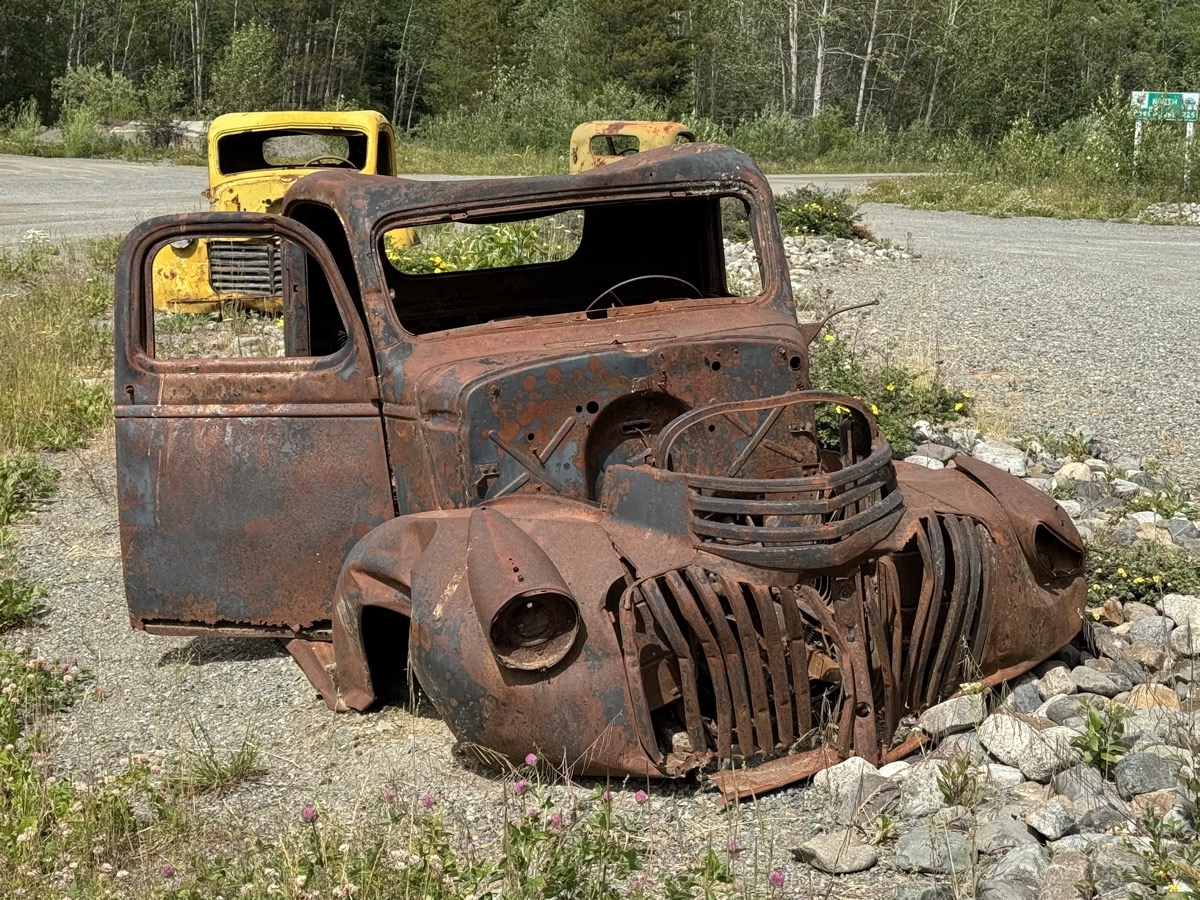
After ferry-crossing Yukon River in Dawson City (yes, good old times ferry) we stopped briefly at steamboat graveyard. Many boats were pulled on shore after gold rush never to sail again. Tylor Highway climbs to the top of the hills and winds around staying high most of the time. Nice views of surrounding valleys and forest. Weather was changing from mostly sunny to hail and back to mostly clouded. We crossed YT-AK border in slight rain and drove down into Wade Creek valley to Chicken (AK). We stopped there for coffee, photographing Pedro Dredge and other rusting gold rush machinery as we were walking back to our car.
Ferry-crossing Yukon River
Steamboat graveyard
View from Tylor Highway
Tylor Highway
Approaching YT-AK border
Chicken (AK)
Pedro Dredge
…
…
Day 35.
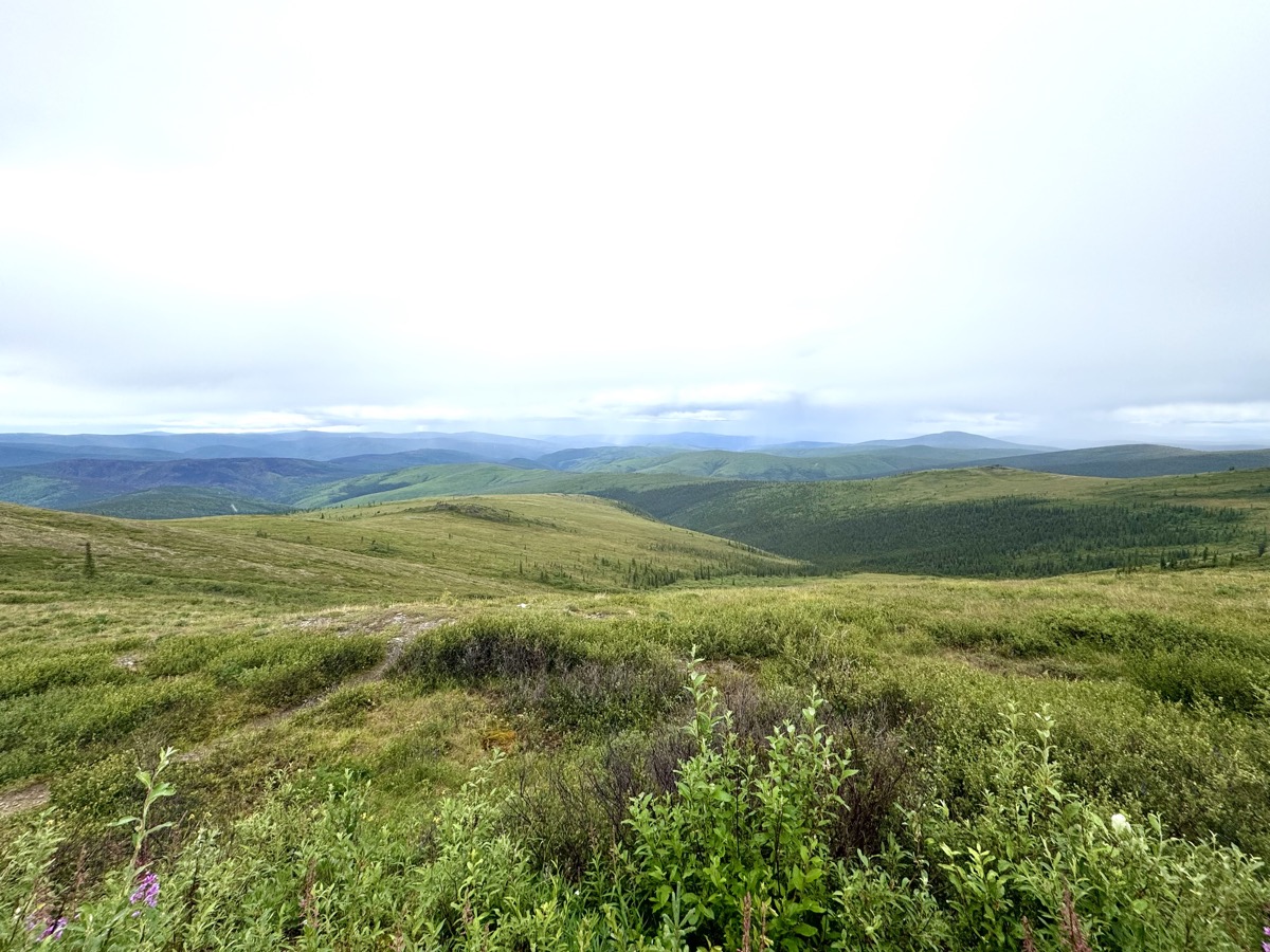
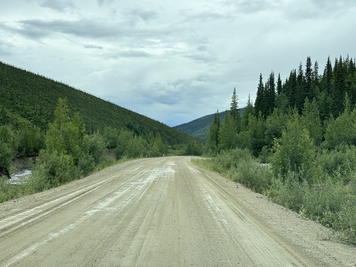
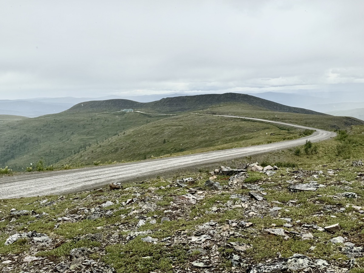
Now we were driving on Top of The World Highway towards Tok (AK). And it was pleasant experience on its own. Taiga along the highway, small mountains on the horizon (no time to hike anything), some snow and quite dramatic weather scenery at times. With “bad tire” on our mind (weather never got really bad enough to worry us too much, but remoteness did), it was just pretty much driving through.
Top of the World Highway
Mount Fairplay
…
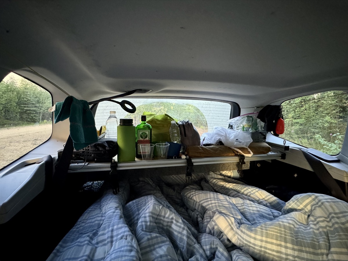
As we were passing Mount Fairplay, we started looking for a camping site. Road-side parking lots were not too bad (not much traffic), but for us not too inviting either. Later, many side roads were on private land. By strike of luck, we found sandy side road running along the main road. As we learned next morning it was used as construction by-pass. We found a perfect spot at small road leading to Four Mile Lake. We called it “Moose Lane” because of many fresh moose “remains”. It was still daylight when we were ready to sleep.
Wild camping at “Moose Lane”
10 pm, waiting for sun to set
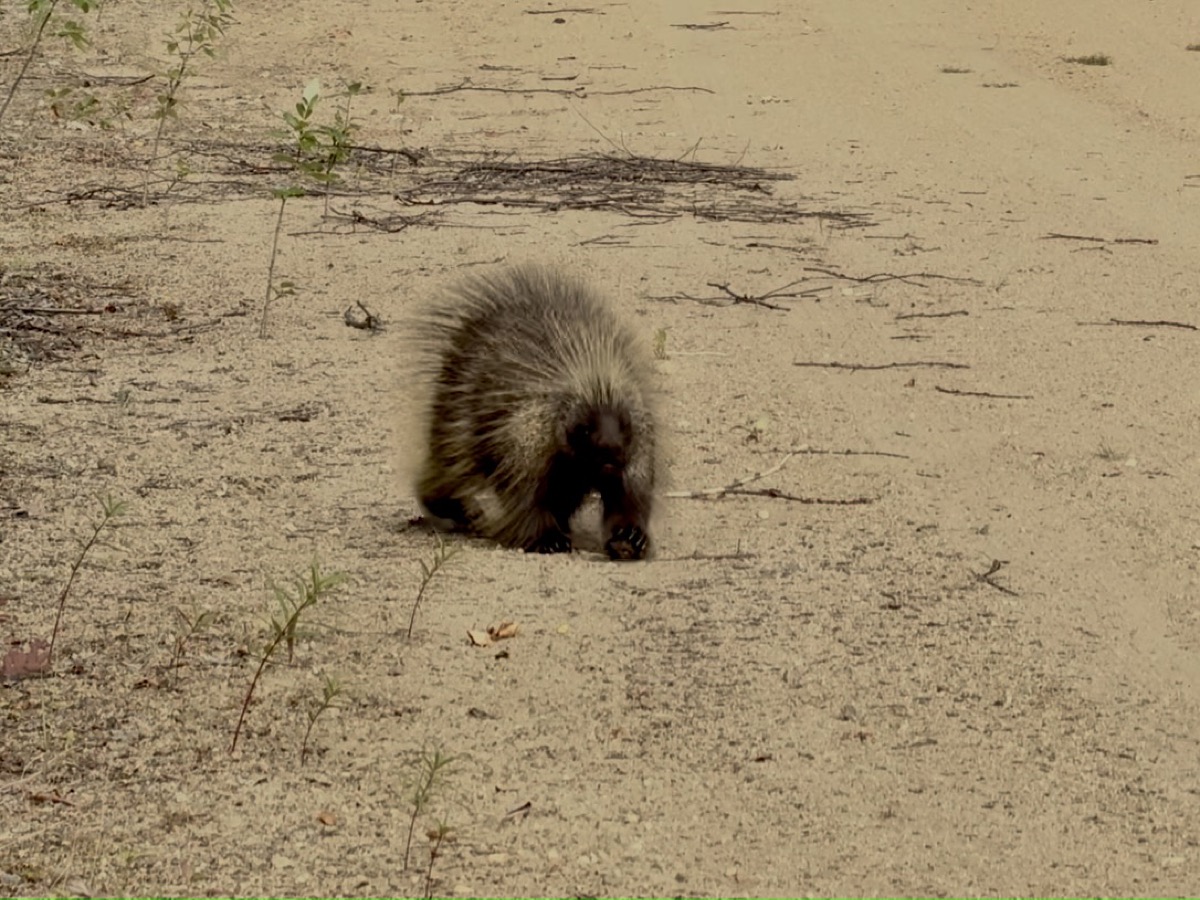
Next morning porcupine visit
Day 36.
Surprised (North American) porcupine started to walk towards us in the morning (was it coffee and breakfast smell?). We were happy to see it disappear in the bushes once it realized we were people.
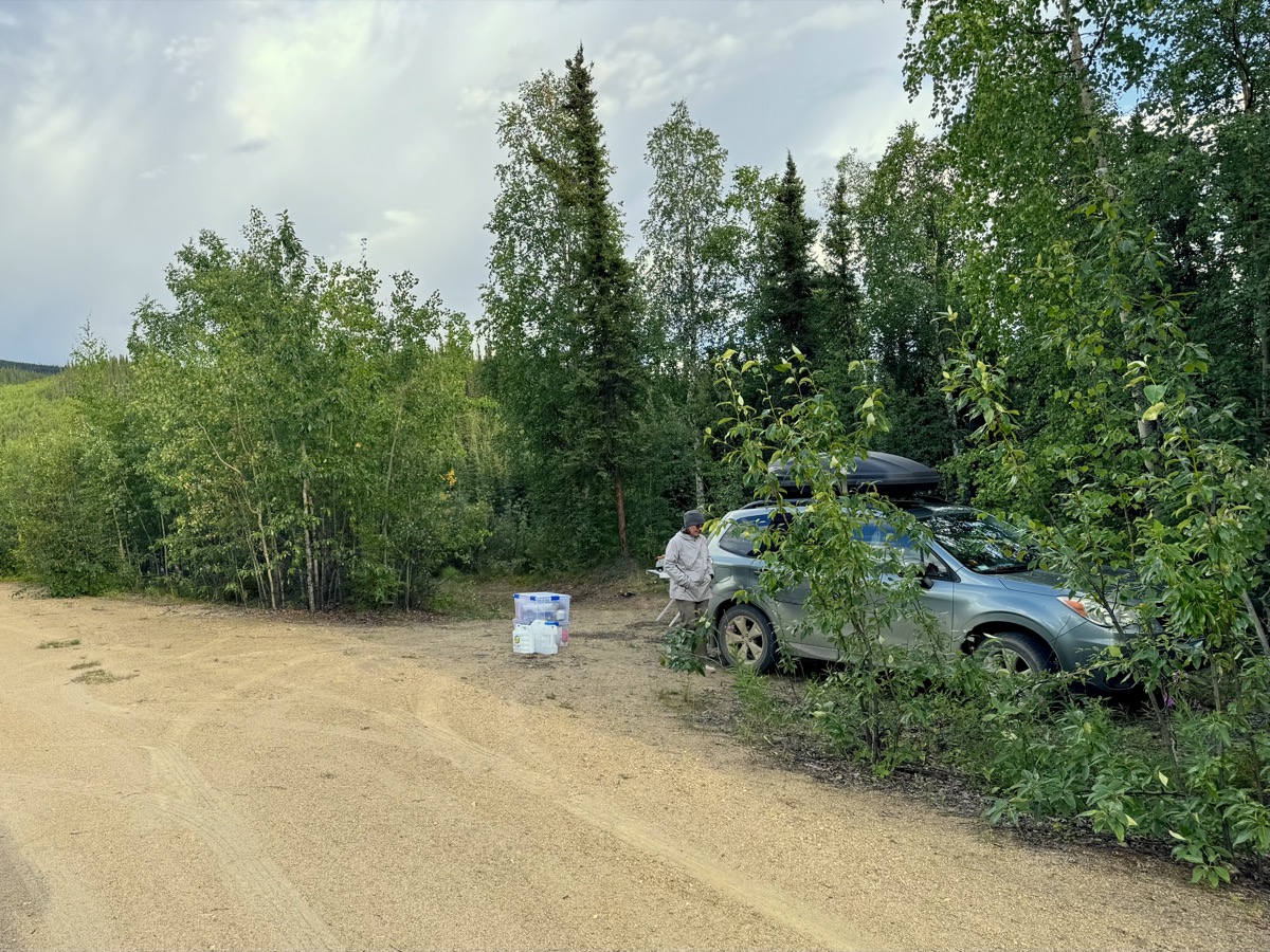
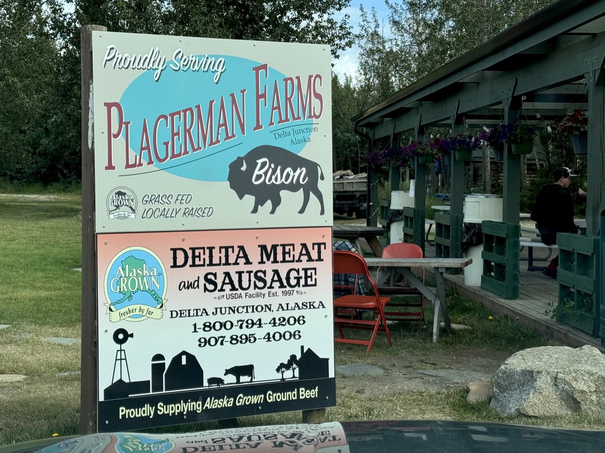
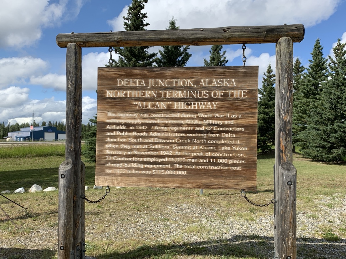
We passed Tok and stopped for lunch in Delta Junction (Buffalo Center hamburgers). We continued on Richardson Highway along Tanana River to Fairbanks.
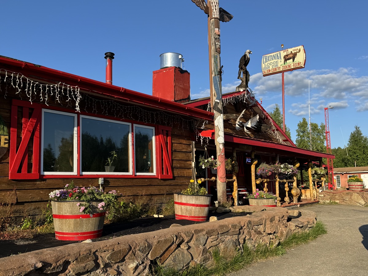
We arrived in late afternoon. No available spots on campgrounds, accommodations harder to find and more expensive than always expensive because of Golden Days (parade, rubber duck race, vintage car gathering). We stayed at Chatanika Lodge 45 km from town. Interesting place with character (nice owners, good dinner) visited mostly by locals and bikers, but past its prime.
Porcupine
Day 37-38.
The following two days were about getting new tires and battery, and our car checked, laundry and grocery shopping. We had some mild respiratory infection on top of it all, not the best of times. Joanna managed to visit the town more (city walk along Chena River from Pioneer Park to Morris Thompson Cultural and Visitors Center).
Delta Junction
…
Tanana River, Richardson Highway
Chatanika Lodge
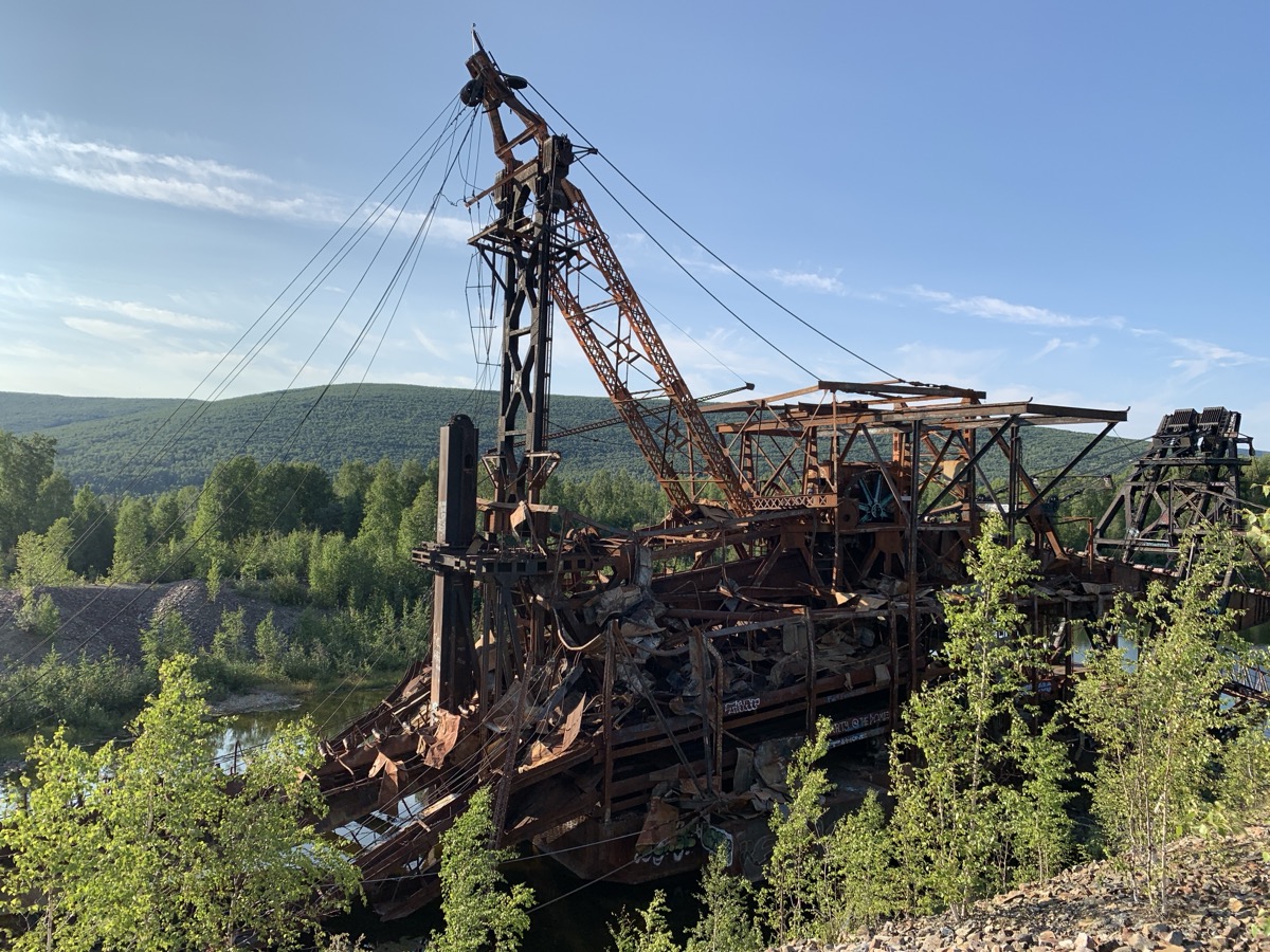
Chatanika dredge
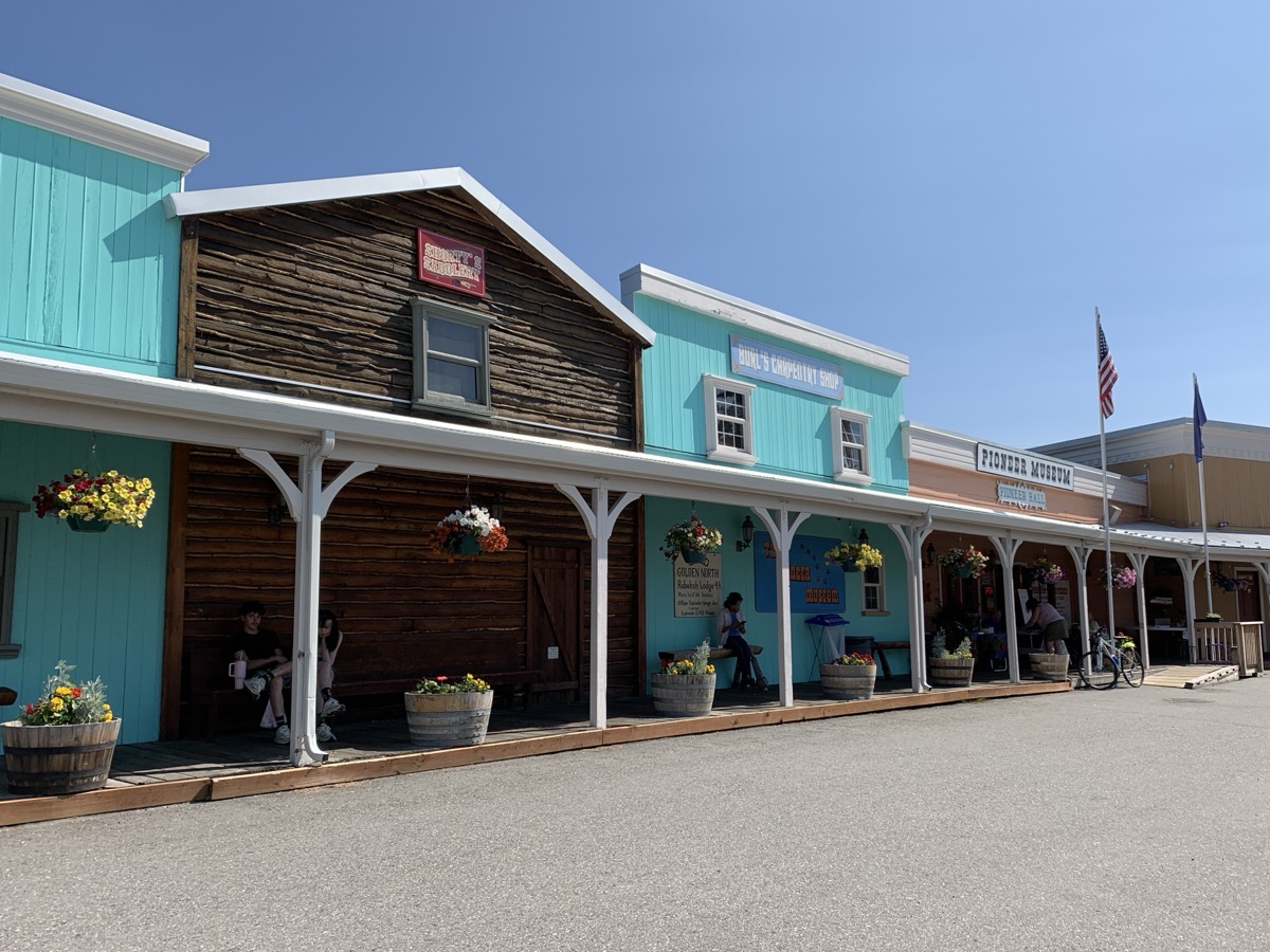
Pioneer Park
Museum
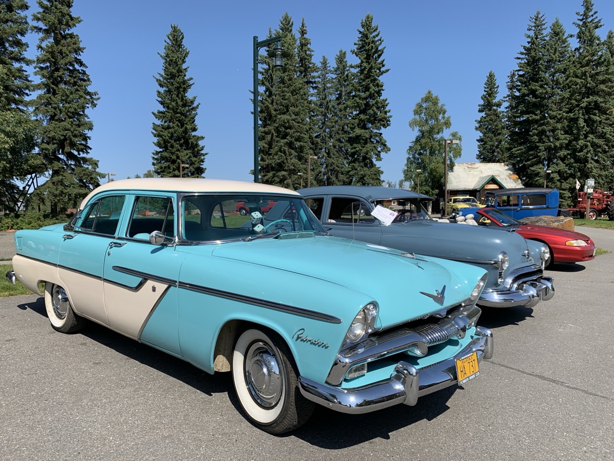
Vintage cars
Golden Heart Plaza
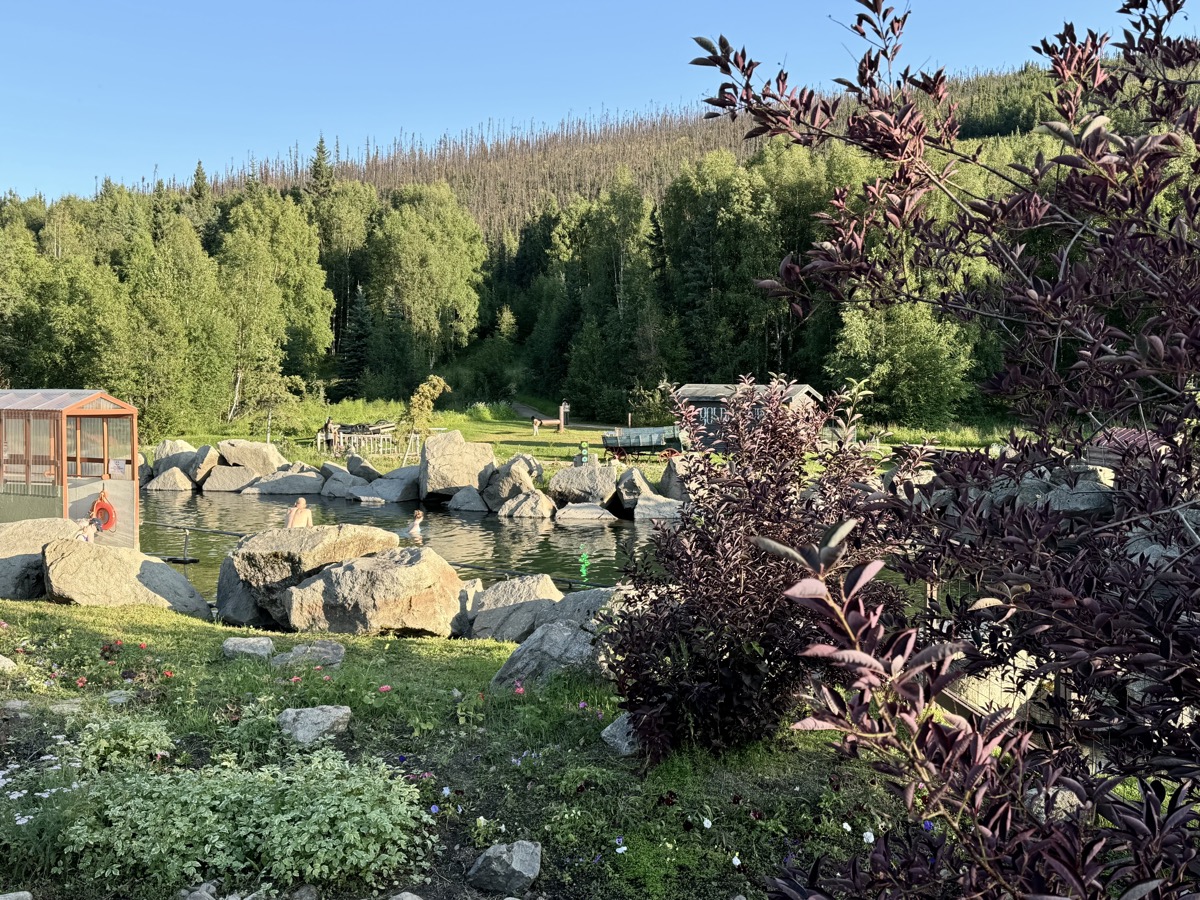
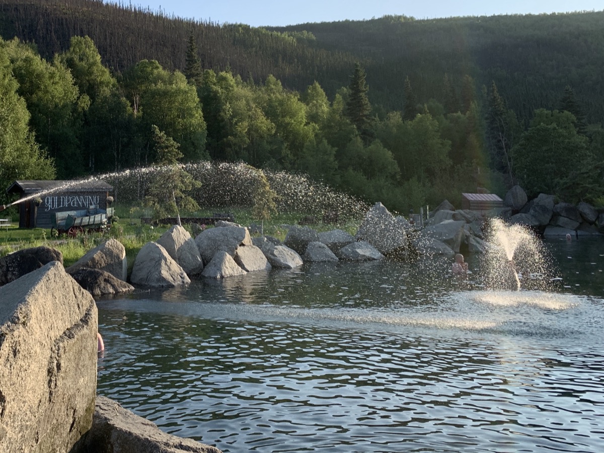
On new tires and aligned wheels we were ready to roll. Fairbanks was not on our top list of destinations, but Joanna did research about Chena River Road and Hot Springs. The side trip was pleasant, and hot spring experience much better than (Piotr) expected (quite a few people around the resort, but all well organized and pools were not crowded). We first hiked to Angel Rocks (many hikers on sunny Sunday) above the valley to sweat and then soaked in hot springs for couple of hours (both recommended). There were no good camping spots at the resort, but campgrounds along Chena Hot Springs Road were empty. We looked for a place with less standing water and fewer (?) mosquitoes, but it did not matter what we chose (stayed at Granite Tors).
Day 39.
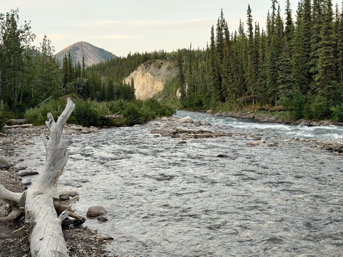
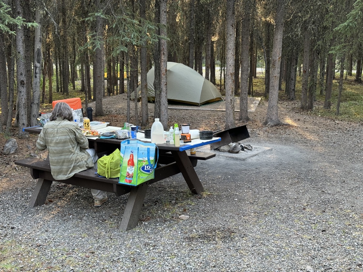
Now we felt the Denali rush. We drove non-stop (300 km) to the park, secured a spot at tent walk-in Riley Creek Campground (everything else was booked). We arrived early enough to choose best spot, set-up camp, go for a walk along Riley Creek and cook dinner. This is really top-notch NPS campground (recommended) and we stayed there for four nights.
Driving 400 km on Alaska Highway. We made it to Whitehorse in late afternoon, checked out a couple of campgrounds (we did not like overcrowded RV Park and a recommended place did not allow car camping). We ended up driving back to Caribou RV Park (recommended). The place is not big and is packed quite densely, but it has a lot of character (European owners), real bathrooms and good food served out of food truck. We made a few stops on the way of course: in Teslin (at the bridge and Tlingit Heritage Centre), Johnsons Crossing (to see what is left of collection of cars abandoned after Canol Road construction during WWII) and Marsh Lake (Joanna discovered new iPhone soft light filter=dirty lens).
Teslin Lake and Bridge
Johnsons Crossing
Marsh Lake
Day 30.
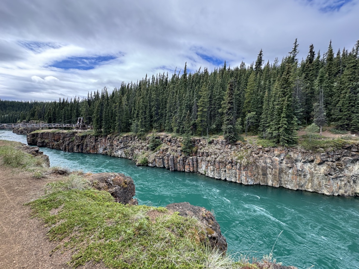
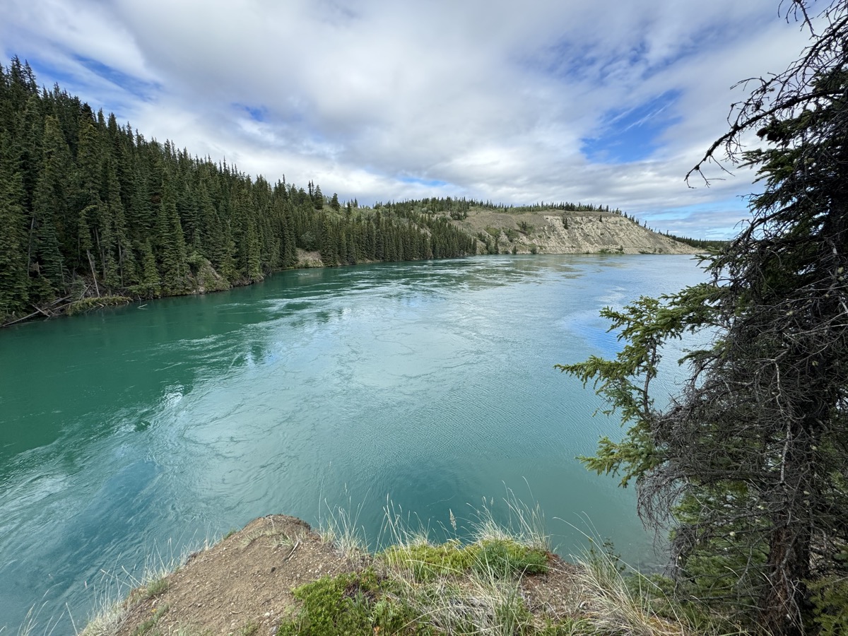
Time for Whitehorse and we were getting deeper into gold rush history. We started the day walking along Yukon River Miles Canyon to historic site of Canyon City and towards Schwatke Lake. Whitehorse Falls, now submerged after the river was dammed, were treacherous waters to be conquered by river boats carrying people and cargo. Jack London navigated boats through rapids on the way to gold fields. The water is still running fast through the canyon. It has intense blue-green color.
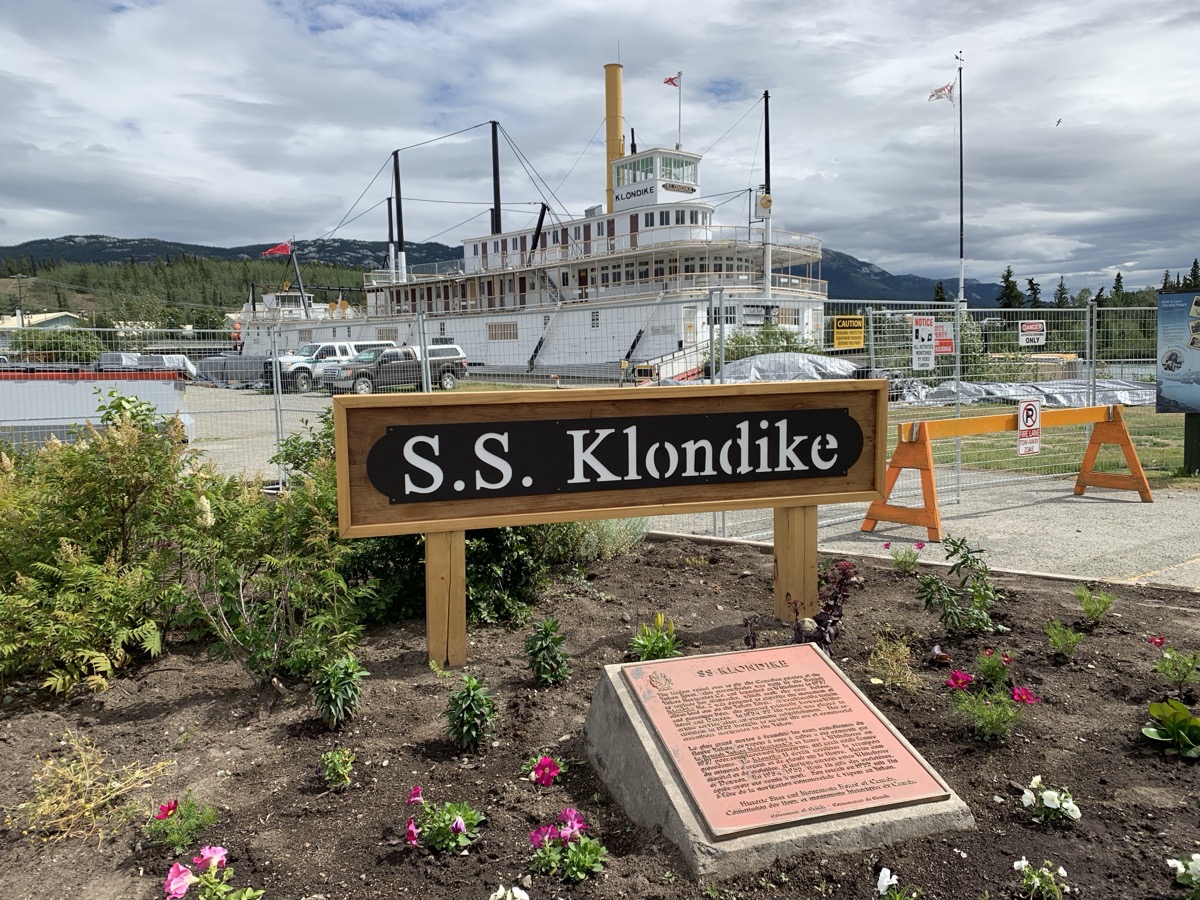
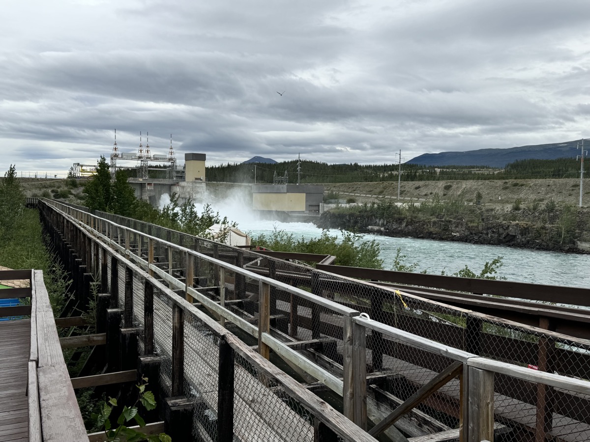
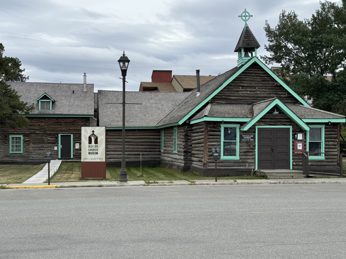
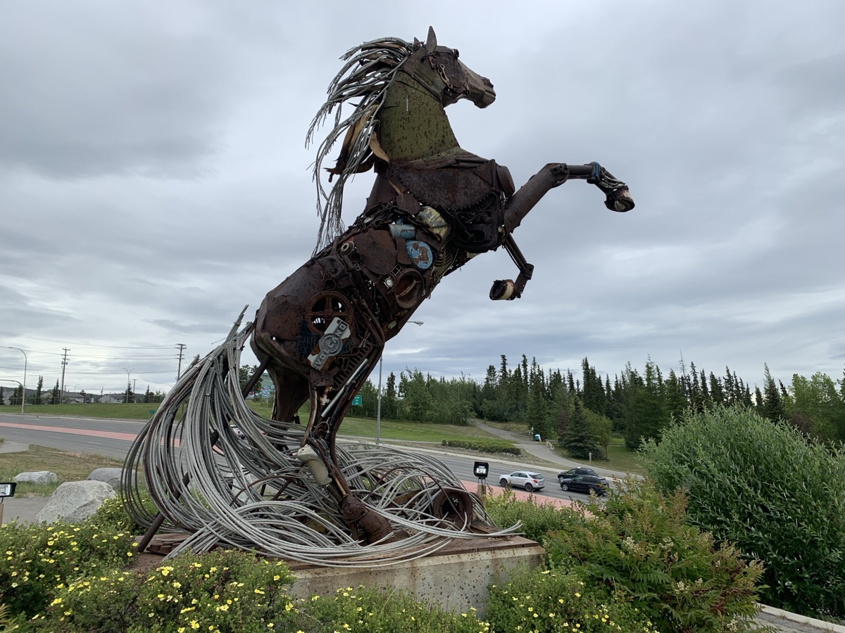
We stopped at S.S. Klondike museum (closed for renovation) and then visited fish ladder built to allow fish swim up- and down- the river passing the dam (interesting, no salmon yet, but plenty of other fish to watch). The town is nice, but not really that interesting. We walked around to Old Log Church and drove to The Horse of Whitehorse (of course). With rain coming and no good camping options, we decided to spend the night at Kaleido Lodge (recommended). The lodge is run very well by and staffed by Japanese company, and caters in season to tourists who come to watch aurora borealis.
Fish ladder
Window into fish ladder
Miles Canyon
Schwatke Lake
S.S. Klondike museum
Fish ladder at Whitehorse Dam
Old Log Church, Whitehorse
The Horse of Whitehorse
Day 31.
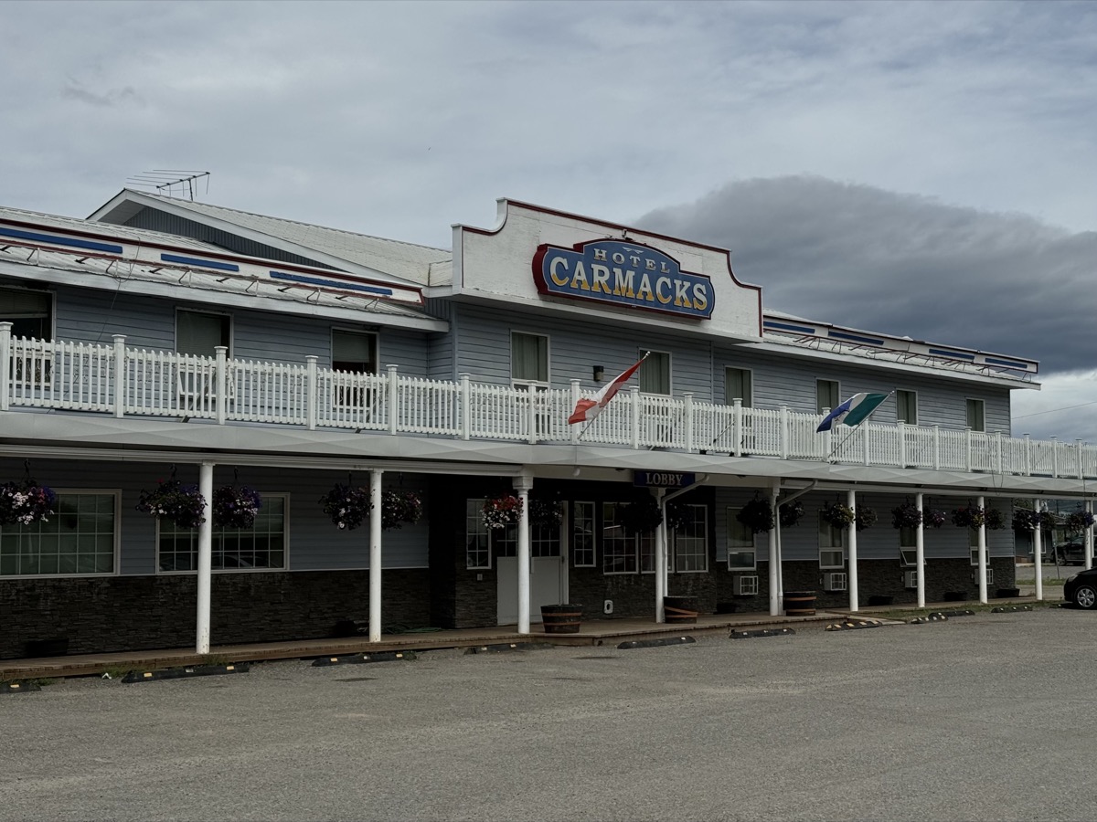
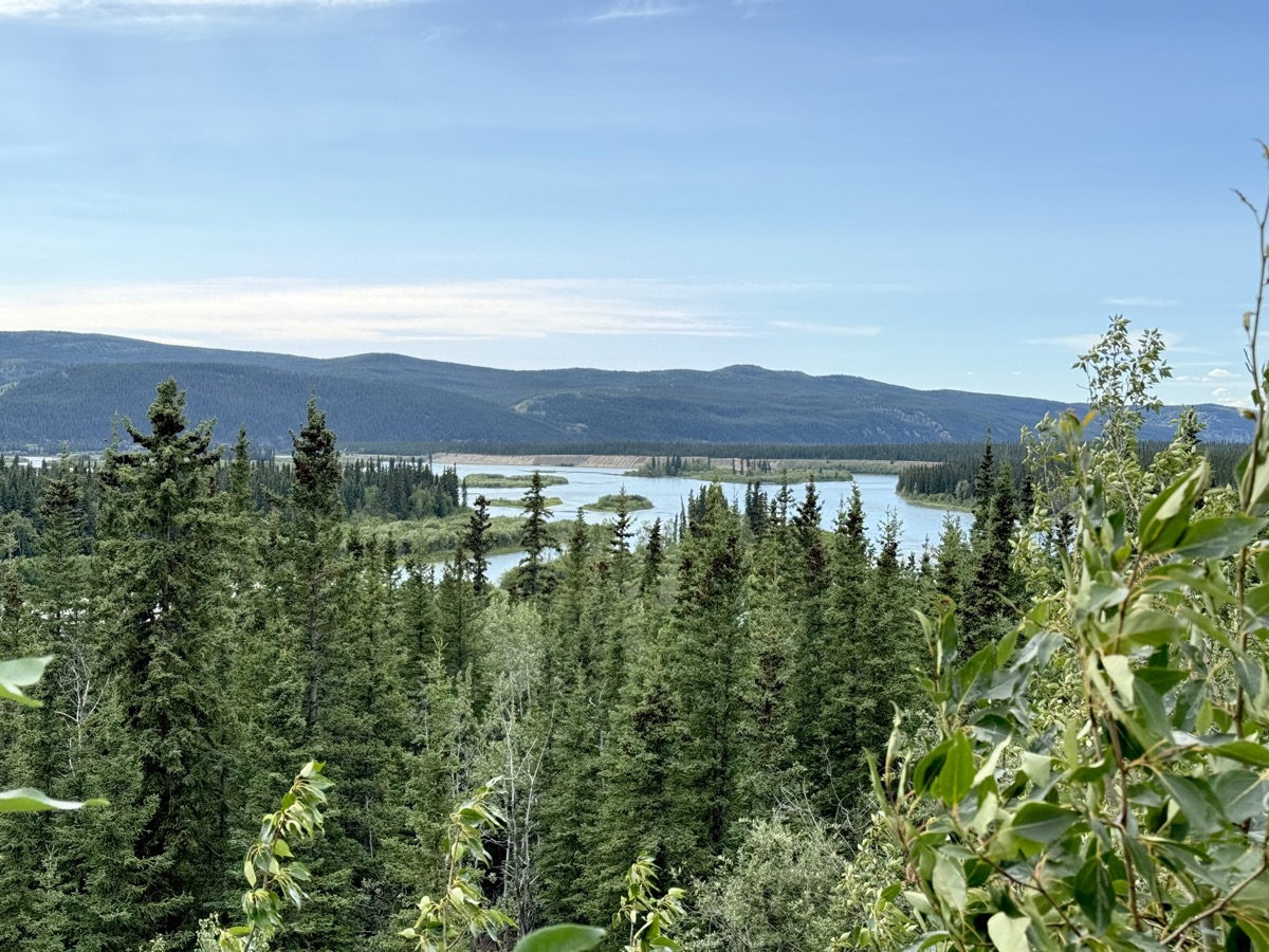
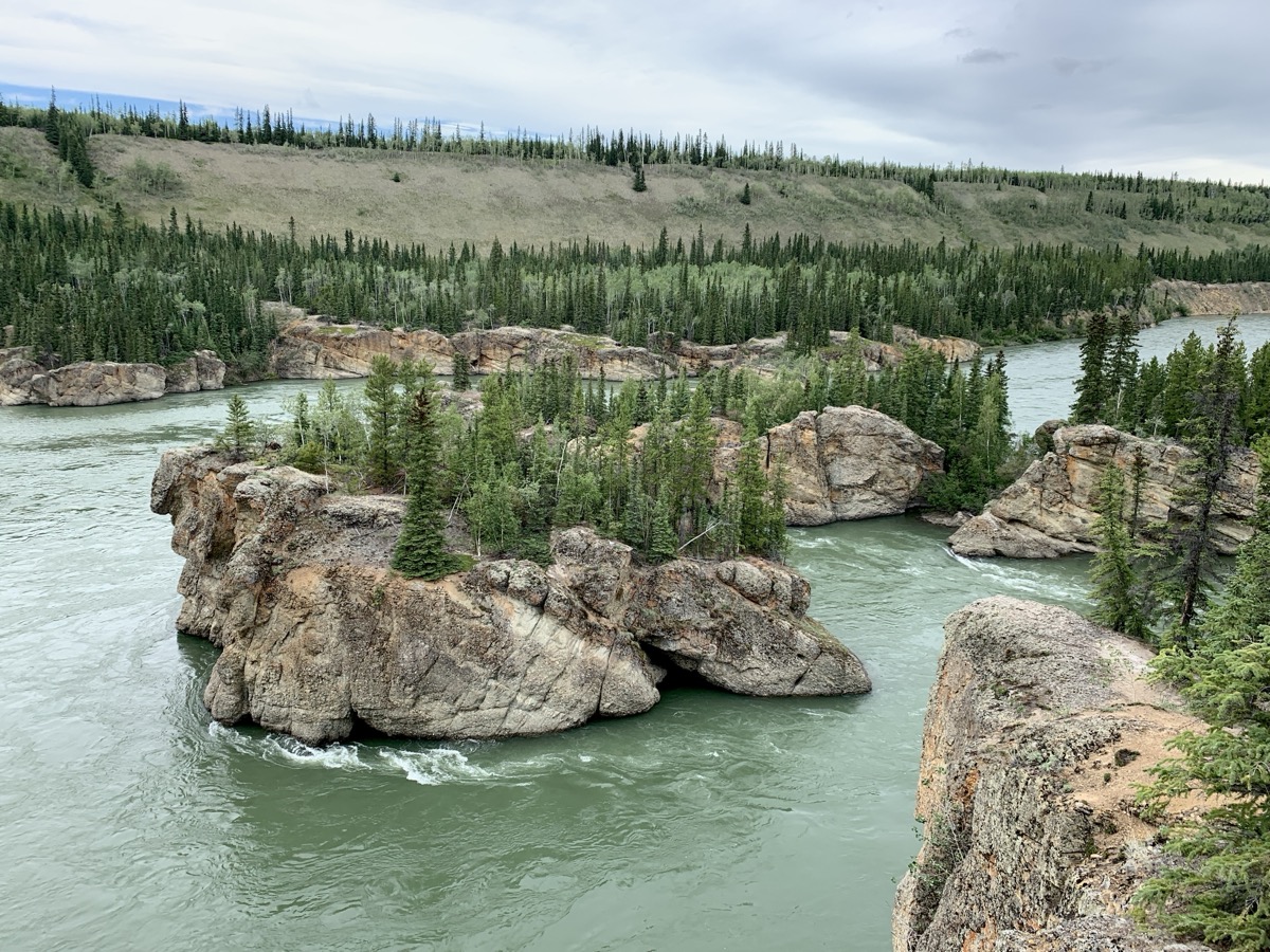
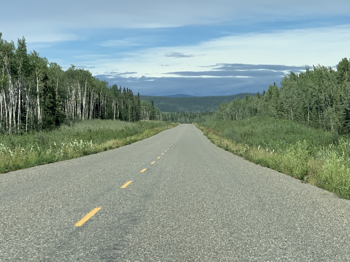
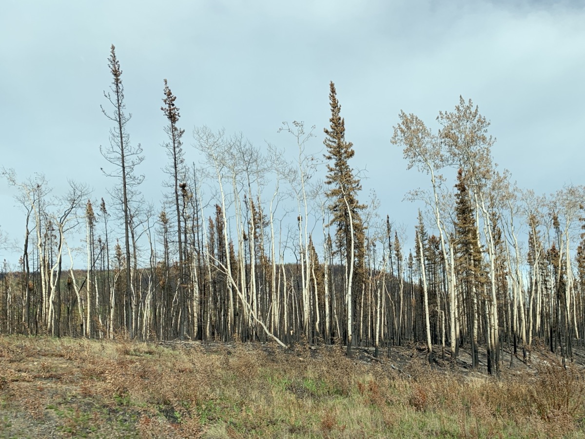
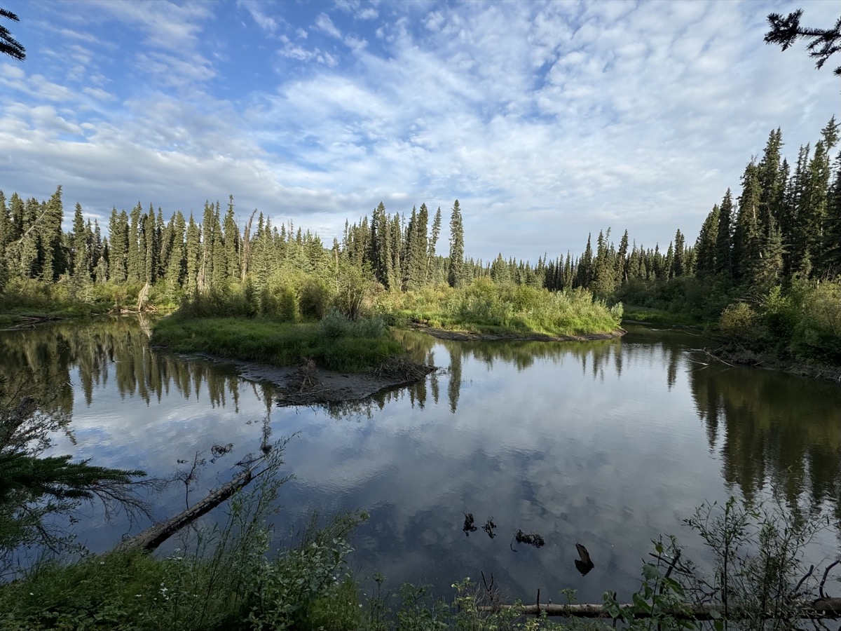
Dawson City was next, to get there we drove on Klondike Highway, 600 km in two days. Now we were visiting places where the gold rush was invented. Carmacks first, not much left from the old days (Montague Roadhouse, hotel and post office). But the Mighty Yukon River is still flowing north. Five Finger Rapids was another difficult navigation spot on the river (at high water). It was short, but steep walk down from highway parking lot to river’s cliff to view the rapids. Klondike Highway seemed endless and empty (it really was). We saw larger areas destroyed by wildfires as we approached Stewart Crossing (some fires still smoldering, the highway was just re-opened). With road construction slowing us down, we decided to camp at Moose Creek Campground (nice not crowded), just 25 (slow) km past Stewart Crossing. With long daylight, we had enough time for a walk down the creek to Stewart River. Wet forest and marshes. As we were reading nature trail poster about not all mosquitoes being “bad and biting”, mosquitoes diving at our backs did not feel constrained by science.
Carmacks Hotel
Mighty Yukon River
Five Finger Rapids, Yukon River
Klondike Highway
Wildfire destruction
Marshes and wetlands along Moose Creek
Day 32.
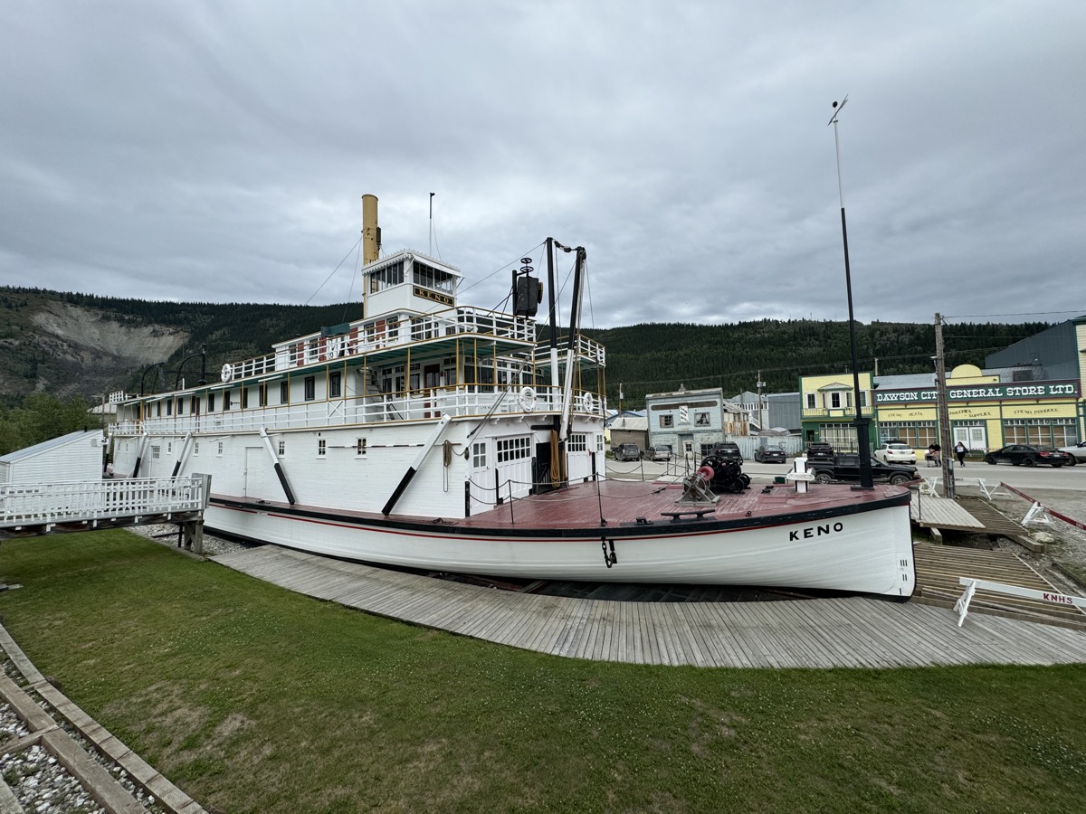
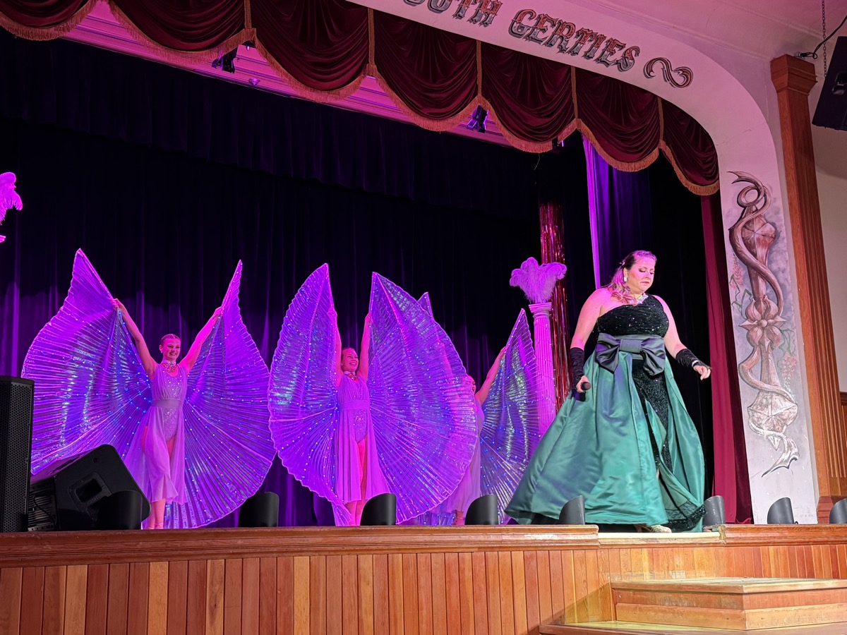
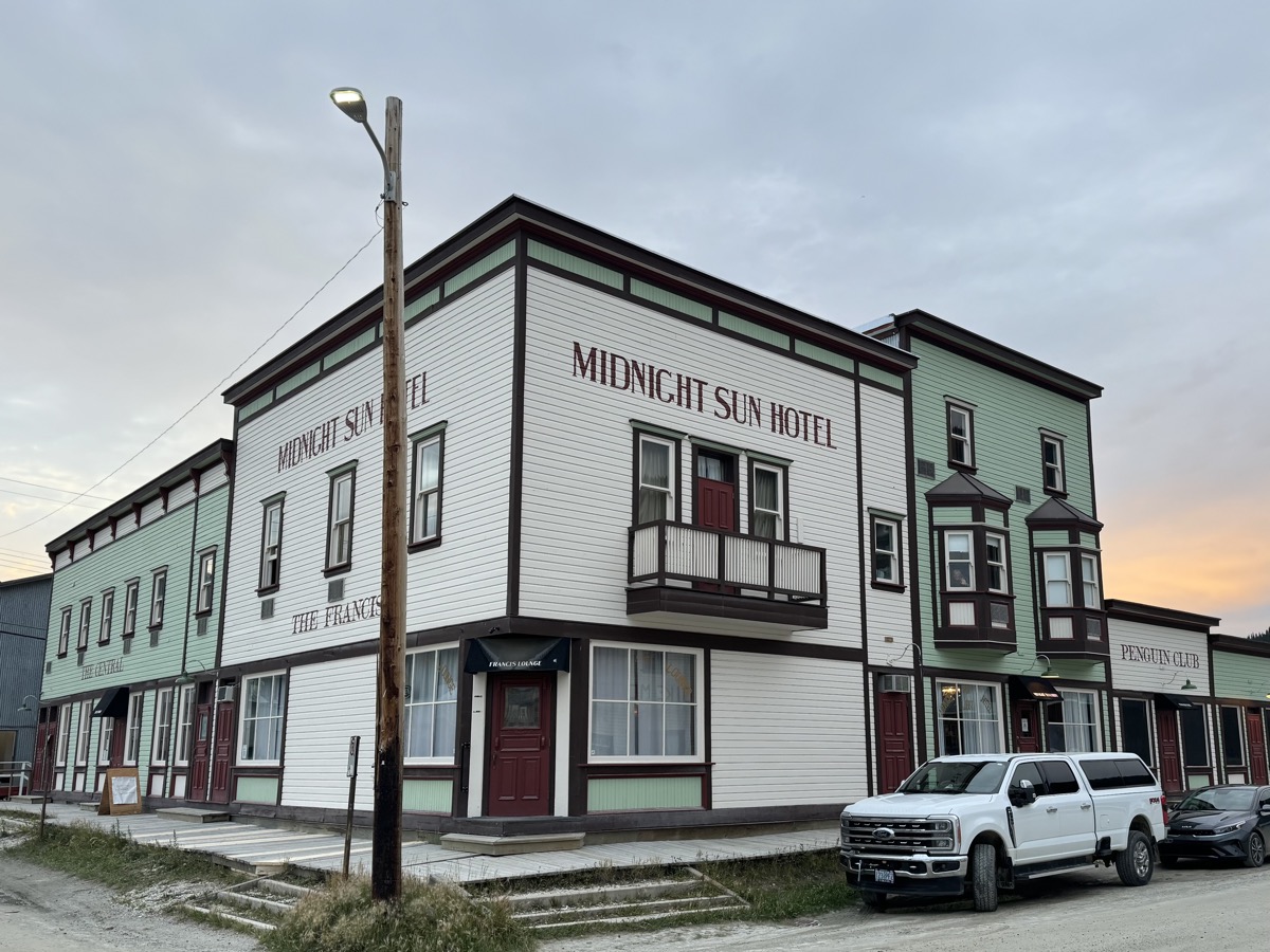
We enjoyed reading about and viewing Tintina Trench: 1000 km long linear depression on top of fault line cutting across Yukon in part of which Klondike River flows until it merges with Yukon River in Dawson City. Then Joanna heard hissing noise – flat tire, nail or something. We drove 60 km on spare to Dawson City. Flat tire was fixable by local shop. With the problem temporarily solved, we rented private room with kitchen for two nights. We enjoyed the stay. Walking around town and visiting historic buildings from gold rush era, walking along Yukon River (rivers and steam boats provided key means of transportation back then), spending couple of hours at Diamond Tooth Gerties (evening show, beer and friendly talking with other tourists) and walking at midnight in what looked like almost full daylight. The whole town is like a living museum, very interesting.
Tintina Trench
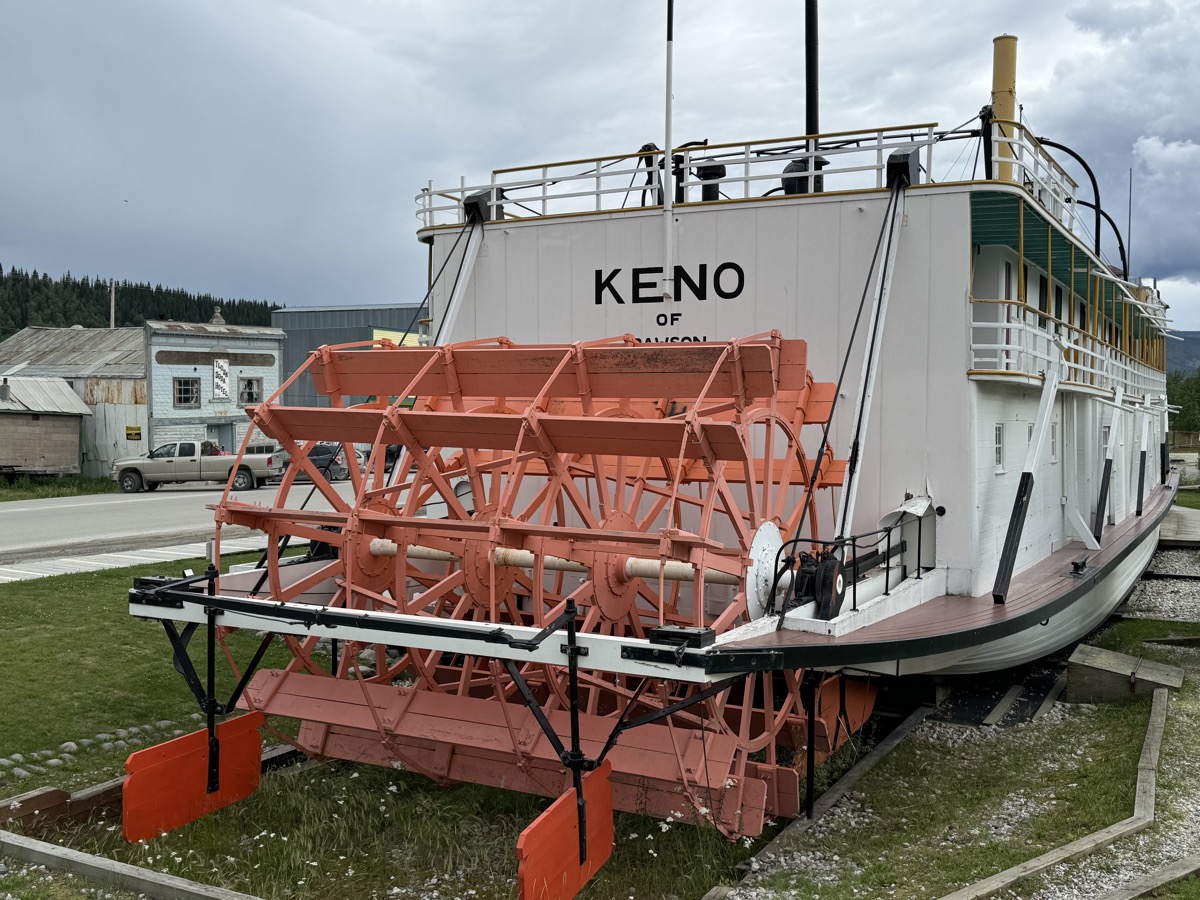
Steamboat Keno…
…stern paddle wheeler
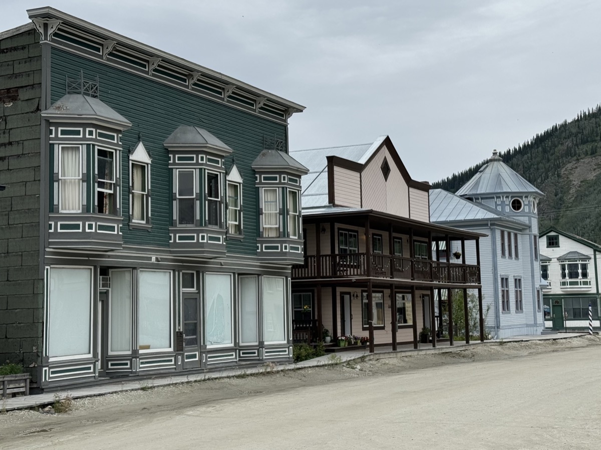
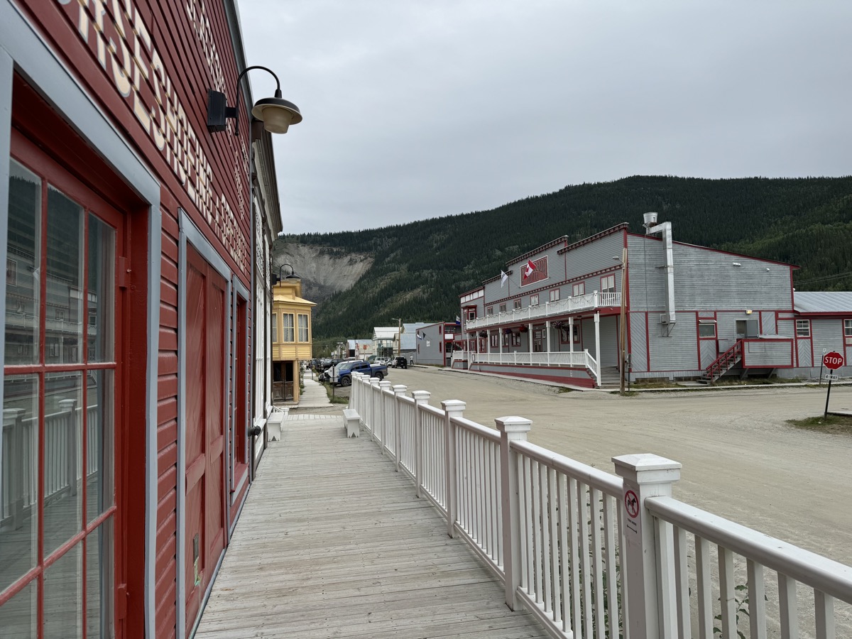
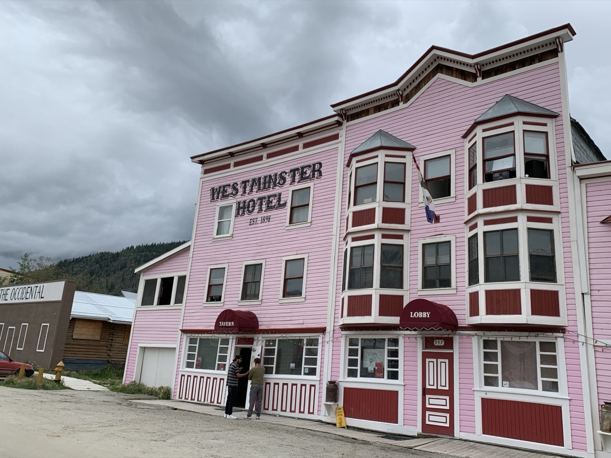
Streets of Dawson City
…
…
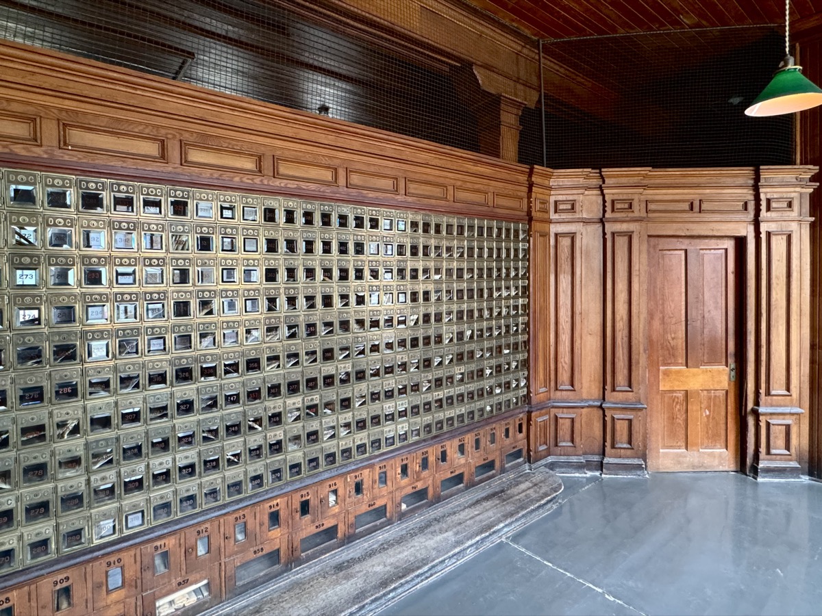
Post Office
Show at Diamond Tooth Gerties
Midnight Sky Hotel at midnight
16Day 33.
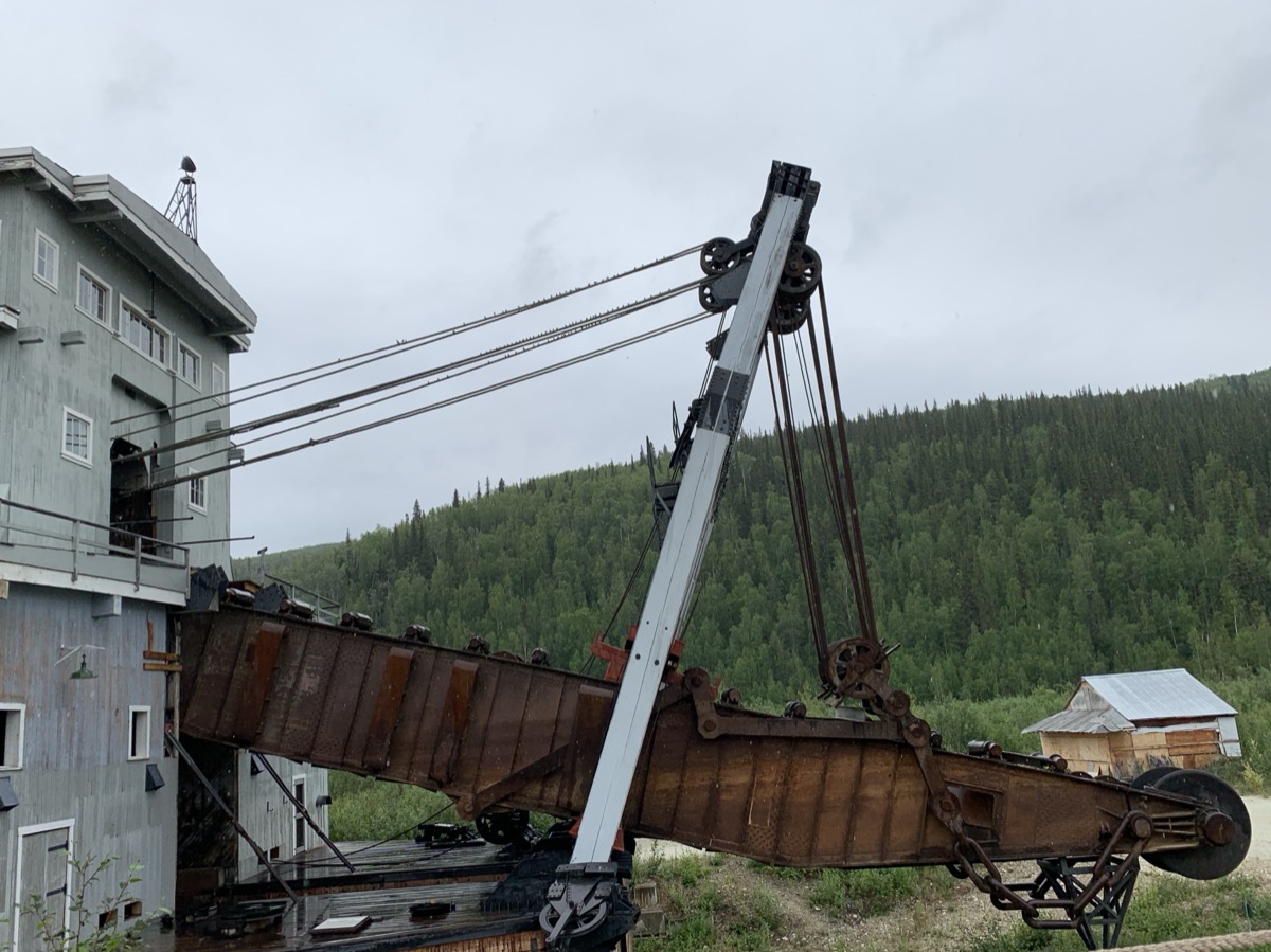
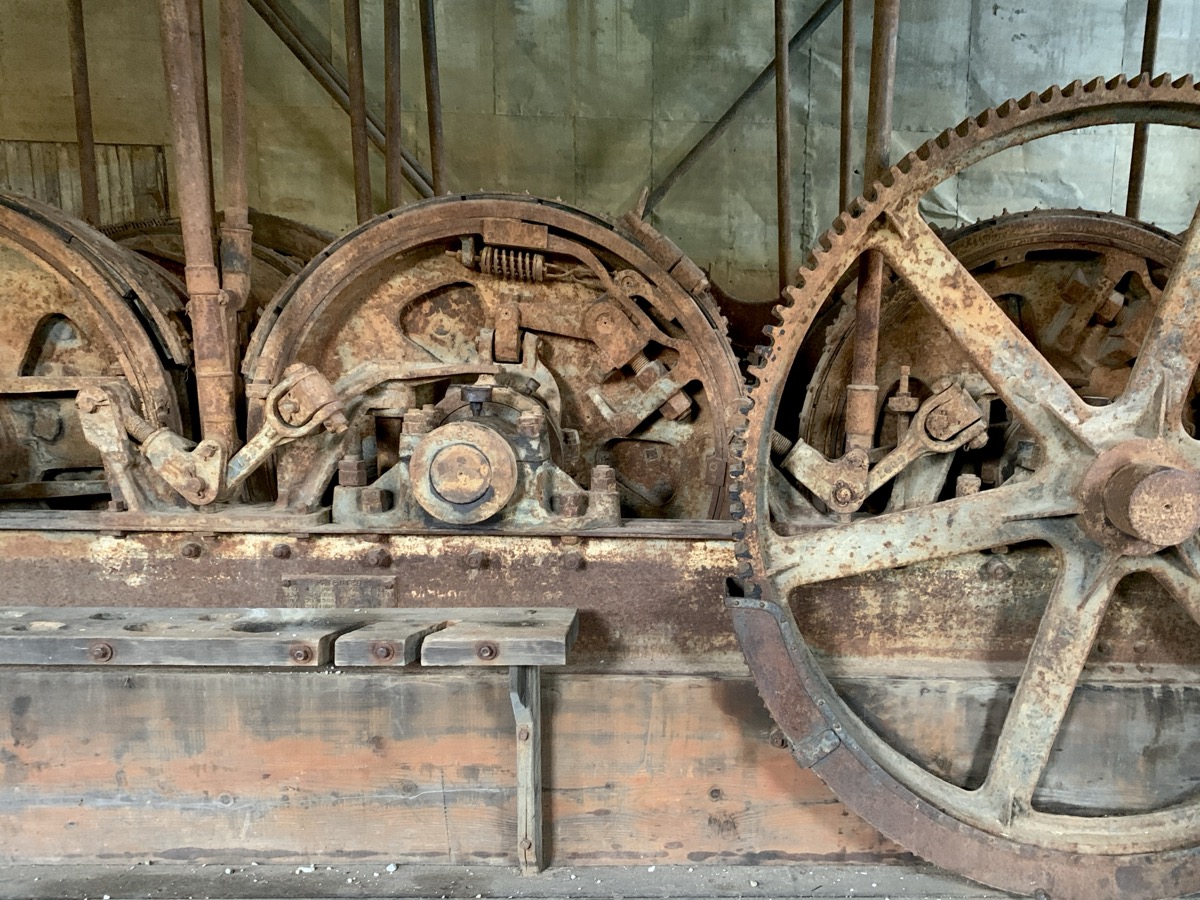
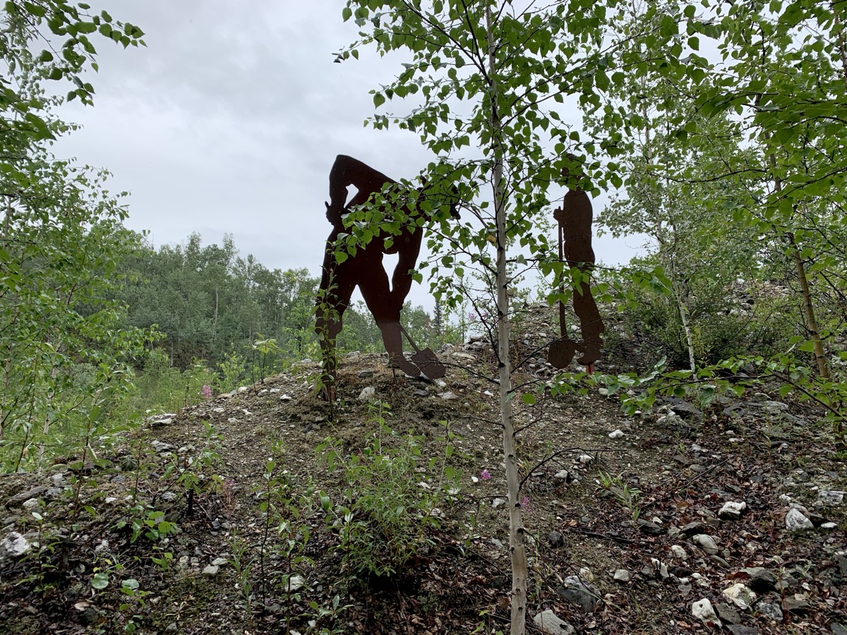
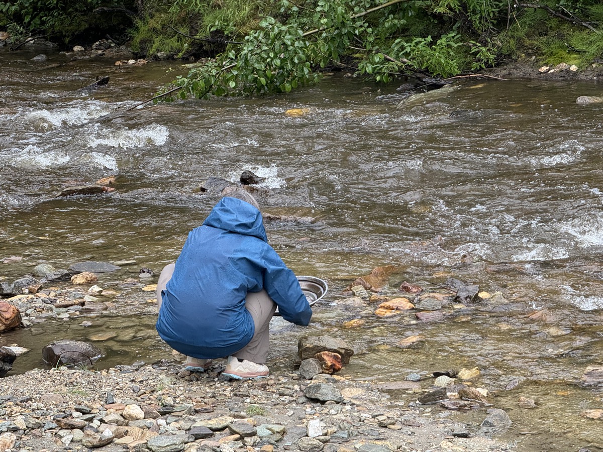
Gold rush in Bonanza Creek. We joined organized tour of Dredge 4 Historic Site (Parks Canada), bought tickets and rented pans the night before at Dawson City Visitor Center. Park ranger gave us good overview of gold rush era activities (1896-1999), how dredges worked, how gold was dug up etc. The entire valley floor is covered with mounds of dirt and rocks dug 100 times over by prospectors. Some shafts and rusting machinery can be found along interpretative trail. Gold mining claims and some operations continue. We did not dig, but tried panning in Klondike gold rush spirit (no luck).
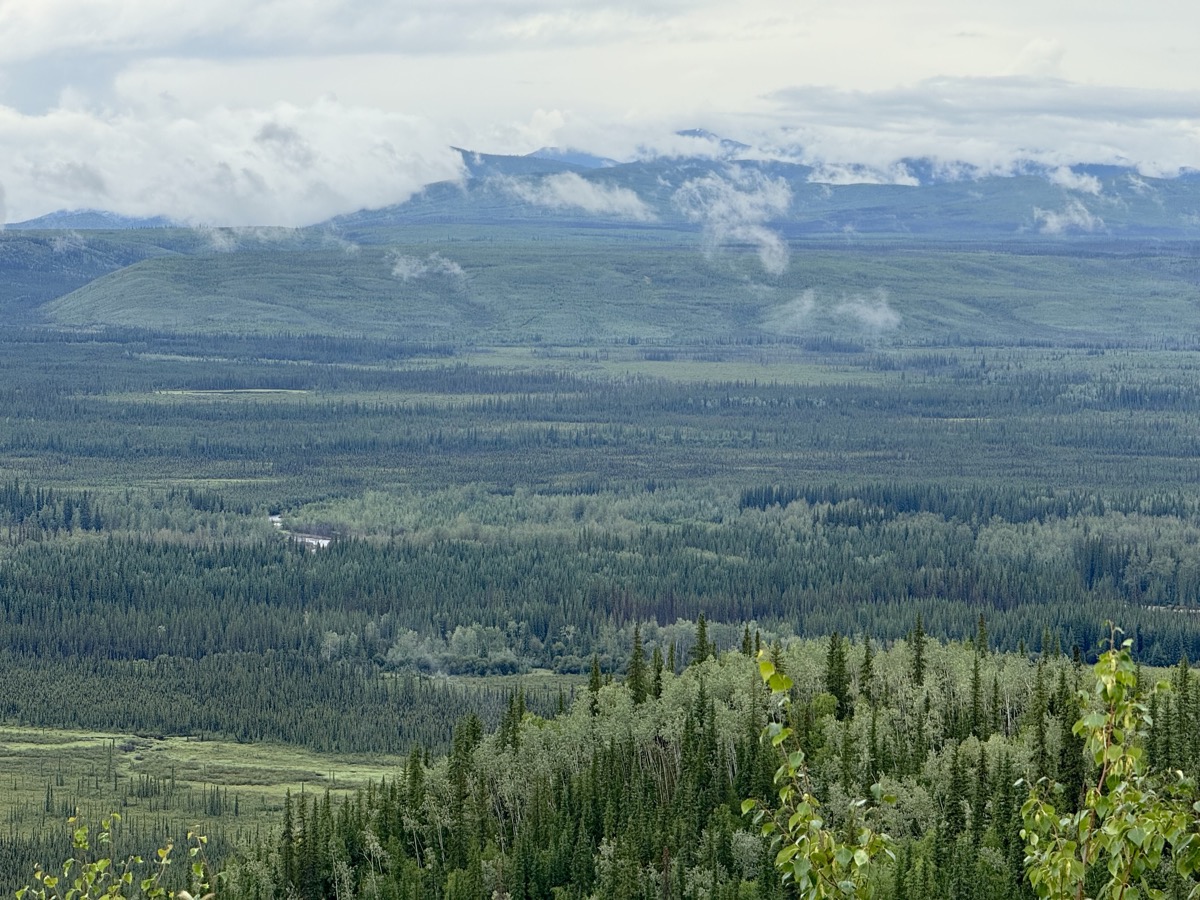
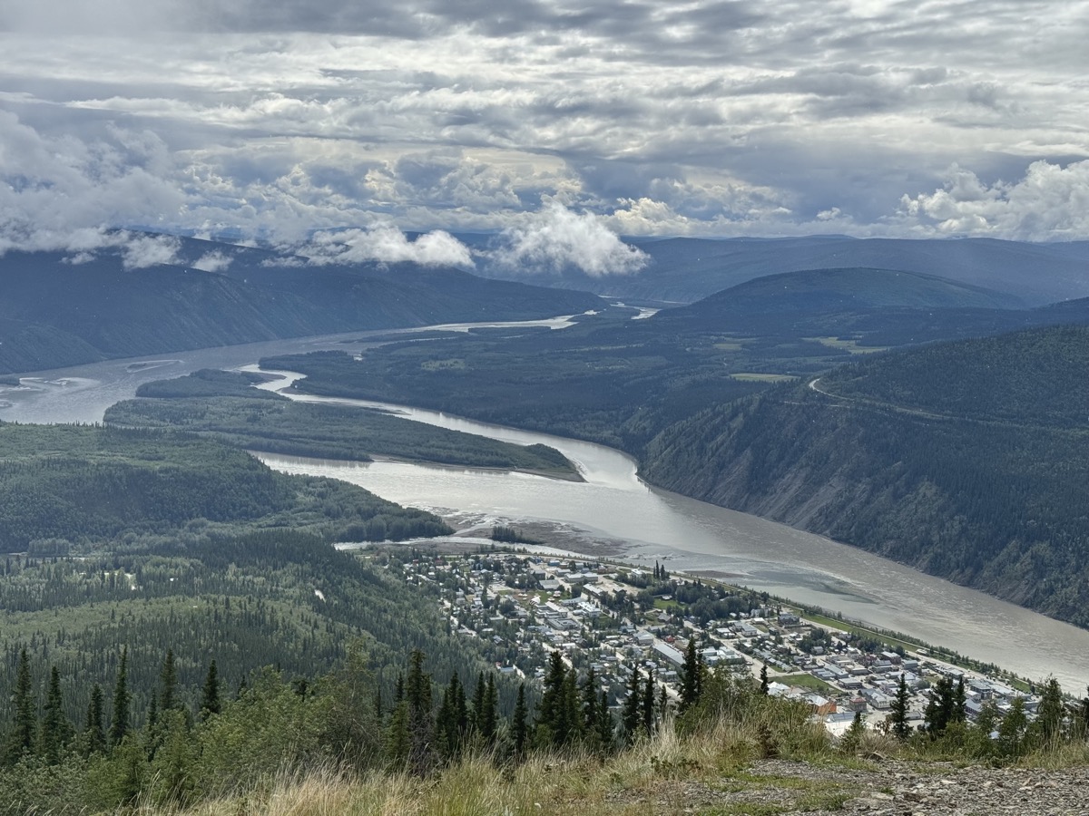
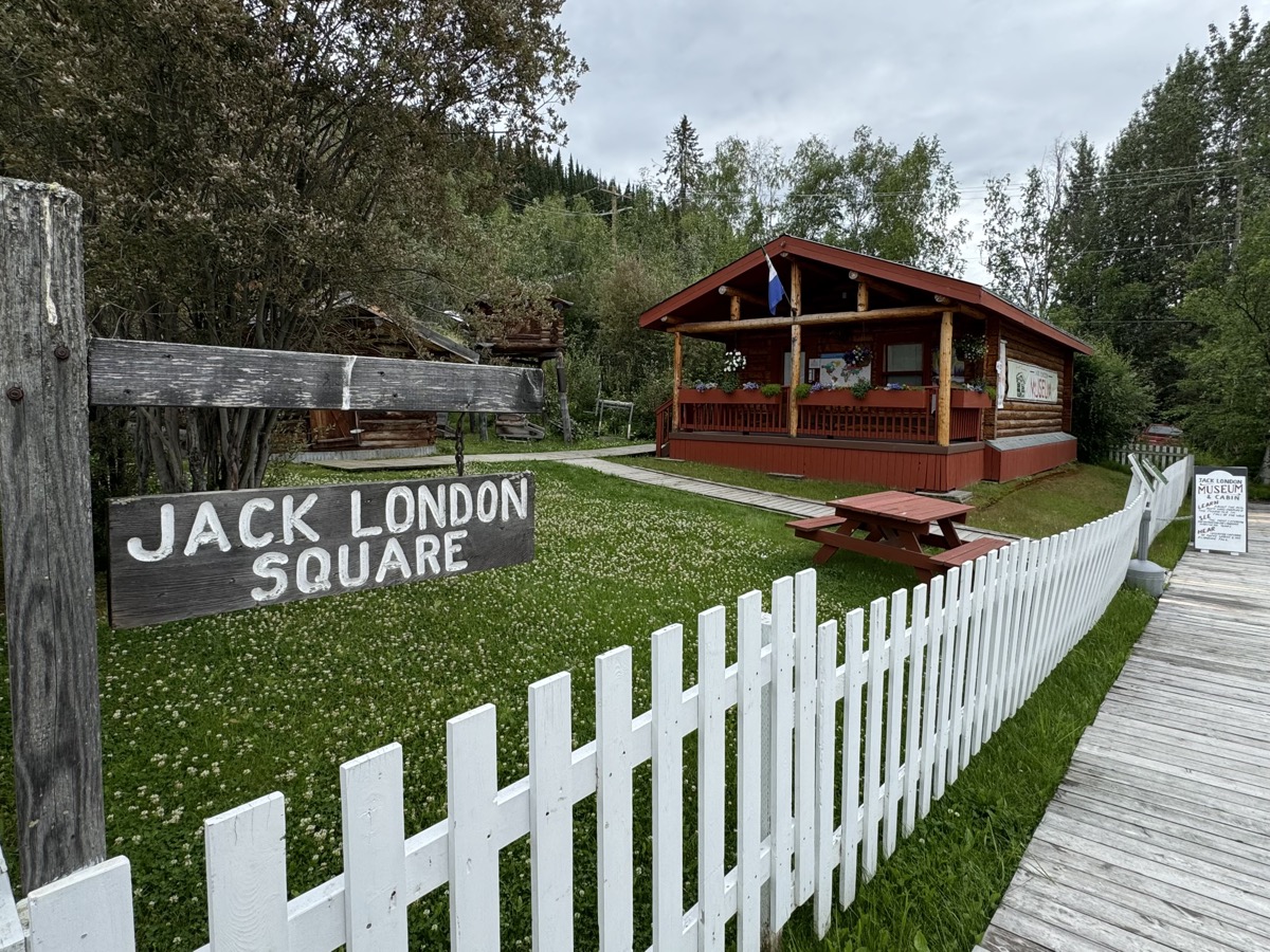
Panoramic view from Midnight Dome was great (some wildfire smoke was in the air): Dawson City, Yukon River and confluence with Klondike River. Later we walked on river trail to the confluence, stopped at governor’s mansion and Jack London cabin (museum), looked around to identify more historic buildings described in guidebooks. Grocery shopping was just an attempt, but good enough to cook dinner at home (always good to have pantry under the deck, in our car that is).
Dredge 4
Dredge guts
Prospectors are gone
Except us and a few others
View from Midnight Dome
Jack London Museum
We discovered that the punctured tire was also wearing off much faster than the rest and was already mostly bald. It was OK to drive for a few hundred km, but we still had thousands to Chicago. Shipment of new tires would take several days. We decided to go 600 km to Fairbanks (rather than 1100 km to Anchorage) to look for them. It was second major change of direction. Fairbanks was not high on our list of destinations.