Michigan Upper Peninsula day 1-5: Pictured Rocks

Our first trip to Michigan Upper Peninsula was very nice and relaxing. 1180 miles of driving, 65 miles of walking in total plus a few miles in canoe. This time around we were organized a bit better and mostly packed the day before the trip. Still driving 405 miles to Little Beaver Lake in ☞ Pictured Rocks National Lakeshore was slow. Piotr was tired and we had to stop multiple time for short breaks, sometimes in nice spots along Lake Michigan. We traveled in this part of the Upper Peninsula north of Green Bay for the first time.

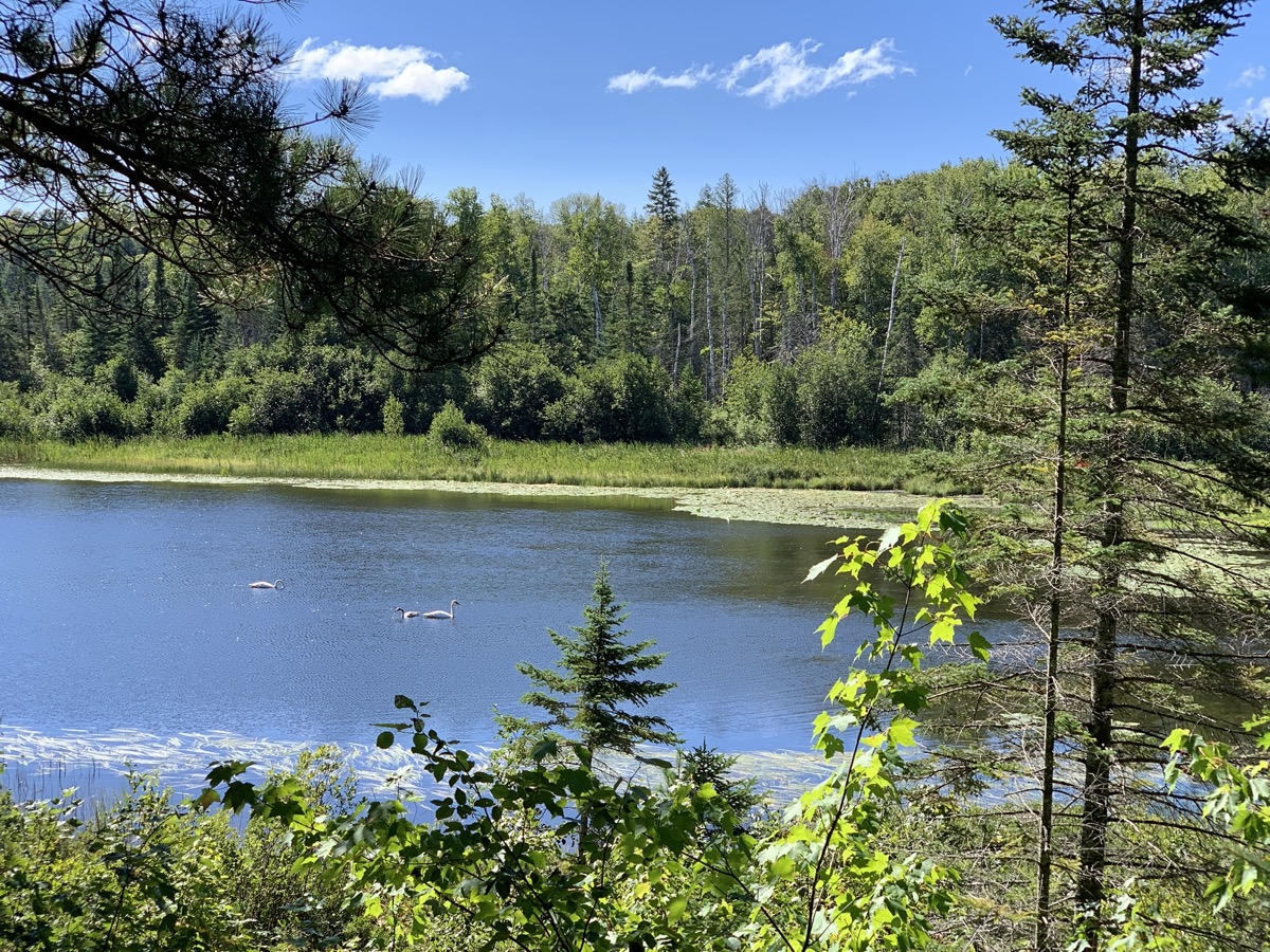
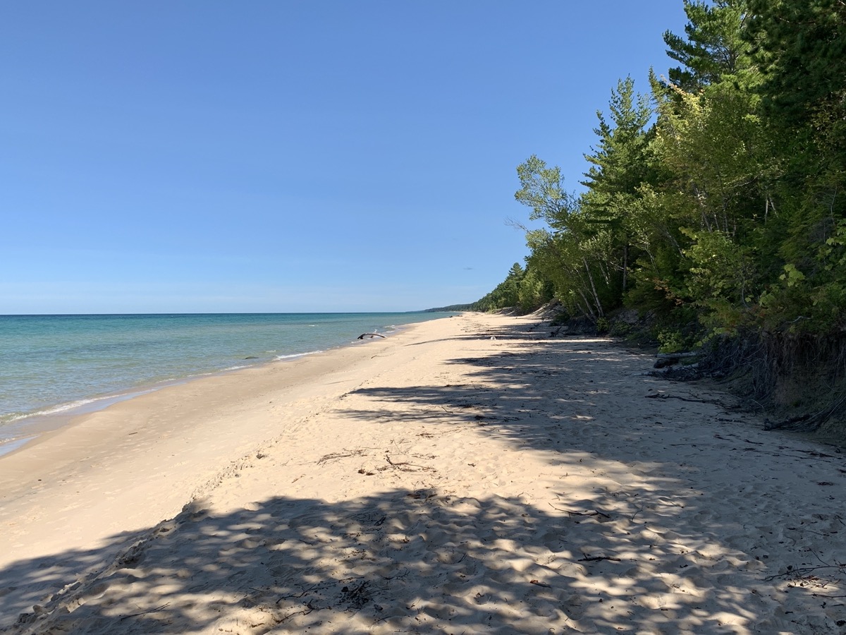
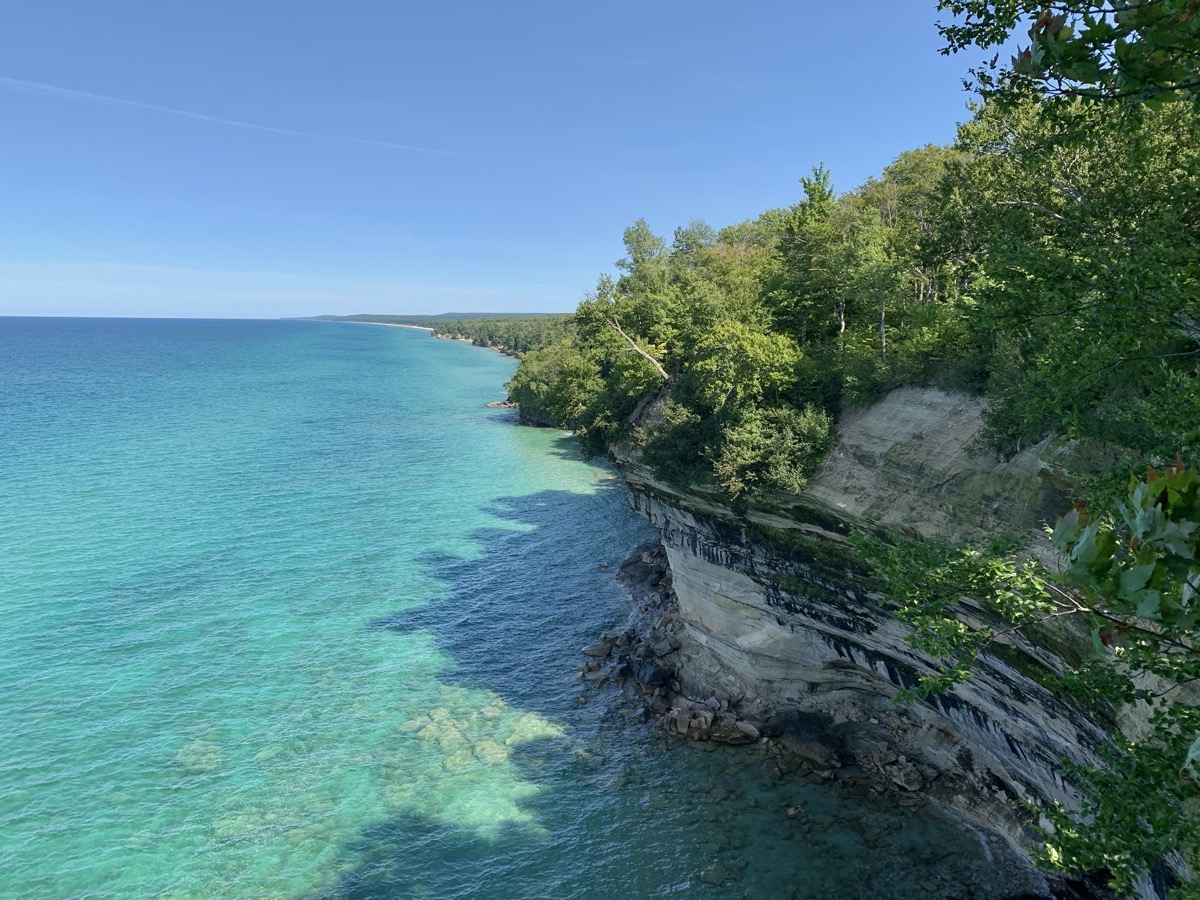
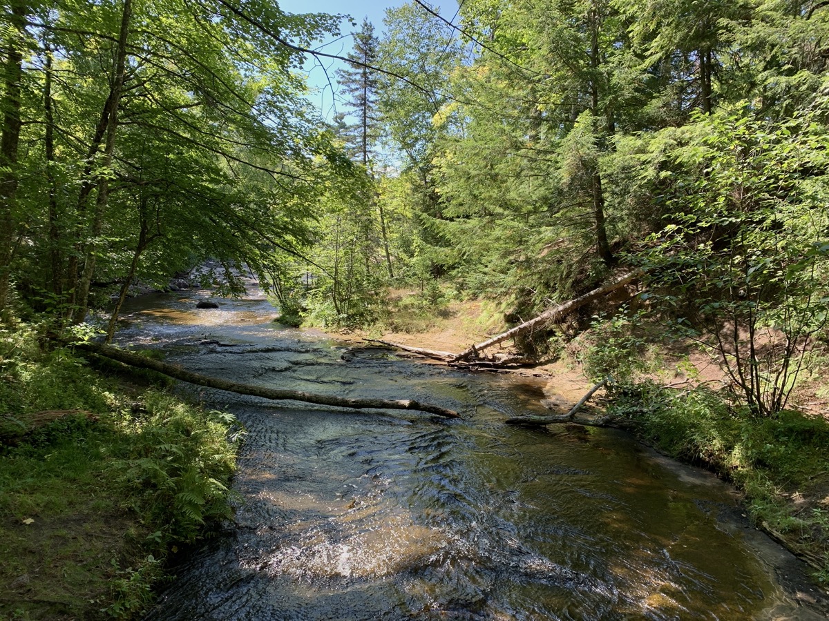
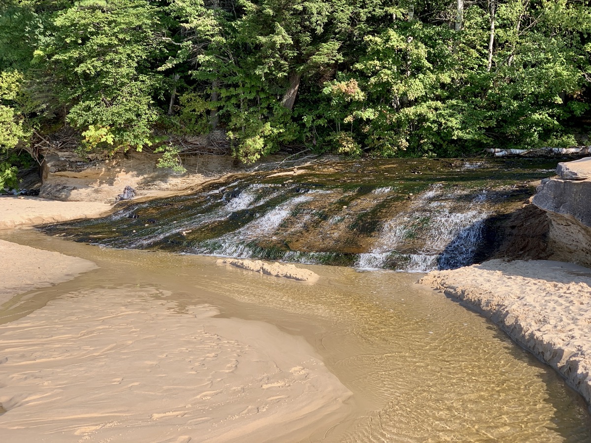
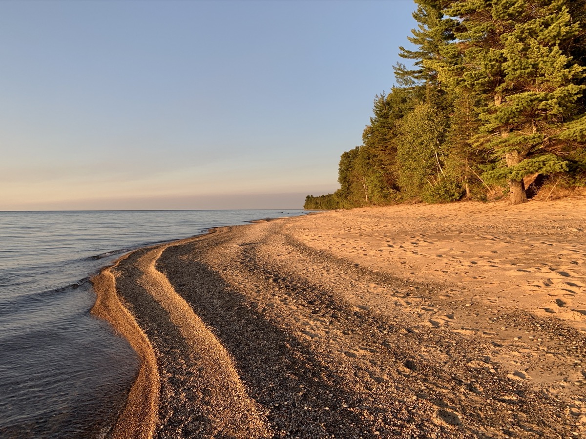
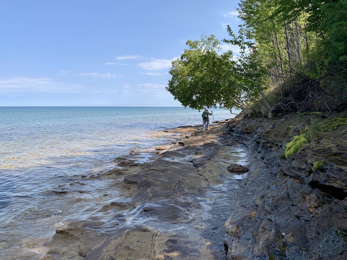
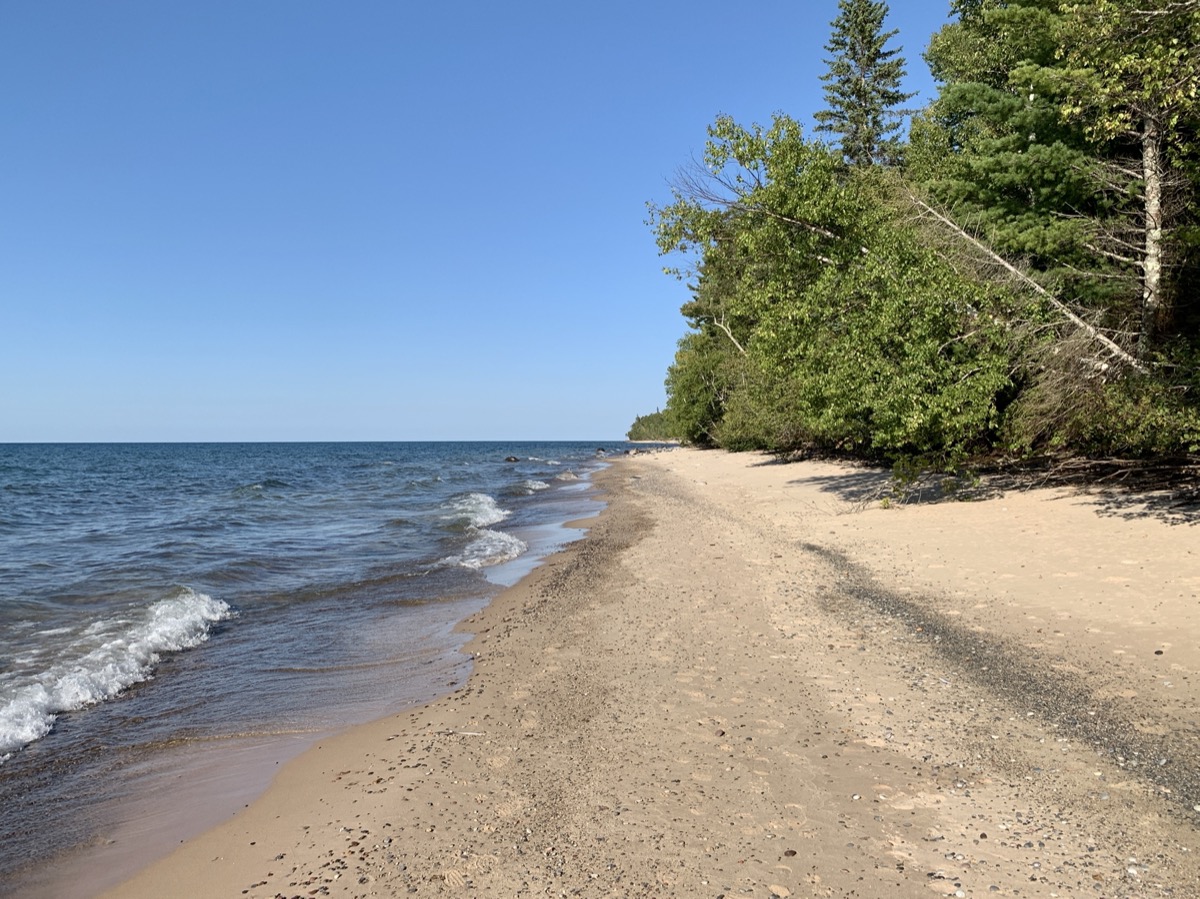
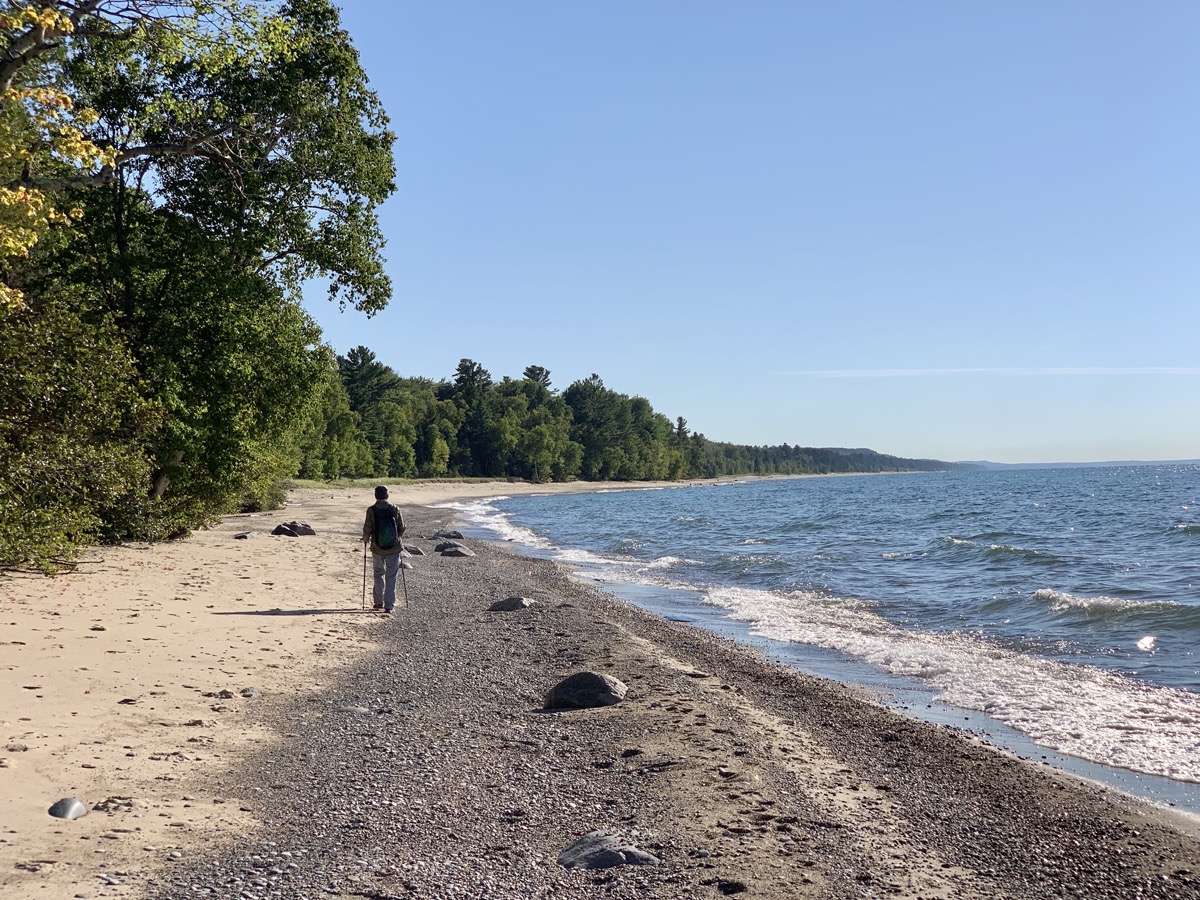
We arrived at small Little Beaver Lake Campground, forested but with sites close to one another, quite late. We had reservation, so it was not a big deal. Next morning we were ready for our first hike: 8.5 miles around Little Beaver Lake and Beaver Lake, down Beaver Creek to Lake Superior, west along Twelvemile Beach towards Spray Falls (though did not make it that far), returning to Little Beaver Lake and our campground. We were learning how to cross-over between the trail running on top of the cliff and sandy beach. And we were adding miles (throughout this entire trip) hiked on North Country Trail, our favorite.

Find Nearby Share Location Get Directions
Close

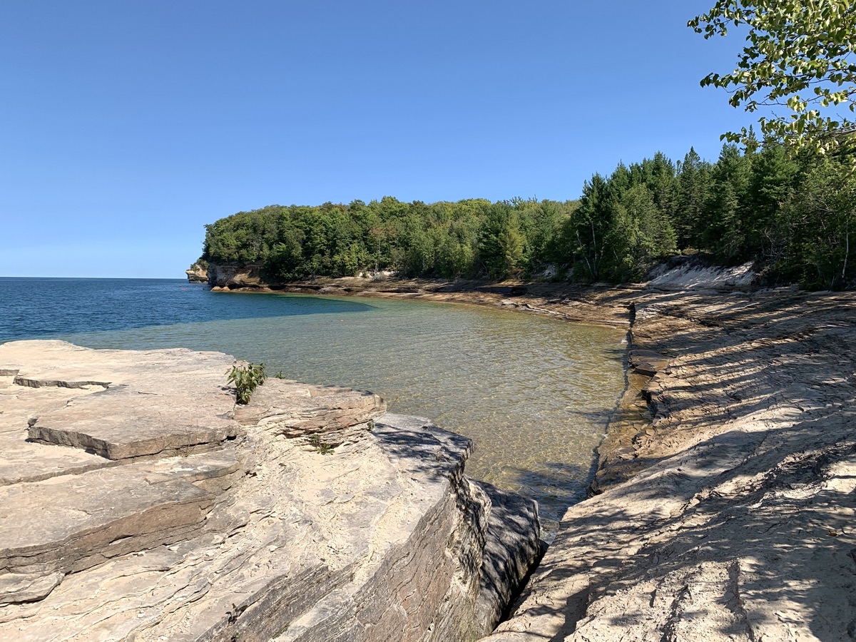
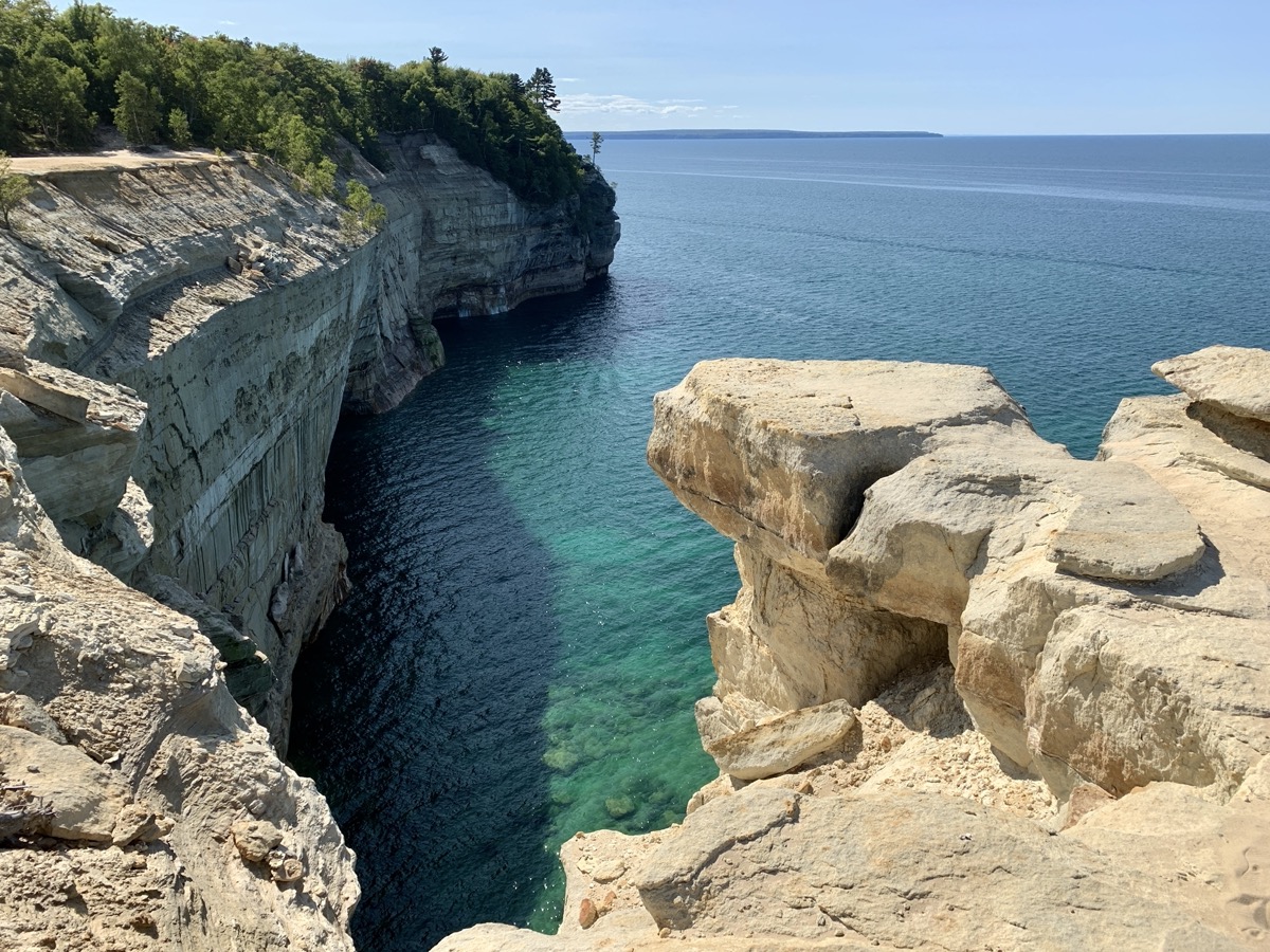
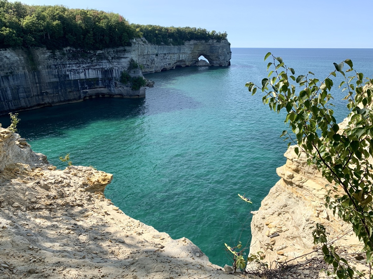
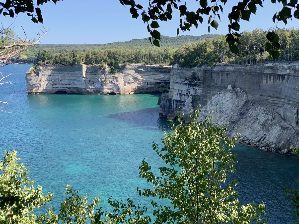
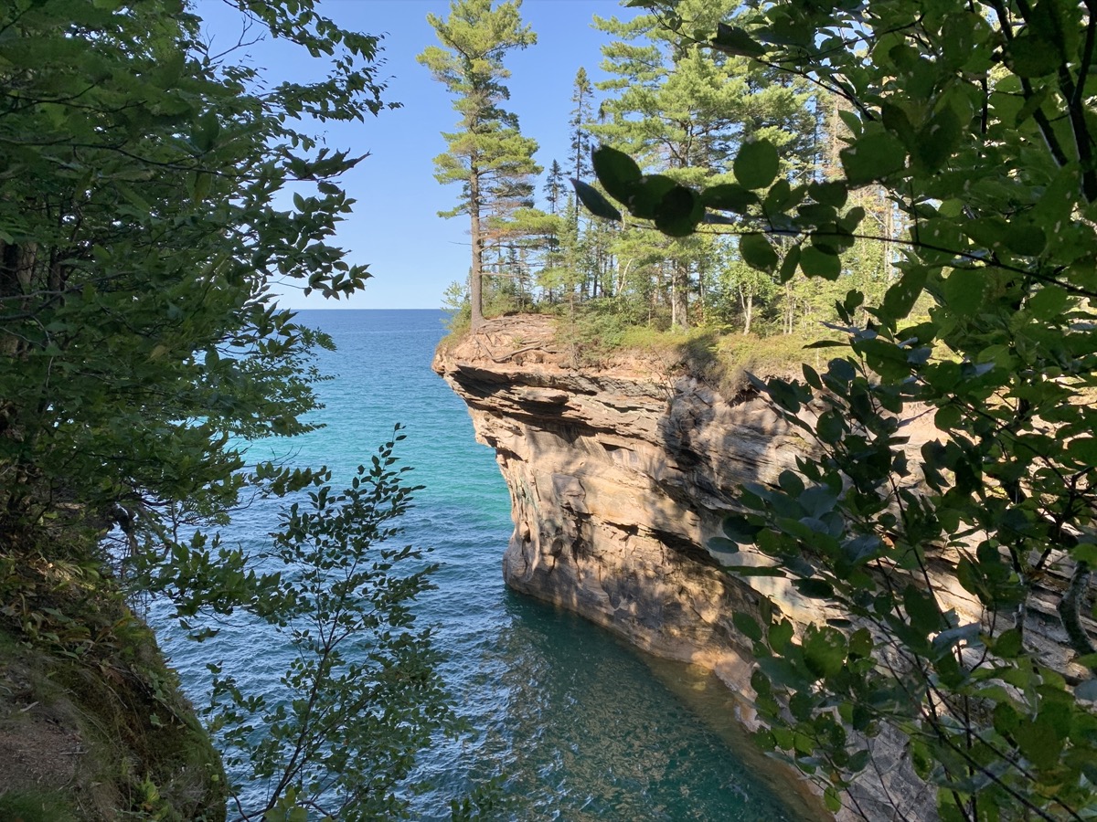
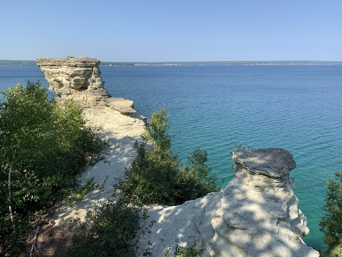
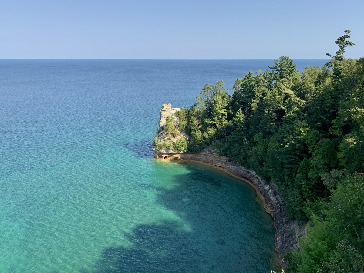
Water in Lake Superior was surprisingly warm and had intense, changing color. Our pictures do not lie – it looked like a tropical sea, not a northern lake. In the evening we moved to Upper Hurricane River Campground for three nights.

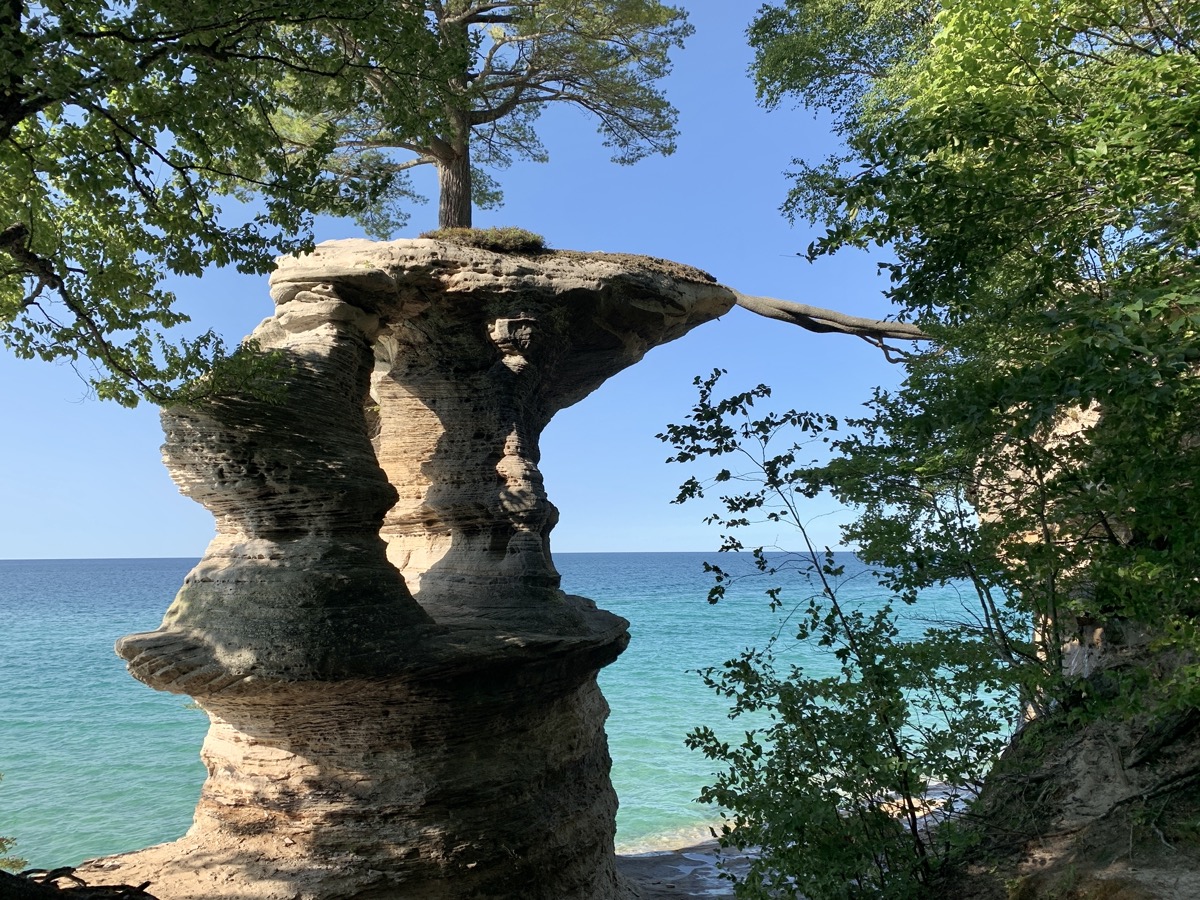
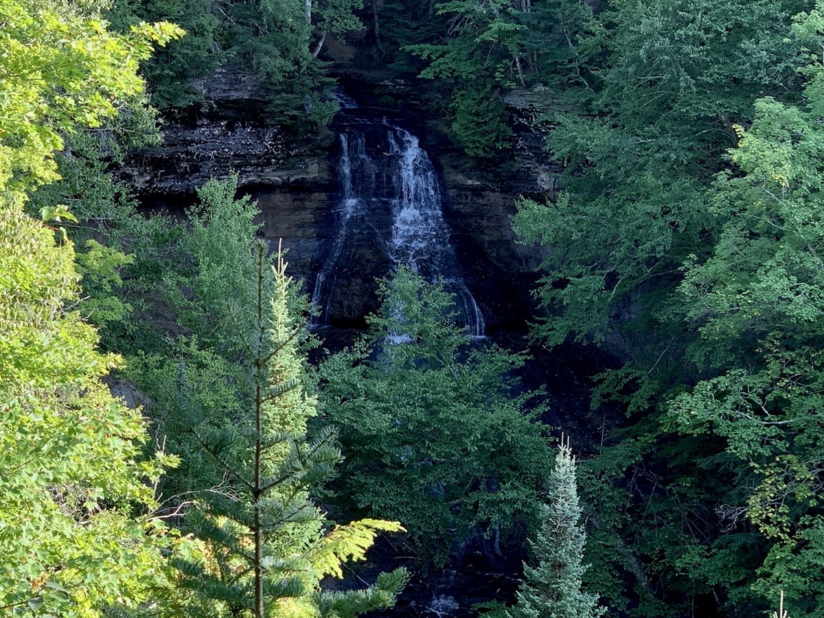
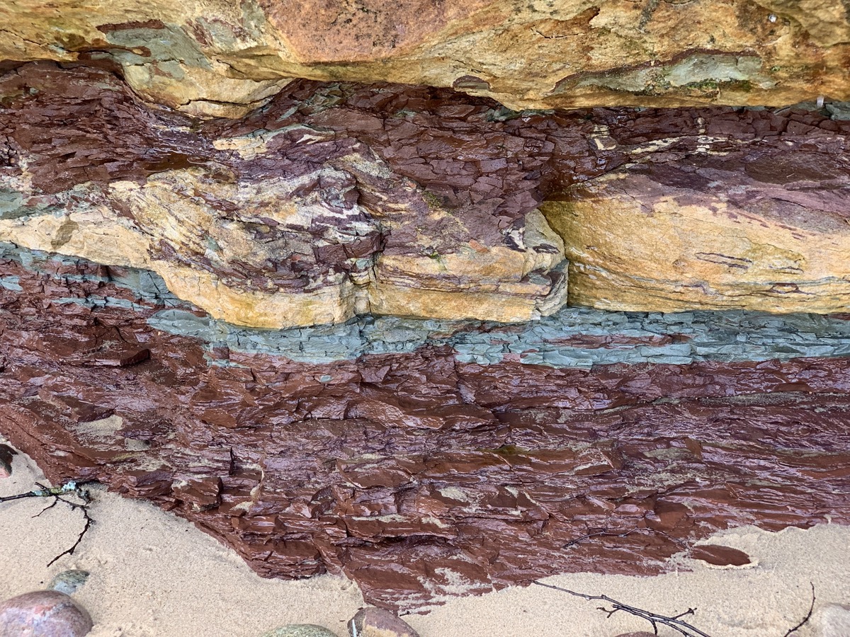
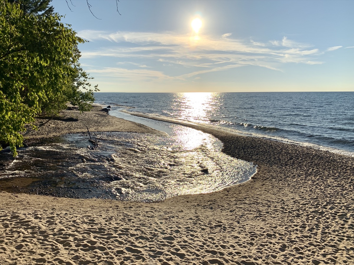
Next morning we drove to Chapel Falls trailhead and walked 10.5-mile loop to Mosquito Falls and Mosquito Beach, Grand Portal Rock, Chapel Beach and Rock, Chapel Falls. Beatiful views of the clifs and turquoise water. Many people, but this was Memorial Day weekend and great weather. On the way back to our campground, we stopped for a short sunset walk on Twelvemile Beach near Lake Superior (Sulivan Creek) Overlook.

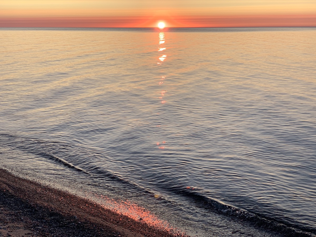
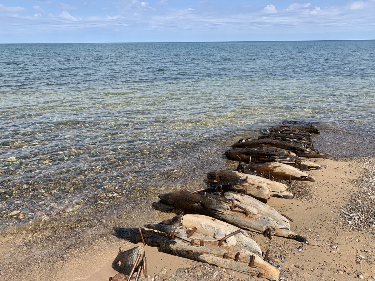
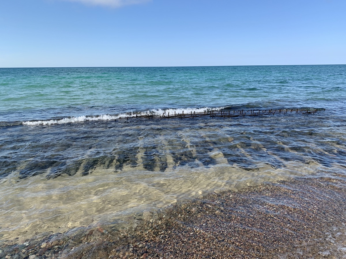
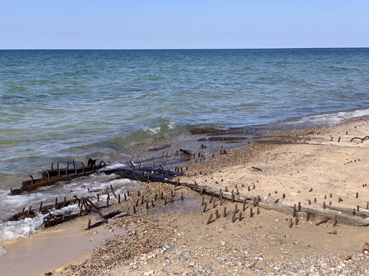
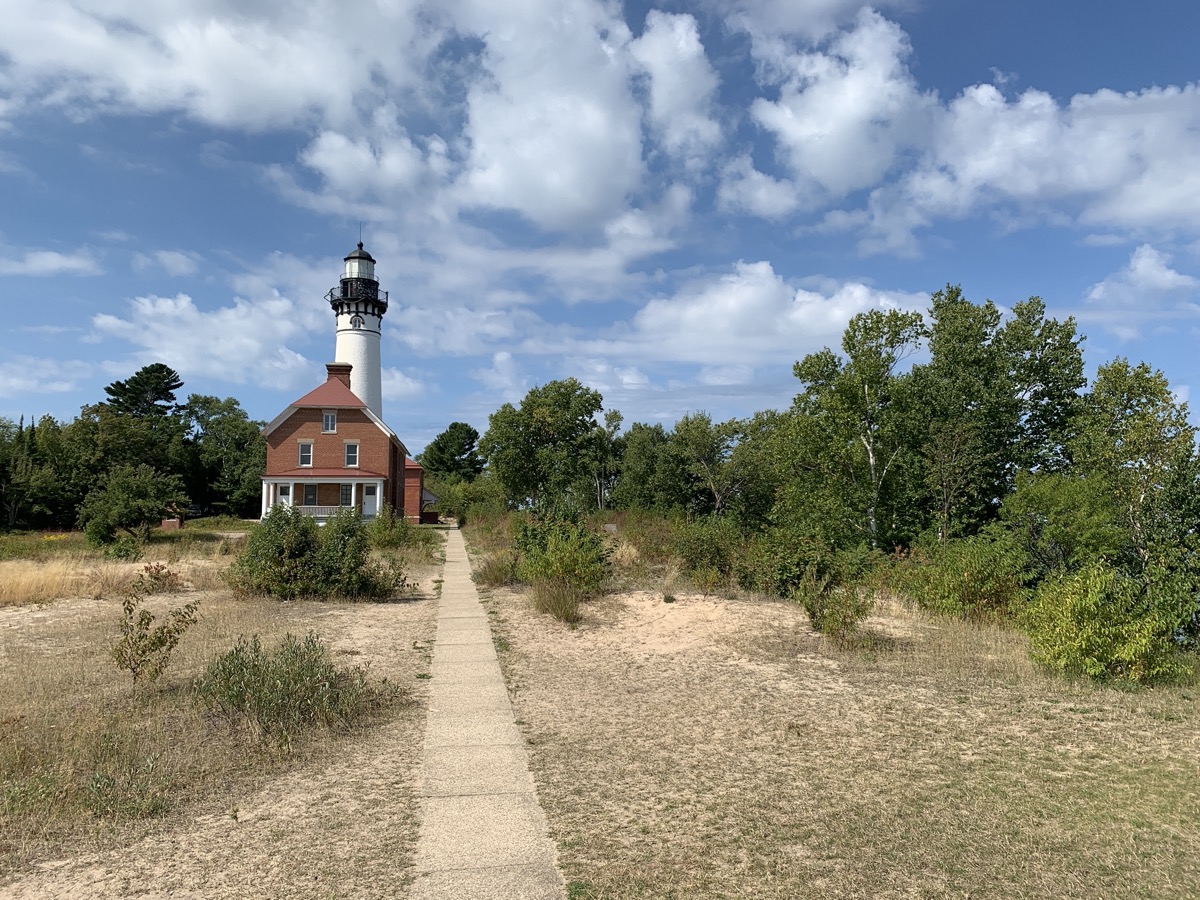
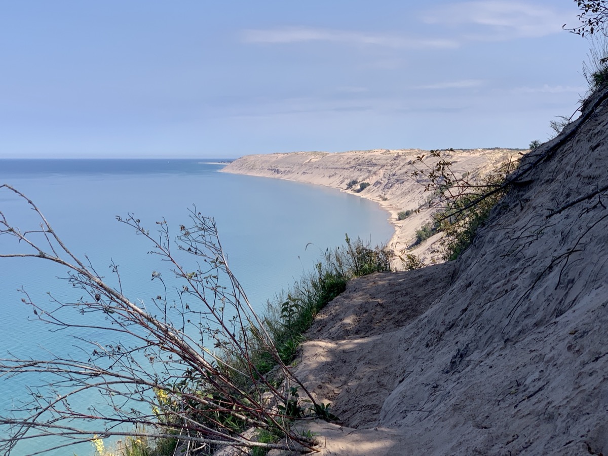
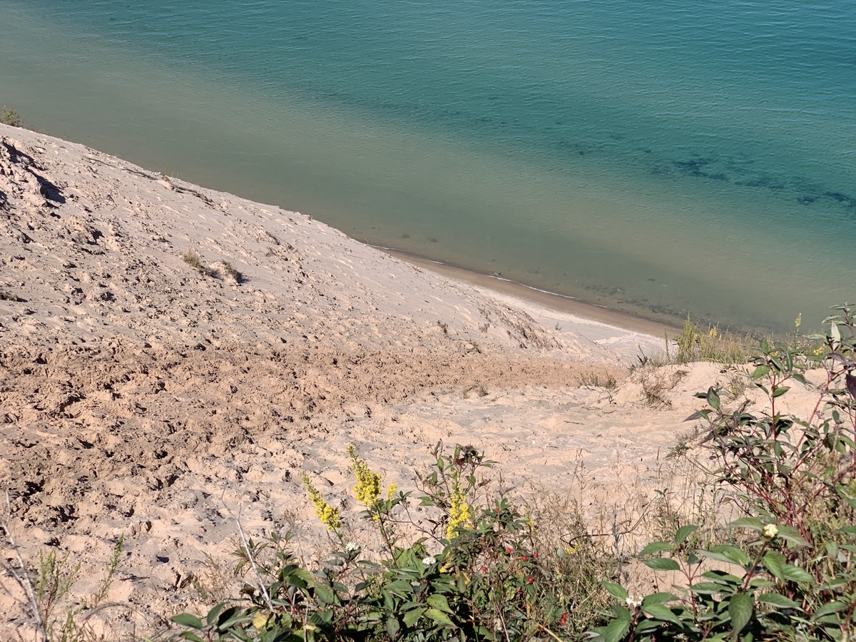
Day four, we drove very short distabce to Huricane River parking lot and walked 9 miles (return) to Au Sable Light Station, investigating ship wrecks clearly visible close to shore, than continued to steep Grand Sable Dunes (log slide point), returning the same way and finishing the day at sunset on the beach near Huricane River outlet. During lunch time at the Sable log slide we discussed extensively rolling down the slide to the lake shore, but did not do it.

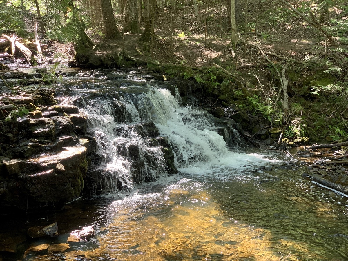
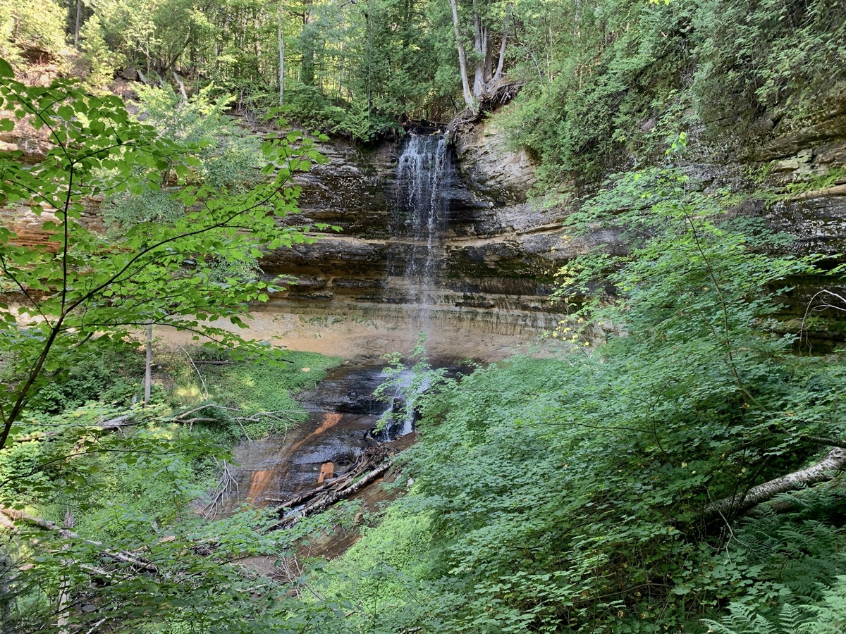
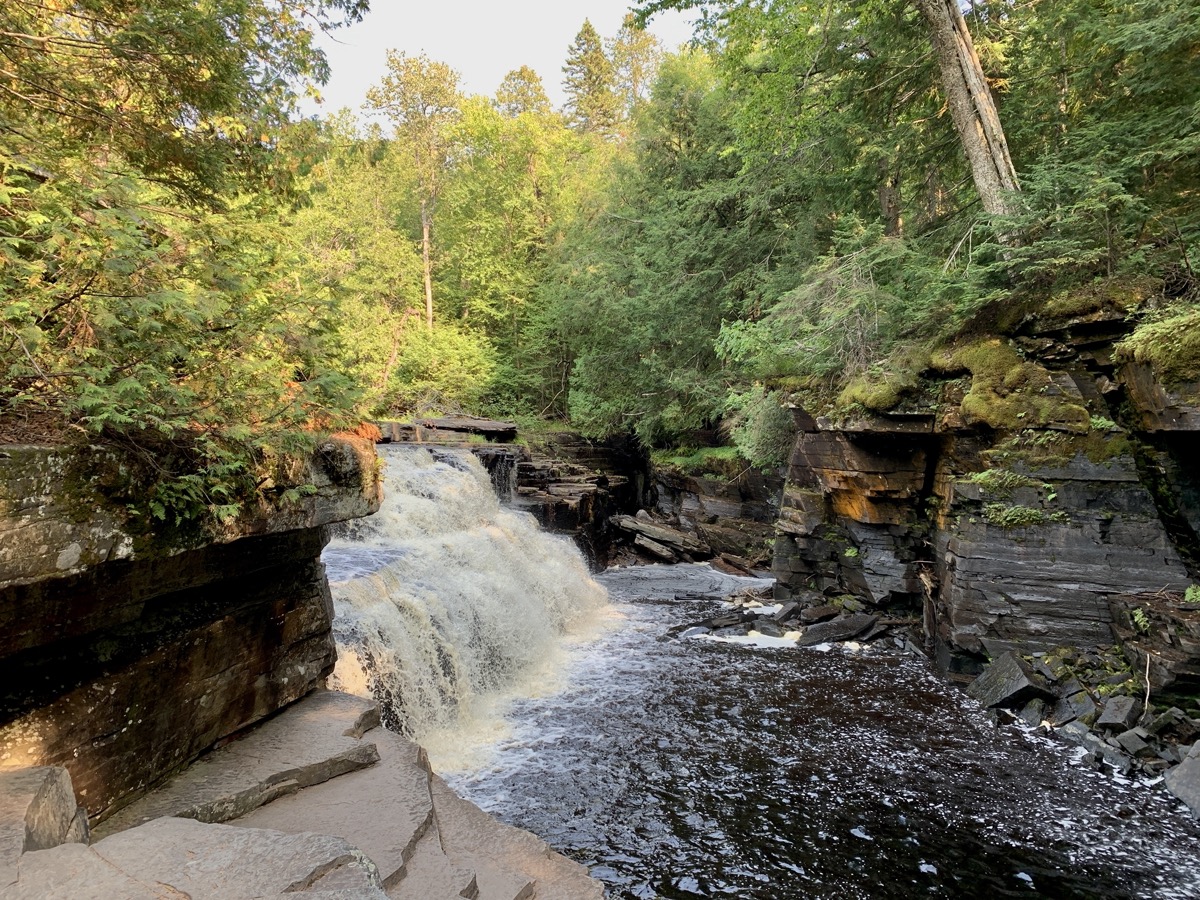
The following day, we drove 230 miles to Porcupine Mountains after visiting Miners Beach and two short breaks on the way to walk to Munsing Falls and Canyon Falls. We enjoyed sunny and mild weather the first five days of the trip and we loved the scenery. It would be nice to backpack the whole lenghth of Pictured Rocks Lakeshore, but we were late to planning and happy to score any campsites at all.

We arrived quite early at ☞ Porcupine Mountains Visitor Center to check-in for one night at Union River Outpost Campground. We had to come back next morning to get backcountry permit, but a bigger problem was brewing: serious rain sweeping through the area the following 24 hours. We spent the evening preping for the multi-day hike, packing and waterproofing our backpacks, eating extra calories and taking extra long shower at Union Bay Campground. The rain came late next morning.

Southwest road trip 2022

We are back from 29-day (May 11-June 8) trip to the Southwest. We drove some 5000 miles (between destinations plus local) and walked/hiked 170 miles. Our Forester performed quite well on dirt roads – it allowed us to visit some more remote wilderness areas (we avoided the temptation to explore interesting roads that required higher clearance). As we visited many of the national parks years ago, this time we focused on hiking and viewing less known sites: Puebloan ruins, narrow canyons, rock formations. We also spent some time at more popular destinations and visited historical/archeological sites. 5-day (49-mile) hike down Buckskin Gulch and Paria River Canyon was the top highlight. We liked Ah-shi-sle-pah Wilderness, Chaco Culture Park and Great Gallery in Horseshoe Canyon, and pretty much everything else.

We finally tested our minimalistic camper (converted Subaru Forester): sleeping in the back is comfortable, but packing all the stuff is quite challenging (rooftop cargo box helps, we need to make some improvements before next long trip to Canada). We stayed at organized campgrounds or car-camped in the wild and from time to time stayed at motels to “reset”. Weather was cooperating: a few really hot days and a few colder nights, nothing extreme, no rain.

Completed itinerary
Day State Destination   Walking Driving
        miles miles
1 IL-MO   Bennett Spring Campground   475
2 TX   Fortress Cliff Campground   632
3 TX Palo Duro SP Mesquite Campground 9 2
4 NM Palo Duro SP Southwest Motel, Grants 5 389
5 NM El Malpais NM El Morro Campground 6 92
6 NM El Morro NM Rio De Las Vacas Campground 5 216
7 NM Chaco Culture NHP Gallo Campground 8 84
8 NM Chaco Culture NHP Gallo Campground 10 0
9 NM Ah-shi-sle-pah Wilderness De-Na-Zin Wilderness camp 8 57
10 NM Bisti/De-na-zin Wilderness Economy Inn Motel, Farmington 13 65
11 UT Hovenweep NM Hovenweep Campground 3 103
12 UT Butler Wash, Mule Canyon Muley Point camp 6 98
13 UY-AZ Valley of the Gods Canyon View Campground 5 105
14 AZ Navajo NM Cliff Dwellers Lodge, Marble Canyon 4 119
15 UT-AZ Wire Pass – Buckskin Gulch camp 1 14 0
16 AZ Paria Canyon camp 2 10 0
17 AZ Paria Canyon camp 3 10 0
18 AZ Paria Canyon camp 4 9 0
19 AZ Paria Canyon – Lees Ferry Lake Powell Stay Airbnb, Page 6 46
20 UT Cottonwood Canyon Cottonwood Canyon camp 7 52
21 UT Burr Trail Rd Capitol Reef NP Deer Creek Campground 5 89
22 UT Headquarters Canyon, Notom Rd Burro Wash camp 4 60
23 UT Horseshoe Canyon Canyonland NP Green River camp 8 103
24 UT Canyonlands NP Island in the Sky Adventure Inn, Moab 6 155
25 UT Canyonlands NP The Needles Needles Campground 6 79
26 UT Canyonlands NP The Needles Needles Campground 12 0
27 UT-CO   Penitente Canyon Campground   289
28 CO-KS   Rodeway Inn, Salina   588
29 KS-IL Chicago     680
Resources

additional resources/links are included in location-specific posts
☞ Road Trip Ryan
☞ Utah GPS Tracks
☞ BLM National Conservation Lands
☞ BLM Visit
☞ David Day Guidebooks
☞ NM Public Lands
☞ UT Land Ownership BLM map
☞ AZ 511
☞ NM roads
☞ Your Hike Guide
☞ Visit Utah
☞ Earth Trekers
☞ Your Hike Guide
☞ Bears Ears Partnership

Southwest video clips

Highlights

Southwest day 24-29: Canyonlands NP and return to Chicago

June 3-8

After breakfast at our best camp of the trip, we slowly made our way to Green River UT (couple of photos in previous post) to resupply. The neighborhood looked familiar – we stopped in town on our way back to Chicago from California in 2021. We arrived at ☞ Island in the Sky District of Canyonlands NP just after noon. Small Willow Flat campground was full (Friday). We decided not to look for camping alternatives, but instead head to Moab at the end of the day (stayed at Adventure Inn). This way we had entire afternoon to check-out a few spots/overlooks: Green River Overlook, Upheaval Dome (short walk), Grand View Point (Joanna walked the rim trail, Piotr took driver’s nap), Mesa Arch (short trail). Views were beautiful but this is the most popular section of the park and the only “crowded” place on our trip. We often looked down at different sections of 100-mile White Rim Road (one rim lower) and wondered, if we could drive on it in our Subaru (?). First section down Shafer Canyon looked OK and was very tempting (next time).

Grand View Point
Mesa Arch

Next morning we drove around to ☞ The Needles District of Canyonlands NP – enjoyed the views on the way, but without stopping to get to the Squaw Flat campground early to reserve a good site for two nights (Saturday and Sunday, we expected many visitors for the weekend). It worked – the campground is large and there were many spots to choose from when we arrived. Our spot was spacious and nice, not too close to neighbours, so we decided to sleep in tent for a change. With campsite in the bag, we were ready for short walks: Pot Hole Trail, Big Spring Canyon Overlook, Slickrock Trail, Roadside Ruin Trail. Despite the weekend, Needles District was not too crowded, far less so than Island in the Sky the day before. It looked like more people come here for longer hikes and spread out through quite large area.

Our last full hiking day of the trip: 12-mile Chesler Park/Joint Trail loop. We drove short distance from our camp to Elephant Hill trailhead, followed easy trail up on open rocky terrain passing across some impressive looking rocks on the way. Chesler Park is a large meadow that sits on small plateau with rock “monuments” standing all around. At some point we descended a bit from the plateau (one “level ” down towards Colorado River) through a maze of slots in sandstone to dry wash only to go back up different way to close the loop and return to the trailhead. It was quite hot in Devils Kitchen. Yes, some of the standing rocks look like “needles”.

Canyonlands is vast with open vistas all the way to the horizon, the Horseshoe Canyon quite far away (north-west) on the other side of Green and Colorado Rivers. We had good sunny weather, quite warm and just a few drops of rain one night. In the short time we saw the main features (Piotr visited Canyonlands briefly years ago), perhaps could come back for backcountry hiking in Maze district or camping along White Rim Road.

We stopped at Newspaper Rock on the way out of Canyonlands, filled-up the tank and started serious driving back home. We made it to Colorado Penitente Canyon Campgroud (disappointing) on the first day, Salina KS and Chicago over the following two days. Somewhere after Colorado Springs a big storm started gathering on the horizon behind us and followed us (literally) for some 400 miles as we were driving east. We could not stop or slow down without it catching up with us quickly. Piotr did not want to waste time waiting it out and we were a bit afraid of driving in strong wind with the cargo box on the roof. Wind and heavy rain did catch up with us shortly after we checked in to Roadway Inn in Salina, but at that time severe weather and shelter in place warnings were just cancelled. Easy (boring) driving the rest of the way.

Southwest day 23: Horseshoe Canyon (Canyonlands NP)

June 2

Change of focus: our main objective for the day is to explore rock art in ☞ Horseshoe Canyon – different than other sites in the Southwest as it contains mostly pictographs rather than petroglyphs. It is 7-mile hike 240 m down to the canyon floor with yellow and red rocks around, hot and desert-like (there was same water and green vegetation in the creek). The day started by quick drive on Hwy 24 past Hanksville followed by slow ride east on unpaved road to the trailhead. The road was in good condition, but the area had good remote feel. We started descending slowly into the canyon on trail which runs in part on old jeep road. There were a few signs of past human activity (water tank and remains of old rancho). As well as some dinosaur prints. Just when we started walking towards first rock art site, we met volunteer ranger on patrol. He showed us around and answered many questions – we enjoyed our private tour. We saw only one group of school children in the canyon, nobody else the whole day. We spent entire afternoon hiking, checking out the galleries with the ranger and then on our own. The Great Gallery is the most spectacular, with life-size and larger figures. Rock paintings are from different times, 2000 BC to 500 AD, but some artifacts found around were from 11000 years ago. On the way back, we stopped at Alcove Gallery. Around 7 pm we started heading north on Lower San Rafael Rd for 9 miles and then 5 miles east on dirt road to amazing wild campsite on high rim of Green River Labyrinth Canyon (found by Piotr studying maps and satellite images before the trip). Beautiful sunset, no wind, no people anywhere. Perfect end to a beautiful day. And then relaxing breakfast before heading north on Lower San Rafael Rd to Green River on the way to Canyonlands NP.

error: