Day 62-65: Root Glacier-Wrangell St.Elias NP

August 14-17

Day 62. Finished packing our backpacks after breakfast and drove to Kennicott pedestrian bridge. We then left our car on nearby parking lot. Crossed the bridge, took shuttle to McCarthy Convenience Store and another one to Kennecott Visitor Center (as we did before). After conferring with rangers and lunch at Meatza Wagon we started easy walk up Root Glacier Trail. Considered a few camp sites and settled at a somewhat secluded/hidden between trees spot off Erie Mine Trail (on short connector between the two trails in Jumbo Creek camping area). We were close to trails, food lockers and pit toilet, and on top of lateral moraine with views down on the glaciers. We wasted no time and walked down to the ice’s edge to check access point before planned longer ice walking following day. The trail goes down steeply into the “ditch” which 100 years ago was filled with ice. We watched for a moment few people still on glacier. No problem.

The mostly “white” (exposed faster flowing ice) Root Glacier closer to us merges with and disappears underneath larger “dirty” (ice covered with layer of small rocks and dirt) Kennicott Glacier coming from behind small mountain ridge. Kennicott Glacier is 500-1000 m thick (estimate ?). Both glaciers are part of the same system coming down from ice field at the base of Mt Blackburn (4966 masl) and nearby peaks. Cracking sound (ice) can be heard frequently, sometimes quite loud.

Day 63. Micro-spikes on and walking sticks in hands, we explored the glacier for several hours, both the “white” and “dirty” parts. We adjusted to walking on ice quite quickly, meandered around bigger dips and cracks in ice, pools of standing water and small streams. We crossed the first “white” arm, climbed-up on “dirty” part in the middle and walked a bit on the other arm. Joanna walked further, but didn’t cross the ice all the way. Walking on the ice in warm sun is relaxing and does not feel overwhelming, but one never forgets how big the glacier is. Small rocks may look like frozen in a clear puddle, but ice underneath can be hundreds meters deep. Glacier is not silent: ice is cracking and small water streams rush somewhere, wind is sweeping down the mountains (rather quiet when we were there).

When we approached our camp, we saw black bear walking down a small hill 50-100 m away. We made some noise, but it stoically walked away towards other campsites. Shortly we heard horns sounding there. No danger to us, even though it for sure knew about food in lockers. Plenty of sweet berries to eat. Food lockers (worked also as tables) were good place to cook meals and meet other hikers. Open view on glacier. Quite far from tents. Joanna cooked, Piotr watched and listened to surrounding bushes.

Day 64. Short, lazy walk on the lateral moraine to see Root Glacier from higher above. Looking down one realizes how much ice is gone. The trail runs on old Erie Mine Rd (used to bring ore down), but we were too relaxed to hike up high to the mine itself. Many signs on the trail of bears feasting on berries. It was foggy weather with occasional drizzle. We walked to the big wash-out (Piotr refused to search for possible by-pass) and returned to camp. Joanna collected wild mushrooms for dinner. With no enticing camping options in McCarthy, we decided to stay another night and walk down next morning.

Day 65. On the way out we took to the air to get a good look of Wrangell Mountains and glaciers. Plenty to see on just 70 min loop around Mt Blackburn area. After walking down from Root Glacier we had barely had enough time for lunch at Meatza Wagon and shuttle ride to McCarthy airport. We flew with Wrangell Mountain Air arranged by St. Elias Alpine Guides. Pilot/guide, us and two other tourists in a 6-seater. We were lucky again to make the arrangement at last moment. Perfect weather. From airplane we could see where glaciers start on high peaks and ice fields, and then icefalls, glacier valleys, lakes and rivers. Hard to believe we walked on one of those glacier tongues.

The original plan was to now go back to Canada and visit Kluane NP, but we decided to spend a few more days exploring Wrangell Mts, this time from Nabesna Road. Two days to get there. We had enough time to drive back on McCarthy Rd to Gilahina Trestle. Camping spots at the bottom were occupied and/or not too interesting, but we noticed a little earlier small path going into the woods – railway tracks leading to the trestle used to run there. Great, quiet camping spot and history in sight.

Day 58-61: Valdez-Chitina-Kennecott-Wrangell-St. Elias NP

August 10-13

Day 58. 
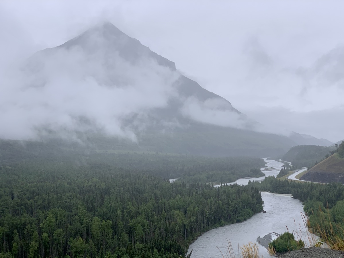
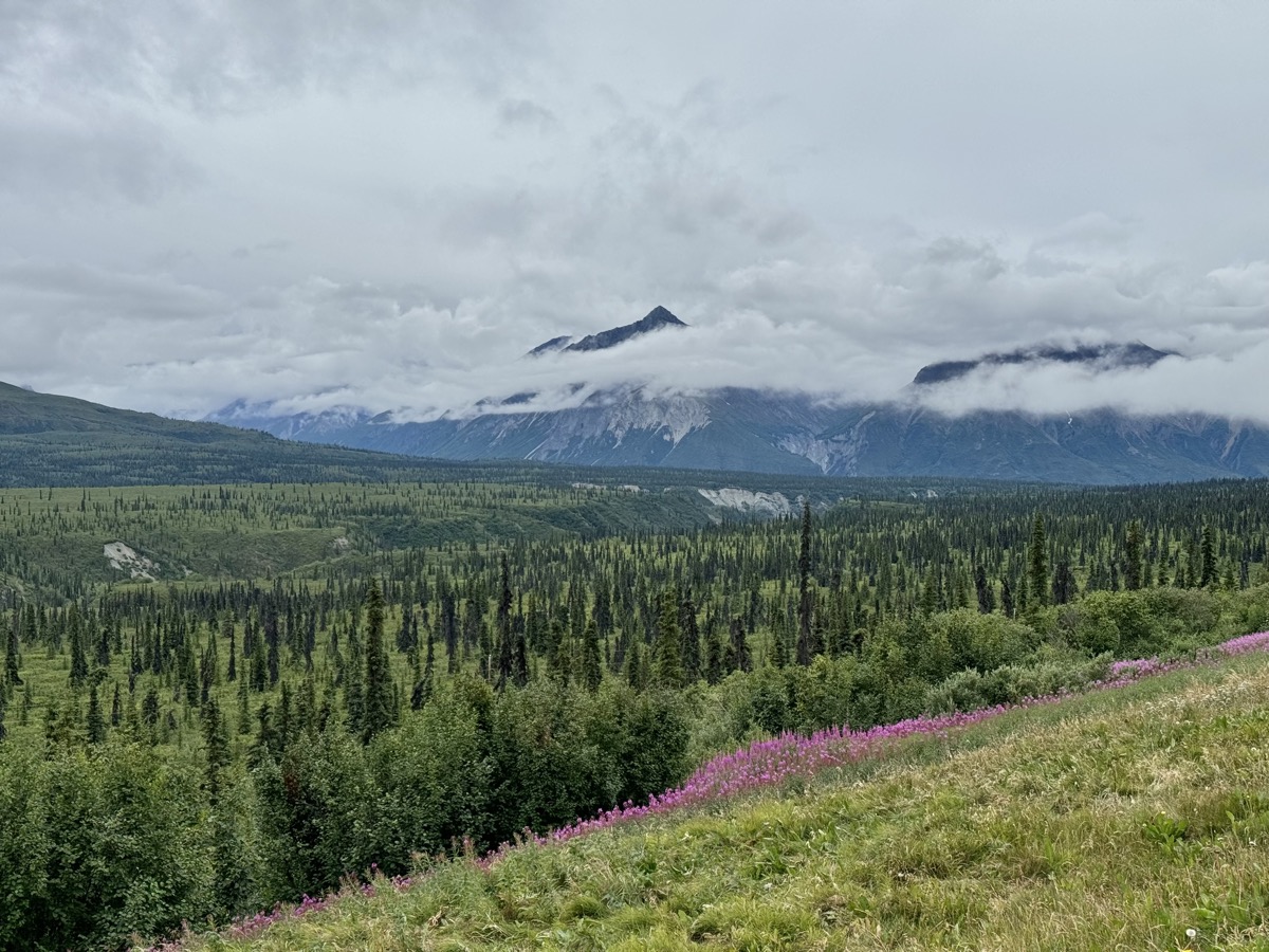
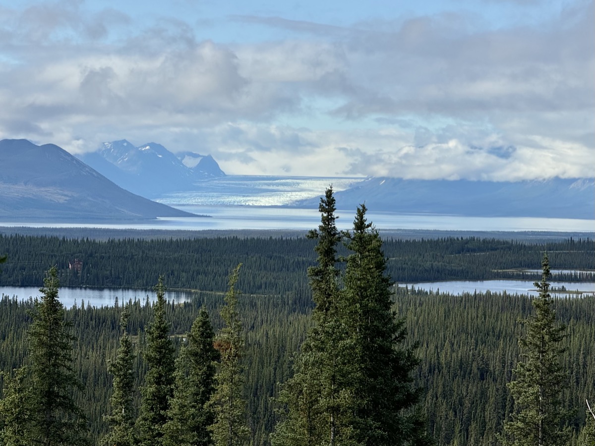
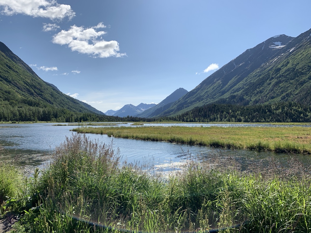
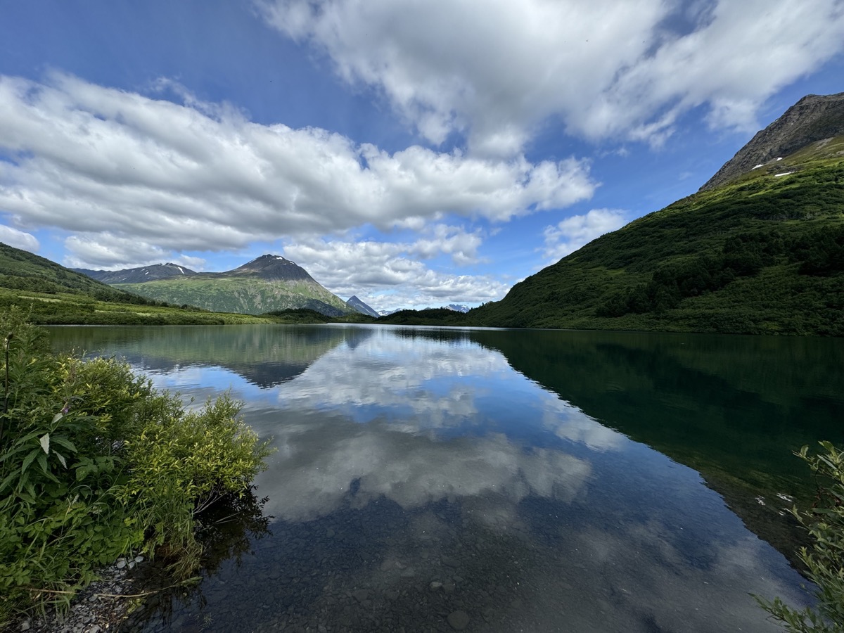
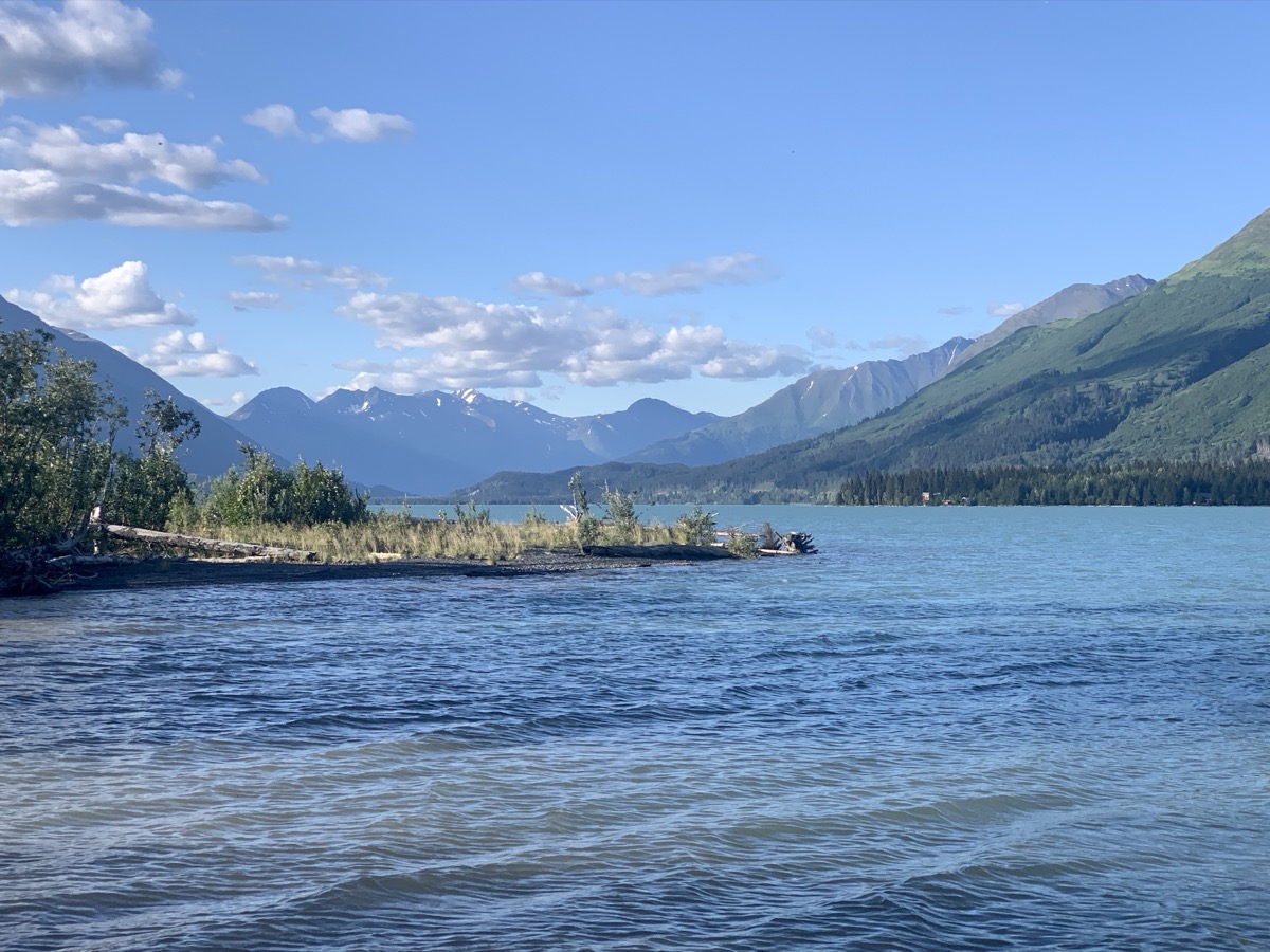
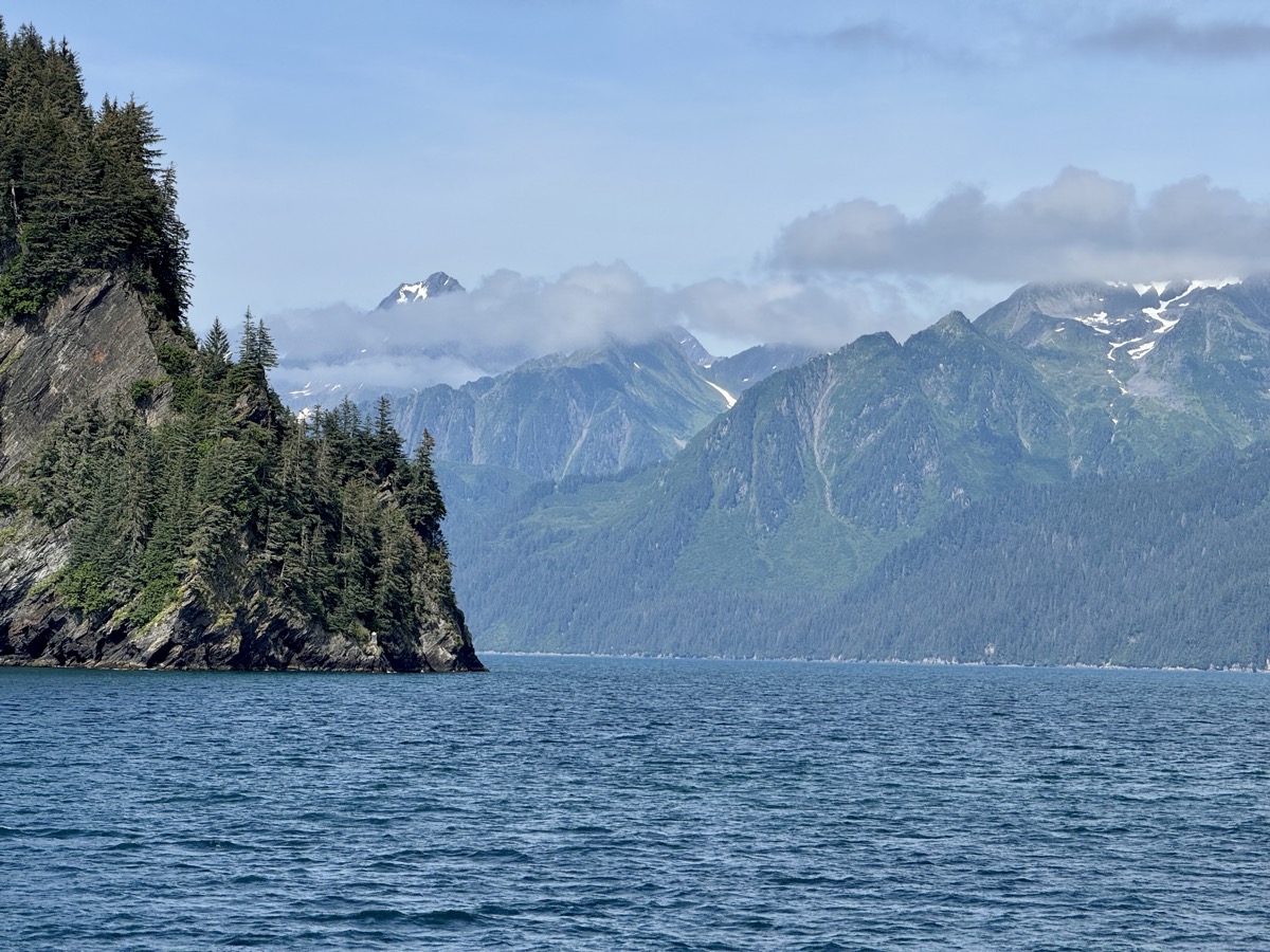
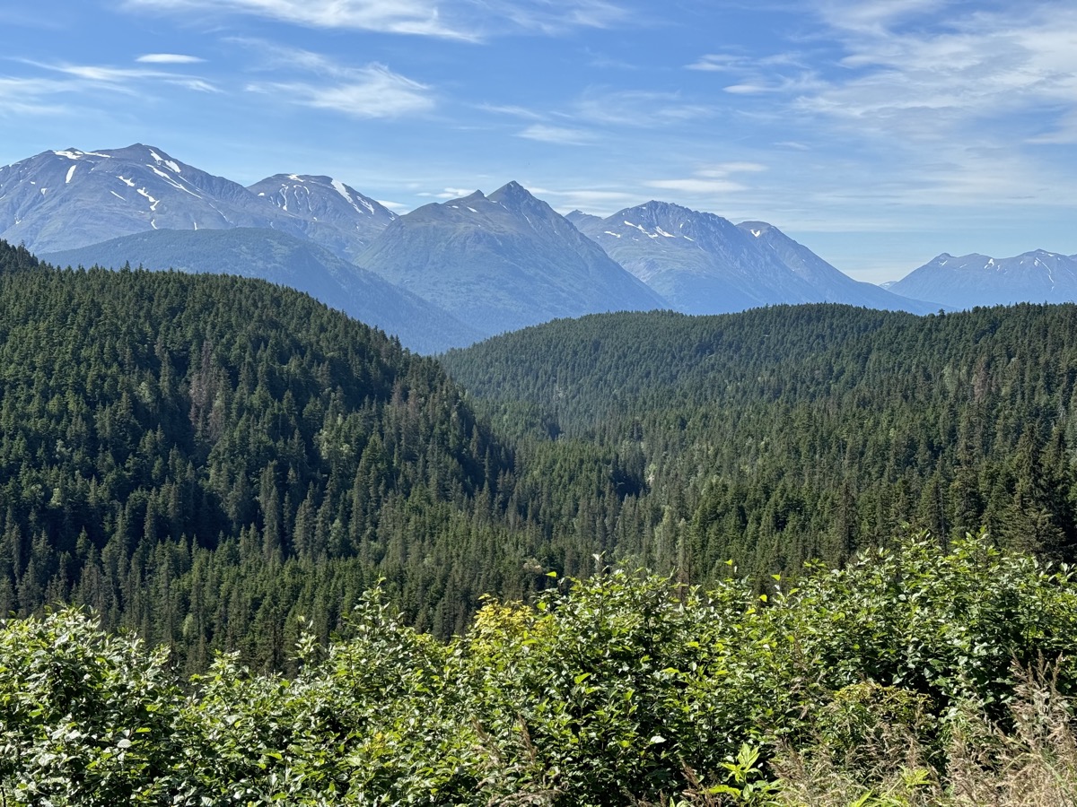
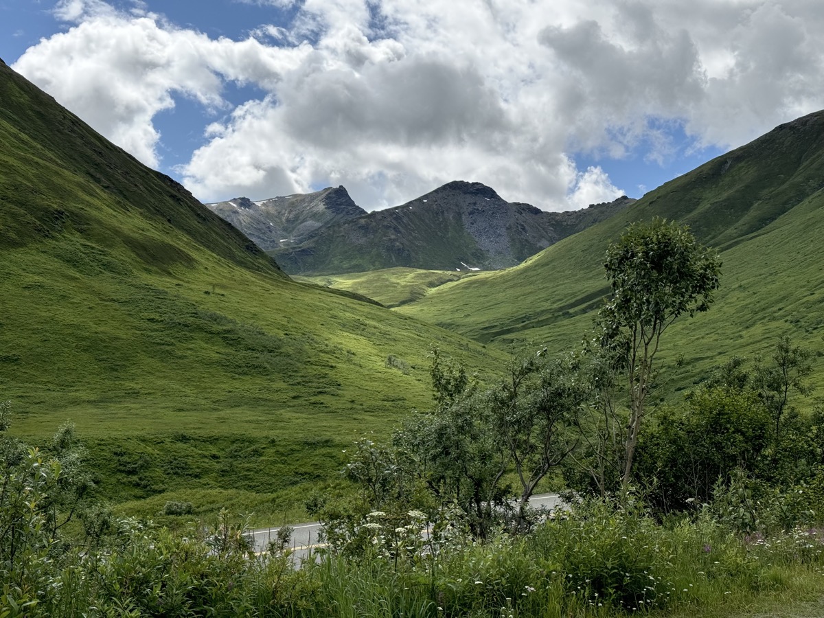
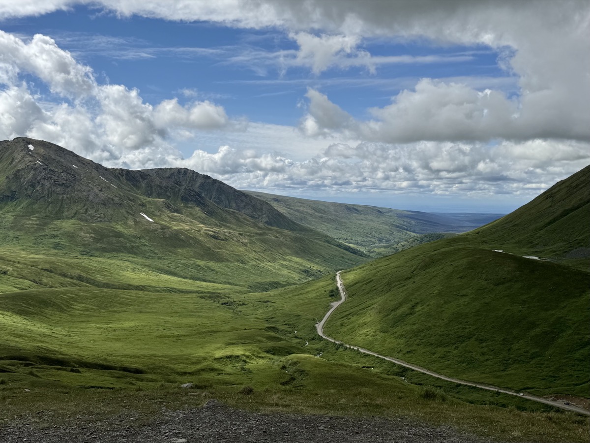
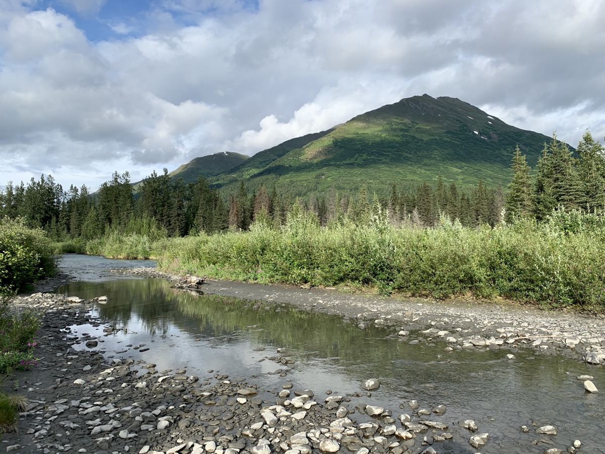
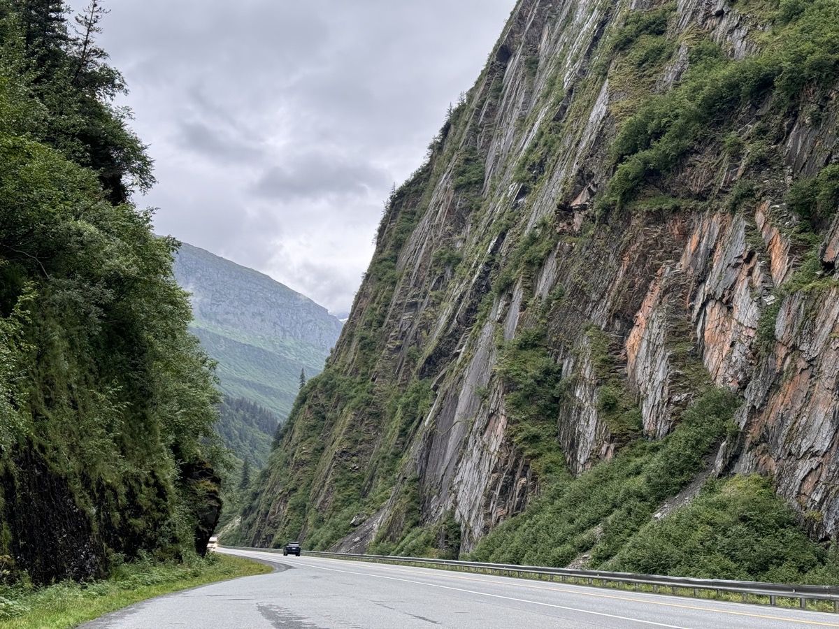
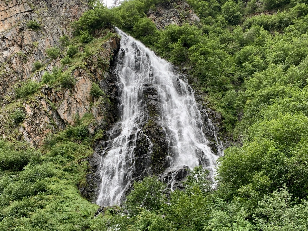
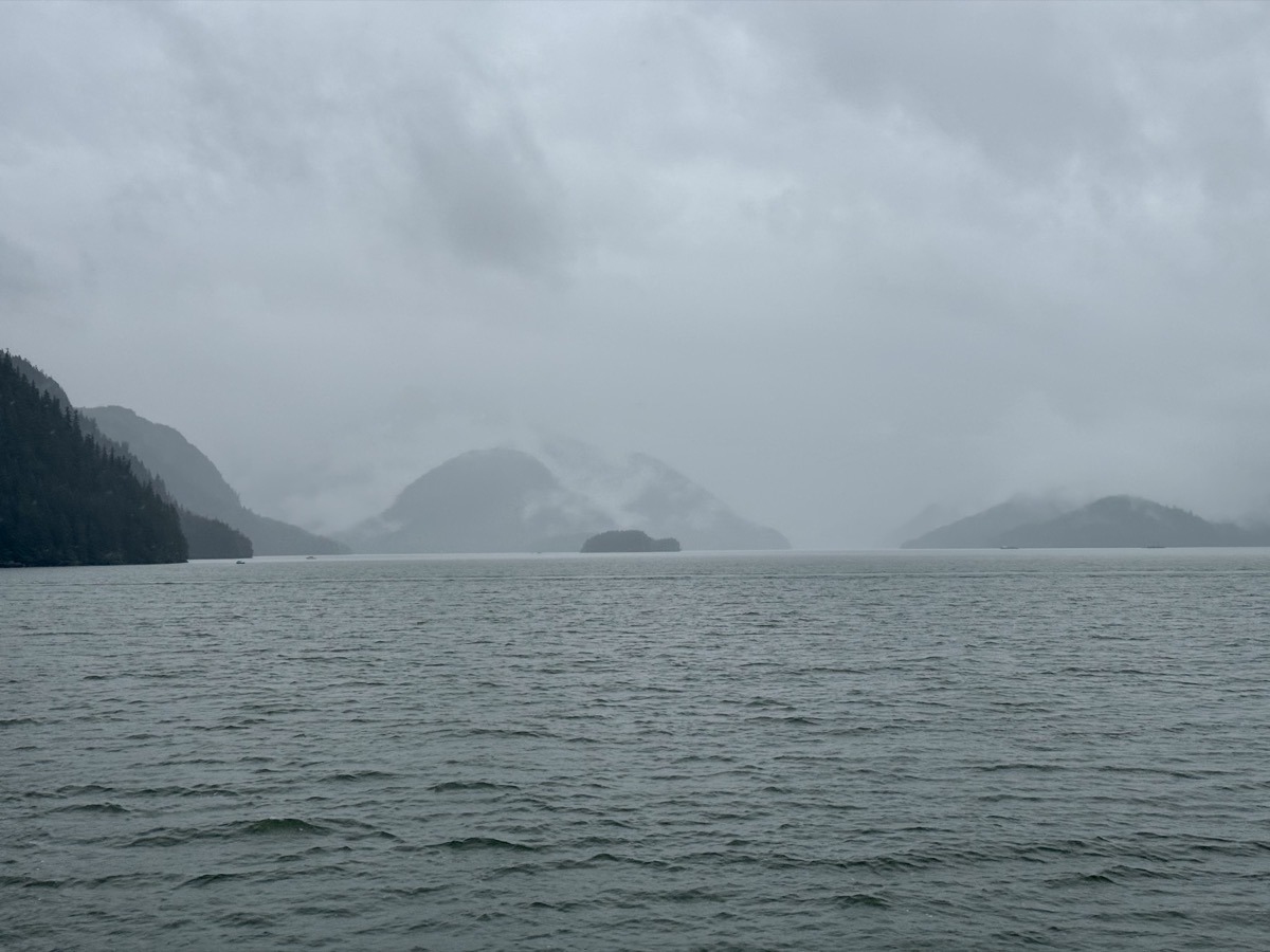
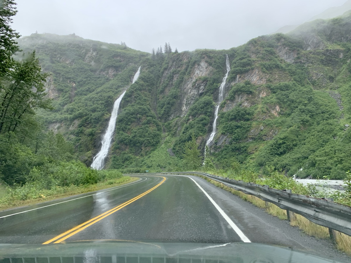
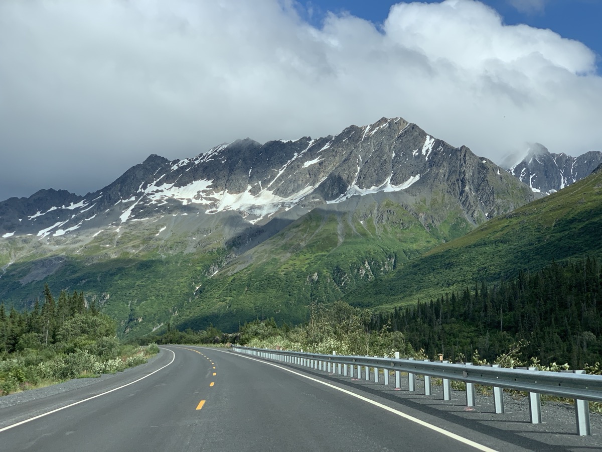
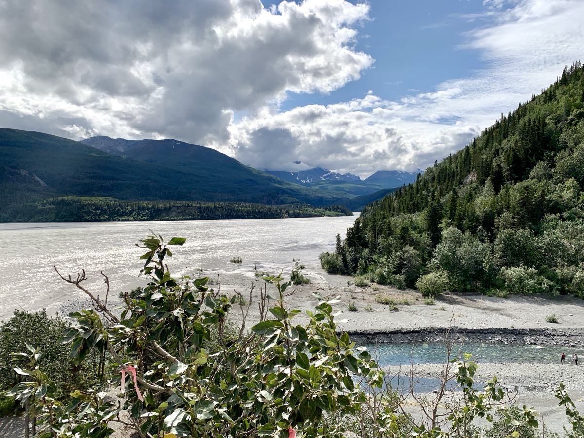
We started the day driving on Richardson Hwy along Lowe Lakes and River, passing Bridal Veil Falls and Horsetail Falls. First stop in Valdez was at Crook Creek Information Center. We visited all these places again a day later on the way back. The weather was still fine, cloudy but no constant rain. 
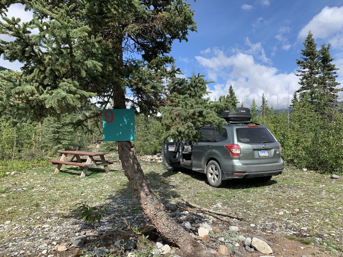
We knew of possible accomodation problems (weekend and some big event in town). There was nothing available in reasonably priced motels. By noon we made it to Stan Stephens Glacier & Wildlife Cruises office and booked 6-hour afternoon trip to Columbia Glacier. We were quite happy with this lucky arrangement made at very last moment. We had just enough time to go to Valdez Glacier Campground to reserve a site. By 2 PM we were on the boat heading out to sea.

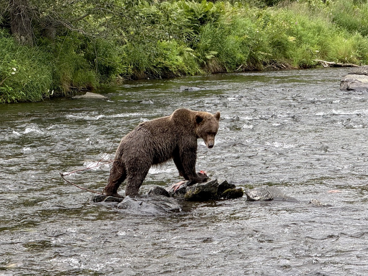
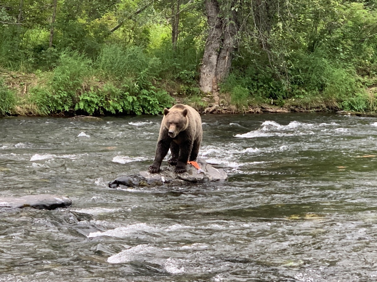
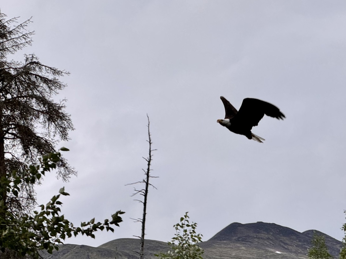
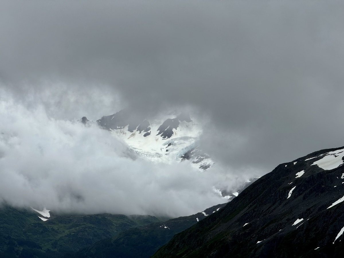
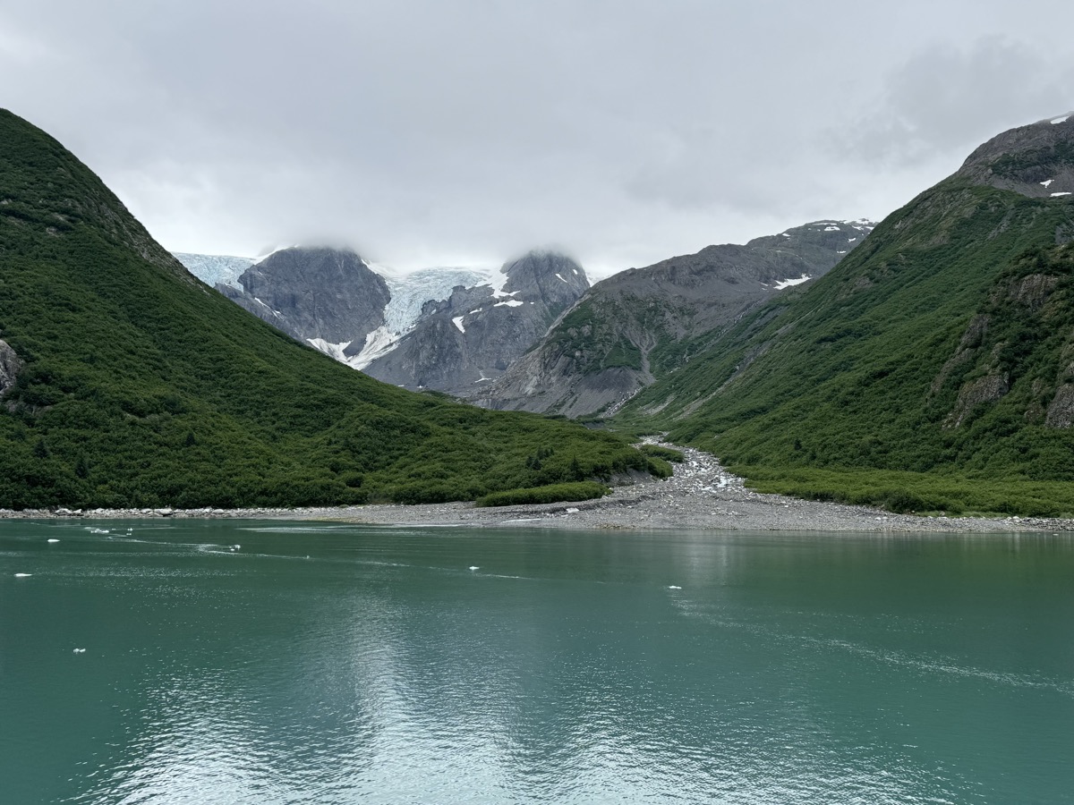
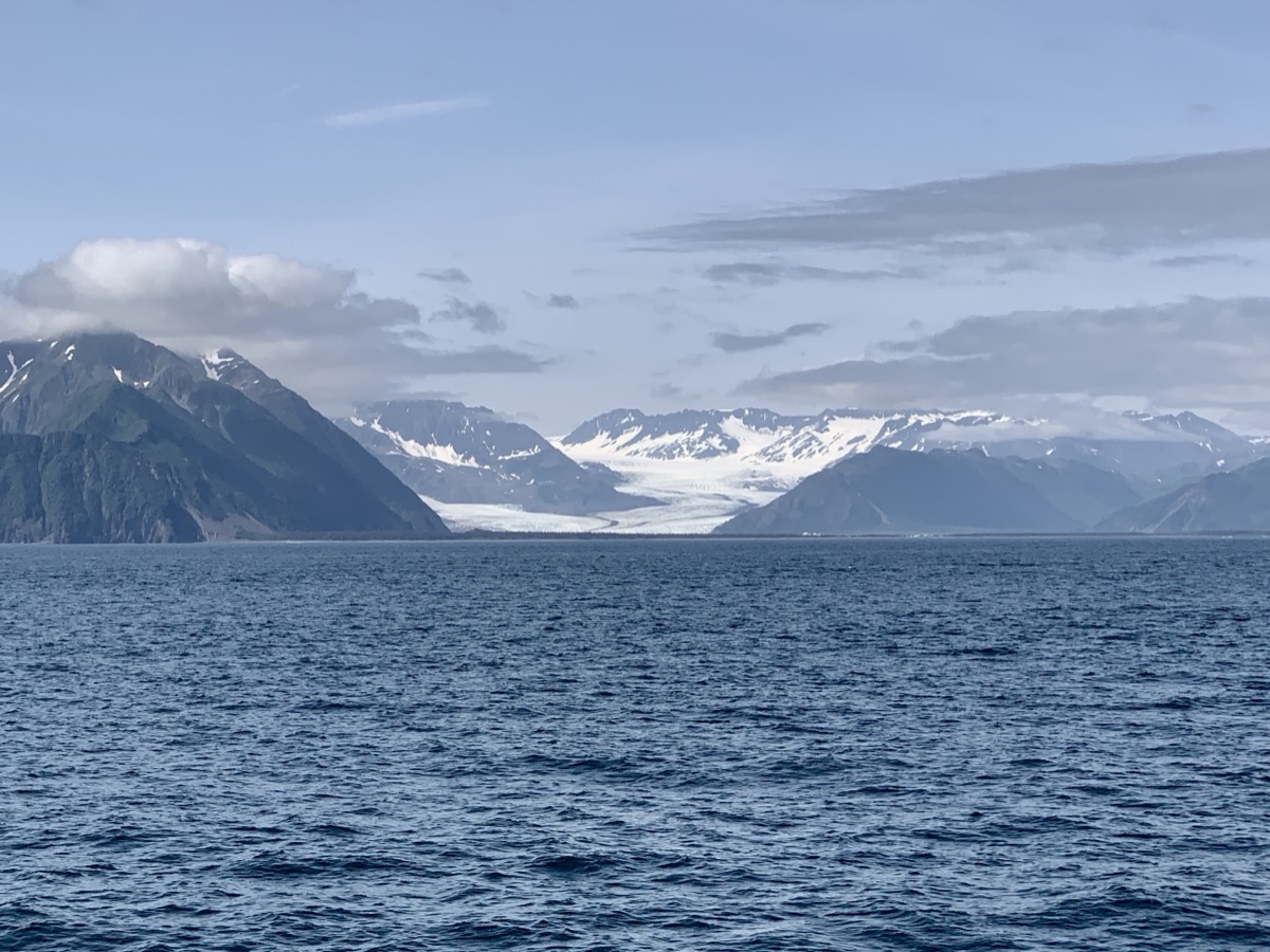
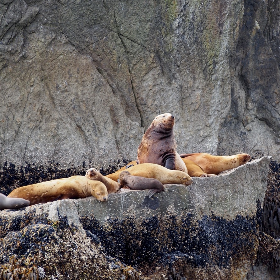
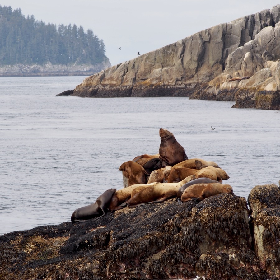
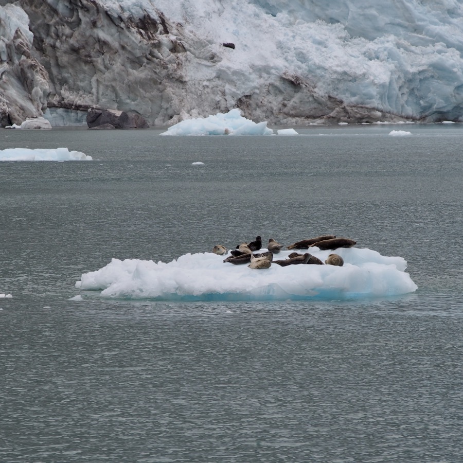
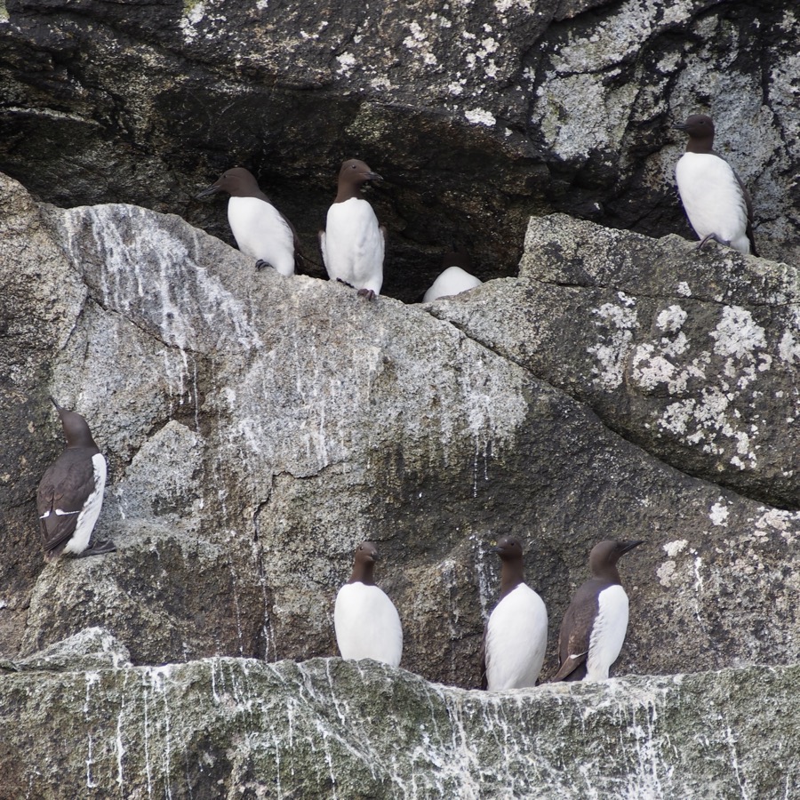
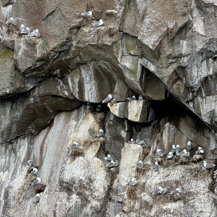
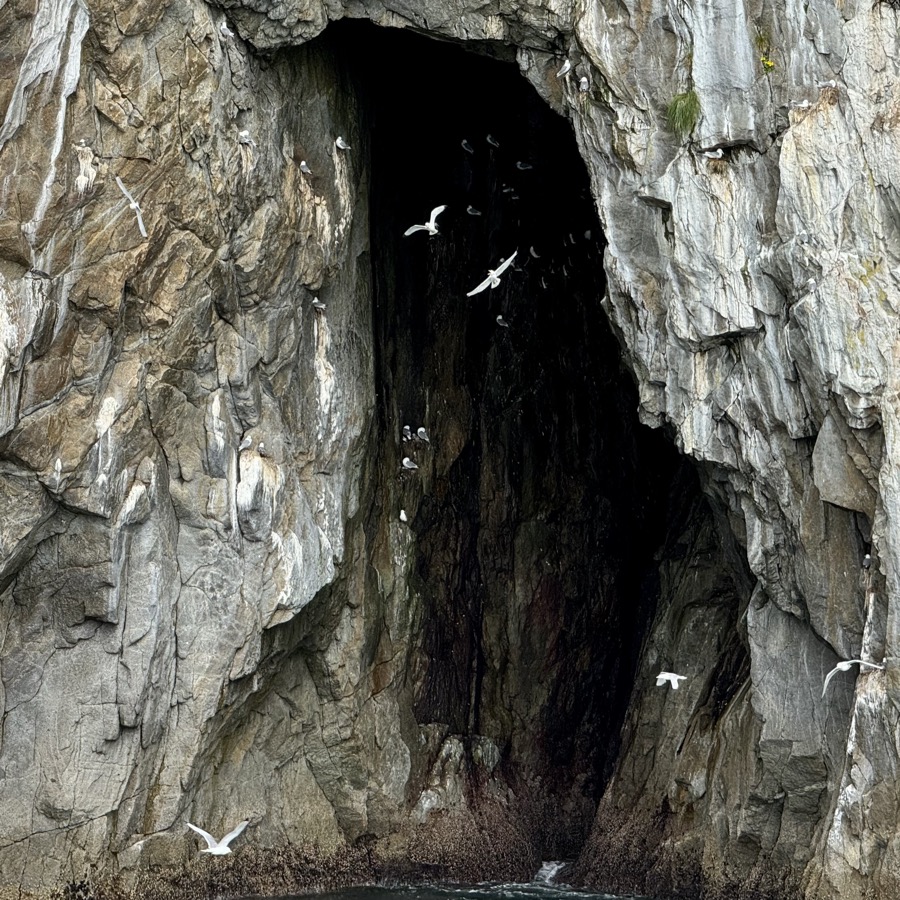
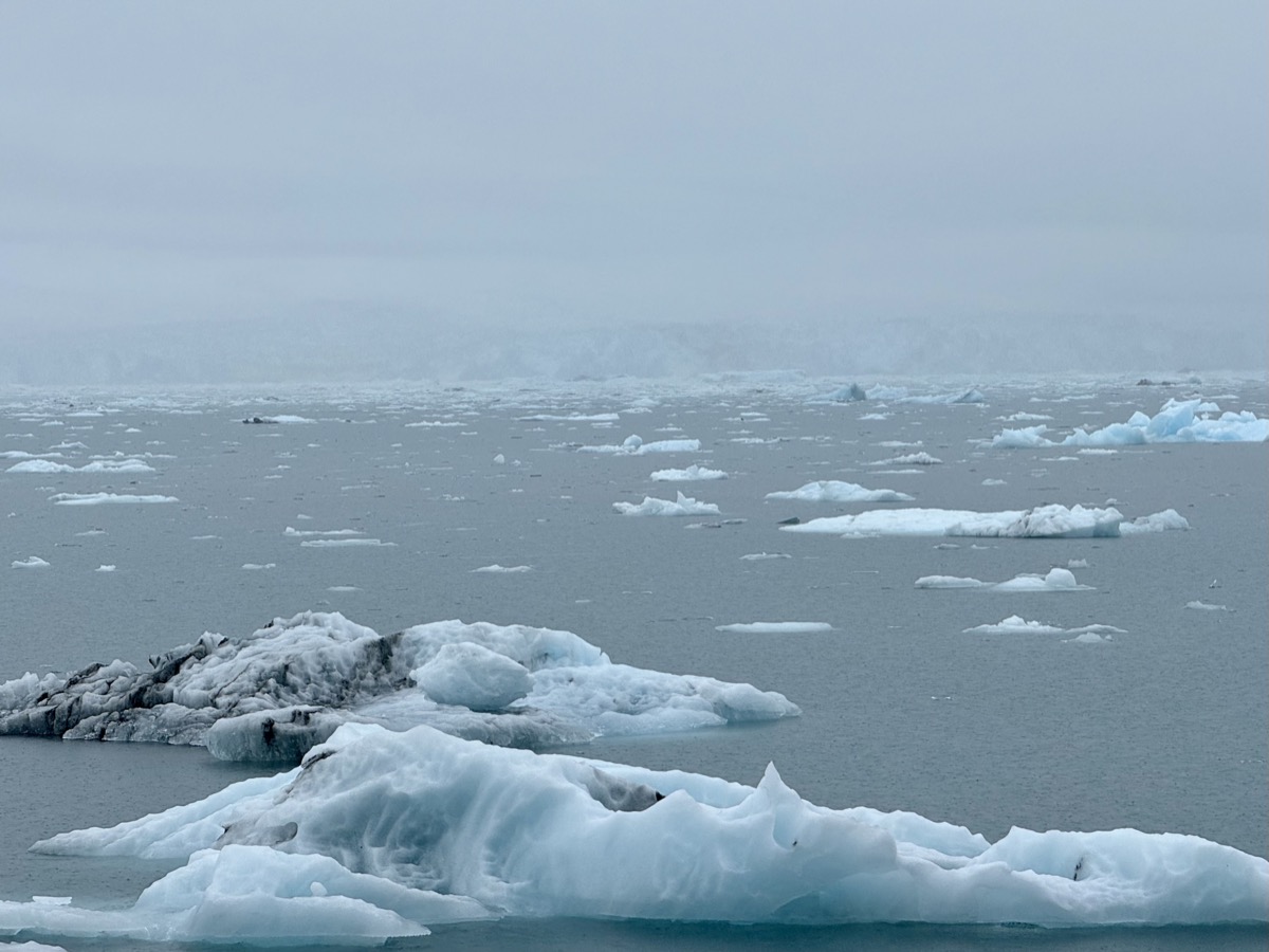
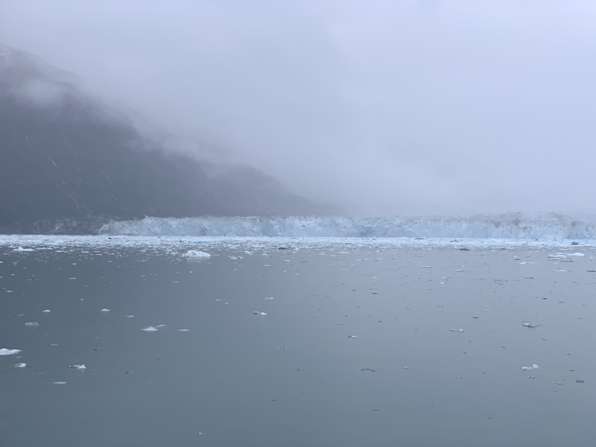
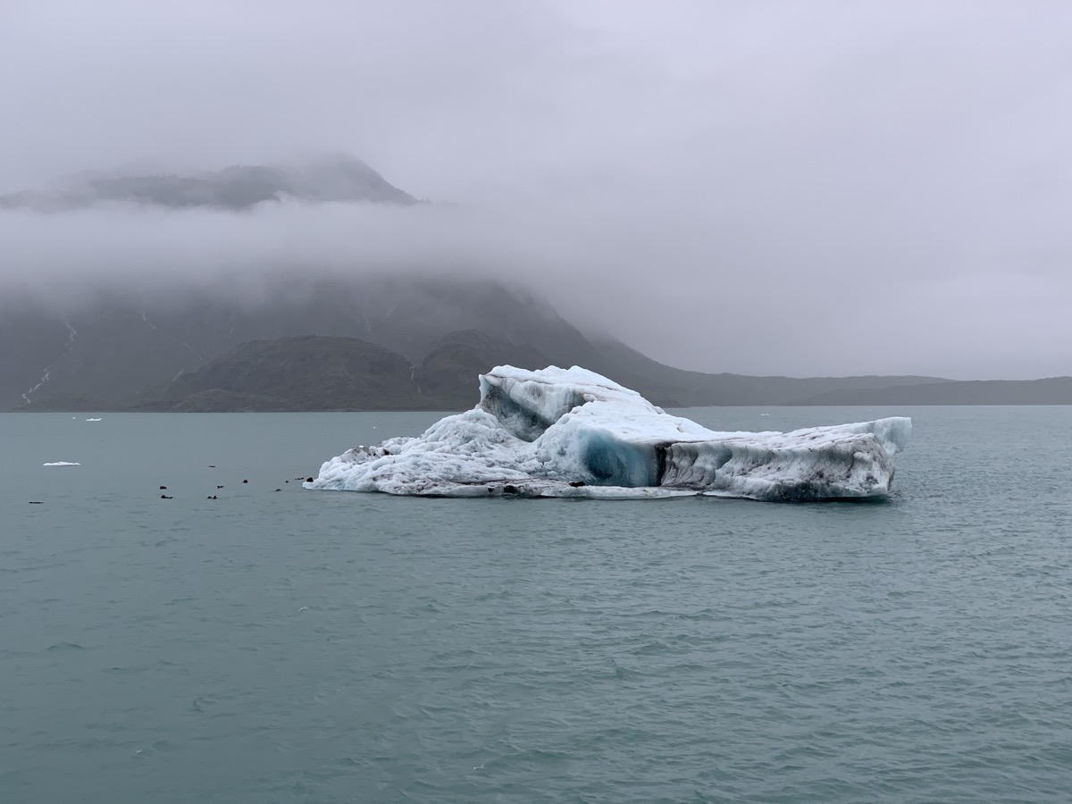
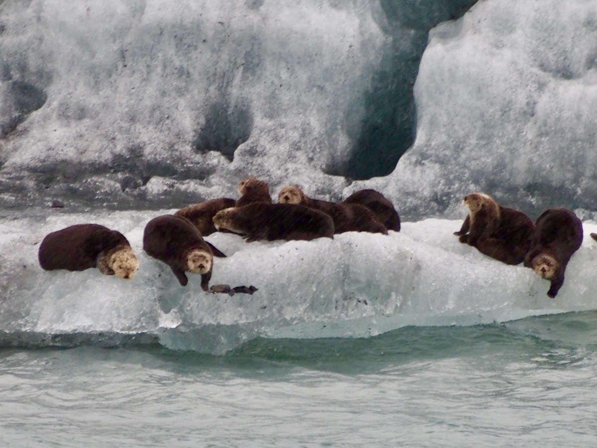
Bald eagles, sea otters, harbor seals, orcas and vanishing chance to see fast retreating glacier. Weather forecast: rain likely, likelihood 100%. 
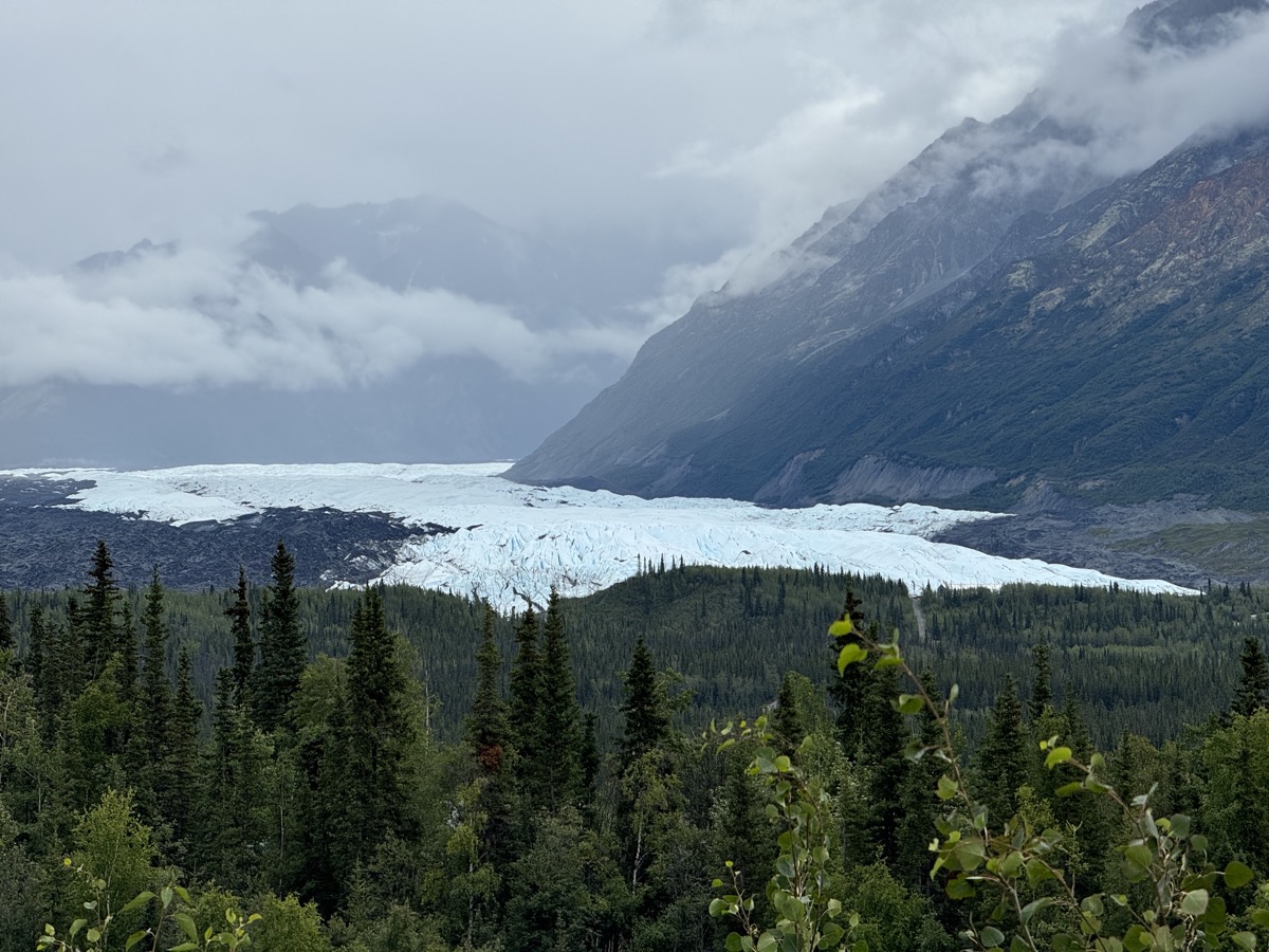
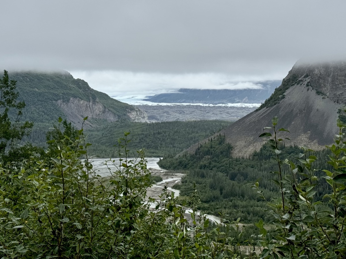
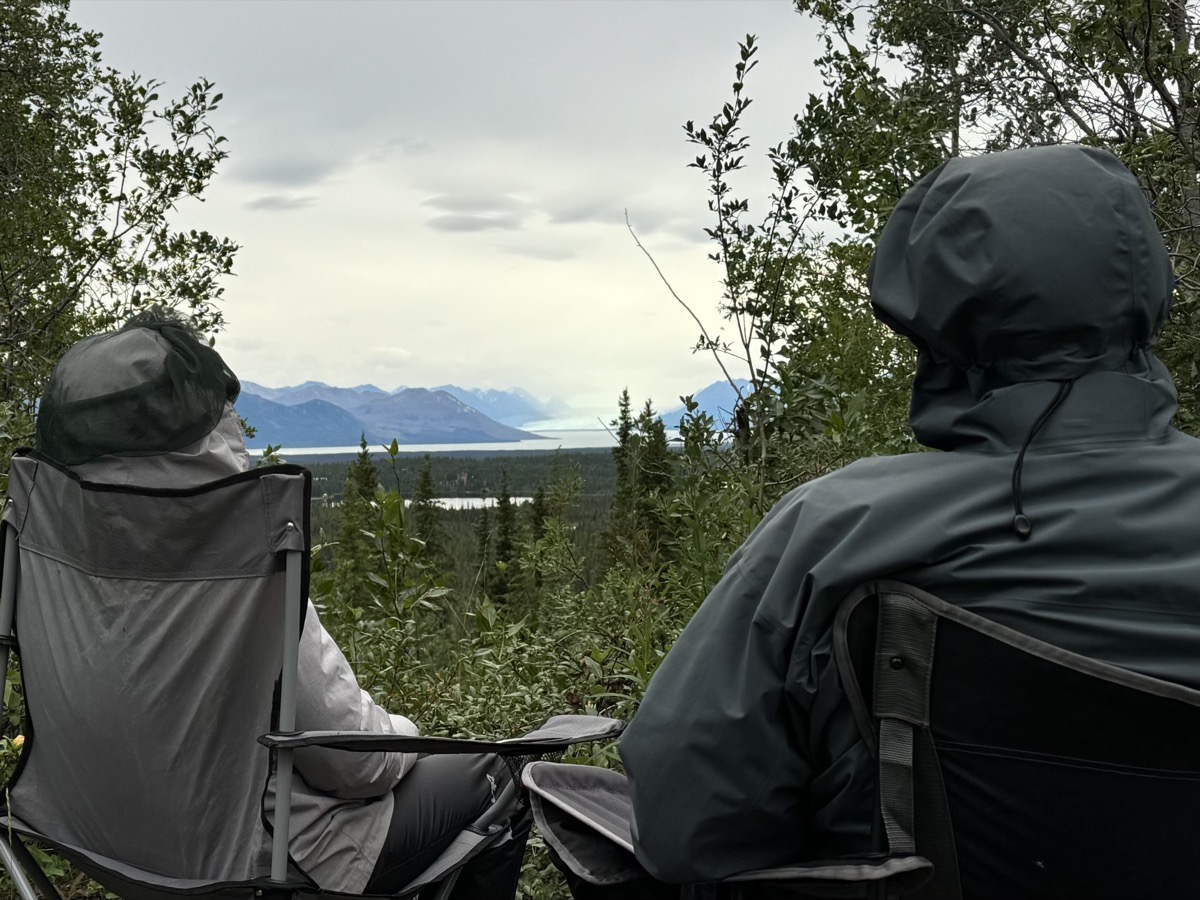
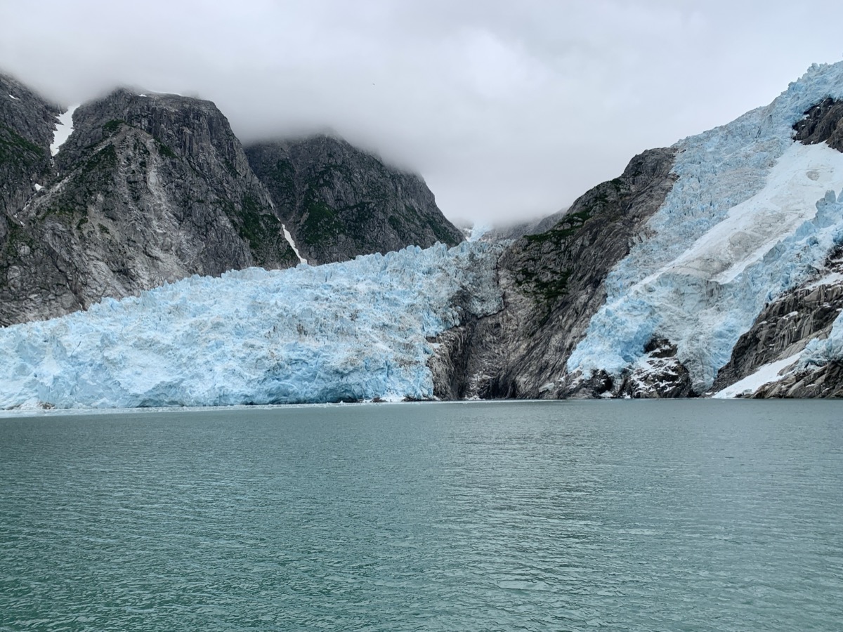
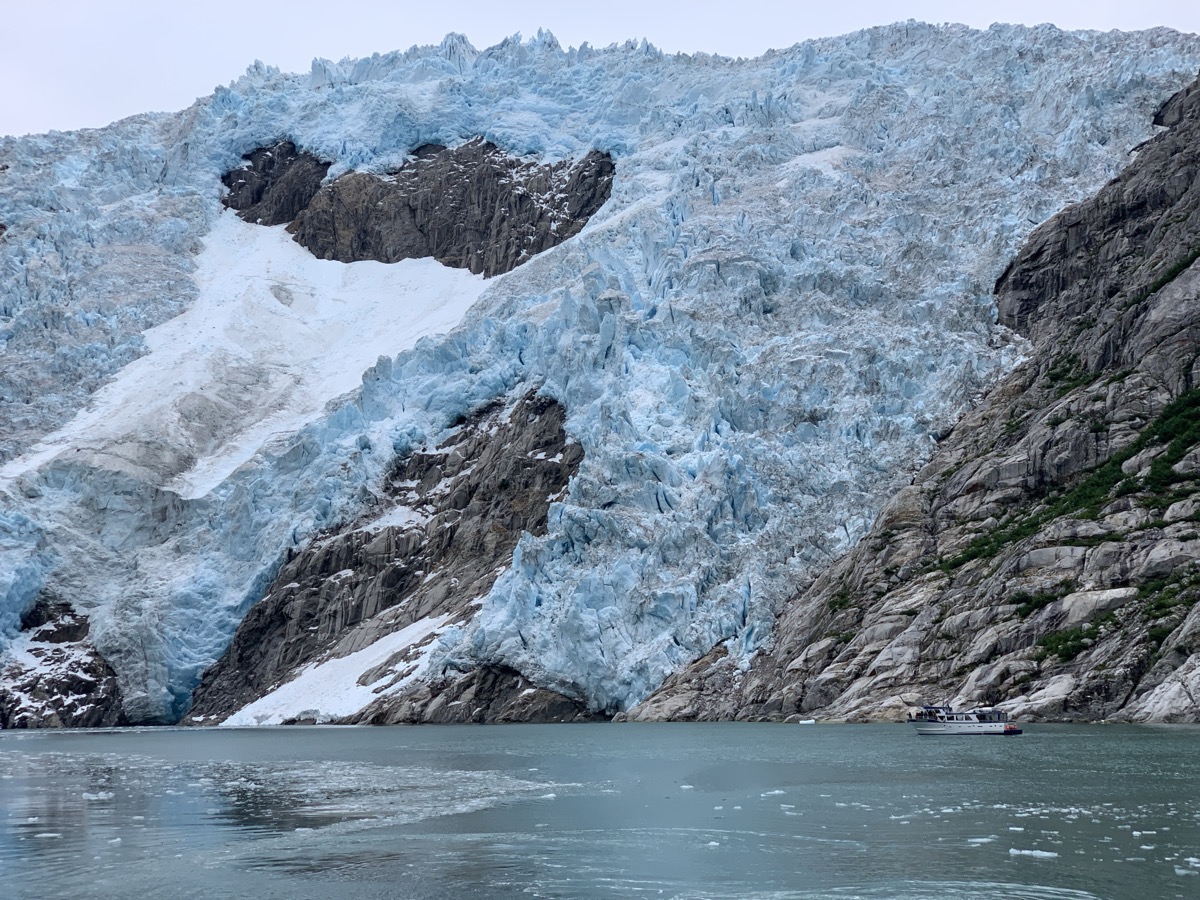
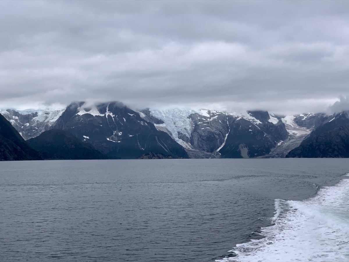
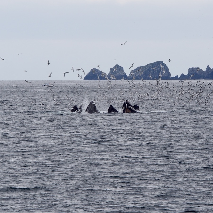
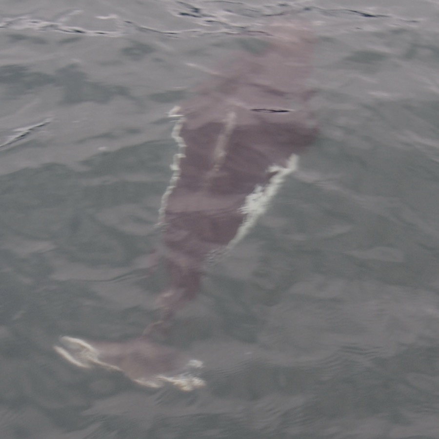
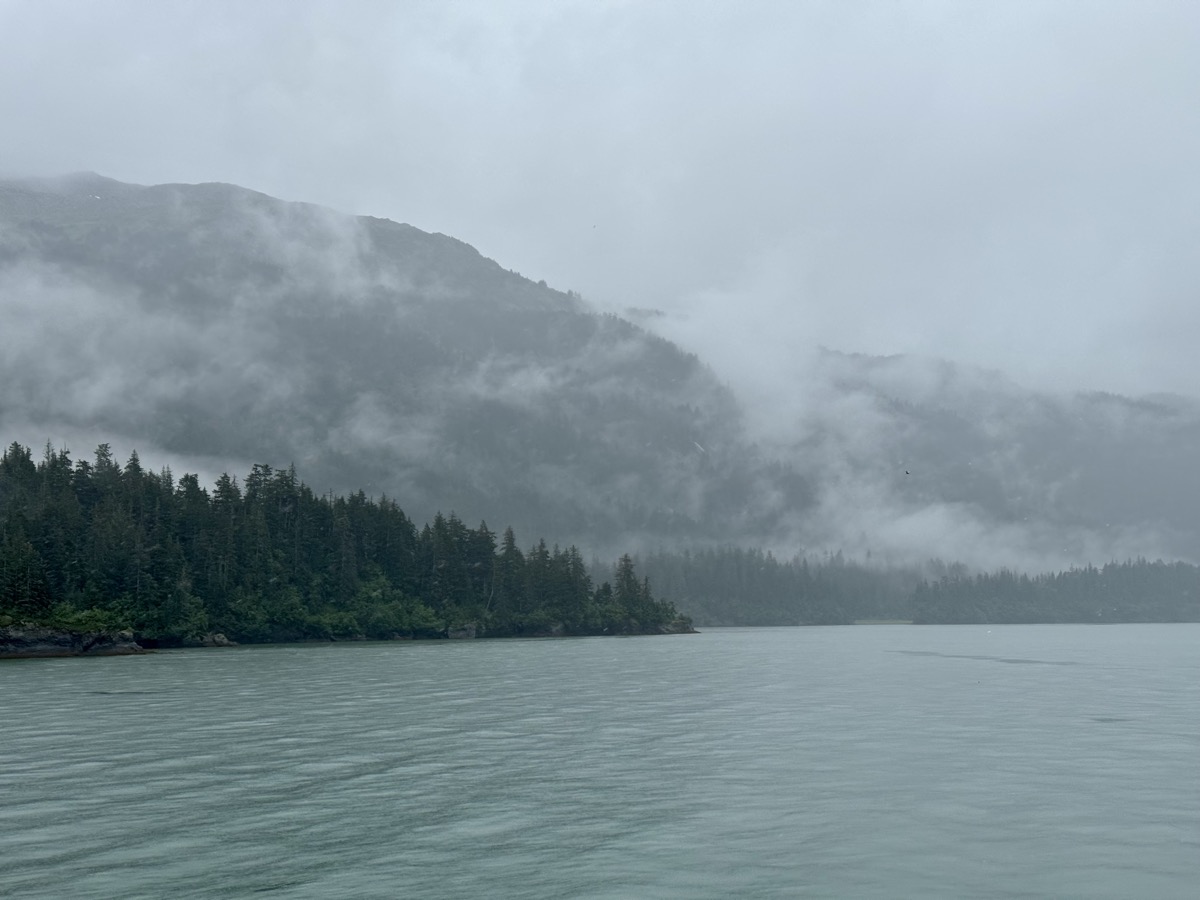
Orcas saved this rainy and choppy cruise, it was awesome to watch them. Columbia Glacier from 1 mile away, 2nd largest tidal glacier in North America, flowing 80 feet per day! And receding very fast. It was a lot of movement on board as we were sheltering from rain inside and running outside at first sign of something interesting. Luckily our boat was not overcrowded (50% capacity or so). Everybody was outside for half an hour, wet or not, when we were watching orcas playing around. Taking pictures was not easy (cutting rain, water pouring from the roof, strong wind) – the real experience was much better than what pictures captured.

It was already past 9 PM when we made it back to town and started checking weather reports: heavy rain and wind storm was coming. We were not sure how reliable these reports were, some even calling for “shelter-in-place”. We abandoned our campground spot (lousy state of facilities was another argument against staying there) and checked-in to Valdez Airport Mancamp Hotel (large barracks). Our room was small, but clean, enough space to prepare evening snacks. New clean bathrooms. Our hosts were nice, but we had the impression they do not see too many tourists, as the hotel houses pipeline workers. It emptied for the weekend. Joanna was bothered by strong smell of petroleum product(s) used in recent renovation (?) and very loud heating system. Piotr remembered workers hotels from distant past. Just new experience. Good place to wait-out the storm. It never came.

Day 59. 
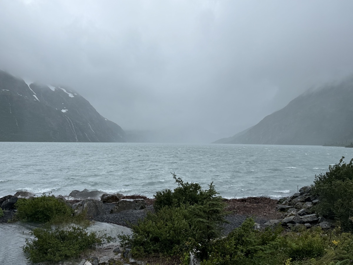
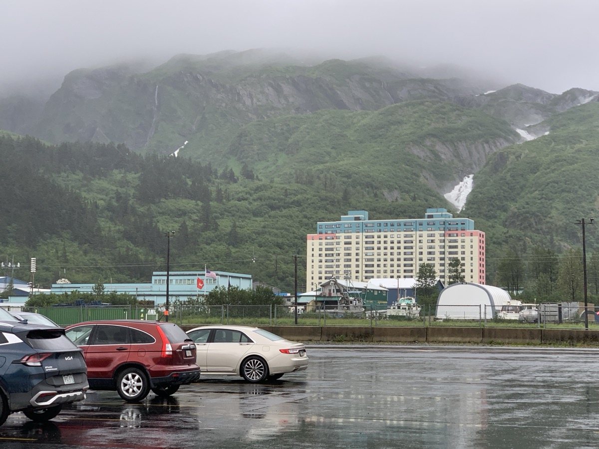
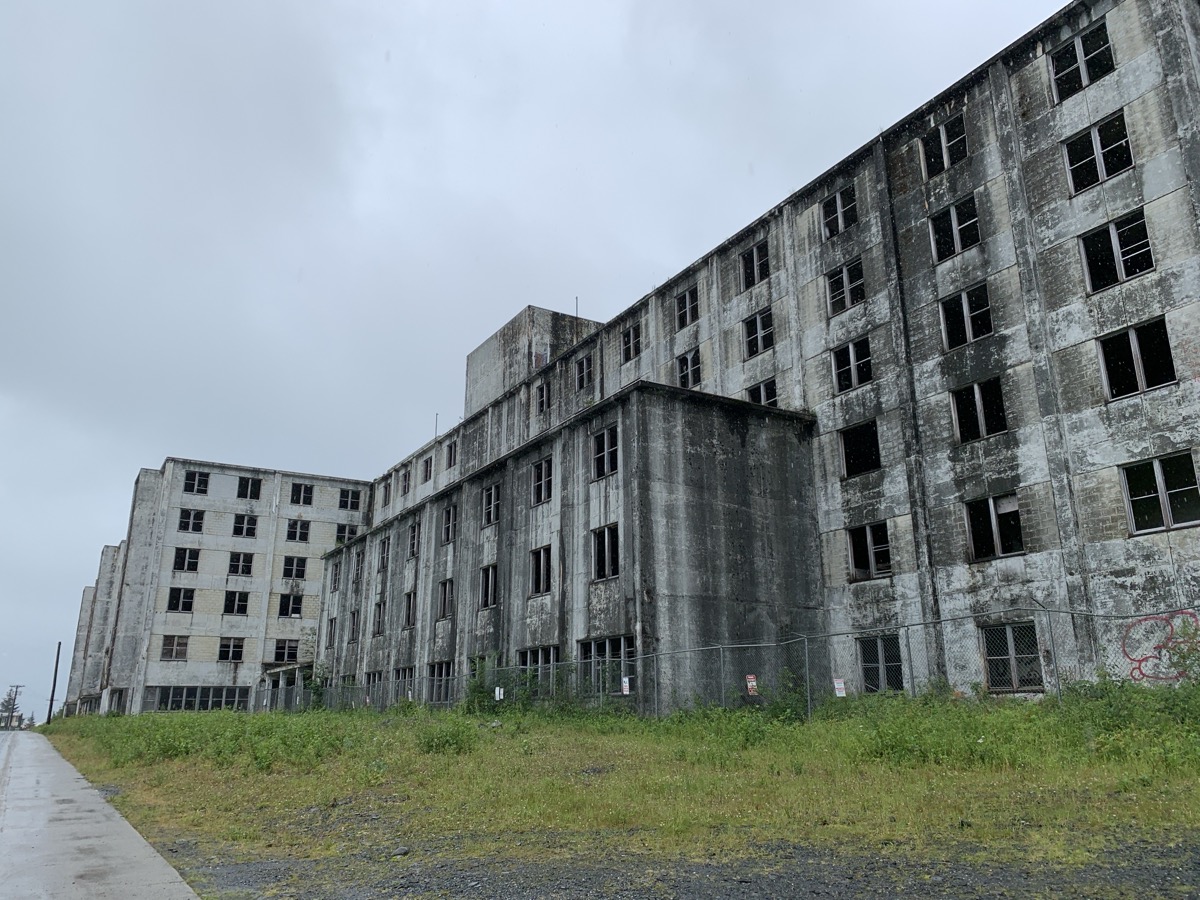
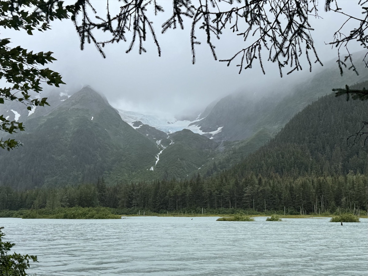
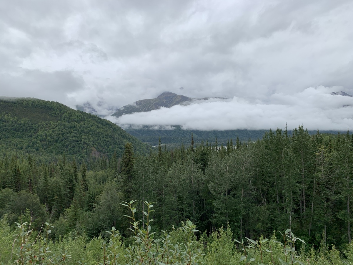
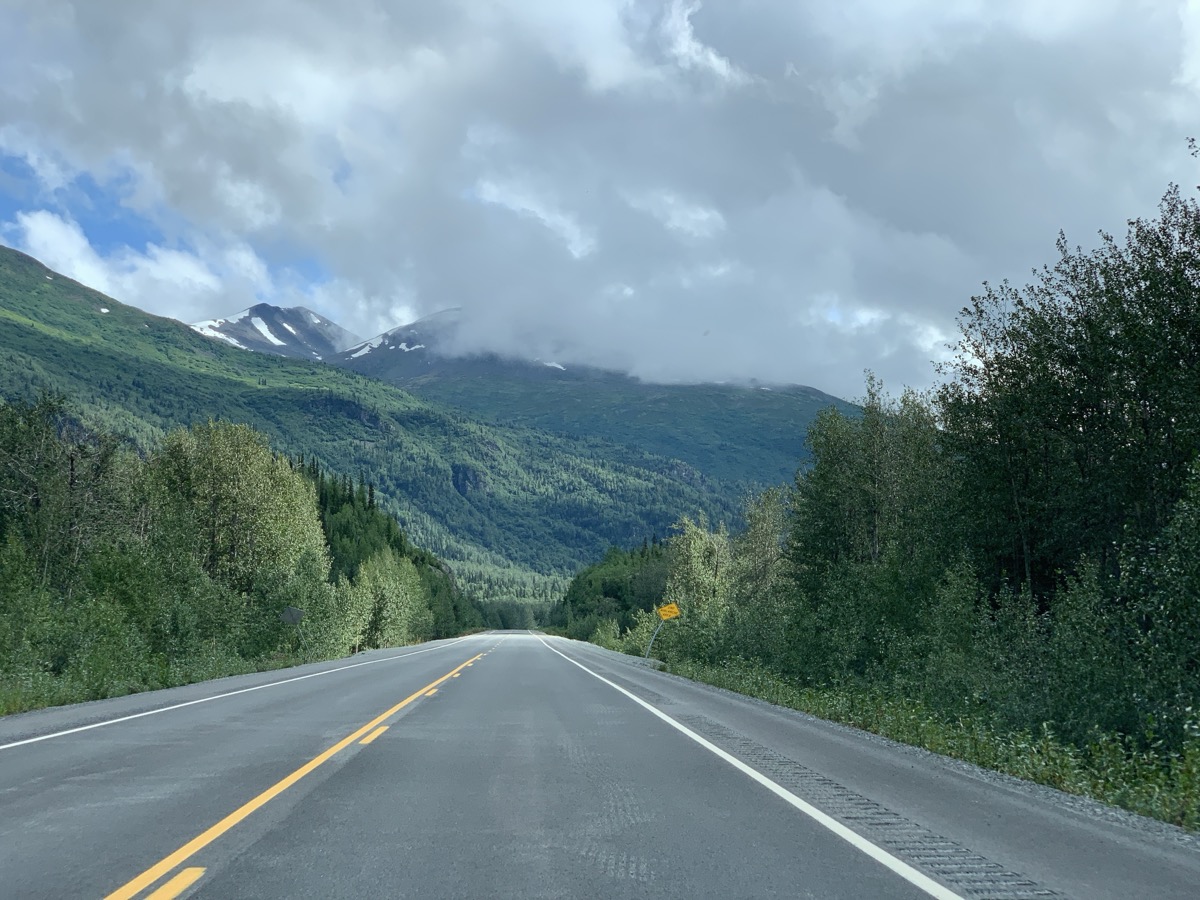
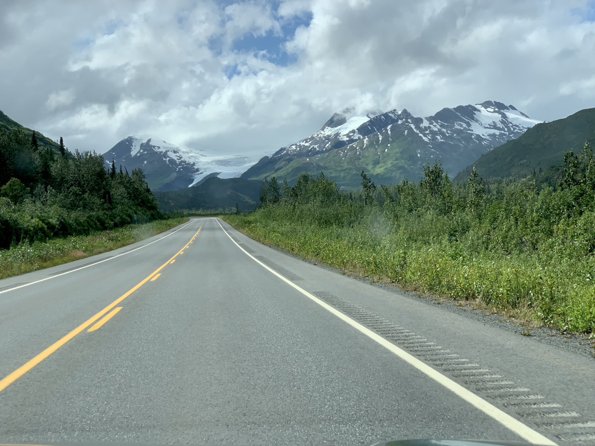
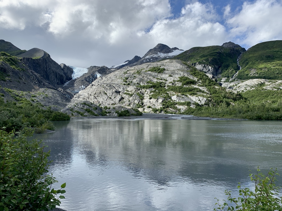
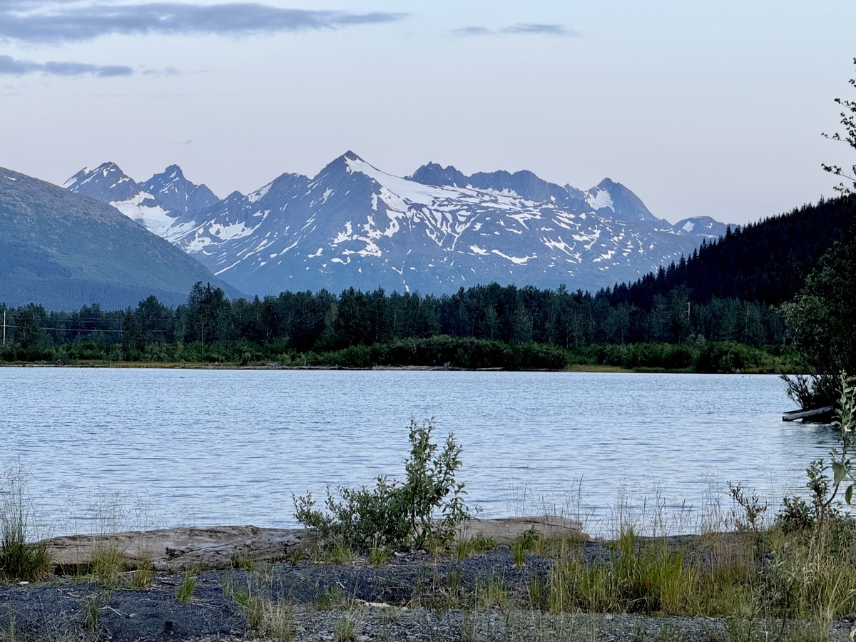
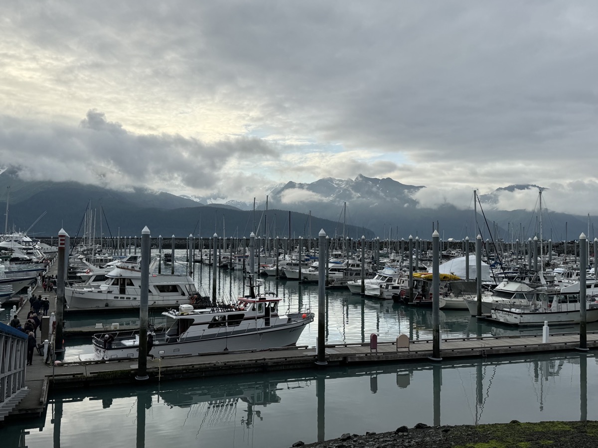
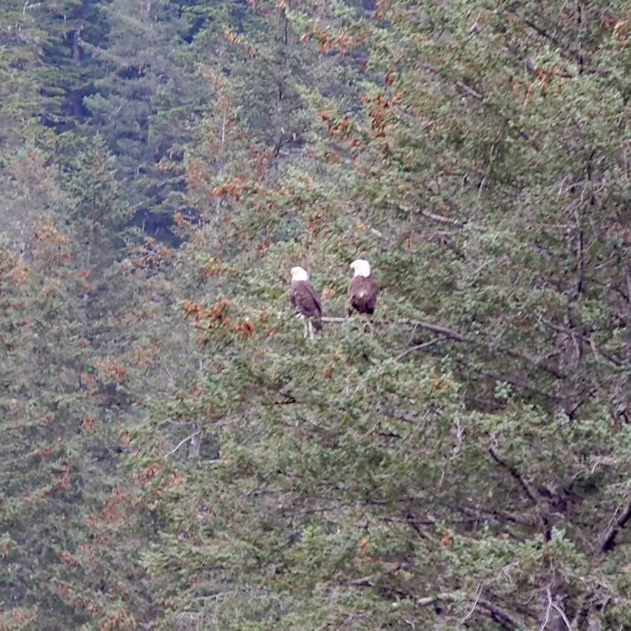
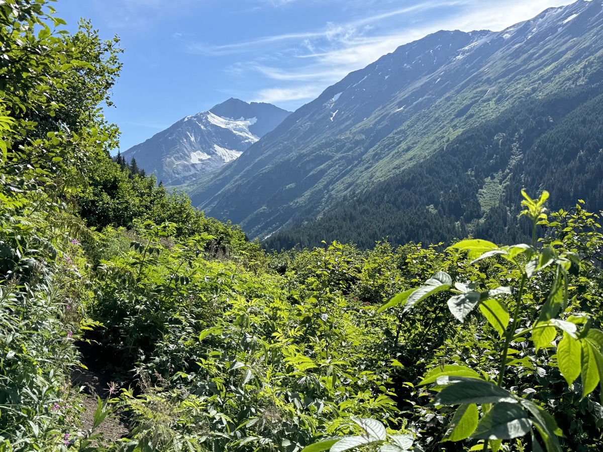
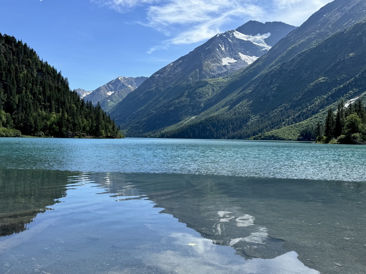
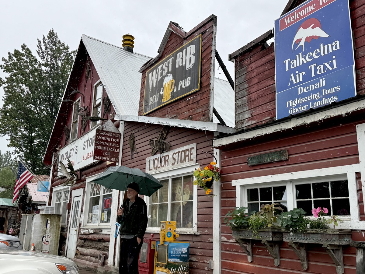
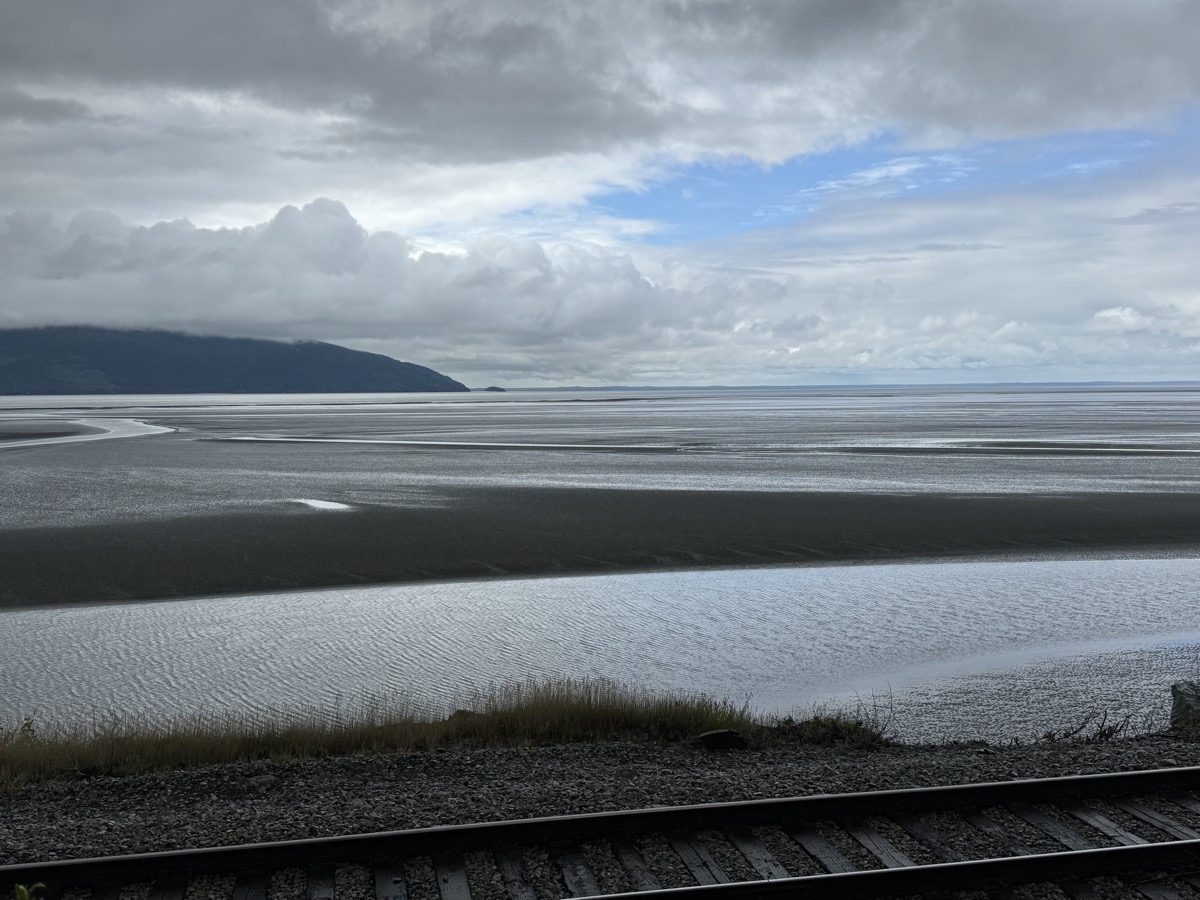
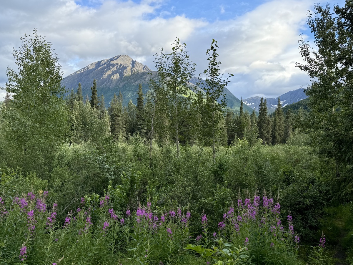
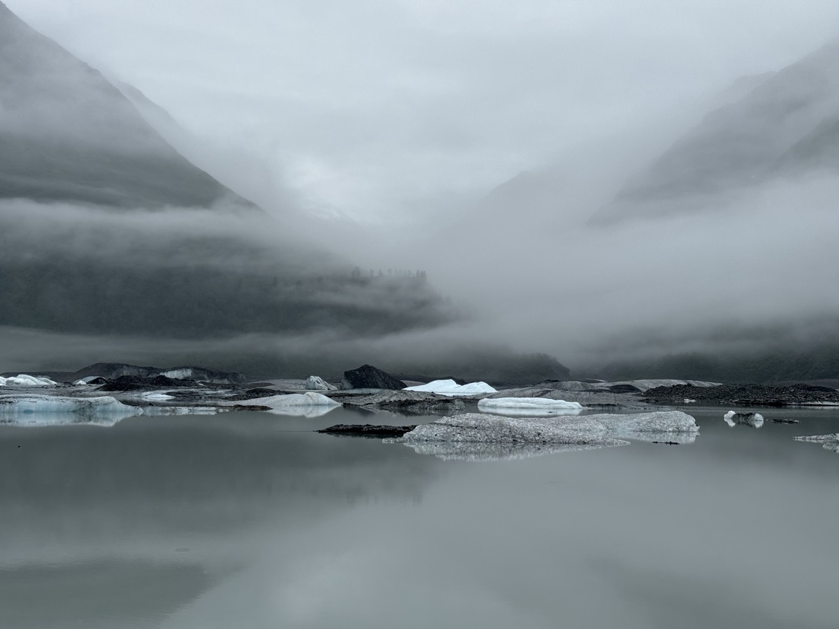
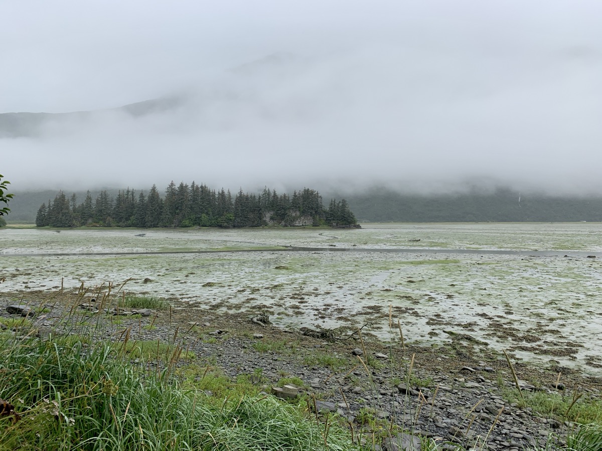
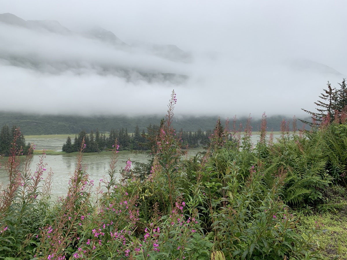
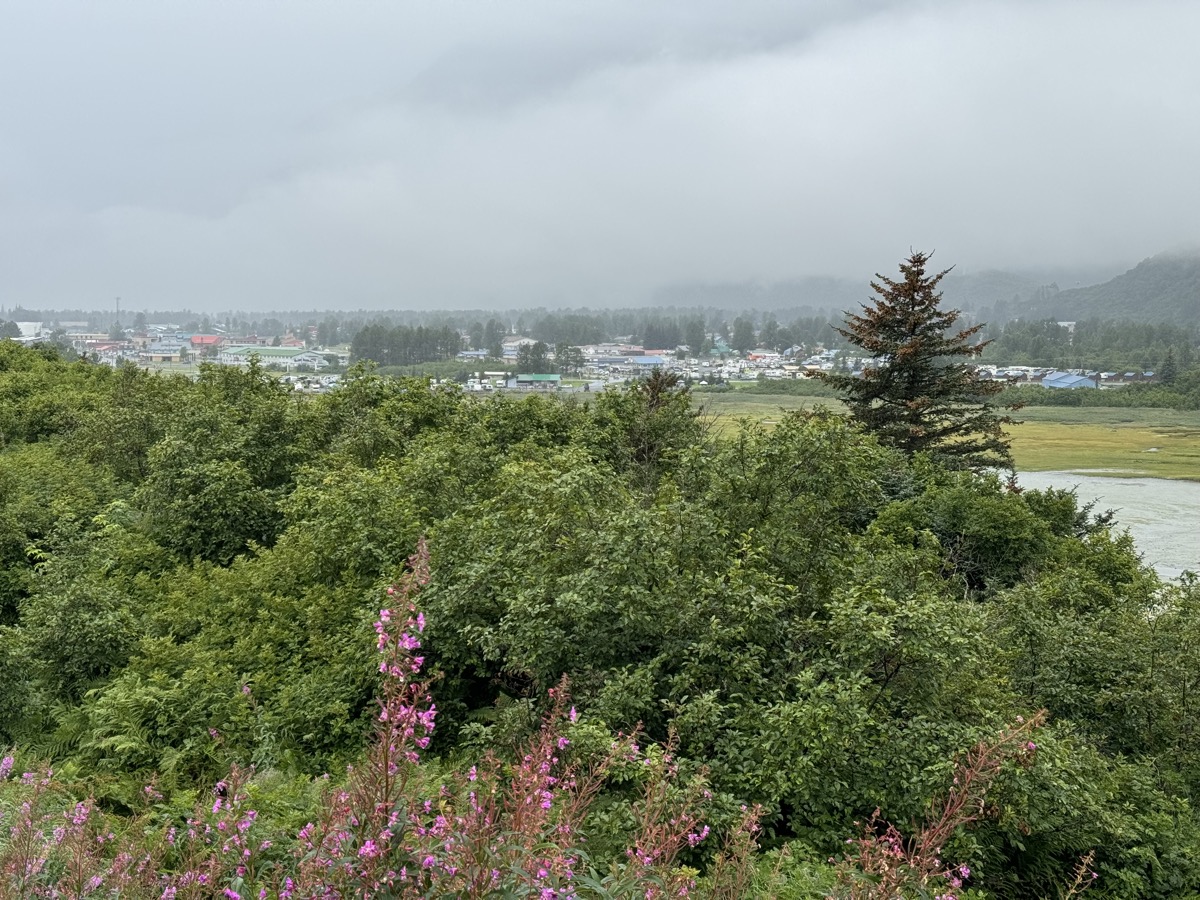
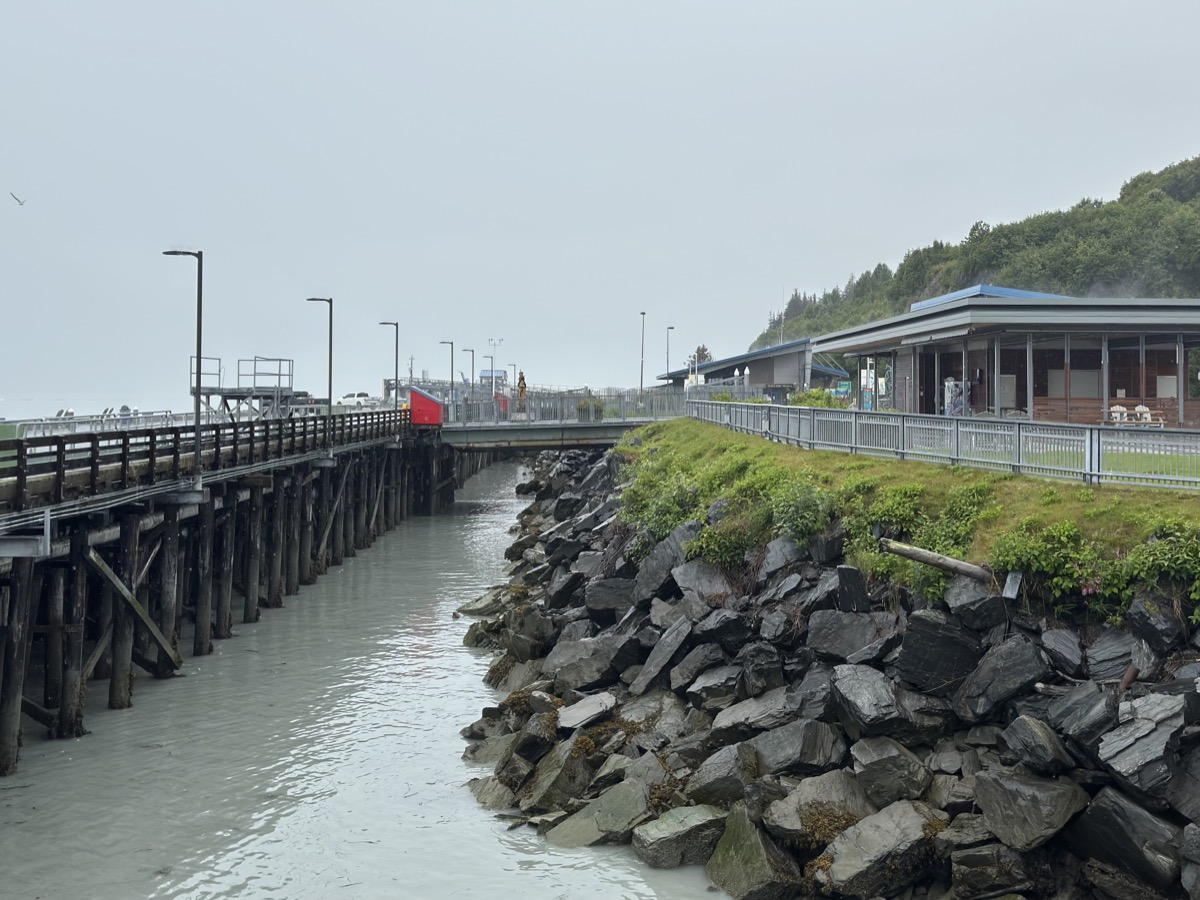
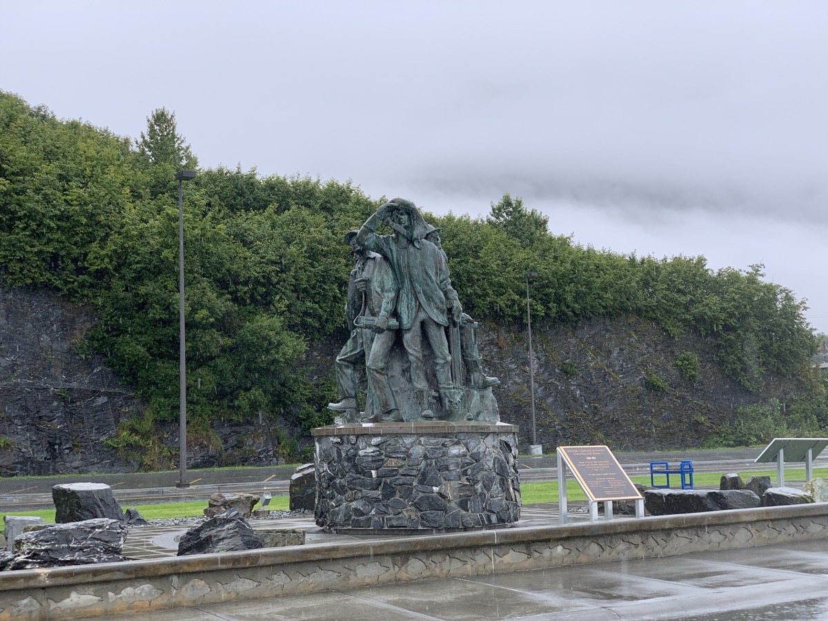
After short visit to misty and beautiful Valdez Glacier Lake we walked Dock Point Trail (loop around small peninsula). Watched young eagles getting ready to fly off for the first time above tidal mud flats (Duck Flats). Views on the flats and Port Valdez. In dense fog and light drizzle, we milled around Valdez: ice-free port from gold rush times through copper mining (Kennicott, our next destination) to trans-Alaska pipeline terminal. Had very good salmon rolls (at The Potato) for lunch and coffee from small booth (coffee booths are very common in Alaska, Piotr’s favorite stops). Walked along the docks towards Ferry Terminal. Just a short stop at Old Valdez (abandoned after 1964 earthquake) on the way out and we were back on scenic Richardson Hwy. We were driving by familiar spots in revers (Day 58 above and Day 57 in previous post). Stopping for photos as weather improved.

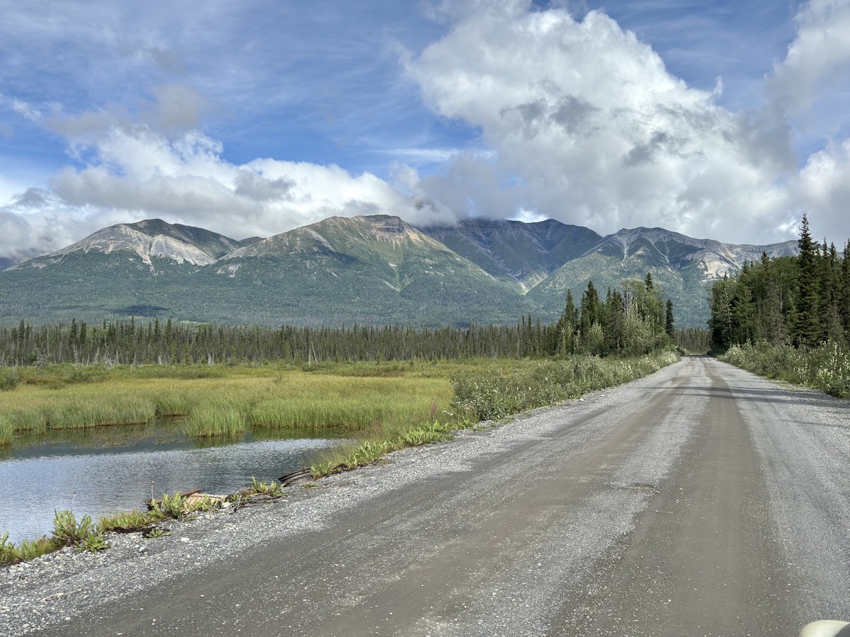
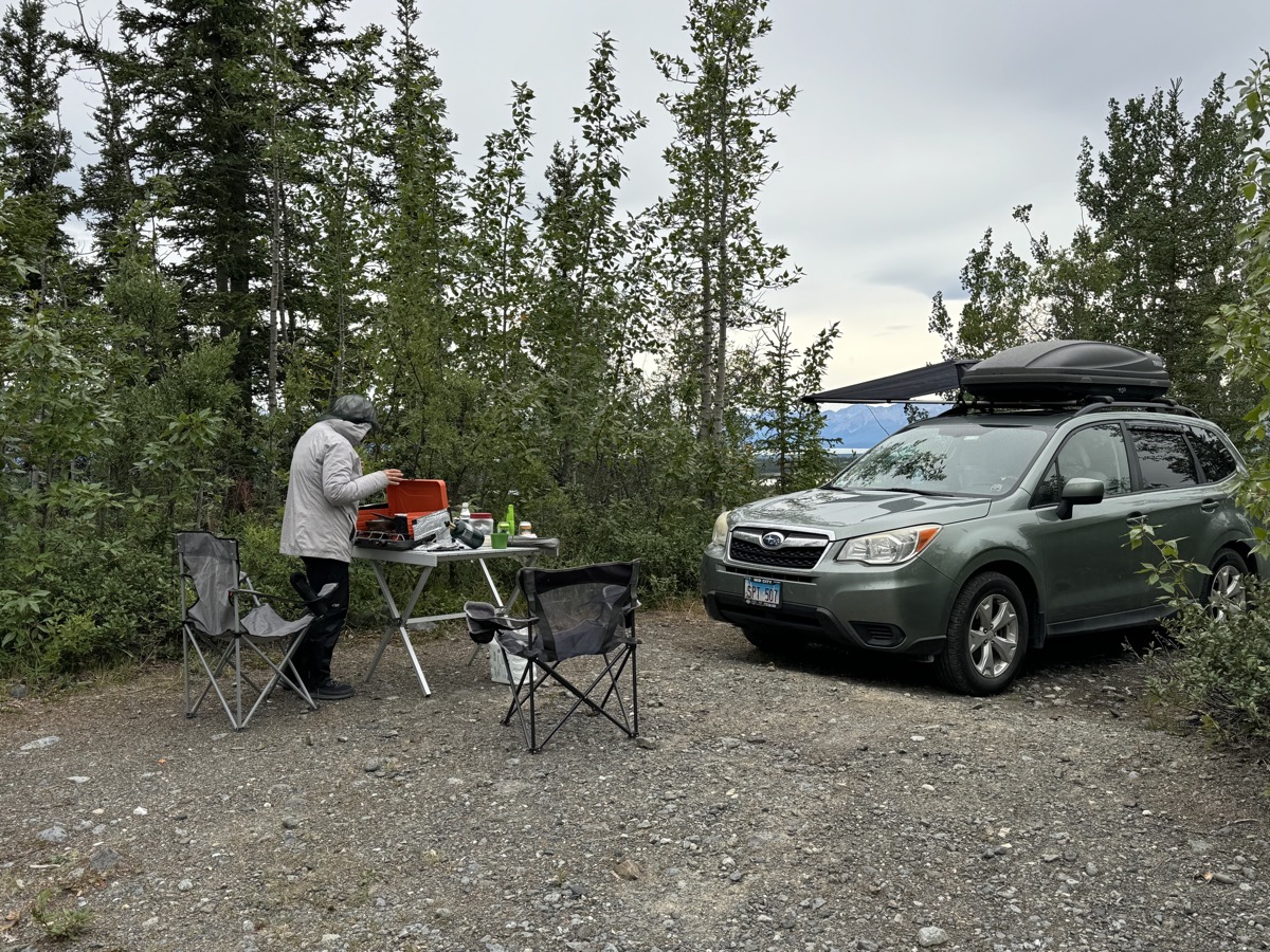
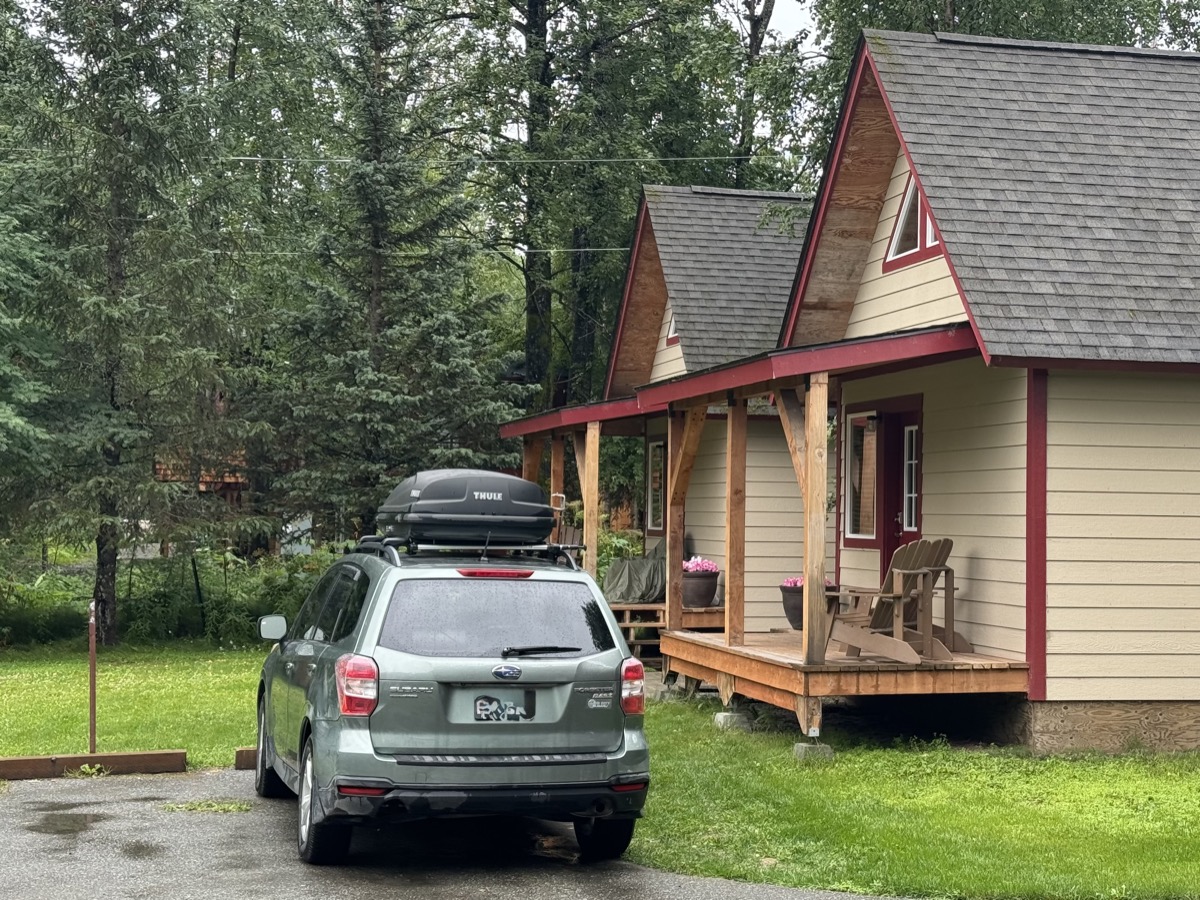
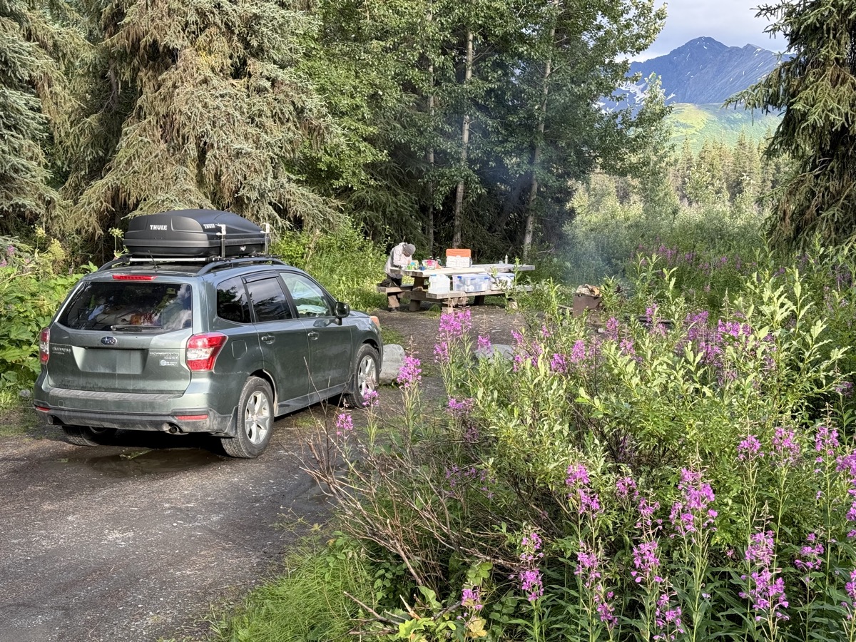
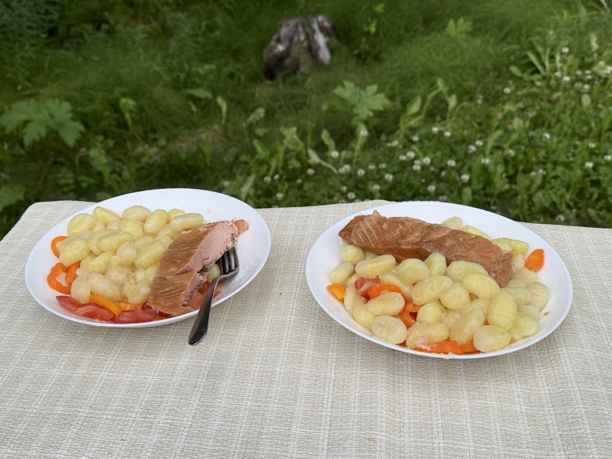
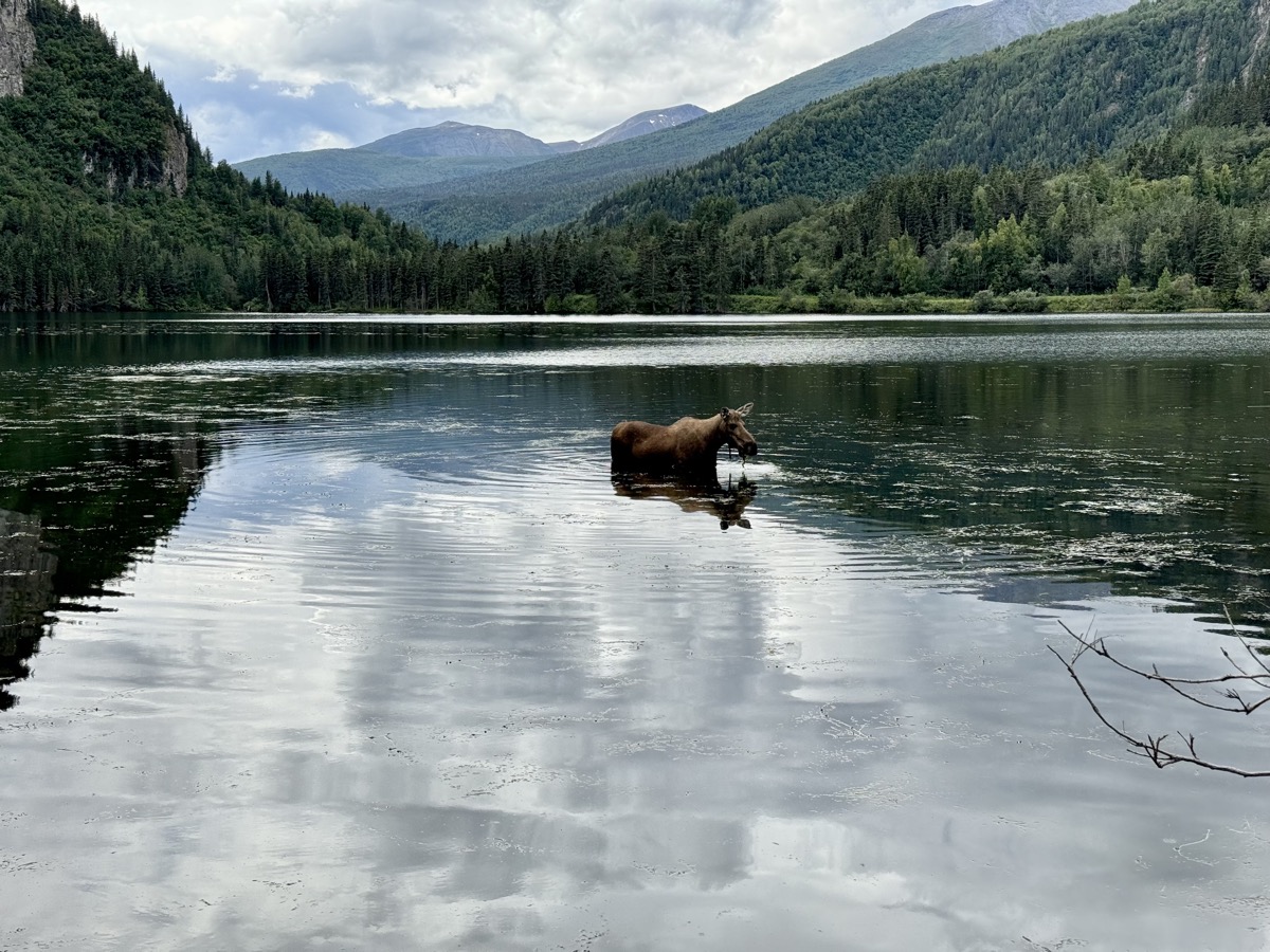
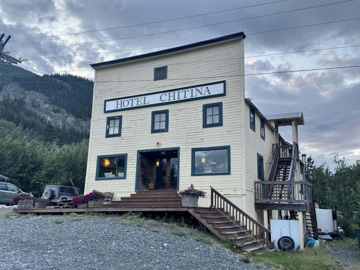
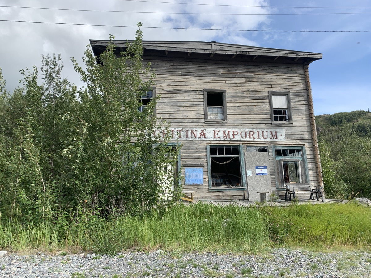
We turned on Edgerton Hwy to complete 200 km drive to Chitina. We checked-out nice rustic cabin, but it was too far from parking. Joanna somehow talked the owner of (historic) Gilpatricks Hotel (Hotel Chitina) into accepting us even though they were closed that day. We liked it and stayed there two nights. We prepared our own dinner (kitchen was closed). And we got outside with our neighbors to watch resident moose pulling out algae from the bottom of small pond.

Day 60. 
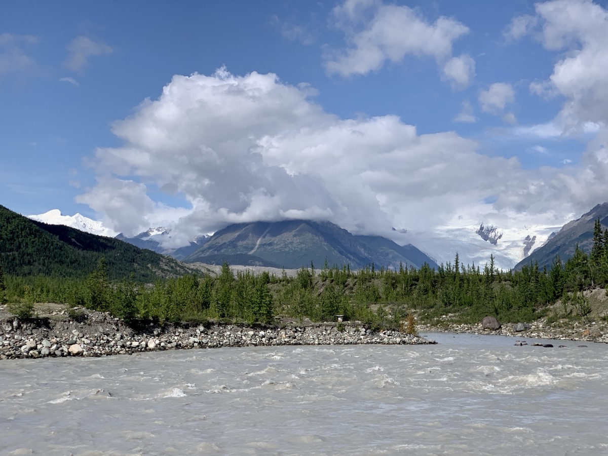
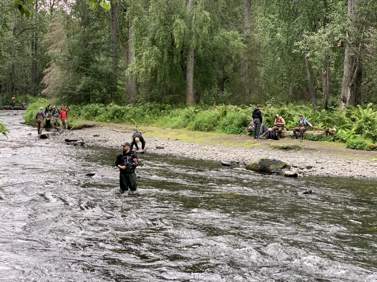
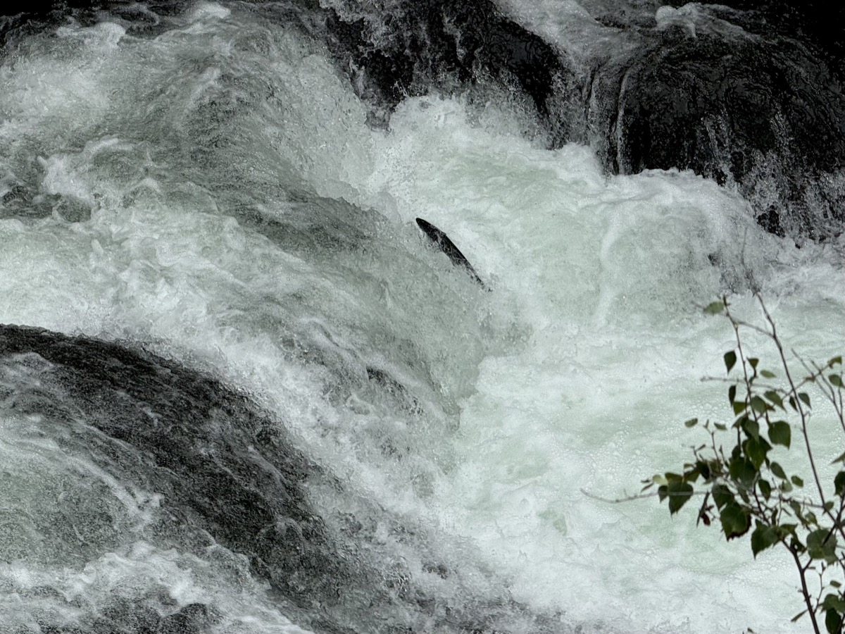
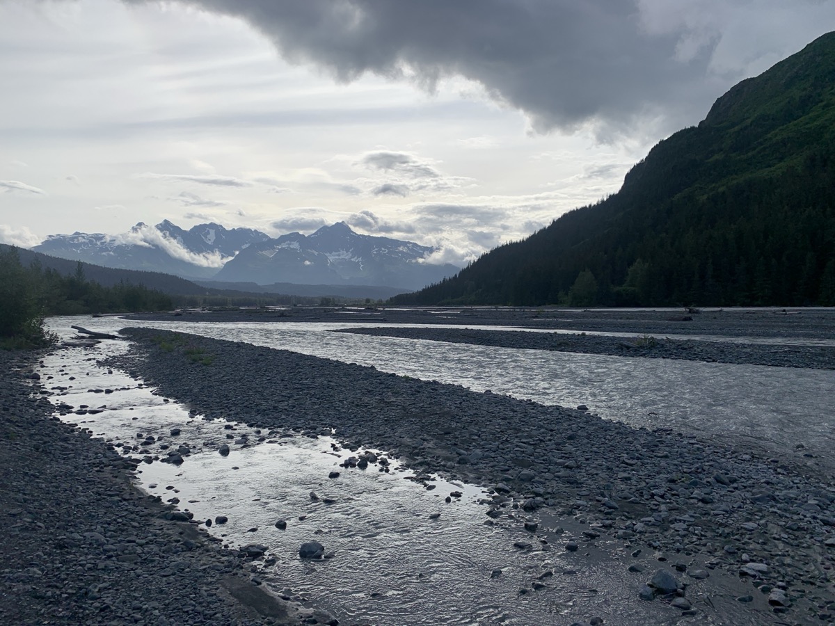
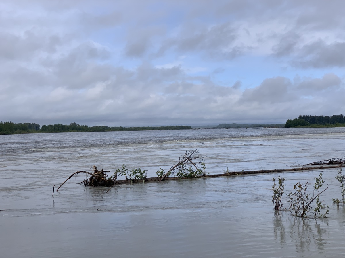
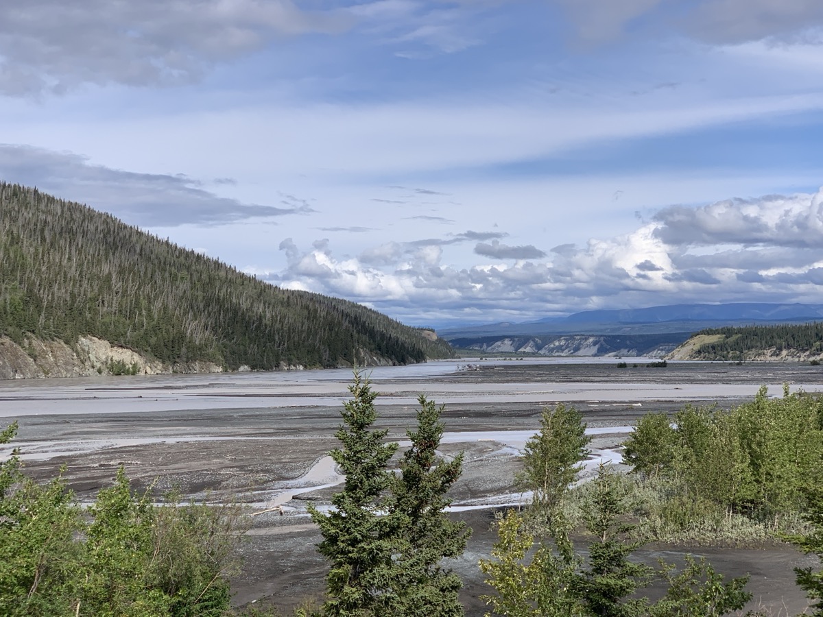
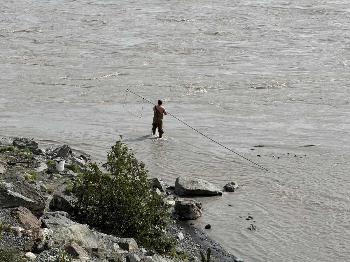
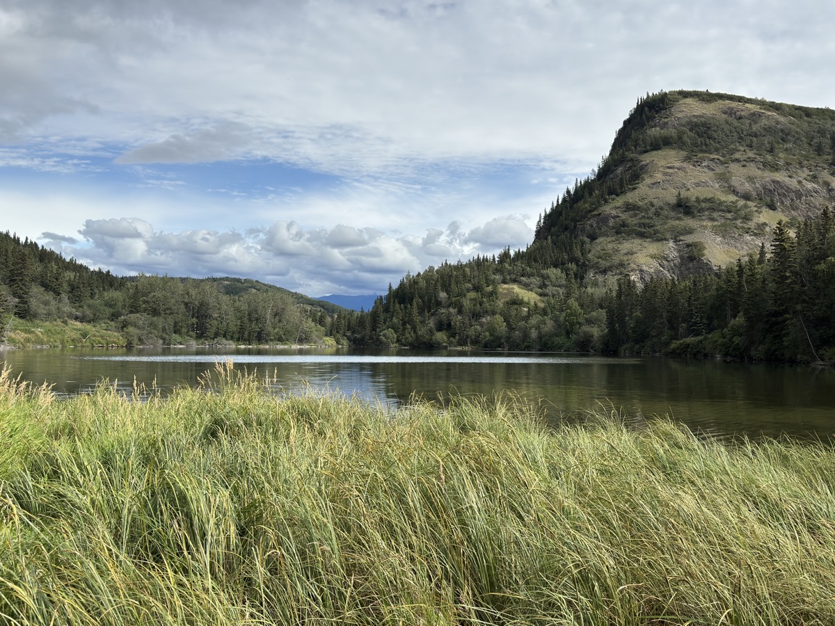
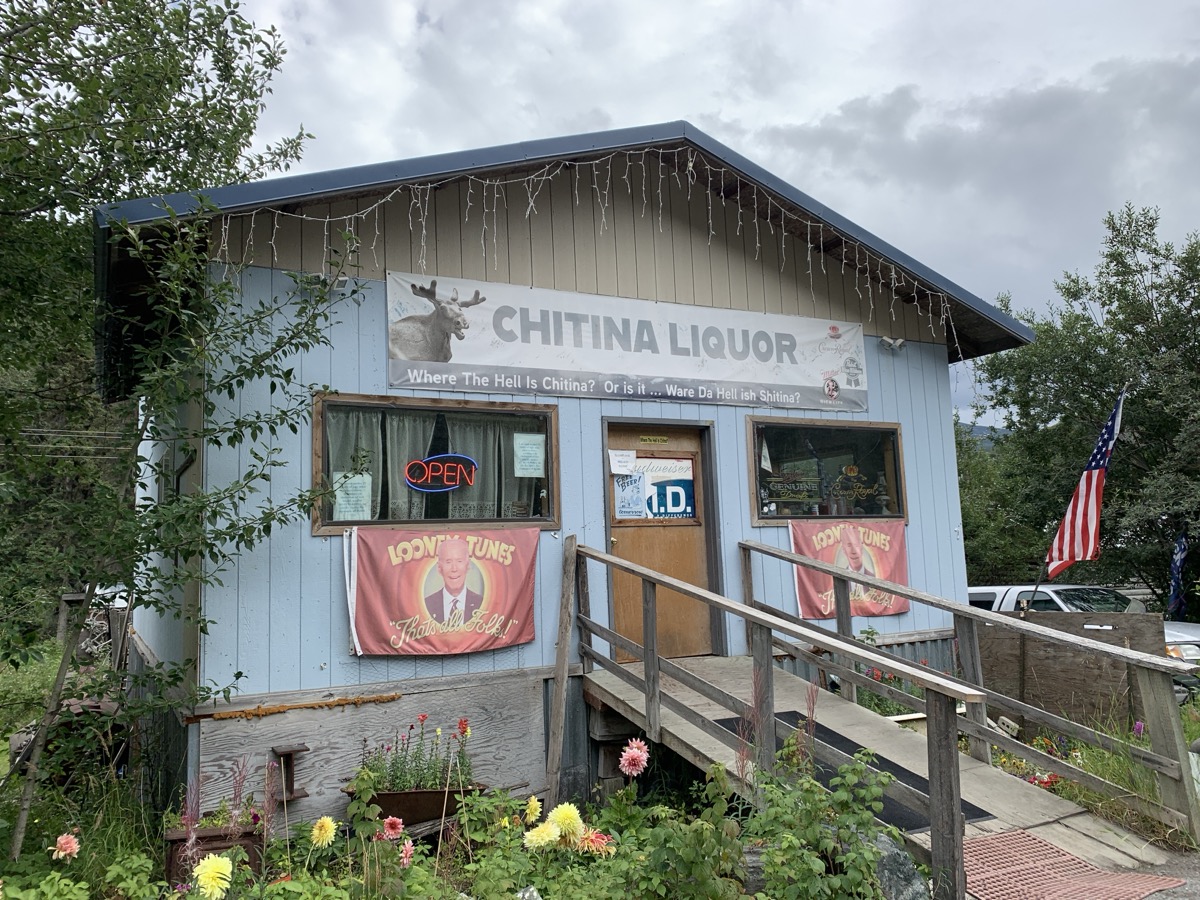
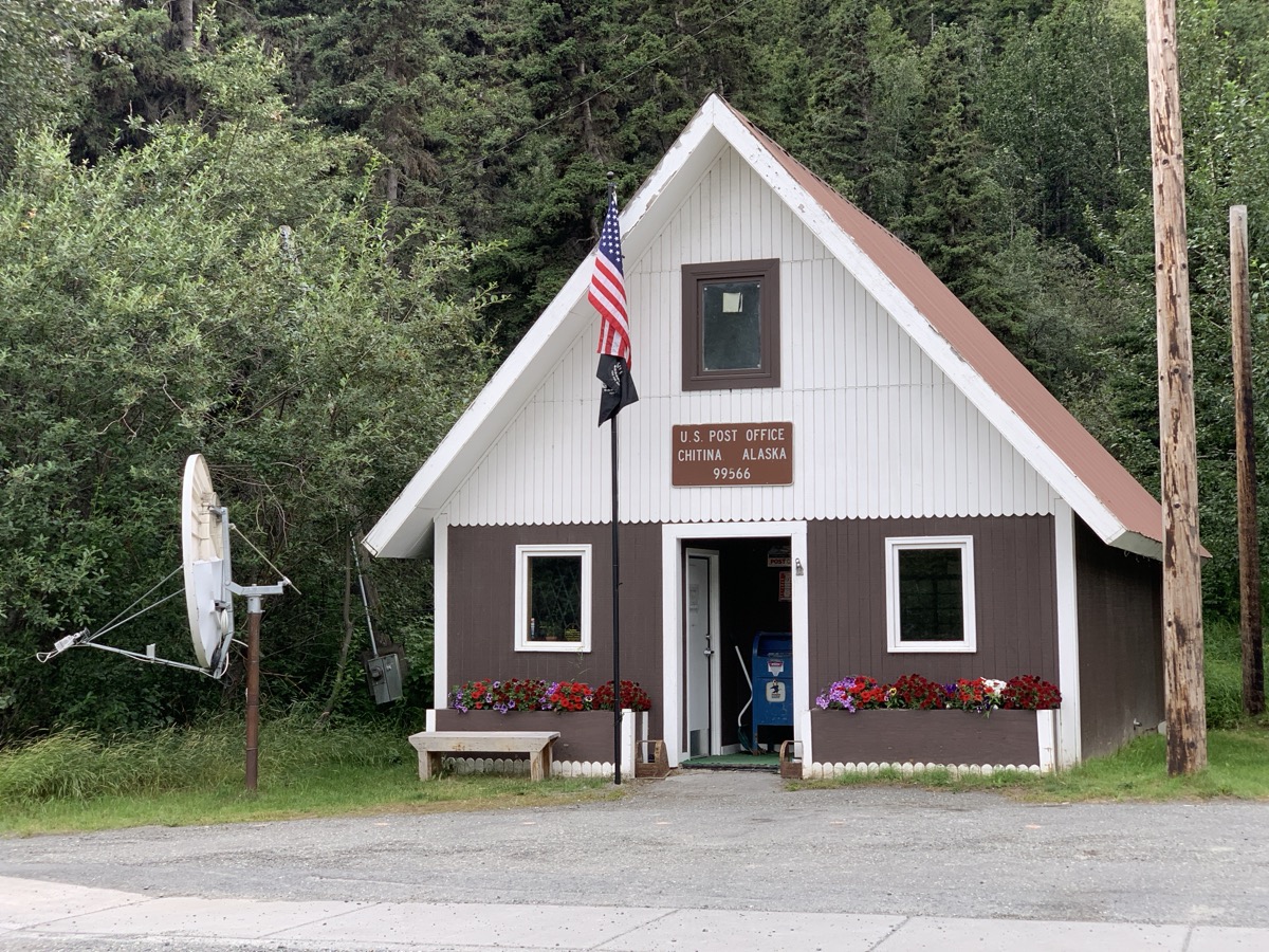
Slow rest day in Chitina. We crossed the bridge to get a better look at Chitina and Copper River confluence, observed novel (for us) from-shore fishing technique and talked to disappointed fishermen who were unable to go on the river because of very high water level. And we drove to O’Brien Creek on dirt road which runs where the old rail tracks used to be. Chitina was an important stop on Kennicott-Cordova line built to carry copper ore to the coast. Visited small grocery/supply store. Watching (same) moose eating lunch in a (different) pond (Chitina Town Lake) was our top activity for the day. Stopped at small liquor store. Drove again closer to Copper River, but could not find any working fishing wheels which Joanna wanted to see. By the end of the day we felt like we had talked to everybody in town and learned life story of a few.

Day 61. 
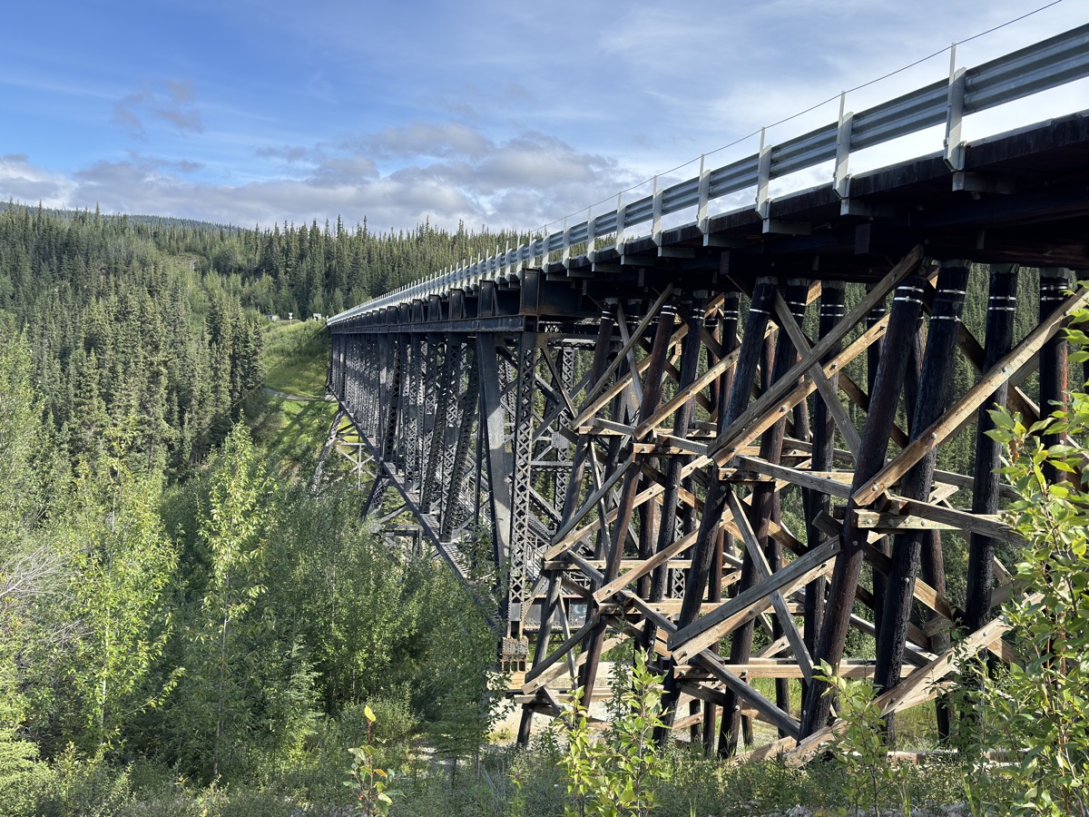
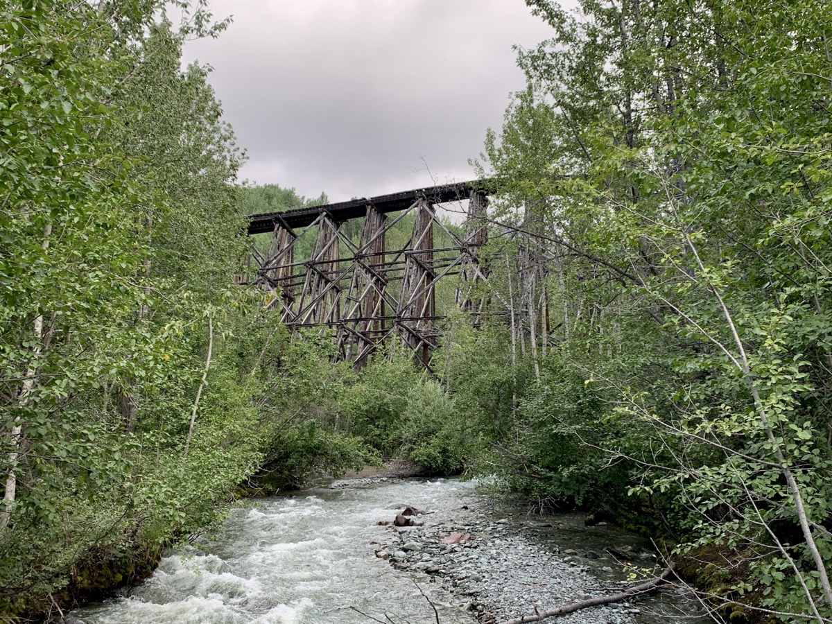
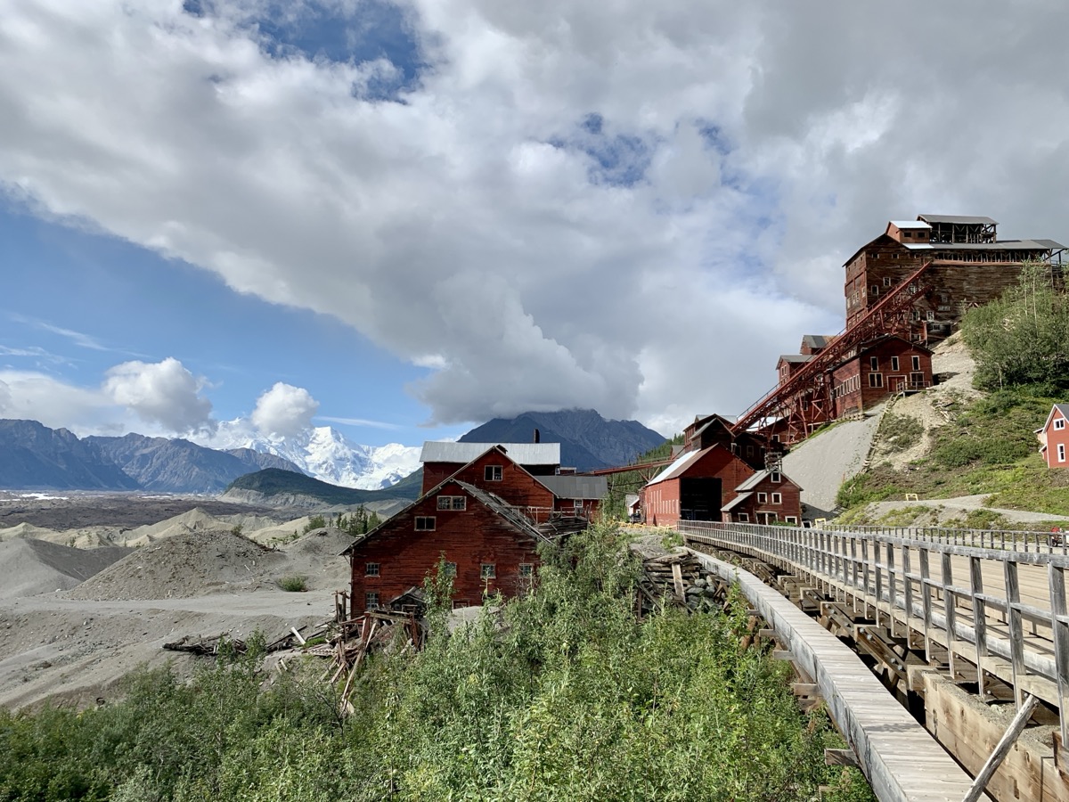
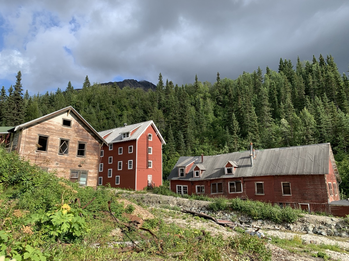
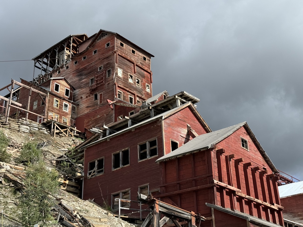
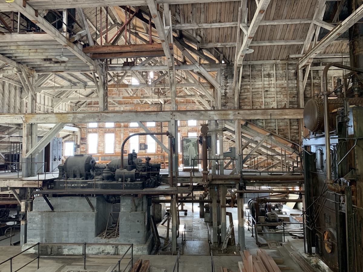
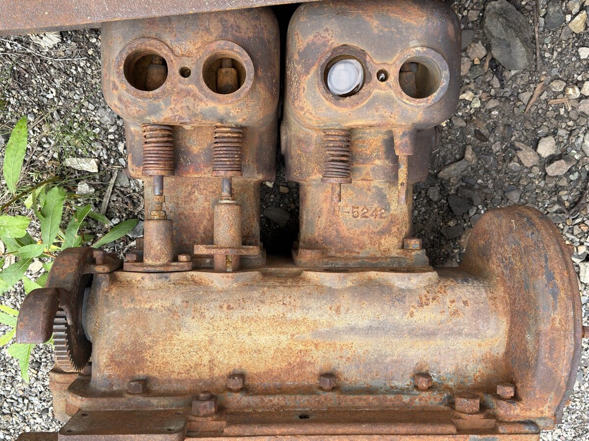
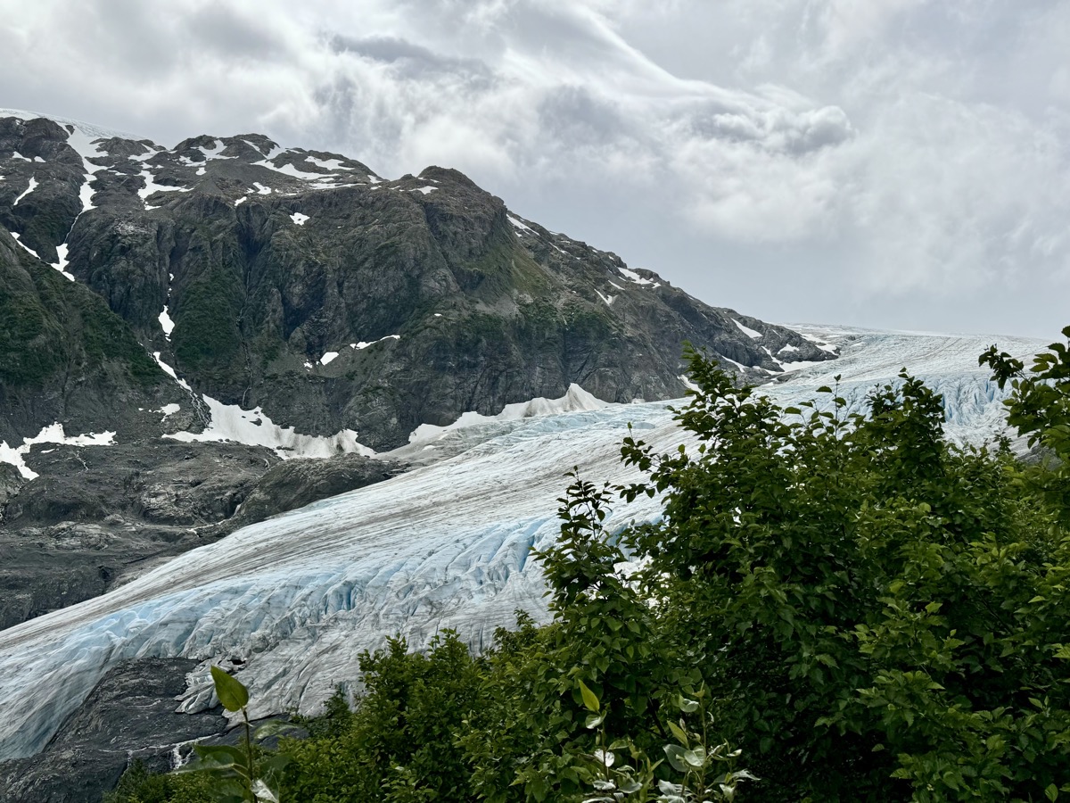
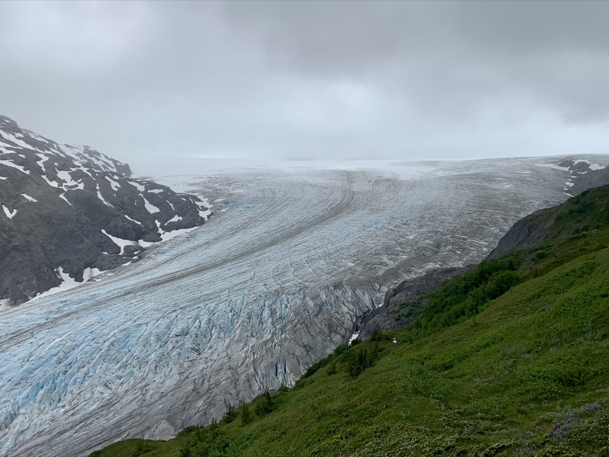
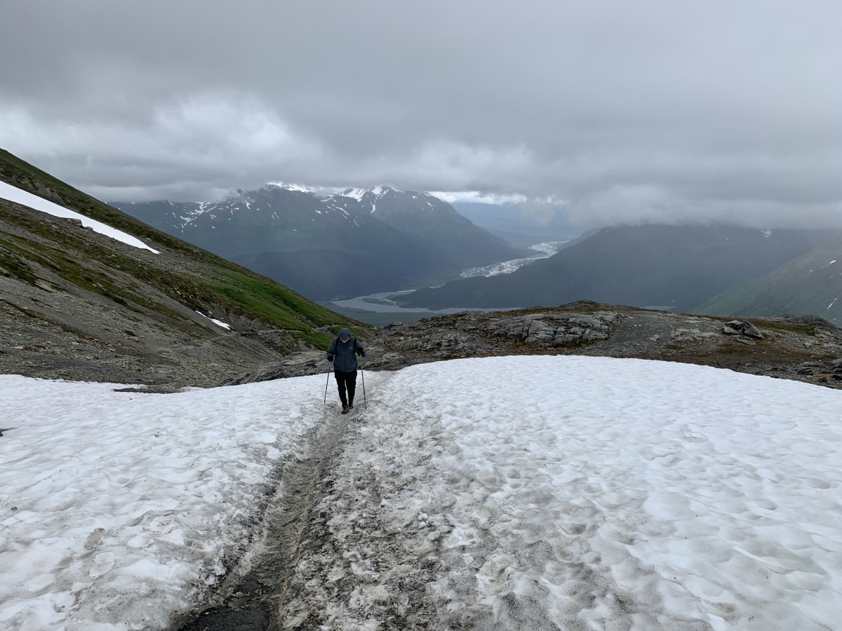
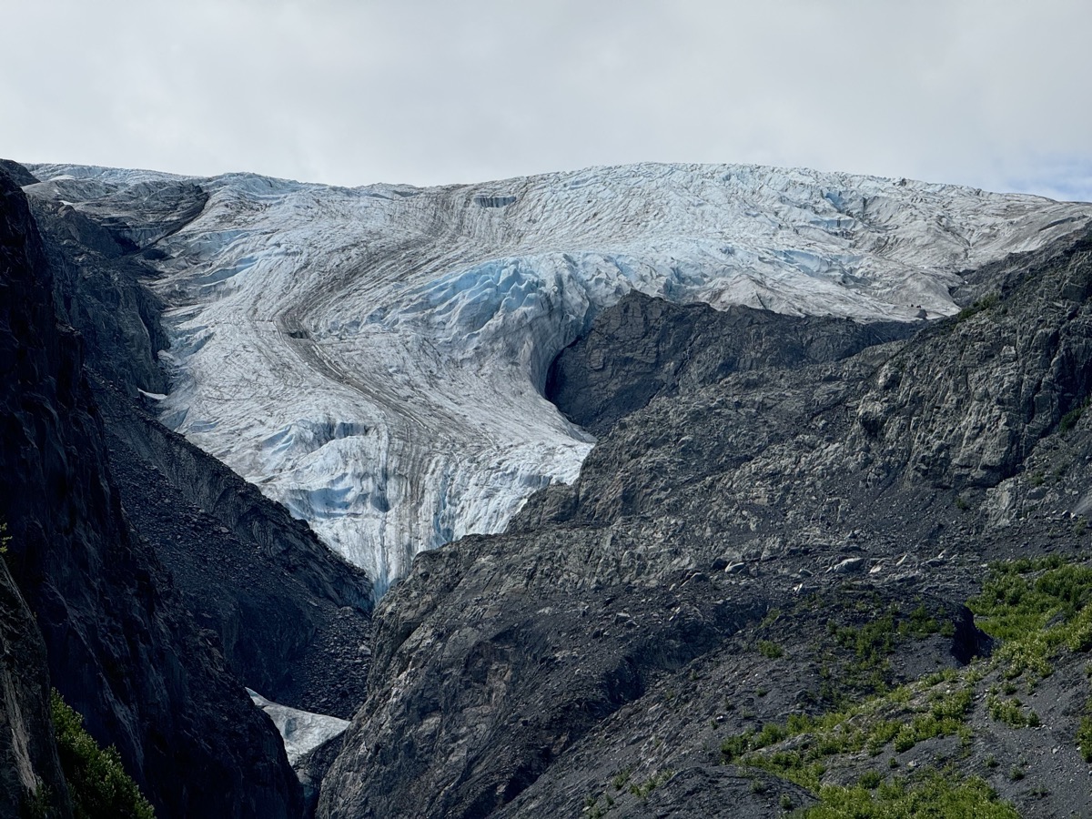
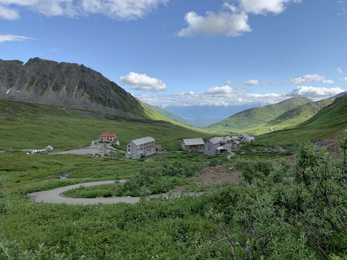
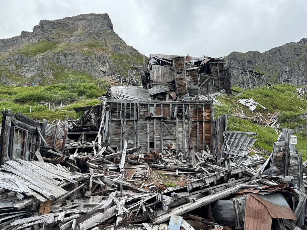
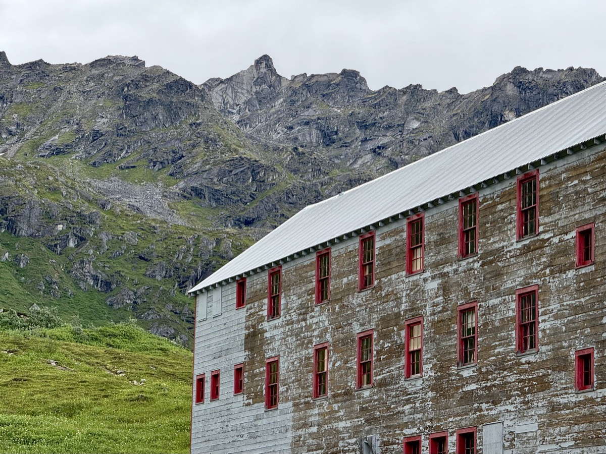
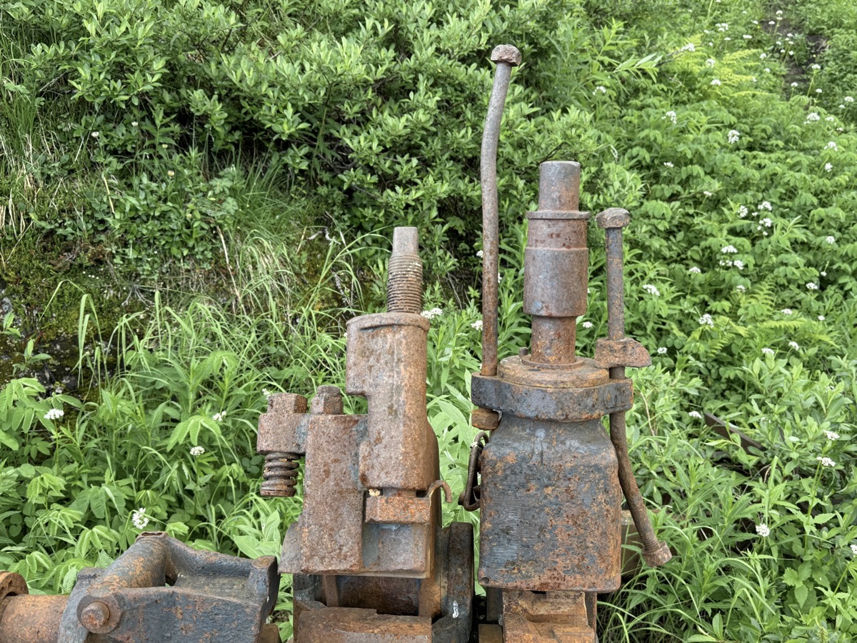
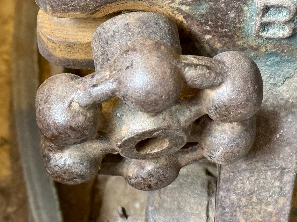
Our next destination was obvious – we took McCarthy Rd to Wrangell-St. Elias NP. It was 60 miles of unpaved, but quite well maintained gravel/dirt road. It runs along Chitina River valley. Slow going with nice views. Occasional remnants (bridges, trestles) of old copper ore railroad to Chitina and Cordova. In McCarthy we took a nice spot on private campground (terrible restrooms, same was true for another private campground we checked out) located within walking distance to Kennicott river pedestrian bridge. Two shuttles and we were at Kennecott Mine historical site, part of the NP. Two different spellings are used, one for the mine (with “e”), one (with “i”) for everything else. Did not go on guided tour of the mine (wrong timing), but visited several buildings open to the public.

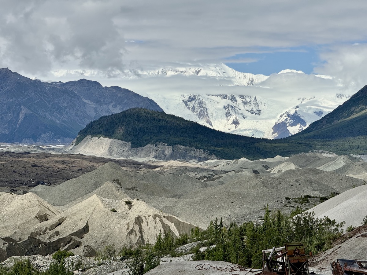
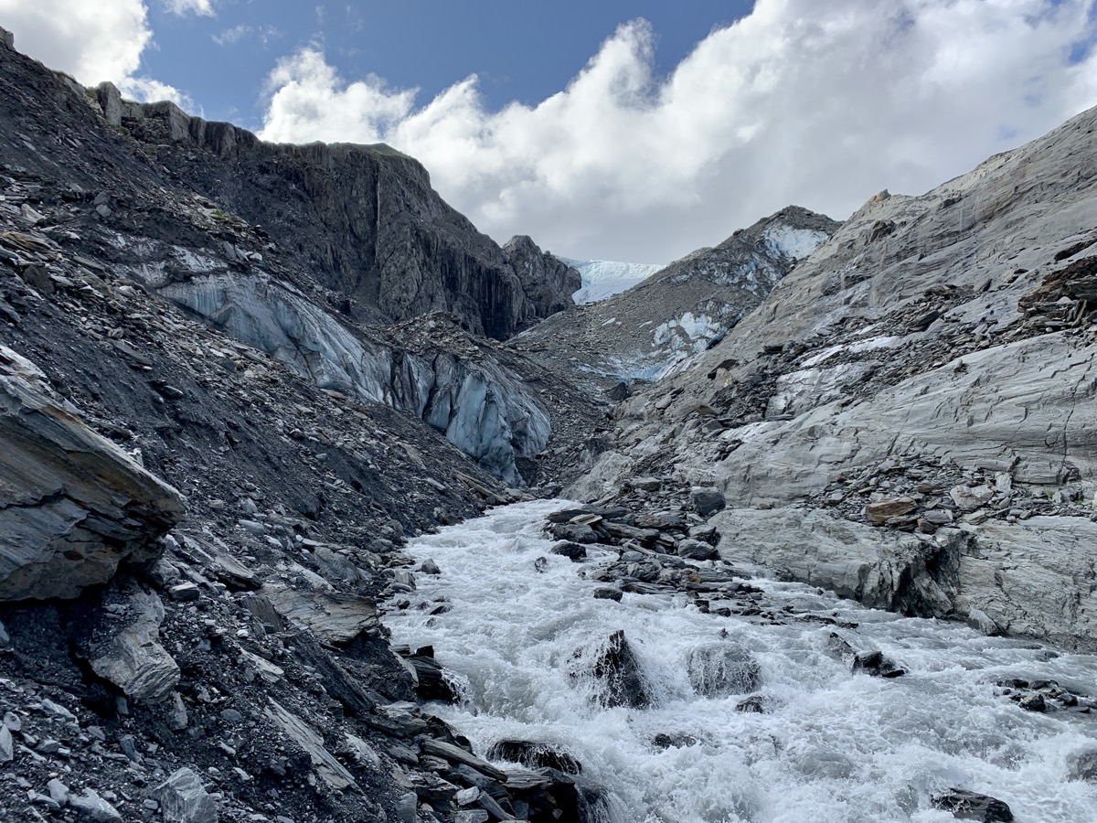
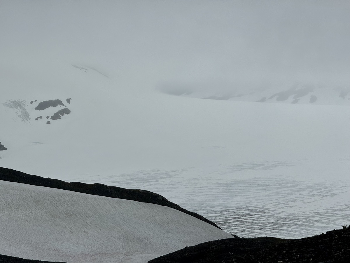
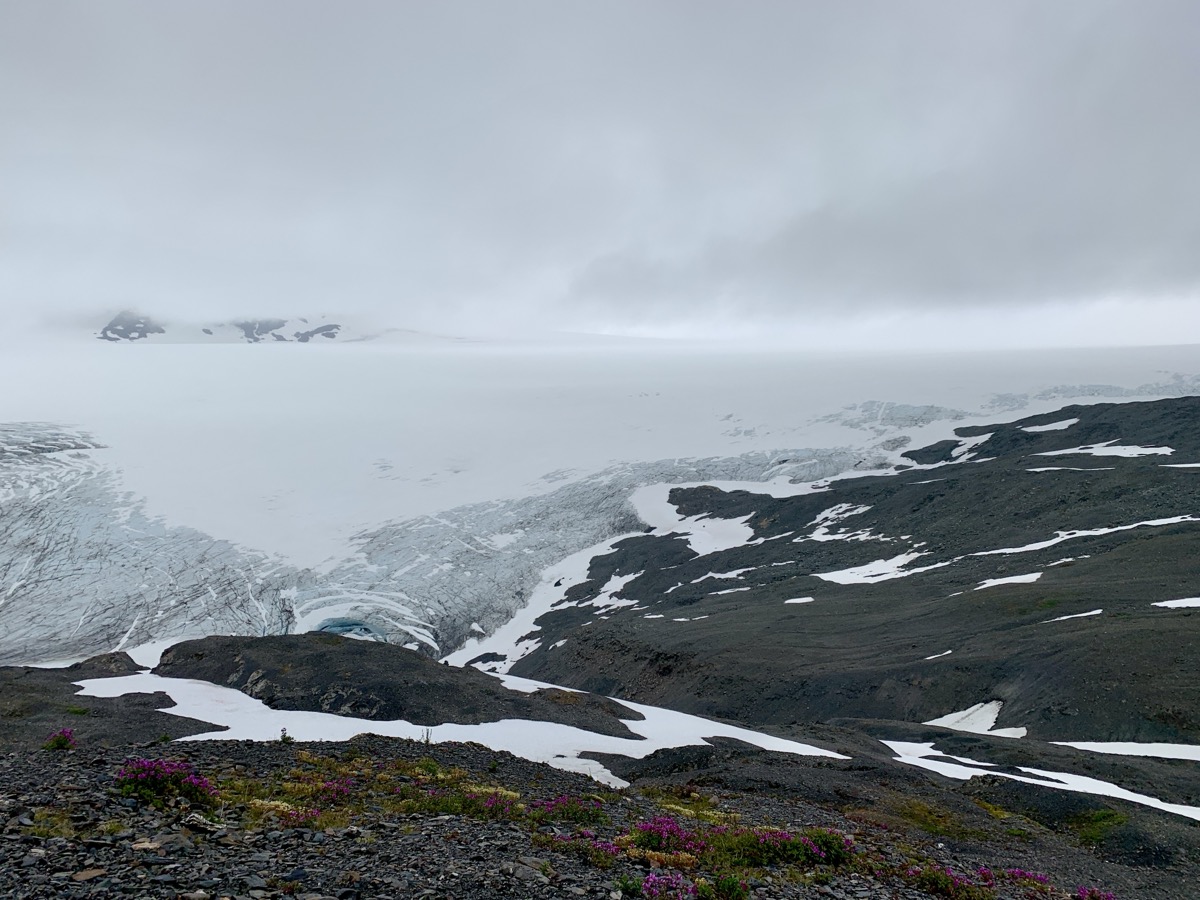
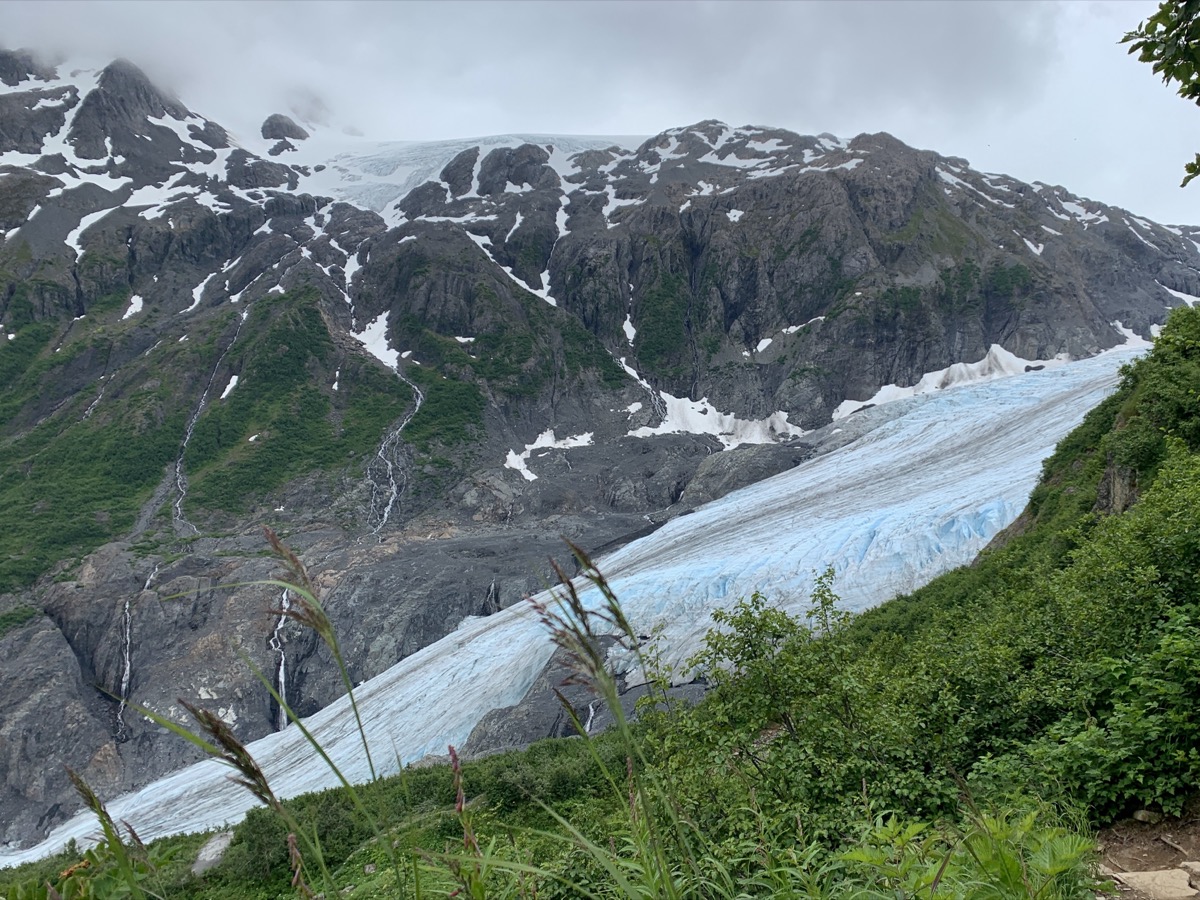
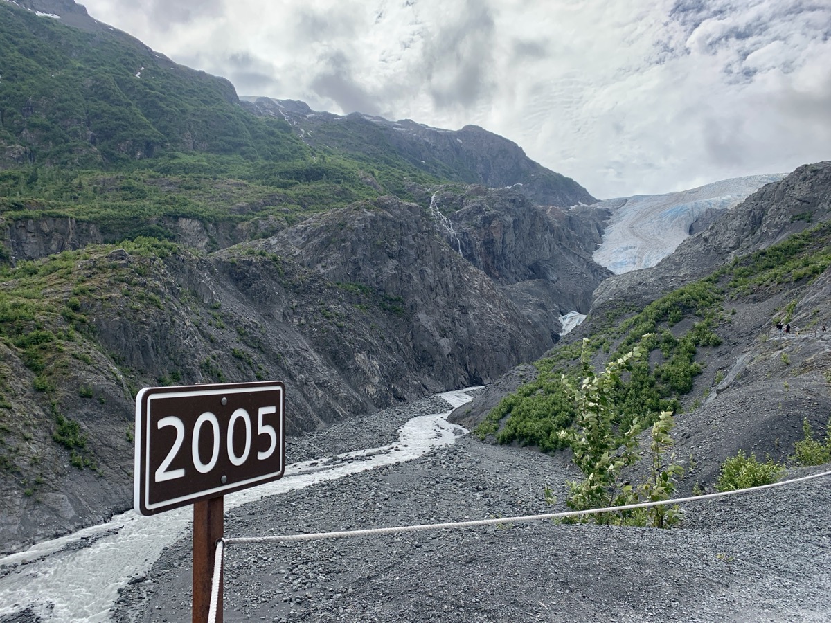
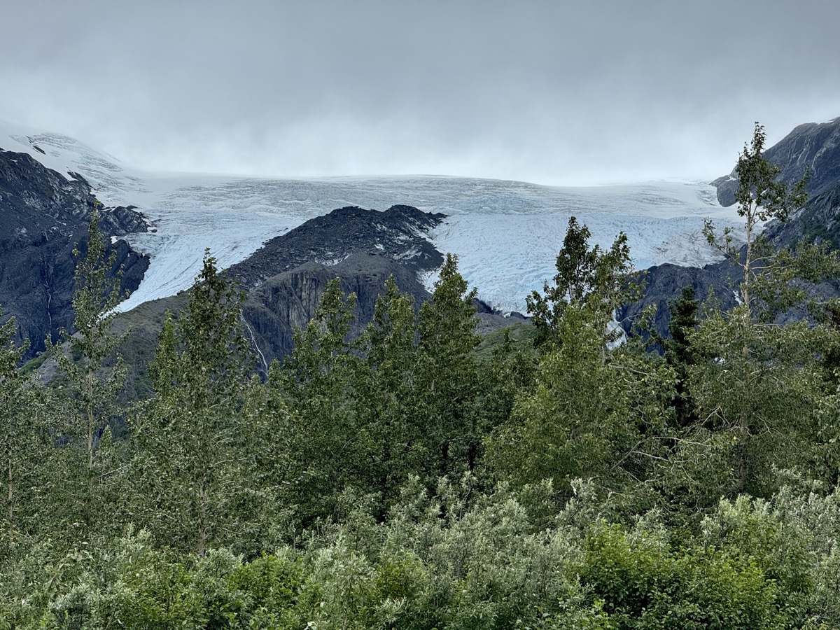
When the mine was built in early 20th century, Kennicott Glacier and Root Glacier were some 100 m thicker/higher blocking the view of mountains on the other side of the valley and people were unaware of the big valley filled with ice in front of them, as the legend goes. Copper ore was brought down to the mill from mines located much higher on mountain slopes.

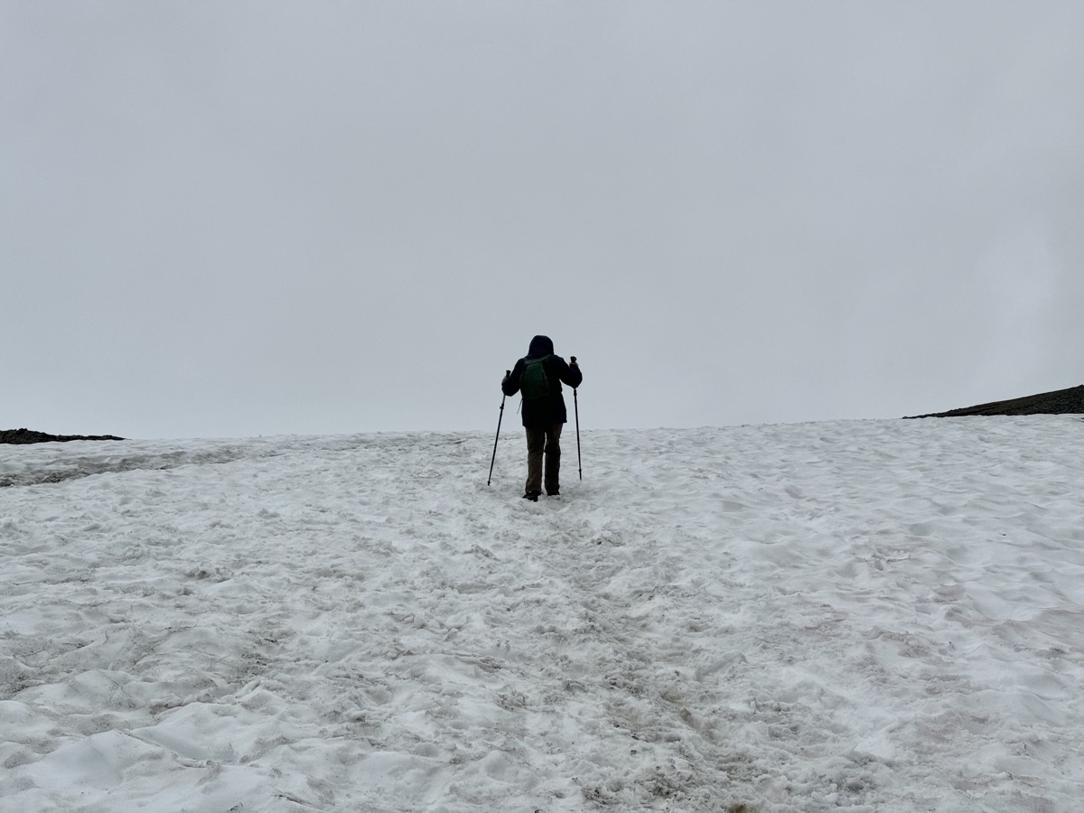
We spent the night at McCarthy campground and in the morning packed backpacks to spend couple days camping on lateral moraine of Root Glacier.

Day 53-57: Russian River-Whittier-Anchorage-Chugach Mountains

August 5-9

Day 53. Fishing day. With fishing rod in the box and license picked-up on the way, we drove to Russian River Ferry, crossed Kenai River and joined many other people catching salmon. We were busy all afternoon and did not waste time to take pictures. Everybody around was pulling fish, but not us. Clearly our understanding of the problem and technique were poor. It was interesting experience anyway. We drove to nearby Cooper Creek CG (Russian River CG was full) and cooked veggies for dinner.

Day 54. Next morning we drove back to look at salmon one more time. Walking along Russian River we were rewarded by good sighting (quite long observation) of grizzly bear. It didn’t even have to catch anything, more than enough leftovers (discarded by people) to go through. We then walked to Russian River Falls, nice and easy hike, where we watched many salmon still going upstream, struggling to pass the rapids. Everybody comes here in season to fish as salmon pushes upstream to spawn.

We hit Sterling and Seward Highways knowing this stretch already. The weather changed to rain of different intensity. Stopped at Summit Lodge for late lunch/dinner. Good food. With not so good weather we did not want to cook dinner later. Short breaks in heavier rain helped us settle at Williwaw Campground. It was good campground, many sites to choose from and close to next destination. We just walked in light rain to the creek to explore possible stop on the way back.

Day 55. Next destination: the historic town of Whittier (built from scratch for military purposes). The town can be only accessed through road tunnel which is interesting. Wanted also to see if we could get on a ferry to Valdez. But first, at Portage Lake we got a full taste of different Alaskan weather: cutting rain and strong wind. No chance for a hike to Portage Glacier and no view. We warmed up at the Visitor Center. There was not much to do in Whittier. Rain didn’t help. No luck with ferry. We drove around to get a closer look at some historic buildings and one apartment building where nearly entire town population lives, complete with store, post office, laundry, church and more. It is interesting “town” to see.

We headed back out in the afternoon stopping on the way at viewpoints to look at mountains and glaciers across flooded Portage Valley and then to watch spawning salmon in Williwaw Creek from trail with access to the stream every 100 m or so to peek in. As we were walking between two such points Piotr turned around (instinctively) and saw a medium-size black bear running quietly across the trail 30 m behind us. It was interested in salmon, we guessed, and did not want to be seen. They know how to disappear. We drove in the rain to Anchorage, it was quite tiring. We had better weather on the way in. Stayed at airbnb. Restocking and laundry.

Day 56. We could not take the ferry, but decided to go to Valdez anyway. Started driving east on Glenn Hwy through Chugach Mountains. Just 280 km ride took us most of the day. The highway is scenic with good viewpoints. We planned to walk to quite famous Matanuska Glacier. We knew about private enterprise blocking access to public land and were prepared to pay an entrance fee, but expensive guided tour offering little was the only option. Retreat. Glacier views from the highway and short trail at one of the stops were distant, panoramic but quite good. The weather improved. In late afternoon, we reached good camping spot with great view (Joanna found recommendation somewhere) on short stretch of old road running for a while along paved Lake Louise Rd. We walked it in the morning. Many camping options, but nobody around.

Day 57. In Glenallen we turned south on Richardson Hwy to Valdez. Stopped at Wrangell-St Elias Visitor Center to collect good info about the park and hikes (where to go later) and refill water containers, and then at Tonsina River Lodge for Russian lunch (borscht and pelmeni). Nice weather, easy driving. Next stop: Joanna was hoping to reach the edge of Worthington Glacier, but ice already retreated too far since a few years ago when she read about it on her favorite travel blog. No easy access now. She tried to climb-up, Piotr stayed around the lake as back-up and taking pictures.

At Thompson Pass we just parked at the entrance of a service road and walked-up to the highest point with great views, not really hiking as we spent most of the time watching changing clouds and fog fast running through mountains and valleys. Very nice Blueberry Lake campground was full, except for a couple not so good overflow spots. We decided to continue and somehow found our way on (pipeline) service roads ending at Sheep Creek and we stayed there. An evening runner on local trail was very surprised to see us. We were happy it was not a bear coming out of the bushes as we just started cooking dinner. He was happy we took all (abundant) mosquitoes away from him.

error: Content is protected !!